- Mallow, County Cork
-
Mallow
Mala— Town — Main street of Mallow, featuring the clocktower and the junction of Spa and Bridge streets
Motto: Per Ignem et Aquam Location in Ireland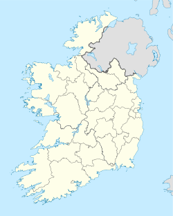
 Mallow
Coordinates: 52°07′52″N 8°38′29″W / 52.131°N 8.6415°WCoordinates: 52°07′52″N 8°38′29″W / 52.131°N 8.6415°W Country Ireland Province Munster County Cork Elevation 74 m (243 ft) Population (2006)[1] – Town 10,241 – Urban 7,864 – Environs 2,377 Irish Grid Reference W549982 Website mallow.ie Historical populations Year Pop. ±% 1821 4,114 — 1831 5,229 +27.1% 1841 6,851 +31.0% 1851 5,439 −20.6% 1861 4,841 −11.0% 1871 4,165 −14.0% 1881 4,439 +6.6% 1891 4,366 −1.6% 1901 4,542 +4.0% 1911 4,452 −2.0% 1926 4,562 +2.5% 1936 4,948 +8.5% 1946 5,215 +5.4% 1951 5,583 +7.1% 1956 5,729 +2.6% 1961 5,649 −1.4% 1966 5,845 +3.5% 1971 6,506 +11.3% 1981 7,482 +15.0% 1986 7,685 +2.7% 1991 7,521 −2.1% 1996 7,768 +3.3% 2002 8,937 +15.0% 2006 10,241 +14.6% [2][3][4][5][6] Mallow (Irish: Mala,[7] from Magh nAla, plain of the swans[8]) is the "Crossroads of Munster" and the administrative capital of north County Cork, in Ireland. The Northern Divisional Offices of Cork County Council are located in the town.
Set deep in the Blackwater Valley, Mallow was traditionally an agricultural market town but due to vast improvements in infrastructure, coupled with significant promotion and investment from the Mallow Town Council[citation needed] and the private sector,[citation needed] the town has become a thriving business town.[citation needed]
Contents
Name in Irish
The earliest form of the name is Magh nAla "plain swan", being Magh = Plain and Ala = Swan which was gradually elided to Mala.[8] In the Anglicisation "Mallow", -ow originally represented a reduced schwa sound, which is now however pronounced as a full vowel /oʊ/[9] In 1975, Mala was among the first Irish placenames adopted by statute,[10] on the advice of the Placenames branch of the Ordnance Survey of Ireland.[11][12]
In the Annals of the Four Masters, compiled in the 1630s, Magh nAla is misrepresented as Magh Eala, the Donegal-based authors being insufficiently familiar with Cork places.[8] P.W. Joyce in 1869 surmised that in Magh Ealla [sic], Ealla referred to the river Blackwater, and connected the name to the nearby barony of Duhallow.[8] Professor T. F. O'Rahilly in 1938 interpreted Magh Eala as "plain of the swans".[8] This false etymology remains widely cited and has caused resentment of the official Mala as being a gratuitous simplification of Magh Eala.[8]
Of all the meanings for "Magh Ealla" in Gaelic, the true meaning of this name in English is Bright Mound, Magh meaning mound in English and geal in Irish means bright.It was from the colour of the bird that the swan got its name, literally meaning "Bright". Similarly so, " Mallow", ie. Magh Ealla, bright mound as the white limestone comes up through the earth on the Muddy Hill and also through the field at Bearforest and other places along the banks of the Blackwater. At the car park opposite the present Garda Garda station there was a limestone quarry plain to be seen up to the late 1960s and there was a lime burning kiln at the Muddy Hill and the remains of it can be seen to this day so therefore the true literal meaning of Mallow is simply,"Bright Mound" from the colour of the rock. The true meaning of the Anglicism of Mallow, however, is still unknown to both natives and foreigners
History
Evidence of pre-historic settlement is found in Beenalaght (13.6 km/8.5 miles south-west of Mallow), where an alignment of six standing stones lie on a hill to the west of the Mallow-Coachford Road.[13] (grid ref: 485 873, Latitude: 52.035818N Longitude: 8.751181W[14])
During the Irish War of Independence, the town was the HQ of the North Cork Militia – known as North Cork Rifles. The town's RIC barracks was the only one captured nationwide during the war. In retaliation, several main street premises were subsequently torched by the British Army.
Mrs King, wife of Capt W H King, RIC was killed during attempt to kill Capt King near Mallow Railway station. In retaliation, British military and Black and Tans killed three railway workers-Patrick Devitt, Daniel Mullane and Bennett. The murders prompted industrial action by the National Railworkers Union in Britain and Ireland.
Natural occurrence of Radon gas
Some of the highest naturally occurring readings of Radon ever have been recorded in Mallow, prompting local fears regarding lung cancer.[15][16]
Demography
The urban area has a population of 7,864 (2006 census) and with improved road and rail since the mid 1980s, has developed significant student and worker commuter traffic with Cork city.[citation needed]
Economy
Mallow developed as a defensive settlement protecting an important ford on the River Blackwater. Mallow developed in the late 16th century as a plantation town. It has prospered throughout the centuries as a market town due to its rich agricultural hinterland.[citation needed] Irish states-men such as Thomas Davis and William O'Brien were both born in Mallow in the 19th century. The main street in Mallow is called Davis St. (although commonly referred to as Main St.), and joins with William O'Brien St. outside Mallow Town Hall. At the point where Davis St. meets O'Brien St. there is a monument to J.J. Fitzgerald, a little-known local politician who was instrumental in establishing both Mallow Urban District Council and Cork County Council.
The town developed a significant industrial base in the early 20th century, based largely on its agricultural capability, with dairy produce and sugar beet supplying the Sugar Factory, Rowntree Macintosh, Bournes and Dairygold. Changes in the European Union sugar subsidy programme resulted in the closure of the Sugar Beet factory in mid 2006, after 75 years continual production.
The development of Market Square (which contains both residential and commercial units) in 2006 effectively relocated the town centre.[citation needed]
Transport and communications
Road
Mallow lies at the convergence of several important routes:
- National Primary Route 20 (N20) north-south road between Cork (35 km) and Limerick (70 km)
- National Secondary Route 72 (N72) east-west between Dungarvan (51.5 km) and Killarney (41.5 km)
- National Secondary Route 73 (N73) northeast to Mitchelstown and the M8 motorway (21 km)
Air
The nearest airports are Cork Airport (42.5 km) and Shannon Airport (59 km). There is also a flying club at nearby Rathcoole. There is also a Helicopter Charter Company in nearby Dromahane.
Mallow Racecourse, now known as Cork Racecourse, became an emergency airfield on April 18, 1983, when a Mexican Gulfstream II business jet piloted by Captain Reuben Ocaña made a precautionary landing. A temporary tarmacadam runway of 910 m (3,000 ft) in length which was paid for by the plane's insurers was laid to enable the aircraft to leave five weeks later, whereas in the meantime Captain Ocaña became a local celebrity. On May 23, 1983 just before the plane departed, the Captain said his farewell to the people of Ireland in the Irish language, forever endearing himself to the nation. The runway was subsequently utilised for parking during race meets and was a popular facility for learner driving. Light aircraft have occasionally landed at the racecourse on the grass area. The F3A World Model Aircraft Aerobatic Championship was held there in 2001.
Rail
The Mallow railway viaduct which straddles the Blackwater, commonly known as the "Ten Arch Bridge", was bombed and destroyed during the Irish Civil War. It was rapidly rebuilt in girder form due to its importance in connecting the Cork, Tralee and Dublin lines. An additional line east through Fermoy and Lismore to the Waterford South station closed in 1967. Mallow railway station opened on 17 March 1849.[17]
Sport
Founded in 1882, Mallow Rugby Club[18] is one of the oldest rugby clubs in the country and one of the predominant sporting clubs in the area.
The towns association football club, Mallow United Football Club, was founded in 1926 and fields senior, junior, schoolboy, and schoolgirl soccer teams in the Munster Leagues.[19]
Mallow Golf Club, founded in 1947,[20] is located just outside Mallow and has 18 holes.
The local racecourse, now renamed "Cork Racecourse at Mallow",[21] plays host to large horse racing events.
Mallow GAA is the town's GAA club.
Mallow has a cinema as well as other community amenities such The Youth Centre as well a nearby swimming pool. It also has several gyms and a driving range situated a few kilometres from the town centre.
The town also has several pubs and night clubs to cater to every demographic.
People
- Birthplace of Thomas Osborne Davis (1814 – 1845), nationalist, politician, author, poet and patriot. Author of the famous Irish rebel song "A Nation Once Again".
- Birthplace of William O'Brien (1852 – 1928), nationalist, journalist, agrarian agitator, social revolutionary, politician, party leader, newspaper publisher and author.
- Birthplace of Seán Sherlock (Labour Party TD) for Cork East Constituency, elected to Dáil Éireann 2007 General Election.
- Donovan (singer)
- John Hogan (1805–1892) was a United States Representative from Missouri born in Mallow.
- Ancestral home of US Congressman Tip O'Neill
- Joe Lynch (Actor)
- Elaine Crowley, TV3
International relations
Twin towns — Sister cities
Mallow is twinned with the towns of
- Tinley Park in the United States
- Tréguier in France
See also
- Metropolitan Cork
- List of towns and villages in Ireland
- Mallow (Parliament of Ireland constituency)
- The Corkman
References
- ^ "Census 2006 – Volume 1 – Population Classified by Area" (PDF). Central Statistics Office Census 2006 Reports. Central Statistics Office Ireland. April 2007. http://www.cso.ie/census/documents/census2006_volume_1_pop_classified_by_area.pdf. Retrieved 2011-05-14.
- ^ Census for post 1821 figures.
- ^ http://www.histpop.org
- ^ http://www.nisranew.nisra.gov.uk/census
- ^ Lee, JJ (1981). "On the accuracy of the Pre-famine Irish censuses". In Goldstrom, J. M.; Clarkson, L. A.. Irish Population, Economy, and Society: Essays in Honour of the Late K. H. Connell. Oxford, England: Clarendon Press.
- ^ Mokyr, Joel; O Grada, Cormac (November). "New Developments in Irish Population History, 1700–1850". The Economic History Review 37 (4): 473–488. doi:10.1111/j.1468-0289.1984.tb00344.x. http://www3.interscience.wiley.com/journal/120035880/abstract.
- ^ http://www.logainm.ie/?text=Mallow
- ^ a b c d e f Ó hÚrdail, Roibeárd (1996-03-01). "Marshmallows". The Irish Times: p. 15.
- ^ Gazetteer of Ireland / Gasaitéar na hÉireann. Government of Ireland. ISBN 0 7076 0076 6.
- ^ "I.R. Uimh. 133/1975 — An tOrdú Logainmneacha (Foirmeacha Gaeilge) (Uimh. 1) (Postbhailte) 1975." (in Irish). Government of Ireland. 1975-07-22. http://www.irishstatutebook.ie/1975/ga/si/0133.html. Retrieved 2008-01-27. "Mallow (33) Mala (g. Mhala)"
- ^ "Placenames Orders". Department of Community, Rural and Gaeltacht Affairs. http://www.pobail.ie/en/IrishLanguage/ThePlacenamesBranch/PlacenamesOrders/. Retrieved 2008-01-27.
- ^ "The Placenames Commission". Archived from the original on 2007-09-24. http://web.archive.org/web/20070924124141/http://www.logainm.ie/English/history.asp. Retrieved 2008-01-27.
- ^ Weir, A (1980). Early Ireland. A Field Guide. Belfast: Blackstaff Press. p. 113. ISBN 0856402125.
- ^ "Beenalaght". The Megalithic Portal. http://www.megalithic.co.uk/article.php?sid=1768. Retrieved 2008-06-11.
- ^ "Record radon levels found at Mallow office". RTÉ News. http://www.rte.ie/news/2007/0920/radon.html. Retrieved 2009-07-17.
- ^ "Ireland's Radon Gas Levels Dangerous". Radon Barrier Co Ltd. http://interplanleisuregroup.com/site/irelands-radon-levels-dangerous. Retrieved 2009-07-17.
- ^ "Mallow station". Railscot – Irish Railways. http://www.railscot.co.uk/Ireland/Irish_railways.pdf. Retrieved 2007-08-31.
- ^ Official Mallow Rugby Website
- ^ Official Mallow United FC Website
- ^ Mallow Golf Club
- ^ Cork Racecourse At Mallow
External links
Categories:- Untranslated Irish place names
- Mallow, County Cork
- Towns and villages in County Cork


Wikimedia Foundation. 2010.