- Bettyhill
-
Coordinates: 58°32′N 4°13′W / 58.53°N 4.22°W
Bettyhill Scottish Gaelic: Am Blàran Odhar 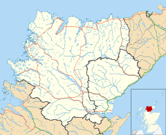
 Bettyhill
Bettyhill shown within the Sutherland areaOS grid reference NC706618 Council area Highland Lieutenancy area Sutherland Country Scotland Sovereign state United Kingdom Post town THURSO Postcode district KW14 Dialling code 01641 Police Northern Fire Highlands and Islands Ambulance Scottish EU Parliament Scotland UK Parliament Caithness, Sutherland and Easter Ross Scottish Parliament Caithness, Sutherland and Easter Ross constituency in the Highlands and Islands electoral region List of places: UK • Scotland • Bettyhill (Scottish Gaelic: Am Blàran Odhar) is a village on the north coast of Scotland.
Bettyhill lies on the A836 road 32 miles (51 km) west of Thurso and 12 miles (19 km) from Tongue. And 5 miles from the village of Skerray Its former fishing port was called Navermouth [1]
 The Free Church at Bettyhill
Bettyhill's principal attractions are the expanse of Torrisdale Bay, the Strathnaver Museum and salmon fishing on the River Naver. The Strathnaver Museum, probably better known as "The Mackay Museum", has an upstairs, older & larger section devoted to the ancient Clan Mackay. The whole of the north-western highlands (Assynt to Cape Wrath, Loch Shin to Strath Halladale and Reay) was known as "Mackay Country" from the 13th century.[citation needed]
Farr High School has a swimming pool which is open for public use. The craft shop serves fish and chips on a Friday and Saturday night, as well as having a cafe ('The Cafe at Bettyhill') which is currently open seven days a week during summer months. There are several lovely empty beaches nearby. The Bettyhill Hotel contains the Eilean Neave restaurant.[2] The Farr Bay Inn, built in 1819, was formerly the manse and is now a listed building.[3] It has recently come under new management and was refurbished in 2009.[citation needed]
Bettyhill holds an annual football competition called the Guy Cup. Teams from nearby northern areas come to compete for the trophy. This annual gathering is held in remembrance of Philip Mackay (nicknamed "Guy") who died in a oil rig accident. The medals and trophy are usually held[clarification needed] by Guy's mother Phyllis Mackay.
References
- ^ Undiscovered Scotland
- ^ "Bettyhill Hotel". Bettyhill Hotel. http://www.bettyhill.info. Retrieved 2009-09-10.
- ^ "Farr Bay Inn". Farr Bay Inn. http://www.farrbayinn.co.uk/. Retrieved 2009-09-10.
External links
- "Bettyhill". Gazetteer for Scotland. http://www.scottish-places.info/towns/townfirst2409.html. Retrieved 2009-09-10.
- "Bettyhill". Undiscovered Scotland. http://www.undiscoveredscotland.co.uk/bettyhill/bettyhill/. Retrieved 2009-09-10.
- "Bettyhill". Mackay Country. http://www.mackaycountry.com/Bettyhill.htm. Retrieved 2009-09-10.
Categories:- Populated places in Sutherland
- Highland geography stubs


Wikimedia Foundation. 2010.