- Murghab, Tajikistan
-
Murghab Location in Tajikistan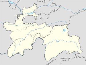
 Murghab
Coordinates: 38°10′08″N 73°57′54″E / 38.16889°N 73.965°E Country  Tajikistan
Province Gorno-Badakhshan Autonomous Region Population (2000) – Total 4,000 Murghab (Tajik Мурғоб; Russian Мургаб, from the Persian word مرغاب meaning "river of the birds") is the capital of Murghob District in the Pamir Mountains of Gorno-Badakhshan Autonomous Region, Tajikistan. With a population 4,000, Murghab is about the only significant town the eastern half of Gorno-Badakhshan. It is the highest town in Tajikistan (and of the former Soviet Union) at 3,650m above sea level. It located at the junction of the Murghab River and the Pamir Highway.
The Pamir Highway goes north to Sary-Tash and on to Osh in Kyrgyzstan and southwest to the region's capital Khorog (about 300 kilometers distant). A newer road goes east over the Kulma Pass to the Karakoram Highway in China connecting to Tashkurgan to the south and Kashgar in the north. When the new road opened in May 2004, only Chinese and Tajik nationals were allowed to cross the Tajik–Chinese border at that point;[1] the status of the border crossing in 2010 remains the same and according to locals in near future no plans are to open Kulma for other nationals.
Murghab's location at the hub of these roads makes it a regional center for trade, reputedly including a significant trade in illicit drugs.
Pamirsky Post
The place was founded by the Russians as 'Pamirsky Post' in 1893, as their most advanced military outpost into Central Asia.
The modern town was constructed during the period of Soviet rule of Tajikistan as a rest stop along the Pamir Highway. The population is about half Pamiri and half Kyrgyz. Murghab is expected to become a major center for trade between Xinjiang and central Asia.[2]
References
- "Gorno-Badakhshan, Tajikistan: Trekking Routes" (map). www.pamirs.org. Retrieved August 25, 2005.
- Jennings, David. (July 18 – July 25, 2004) "Sixty One Degrees: An Occasional Journal of an Asia-overland adventure".
- ^ Travel Tajikistan
- ^ Edward Wong, "China Quietly Extends Footprints Into Central Asia," New York Times, 2 January 2011.
Coordinates: 38°10′08″N 73°57′54″E / 38.16889°N 73.965°E
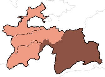
Gorno-Badakhshan Autonomous ProvinceCapital: KhorughDistricts 
Main cities and towns Geography Darvoz Range · Vanj River · Vanj Range · Yazgulyam River · Yazgulem Range · Bartang River · Rushan Range · Gunt River · Shughnon Range · Sarikol Range · Shakhdara River · Shakhdara Range · Ishkoshim Range · Panj River · Sarez Lake · Zorkul Lake · Karakul Lake · Mayakovskiy Peak · Karl Marx PeakCategories:- Tajikistan geography stubs
- Populated places in Gorno-Badakhshan

Wikimedia Foundation. 2010.