- Washington State Route 105
-
State Route 105

Route information Auxiliary route of US 101 Defined by RCW 47.17.180 Maintained by WSDOT Length: 48.56 mi[1] (78.15 km) Major junctions South end:  US 101 in Raymond
 SR 105 Spur near Westport
North end: US 101 in AberdeenHighway system State highways in Washington
Interstate • US • State
Former PSH • 1964 renumbering • Former SR←  SR 104
SR 106  →
→State Route 105 is a state highway in the U.S. state of Washington. It is 48.56 miles (78.15 km) long, and begins in Raymond, ending in Aberdeen, Washington. It connects to U.S. Route 101 at both ends. While US 101 is a costal route for much of its length along the West Coast, between Raymond and Aberdeen it takes a more inland route, and SR 105 parallels Willapa Bay, the Pacific Ocean, and Grays Harbor.
Contents
Route description
State Route 105 begins at an intersection with U.S. Route 101 in the northern part of Raymond, just north of US 101's intersection with State Route 6.[2] It roughly follows the Willapa River then Willapa Bay westward, serving the towns of Tokeland and North Cove, then goes up the Pacific coast and back turns to the east just before Westport, where it meets with State Route 105 Spur.[1][3] It then ends in south Aberdeen, near Cosmopolis, where it reconnects to U.S. Route 101.
Spur routes
State Route 105 Spur (more specifically referred to by the Washington State Department of Transportation (WSDOT) as "State Route 105 Spur Westport") is a spur of State Route 105 that goes north into the town of Westport, USA. It snakes through the city streets, initially as Forrest Street, finally ending at the harbor.
The SR 105/105 Spur junction is about 5 miles (8 km) north of Grayland, Washington, immediately adjacent to Twin Harbors State Park. The spur is 4.02 miles (6.47 km) long.[1]
State Route 105 Spur can also refer to a 0.15-mile (240 m) section of the Aberdeen-area SR 105/U.S. Route 101 junction specifically referred to by WSDOT as "State Route 105 Spur Boone".
History
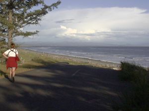 Part of the "Old State Road 105" route near "Washaway Beach, Cape Shoalwater" between Grayland and Tokeland, looking SE into Willapa Bay.
State Route 105 was added to Washington's state highway system in 1937 as Secondary State Highway 13-A.[4] This definition also included the spur north to Westport. In the 1964 state highway renumbering, SSH 13-A was assigned the designation SR 105.[5]
Between Grayland and Tokeland, SR 105 had to be re-routed inland from Cape Shoalwater, due to currents coming out of Willapa Bay causing severe erosion, taking many acres of land out to sea.[6]
Major intersections
County Location Mile[1] Destinations Notes Pacific Raymond 0.00 US 101 – Aberdeen, South Bend18.60 Tokeland Road North Cove 21.16 Old State Route 105 Grays Harbor Grayland 26.68 30.15
SR 105 Spur – WestportAberdeen 48.46 US 101 south – RaymondVia SR 105 Spur Boone 48.56 US 101 north – Hoquiam, Olympia1.000 mi = 1.609 km; 1.000 km = 0.621 mi References
- ^ a b c d Washington State Department of Transportation (2006). "State Highway Log" (PDF). http://www.wsdot.wa.gov/mapsdata/TDO/PDF_and_ZIP_Files/HwyLog2006.pdf. Retrieved 2008-04-10.
- ^ Yahoo! Inc. Yahoo! Maps – Raymond, WA (Map). Cartography by NAVTEQ. http://maps.yahoo.com/#mvt=m&lat=46.68752&lon=-123.729504&mag=4&q1=Raymond%2C%20WA%2C%2098577. Retrieved 2008-03-20.
- ^ Rand McNally (2006). The Road Atlas (Map). p. 108, section I3, I4. ISBN 0528957902.
- ^ Session Laws of the State of Washington. 1937 chapter 207. "An act relating to public highways; classifying public highways outside incorporated cities and towns; establishing, designating and describing secondary state highways as branches of primary state highways of this state; defining the powers and duties of certain public officers with respect thereto; providing for application of laws, rules and regulation of vehicles thereon; repealing acts and parts of acts in conflict; providing for constitutionality; and declaring an emergency.": "Secondary State Highway No. 13A; beginning at Raymond on Primary State Highway No. 13, thence in a westerly direction by the most feasible route by way of Tokeland, North Cove to the shore of Grays Harbor north of Westport; also beginning at Aberdeen on Primary State Highway No. 13, thence in a southwesterly direction by the most feasible route to a junction with Secondary State Highway No. 13A in the vicinity south of Westport."
- ^ Washington State Highway Commission (December 1, 1965). "Identification of State Highways" (PDF). http://www.wsdot.wa.gov/NR/rdonlyres/6836215D-E301-43F3-895A-472BD2FDE86A/0/Identification.pdf. Retrieved 2008-04-10.
- ^ Washington State Department of Ecology. "Washington's Coast: Hazards - Erosion: Washaway Beach, Cape Shoalwater". http://www.ecy.wa.gov/programs/sea/coast/erosion/washaway.html. Retrieved 2008-04-10.
State highways in Washington related to US 101  Former or proposed State Routes: SR 111Categories:
- State highways in Washington (state)
- Scenic highways in Washington (state)
- Transportation in Pacific County, Washington
- Transportation in Grays Harbor County, Washington


Wikimedia Foundation. 2010.