- Chihuahua (state)
-
For other uses, see Chihuahua (disambiguation).
Chihuahua
Estado Libre y Soberano de Chihuahua— State — 
Flag
SealNickname(s): El Estado Grande (The Big State) Motto: Valentía, Lealtad, Hospitalidad
(Bravery, Loyalty, Hospitality)Anthem: Himno del Estado de Chihuahua State of Chihuahua within Mexico
Coordinates: 28°48′51″N 106°26′22″W / 28.81417°N 106.43944°WCoordinates: 28°48′51″N 106°26′22″W / 28.81417°N 106.43944°W Country Mexico Capital Chihuahua Largest City Ciudad Juárez Municipalities 67 Admission July 6, 1824[1] Order 18th Government – Governor César Duarte Jáquez 
– Senators[2] José Antonio Badía 
Ramón Galindo
Fernando Baeza– Deputies[3] Area[4] – Total 247,455 km2 (95,542.9 sq mi) Ranked 1st Highest elevation[5] 3,300 m (10,827 ft) Population (2010)[6] – Total 3,406,465 – Rank 11th – Density 13.8/km2 (35.7/sq mi) – Density rank 29th Demonym Chihuahuense Time zone MST (UTC-7) – Summer (DST) MDT (UTC-6) Postal code 31, 33 Area code ISO 3166 code MX-CHH HDI  0.857 high Ranked 6th
GDP US$ 20,287,214.21 mil[a] Website Official Web Site ^ a. The state's GDP was 259,676,342 million of pesos in 2009,[6] amount corresponding to 20,287,214.21 millon of dollars, being a dollar worth 12.80 pesos (value of June 3, 2010).[7] Chihuahua (Spanish pronunciation: [tʃiˈwawa]) officially Estado Libre y Soberano de Chihuahua (English: Free and Sovereign State of Chihuahua) is one of the 31 states which, with the Federal District, comprise the 32 Federal Entities of Mexico. Its capital city is Chihuahua.
It is located in Northwestern Mexico. It is bordered by the states of Sonora to the west, Sinaloa to the southwest, Durango to the south, and Coahuila to the east. To the north and northeast, it has a long line with the U.S.-Mexico border adjacent to the U.S. states of New Mexico and Texas.
Chihuahua is the largest state in Mexico by area, with a mainland area of 247,455 square kilometres (95,543 sq mi),[4] it is slightly larger than the United Kingdom. It is consequently known under the nickname El Estado Grande ("The Big State").
Although Chihuahua is primarily identified with the Chihuahuan Desert for namesake, it has more forests than any other state in Mexico.[8] Due to its variant climate the state has a large variety of fauna and flora. The state is mostly characterized by rugged mountainous terrain and wide river valleys. The Sierra Madre Occidental mountain range, an extension of the Rocky Mountains, dominates the state's terrain and is home to the state's greatest attraction, Las Barrancas del Cobre, or Copper Canyon, a spectacular canyon system larger and deeper than the Grand Canyon.[9][10] On the slope of the Sierra Madre Occidental mountains (around the regions of Casas Grandes, Cuauhtémoc and Parral), there are vast prairies of short yellow grass, the source of the bulk of the state's agricultural production. Most of the inhabitants live along the Rio Grande Valley and the Conchos River Valley.
The etymology of the name Chihuahua has long been disputed by historians and linguists. The most accepted theory explains that the name was derived from the Nahuatl language meaning "The place where the water of the rivers meet".
Chihuahua has a diversified state economy. The three most important economic centers in the state are: Ciudad Juárez, an international manufacturing center; Chihuahua, the state capital; and Delicias, the state's main agriculture hub. Today Chihuahua serves as an important commercial route prospering from billions of dollars from international trade as a result of NAFTA. On the other hand the state suffers the fallout of illicit trade and activities especially at the border.
On February 6, 2010, former Governor José Reyes Baeza proposed to move the three State Powers (Executive, Legislative and Judicial) from Chihuahua to Ciudad Juárez in order to face the insecurity problems in the latter city,[11] but that request was rejected by the State Legislature on February 12.[12]
History
Prehistory
 Las Jarillas Cave scrambled along the canyons of the Sierra Madre in Northwestern Chihuahua date between 1205–1260 A.D. and belong to the Paquimé culture
The earliest evidence of human inhabitants of modern day Chihuahua was discovered in the area of Samalayuca and Rancho Colorado. Clovis points have been found in northeastern Chihuahua that have been dated between 12000 BC to 7000 BC. It is thought that these inhabitants were hunter gatherers. Inhabitants of the state later developed farming with the domestication of corn. An archeological site in northern Chihuahua known as Cerro Juanaqueña revealed squash cultivation, irrigation techniques, and ceramic artifacts dating to around 2000 BC.[13]
 Paquimé artifact found at Casas Grandes
Between 300-1300 AD in the northern part of the state along the wide, fertile valley on the San Miguel River the Casas Grandes (Big Houses) culture developed into an advanced civilization. The Casas Grandes civilization is part of a major prehistoric archaeological culture known as Mogollon which is related to the Anasazi. Paquime was the center of the Casas Grandes civilization. There is extensive archeological evidence of commerce, agriculture, and hunting at Paquime and Cuarenta Casas (Forty Houses).
Cuarenta Casas, also known as La Cueva De Las Ventanas (The Cave of Windows), are a series of cliff dwellings along an important trade route. Cuarenta Casas is thought to have been a branch settlement from Paquime to protect the trade route from attack. Archeologists believe the civilization began to decline during the 13th century and by the 15th century the inhabitants of Paquime sought refuge in the Sierra Madre Occidental while others are thought to have immigrated north and joined the Anasazi. According to anthropologist current natives tribes (Yaqui, Mayo, Opata, and Tarahumara) are descendants of the Casas Grandes culture.
During the 14th century in the northeastern part of the state nomad tribes by the name of Jornado hunted bison along the Rio Grande; they left numerous rock paintings throughout the northeastern part of the state. When the Spanish explorers reached this area they found their descendants, Suma and Manso tribes. Between 300- 1300 AD in the southern part of the state in a zone known as Aridoamerica the Chichimeca cuture survived by hunting, gathering, and farming. The Chichimeca are the ancestors of the Tepehuane tribe.
Colonial Era
Main article: Nueva Vizcaya, New SpainNueva Vizcaya (New Biscay) was the first province of northern New Spain to be explored and settled by the Spanish. Around 1528, a group of Spaniard explorers, led by Álvar Núñez Cabeza de Vaca, first entered the actual territory of what is now Chihuahua. The conquest of the territory lasted nearly one century, and encountered fierce resistance from the Conchos tribe, but the desire of the Spanish Crown to transform the region into a bustling mining center led to a strong strategy to control the area.
In 1562 Francisco de Ibarra headed a personal expedition in search of the mythical cities of Cibola and Quivira; he traveled through the present-day state of Chihuahua. Francisco de Ibarra is thought to have been the first European to see the ruins of Paquime. In 1564 Rodrigo de Río de Loza, a lieutenant under Francisco de Ibarra, stayed behind after the expedition and found gold at the foot of the mountains of the Sierra Madre Occidental; he founded the first Spanish city in the region, Santa Barbara by bringing 400 European families to the settlement.
 Antonio de Deza y Ulloa the founder of Chihuahua City
A few years later in 1569 Franciscan missionaries led by Fray Agustín Rodríguez from the coast of Sinaloa and the state of Durango founded the first mission in the state in Valle de San Bartolomé (present-day Valle de Allende). Fray Agustín Rodríguez evangelized the native population until 1581. Between 1586 and 1588 a epidemic caused a temporary exodus of the small population in the territory of Nueva Vizcaya.
Santa Bárbara became the launching place for expeditions into New Mexico by Spanish conquistadors like: Antonio de Espejo, Gaspar Castaño, Antonio Gutiérrez de Umaña, Francisco Leyba de Bonilla, and Vicente de Zaldívar. Several expeditions were led to find a shorter route from Santa Barbara to New Mexico. In April 1598, Juan de Oñate finally found a short route from Santa Barbara to New Mexico which came to be called El Paso del Norte (The Northern Pass). The discovery of El Paso Del Norte was important for the expansion of El Camino Real de Tierra Adentro (The Inner Land Royal Road) to link Spanish settlements in New Mexico to Mexico City; El Camino Real de Tierra Adentro facilitated transport of settlers and supplies to New Mexico.
Many other mining towns, missions and presidios were founded in the region Santa Eulalia and Camargo. In 1631 Noah Carrasco de Biesma discovered a rich vein of silver, and subsequently established San Jose del Parral near the site. Parral remained an important economic and cultural center for the next 300 years. On December 8, 1659 Fray García de San Francisco founded the mission of Nuestra Señora de Guadalupe de Mansos del Paso del Río del Norte and founded the town El Paso Del Norte (present day Ciudad Juárez) in 1667. The Spanish society that developed in the region replaced the sparse population of indigenous peoples. The absence of servants and workers forged the spirit of northern people as self-dependent, creative people that defended their European heritage. In 1680 settlers from Santa Fe, New Mexico sought refuge in El Paso Del Norte for twelve years after fleeing the attacks from Pueblo tribes, but returned to Santa Fe in 1692 after Diego de Vargas recaptured the city and vicinity. In 1709, Antonio de Deza y Ulloa founded the state capital Chihuahua City; shortly after, the city became the headquarters for the regional mining offices of the Spanish crown known as Real de Minas de San Francisco de Cuéllar in honor of the Viceroy of New Spain, Francisco Fernández de la Cueva Enríquez, Duke of Alburquerque and the Marquee of Cuéllar..
Mexican War of Independence
Main article: Mexican War of Independence
During the Napoleonic Occupation of Spain, Miguel Hidalgo y Costilla, a Catholic priest of progressive ideas, declared Mexican independence in the small town of Dolores, Guanajuato on September 16, 1810 with a proclamation known as the "Grito de Dolores".[14] Hidalgo built a large support among intellectuals, liberal priests and many poor people. Hidalgo fought to protect the rights of the poor and indigenous population. He started on a march to the capital, Mexico City, but retreated back north when faced with the elite of the royal forces at the outskirts of the capital. He established a liberal government from Guadalajara, Jalisco but was soon forced to flee north by the royal forces that recaptured the city. Hidalgo attempted to reach the United States and gain American support for Mexican independence. HIdalgo reached Saltillo, Coahuila where he publicly resigned his military post and rejected a pardon offered by Viceroy Francisco Venegas in return for Hidalgo's surrender. A short time later, he and his supporters were captured by royalist Ignacio Elizondo at the Wells of Baján (Norias de Baján) on March 21, 1811 and taken to the city of Chihuahua.[15] Hidalgo forced the Bishop of Valladolid, Manuel Abad y Queipo, to rescind the excommunication order he had circulated against him on September 24, 1810.[16][17][18] Later, the Inquisition issued an excommunication edict on October 13, 1810 condemning Miguel Hidalgo as a seditionary, apostate, and heretic.[19]
Hidalgo was turned over to the Bishop of Durango, Francisco Gabriel de Olivares, for an official defrocking and excommunication on July 27, 1811. He was then found guilty of treason by a military court and executed by firing squad on July 30 at 7 in the morning.[17] Before his execution, he thanked his jailers, Private Soldiers Ortega and Melchor, in letters for their humane treatment. At his execution, Hidalgo placed his right hand over his heart to show the riflemen where they should aim. He also refused the use of a blindfold.[20][21] His body, along with the bodies of Allende, Aldama and José Mariano Jiménez were decapitated, and the heads were put on display on the four corners of the Alhóndiga de Granaditas in Guanajuato.[16] The heads remained there for ten years until the end of the Mexican War of Independence to serve as a warning to other insurgents.[22] Hidalgo's headless body was first displayed outside the prison but then buried in the Church of St Francis in Chihuahua. Those remains would later be transferred in 1824 to Mexico City.[20]
 El Templo de San Francisco in Chihuahua.
Hidalgo's death resulted in a political vacuum on the insurgent side until 1812. The royalist military commander, General Felix Calleja, continued to pursue rebel troops.[22] Insurgent fighting evolved into guerrilla warfare,[19] and eventually the next major insurgent leader, Jose Maria Morelos y Pavon, who had led rebel movements with Hidalgo, became head of the insurgents.[22]
Hidalgo is hailed as the Father of the Nation[16] even though it was Agustin de Iturbide and not Hidalgo who achieved Mexican Independence in 1821.[23] Shortly after gaining independence, the day to celebrate it varied between September 16, the day of Hidalgo's Grito and September 27, the day Iturbide rode into Mexico City to end the war.[24] Later, political movements would favor the more liberal Hidalgo over the conservative Iturbide, so that eventually September 16, 1810 became the officially recognized day of Mexican independence.[23] The reason for this is that Hidalgo is considered to be "precursor and creator of the rest of the heroes of the (Mexican War of) Independence."[17] Hidalgo has become an icon for Mexicans who resist tyranny in the country.[22] Diego Rivera painted Hidalgo's image in half a dozen murals. José Clemente Orozco depicted him with a flaming torch of liberty and considered the painting among his best work. David Alfaro Siqueiros was commissioned by San Nicolas University in Morelia to paint a mural for a celebration commemorating the 200th anniversary of Hidalgo's birth.[25] The town of his parish was renamed Dolores Hidalgo in his honor and the state of Hidalgo was created in 1869.[24] Every year on the night of 15–16 September, the president of Mexico re-enacts the Grito from the balcony of the National Palace. This scene is repeated by the heads of cities and towns all over Mexico.[19] The remains of Miguel Hidalgo y Costilla lie in the column of the Angel of Independence in Mexico City. Next to it is a lamp lit to represent the sacrifice of those who gave their lives for Mexican Independence.[20][21]
Constituent legislatures
 Map of Chihuahua in 1824
In the constituent legislature or convention, the conservative and liberal elements formed using the nicknames of Chirrines and Cuchas. The military entered as a third party. The elections for the first regular legislature were disputed, and it was not until May 1, 1826, that the body was installed. The liberals gained control and the opposition responded by fomenting a conspiracy. This was promptly stopped with the aid of informers, and more strenuous measures were taken against the conservatives. Extra powers were conferred on the Durango governor, Santiago Baca Ortiz, deputy to the first national congress, and leader of the liberal party.[26]
Gonzalez's rebellion
Opponents continued to plot against the new government. In March 1827, Lieutenant J.M. González proclaimed himself comandante general, arrested the governor, and dissolved the legislature. General Parras was sent to suppress the movement. Comandante general J. J. Ayestaran was replaced by José Figueroa. When elections failed, the government intervened in favor of the Yorkino party, which had elected Vicente Guerrero to the presidency.[26]
Because of the general instability of the federal government during 1828, the installation of the new legislature did not take place until the middle of the following year. It was quickly dissolved by Governor Santiago de Baca Ortiz, who replaced it with a more pronounced Yorkino type. When Guerrero's liberal administration was overthrown in December, Gaspar de Ochoa aligned with Anastasio Bustamante, and in February 1830, organized an opposition group that arrested the new governor, F. Elorriaga, along with other prominent Yorkinos. He then summoned the legislature, which had been dissolved by Baca. The civil and military authorities were now headed by J. A. Pescador and Simón Ochoa.[26]
Vicente Guerrero
The general features of the preceding occurrence applied also to Chihuahua, although in a modified form. The first person elected under the new constitution of 1825 was Simón Elías Gonzalez, who being in Sonora, was induced to remain there. José Antonio Arcé took his place as ruler in Chihuahua. In 1829, González became general commander of Chihuahua, when his term of office on the west coast expired. Arcé was less of a yorkino than his confrere of Durango. Although unable to resist the popular demand for the expulsion of the Spaniards, he soon quarreled with the legislature, which declared itself firmly for Guerrero, and announcing his support of Bustamante's revolution, he suspended, in March 1830, eight members of that body, the vice-governor, and several other officials, and expelled them from the state. The course thus outlined was followed by Governor José Isidro Madero, who succeeded in 1830, associated with J. J. Calvo as general commander, stringent laws being issued against secret societies, which were supposed to be the main spring to the anti-clerical feeling among liberals.[26]
Durango and Bustamante
The anti-clerical feeling was widespread, and Durango supported the initial reaction against the government at Mexico. In May 1832, José Urrea, a rising officer, supported the restoration of President Pedraza. On July 20, Governor Elorriaga was reinstated, and Baca along with the legislative minority were brought back to form a new legislature, which met on September 1. Chihuahua showied no desire to imitate the revolutionary movement and Urrea prepared to invade the state. Comandante-general J.J.Calvo threatened to retaliate, and a conflict seemed imminent. The entry of General Santa Anna into Mexico brought calm, as the leaders waited for clarity.[26]
Santa Anna
Bishop Zubiria was banished for resisting the law relating to priests and other encroachments on the church; another joined the western states in a short lived coalition for sustaining the federal system. Chihuahua adopted the Cuernavaca Plan in July 1834 while President Valentín Gómez Farías was in power. Because the plan was not enforced, commanding officer, Colonel J.I. Gutiérrez, declared the term of the legislature and governor expired on September 3.
At a convention of citizens called to select a new provisional ruler, Gutierrez obtained the vote, with P. J. Escalante for his deputy, and a council to guide the administration.[26] Santa Anna ordered the reinstatement of Mendarozqueta as comandante general. Gutiérrez yielded, but Escalante refused to surrender office, demonstrations of support ensued, but Escalante yielded when troops were summoned from Zacatecas. A new election brought a new legislature, and conforming governors. In September 1835 José Urrea a federalist army officer came into power.[26]
Comandante general Simón Elías González, was nominated governor and military command was given to Colonel J.J. Calvo, whose firmness had earned well-merited praise. The state was in the midst of a war with the Apaches, which became the focus of all their energy and resources. After a review of the situation, Simón Elías González declared that the interests of the territory would be best served by uniting the civil and military power, at least while the campaign lasted. He resigned under opposition, but was renominated in 1837.[26]
Mexican–American War
Main article: Mexican-American War Battles of Mexican American War in Chihuahua
The state seemed at relative calm compared to the rest of the country due to its close ties to the United States until 1841. In 1843 the possibility of war was anticipated by the state government and it began to reinforce the defense lines along the political boundary with Texas. Supplies of weapons were sent to fully equip the military and took steps to improve efficiency at the presidios. Later, the Regimen for the Defenders of the Border were organized by the state which were made up of: light cavalry, four squads of two brigades, and a small force of 14 men and 42 officials at the price of 160,603 pesos per year. During the beginning of the 1840s, private citizens took it upon themselves to stop the commercial caravans of supplies from the United States, but being so far away from the large suppliers in central Mexico the caravan was allowed to continue in March 1844. Continuing to anticipate a war, the state legislature on July 11, 1846 by decree enlisted 6,000 men to serve along the border; during that time Ángel Trías quickly rose to power by portraying zealous anti-American rhetoric. Trías took the opportunity to dedicate important state resources to gain economic concessions from the people and loans from many municipalities in preparation to defend the state; he used all the money he received to equip and organize a large volunteer militia. Ángel Trías took measures for state self-dependence in regards to state militia due to the diminishing financial support from the federal government.[26]
The United States Congress declared war on Mexico on May 13, 1846 after only having a few hours to debate. Although President José Mariano Paredes's issuance of a manifesto on May 23 is sometimes considered the declaration of war, Mexico officially declared war by Congress on July 7. After the American invasion of New Mexico, Chihuahua sent 12,000 men led by Coronel Vidal to the border to stop the American military advance into the state. The Mexican forces being impatient to confront the American forces passed beyond El Paso del Norte about 20 miles (32 km) north along the Rio Grande. The first battle that Chihuahua fought was the battle of El Bracito; the Mexican forces consisting of 500 cavalry and 70 infantry confronted a force of 1100–1200 Americans on December 25, 1846. The battle ended badly by the Mexican forces that were then forced to retreat back into the state of Chihuahua. By December 27, 1846, the American forces occupied El Paso Del Norte. General Doniphan maintained camp in El Paso Del Norte awaiting supplies and artillery which he received in February 1847.
On February 8, 1847, Doniphan continued his march with 924 men mostly from Missouri; he accompanied a train of 315 wagons of a large commercial caravan heading to the state capital. Meanwhile, the Mexican forces in the state had time to prepare a defense against the Americans. About 20 miles (32 km) north of the capital where two mountain ranges join from east to west is the only pass into the capital; known as Sacramento Pass, this point is now part of present-day Chihuahua City. The Battle of Sacramento was the most important battle fought in the state of Chihuahua because it was the sole defense for the state capital. The battle ended quickly because of some devastating defensive errors from the Mexican forces and the ingenious strategic moves by the American forces. After their loss at the Battle of Sacramento, the remaining Mexican soldiers retreated south, leaving the city to American occupation. Almost 300 Mexicans were killed in the battle, as well as almost 300 wounded. The Americans also confiscated large amounts of Mexican supplies and took 400 Mexican soldiers prisoners of war. American forces maintained an occupation of the state capital for the rest of the Mexican American War.
 Battle of the Sacramento River
The Treaty of Guadalupe Hidalgo, signed on February 2, 1848, by American diplomat Nicholas Trist and Mexican plenipotentiary representatives Luis G. Cuevas, Bernardo Couto, and Miguel Atristain, ended the war, gave the U.S. undisputed control of Texas, and established the U.S.–Mexican border of the Rio Grande. As news of peace negotiations reached the state, new call to arms began to flare among the people of the state. But as the Mexican officials in Chihuahua heard that General Price was heading back to Mexico with a large force comprising several companies of infantry and three companies of cavalry and one division of light artillery from Santa Fe on February, 8 1848, Ángel Trías sent a message to Sacramento Pass to ask for succession of the area as they understood the war had concluded. General Price, misunderstanding this as a deception by the Mexican forces, continued to advance towards the state capital. On March 16, 1848 Price began negotiations with Ángel Trías, but the Mexican leader responded with an ultimatum to General Price. The American forces engaged with the Mexican forces near Santa Cruz de los Rosales on March 16, 1848. The Battle of Santa Cruz de los Rosales was the last battle of the Mexican–American War and it occurred after the peace treaty was signed. The American forces maintained control over the state capital for three months after the confirmation of the peace treaty. The American presence served to delay the possible succession of the state which had been discussed at the end of 1847, and the state remained under United States occupation until May 22, 1848.[27]
During the American occupation of the state, the number of Indian attacks was drastically reduced, but in 1848 the attacks resumed to such a degree that the Mexican officials had no choice but to resume military projects to protect Mexican settlements in the state.[26][28] Through the next three decades the state faced constant attacks from indigenous on Mexican settlements. After the occupation the people of the state were worried about the potential attack from the hostile indigenous tribes north of the Rio Grande; as a result a decree on July 19, 1848 the state established 18 military colonies along the Rio Grande. The new military colonies were to replace the presidios as population centers to prevent future invasions by indigenous tribes; these policies remained prominent in the state until 1883. Eventually the state replaced the old state security with a state policy to form militias organized with every Mexican in the state capable to serve between the ages of 18 and 55 to fulfill the mandate of having six men defending for every 1000 residents.
 La Mesilla, a large area that was claimed by the state of Chihuahua.
La Mesilla
The frontier counties of the state along the border with the United States expected federal protection from the federal government under Herrera and Arista, but were soon disappointed by the federal governments decision to deploy military forces to other areas of the country due to internal challenges in the state of Jalisco. Ángel Trías led a rebellion to successfully depose the unpopular conservative Governor Cordero at the end of 1852.
Despite the efforts of strong political forces lea by Ángel Trías in the state could not stop President Santa Anna from selling La Mesilla as part of the Gadsden Purchase on December 30, 1853 for 15 million USD. It was then ratified in the United States on April 25, 1854 and signed by President Franklin Pierce, with final approval action taken by Mexico on June 8, 1854. The citizens of the area held strong anti-American sentiments and raided American settlers and travelers across the area.
The Reform War and the French Intervention
Main article: Reform WarMain article: French Intervention A mural by Piña in the Government Palace, honouring the liberators Abraham Lincoln, Benito Juárez and Simón Bolivar
The state united behind the Plan of Ayutla and ratified the new constitution in 1855. The state was able to survive through the Reform War with minimal damage due to the large number of liberal political figures. The 1858 conservative movement did not succeed in the state even after the successful military campaign of the conservative Zuloaga with 1,000 men occupied the cities of Chihuahua and Parral. In August 1859, Zuloaga and his forces were defeated by the liberal Orozco and his forces; Orozco soon after deposed the state governor, but had to flee to Durango two months later. In late 1860s the conservative General Cajen briefly entered the state after his campaign through the state of Jalisco and helped establish conservative politicians and ran out the liberal leaders Jesús González Ortega and José María Patoni. Cajen took possession of the state capital and established himself as governor; he brooked no delay in uniting a large force to combat the liberal forces which he defeated in La Batalla del Gallo. Cajen attained several advantages over the liberals within the state, but soon lost his standing due to a strong resurgence of the liberal forces within the state. The successful liberal leaders José María Patoni of Durango and J.E. Muñoz of Chihuahua quickly strengthened their standing by limiting the political rights of the clergy implementing the presidential decree. The state elected General Luis Terrazas, a liberal leader, as governor; he would continue to fight small battles within the state to suppress conservative uprisings during 1861.
 Museo Casa Juarez, a 19th-century building in downtown Chihuahua city, that served as the de facto National Palace of Mexico.
In consequence to the Reform War, the federal government was bankrupt and could not pay its foreign debts to Spain, England, and France. On July 17, 1861, President Juárez decreed a moratorium on payment to foreign debtors for a period of two years. Spain, England, and France did not accept the moratorium by Mexico; they united at the Convention of the Triple Alliance on October 31, 1861 in which they agreed to take possession of several custom stations within Mexico as payment. A delegation of the Triple Alliance arrived in Veracruz in December 1861. President Juárez immediately sent his Foreign Affairs Minister, Manuel Doblado, who is able to reduce the debts through the Pacto de Soledad (Soledad Pact). General Juan Prim of Spain persuaded the English delegation to accept the terms of the Pacto de Soledad, but the French delegation refused.
The liberal political forces maintained strong control over the state government until shortly after the French Intervention which turned the tables in favor to the conservative forces once again. The intervention had serious repercussions for the state of Chihuahua. President Juárez, in an effort to organize a strong defense against the French, decreed a list of national guard units that every state had to contribute to the Ministry of War and the Navy; Chihuahua was responsible for inducting 2,000 men. Regaining power, Governor Luis Terrazas assigned the First Battalion of Chihuahua for integration into the national army led by General Jesús González Ortega; the battalion was deployed to Puebla. After the defeat of the army in Puebla, the Juárez administration was forced to abandon Mexico City; the president retreated further north seeking refuge in the state of Chihuahua.
Under threat from the conservative forces, Governor Terrazas was deposed, and the state legislature proclaimed martial law in the state in April 1864 and established Jesús José Casavantes as the new governor. In response, José María Patoni decided to march to Chihuahua with presidential support. Meanwhile, Maximilian von Habsburg, a younger brother of the Emperor of Austria, was proclaimed Emperor Maximilian I of Mexico on April 10, 1864 with the backing of Napoleon III and a group of Mexican conservatives. Before President Benito Juárez was forced to flee, Congress granted him an emergency extension of his presidency, which would go into effect in 1865 when his term expired, and last until 1867. At the same time, the state liberals and conservatives compromised to allow the popular Ángel Trías take the governorship; by this time the French forces had taken control over the central portions of the country and were making preparations to invade the northern states.
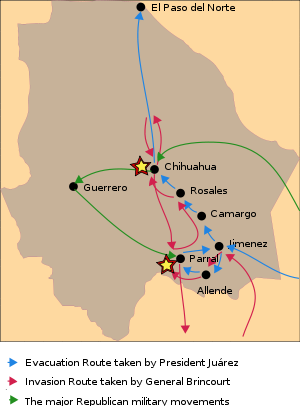
The French forces tried to subdue and capture the liberal government based in Saltillo. On September 21, 1864, José María Patoni and Jesús González Ortega lost against the French forces at the Battle of Estanzuelas; the supreme government led by President Juárez was forced to evacuate the city of Saltillo and relocate to Chihuahua. Juárez stopped in Ciudad Jiménez, Valle de Allende, and Hidalgo de Parral, in turn. He decreed Parral the capital of Mexico from October 2–5, 1864.[29] Perceiving the threat from the advancing French forces, the president continued his evacuation through Santa Rosalía de Camargo, Santa Cruz de Rosales, and finally Chihuahua City. On October 12, 1864, the people of the state gave President Juárez an overwhelmingly supportive reception, led by Governor Ángel Trías. On October 15, 1864 the city of Chihuahua was declared the temporary capital of Mexico.
After running imperial military affairs in the states of Coahuila and Durango, General Agustín Enrique Brincourt made preparations to invade the state of Chihuahua. On July 8, 1865 Brincourt crossed the Nazas River in northern Durango, heading toward Chihuahua. On July 22 Brincourt crossed the banks of Río Florido into Ciudad Jiménez; one day later he arrived at Valle de Allende where he sent Colonel Pyot with a garrison to take control of Hidalgo del Parral. Brincourt continued through Santa Rosalia de Camargo and Santa Cruz de Rosales. President Juárez remained in the state capital until August 5, 1865 when he left for El Paso del Norte (present-day Ciudad Juárez) due to evidence that the French were to attack the city. On the same day, the President named General Manuel Ojinaga the new governor and placed him in charge of all the republican forces. Meanwhile, General Villagran surprised the imperial forces in control of Hidalgo de Parral; after a short two hour battle, Colonel Pyot was defeated and forced to retreat. At the Battle of Parral, the French lost 55 men to the Republican forces. On August 13, 1865, the French forces with an estimated 2,500 men arrived at the outskirts of Chihuahua City, and on August 15, 1865, General Brincourt defeated the republican forces, taking control of the state capital. Brincourt designated Tomás Zuloaga as Prefect of Chihuahua.[30] Fearing the French would continue their campaign to El Paso del Norte, President Juárez relocated to El Carrizal, a secluded place in the mountains near El Paso del Norte, in August 1865, .[31] It would have been easy for the French forces to continue in pursuit of President Juárez across the border, but they feared altercations with American forces. General François Achille Bazaine ordered the French troops to retreat back to the state of Durango after only reaching a point one days travel north of Chihuahua City. General Brincourt asked for 1,000 men to be left behind to help maintain control over the state, but his request was denied. After the death of General Ojinaga, the Republican government declared General Villagran in charge of the fight against the Imperial forces. The French left the state on October 29, 1865. President Juárez returned to Chihuahua City on November 20, 1865 and remained in the city until December 9, 1865 when he returned to El Paso del Norte. Shortly after the president left Chihuahua City, Terrazas was restored as governor of the state on December 11, 1865.
Maximilian was deeply dissatisfied with General Bazaine's decision to abandon the state capital of Chihuahua and immediately ordered Agustín B. Billaut to recapture the city. On December 11, 1865, Billaut with a force of 500 men took control of the city. By January 31, 1866 Billaut was ordered to leave Chihuahua, but he left behind 500 men to maintain control. At the zenith of their power, the imperialist forces controlled all but four states in Mexico; the only states to maintain strong opposition to the French were: Guerrero, Chihuahua, Sonora, and Baja California.[32]
 The Plaza de Armas and the Cathedral of the Holy Cross, Our Lady of Regla and St Francis of Assisi
President Juárez once again based his government in the state of Chihuahua and it served as the center for the resistance against the French invasion throughout Mexico. On March 25, 1866, a battle ensued in the Plaza de Armas in the center of Chihuahua City between the French imperial forces that were guarding the plaza and the Republican forces led by General Terrazas. Being completely caught off guard, the French imperial forces sought refuge by bunkering themselves in the Cathedral of the Holy Cross, Our Lady of Regla, and St Fancis of Assisi and made it almost impossible to penetrate their defenses. General Terrazas then decided to fire a heavy artillery barrage with 8 kg cannon balls. The first cannon fired hit a bell in the tower of the church, instantly breaking it in half; soon after, 200 men of the imperial army forces surrendered. The republican forces had recovered control over the state capital. The bell in the church was declared a historical monument and can be seen today in the Cathedral. By April 1866, the state government had established a vital trading route from Chihuahua City to San Antonio, Texas; the government began to replenish their supplies and reinforce their fight against the Imperial forces.
General Aguirre moved to the deserts of the southeastern portion of the state and defeated the French forces in Parral, led by Colonel Cottret. By the middle of 1866, the state of Chihuahua was declared free of enemy control; Parral was the last French stronghold within the state. On June 17, 1866, President Juárez arrived in Chihuahua City and remained in the capital until December 10, 1866. During his two years in the state of Chihuahua, President Juárez passed ordinances regarding the rights of adjudication of property and nationalized the property of the clergy. The distance of the French forces and their allies allowed the Ministry of War, led by General Negrete, to reorganize the state's national guard into the Patriotic Battalion of Chihuahua, which was deployed to fight in the battle of Matamoros, Tamaulipas against the French. After a series of major defeats and an escalating threat from Prussia, France began pulling troops out of Mexico in late 1866. Disillusioned with the liberal political views of Maximilian, the Mexican conservatives abandoned him, and in 1867 the last of the Emperor's forces were defeated. Maximilian was sentenced to death by a military court; despite national and international pleas for amnesty, Juárez refused to commute the sentence. Maximilian was executed by firing squad on June 19, 1867.
Juárez Regime
 Monument to Benito Juárez in Ciudad Juárez, Chihuahua
President Benito Juárez was re-elected in the general election of 1867 in which he received strong liberal support, especially in Chihuahua. Luis Terrazas was confirmed by the people of Chihuahua to be governor of the state. But soon after the election, President Juárez had another crisis on his hands; the Juárez administration was suspected to be involved in the assassination of the military chief José María Patoni executed by General Canto in August 1868. General Canto turned himself over to Donato Guerra. Canto was sentenced to death, but later his sentence changed to 10 years imprisonment. The sense of injustice gave rise to a new rebellion in 1869 that threatened the federal government. In response, the Juárez administration took drastic measures by temporarily suspending constitutional rights, but the governor of Chihuahua did not support this action. Hostilities continued to increase especially after the election of 1871 which was perceived to be fraudulent. A new popular leader arose among the rebels, Porfirio Díaz. The federal government was successful in quelling rebellions in Durango an Chihuahua. On July, 18 1872, President Juárez died from a heart attack; soon after, many of his supporters ceased the fighting. Peace returned to Chihuahua and the new government was led by Governor A. Ochoa in 1873 after Luis Terrazas finished his term in 1872.
But the peace in the state did not last long, the elections of 1875 caused new hostilities. Ángel Trías led a new movement against the government on June 1875 and maintained control over the government until September 18, 1875 when Donato Guerra the orchestrator of the Revolution of the North was captured. Donato Guerra was assassinated in a suburb of Chihuahua City where he was incarcerated for conspiring with Ángel Trías. During October 1875 several locations were controlled by rebel forces, but the government finally regained control on November 25, 1875.
Porfiriato
 Porfirio Díaz in military uniform
After the death of the president Benito Juárez in 1872, the first magistracy of the country was occupied by the vice-president Sebastián Lerdo de Tejada, who called for new elections. Two candidates were registered; Lerdo de Tejada and General Porfirio Díaz, one of the heroes of the Battle of Puebla which had taken place on May 5, 1862. Lerdeo de Tejada won the election, but lost popularity after he announced his intent to run for re-election. On March 21, 1876, Don Porfirio Díaz rebelled against President Sebastian Lerdo de Tejada. The Plan of Tuxtepec defended the "No Re-election" principle. On June 2, 1876 the garrisons in the state of Chihuahua surrendered to the authority of General Porfirio Díaz; Governor Antonio Ochoa was arrested until all the Lerdista forces were suppressed throughout the state. Porfirio Díaz then helped Tíras regain the governorship of the state of Chihuahua allowing for the Plan of Tuxtepec to be implemented. The victory of the Plan of Tuxtepec, gave the interim presidency to Jose Maria Iglesias and later, as the only candidate, the General Porfirio Díaz assumed the presidency on May 5, 1877. During the first years of the Porfiriato (Porfirio Díaz Era), the Díaz administration had to combat several attacks from the Lerdista forces and the Apache. A new rebellion led by the Lerdista party was orchestrated from exile in the United States. The Lerdista forces were able to temporarily occupy the city of El Paso del Norte until mid 1877. During 1877 the northern parts of the state suffered through a spell of extreme drought which were responsible for many deaths in El Paso del Norte.
 Palacio de Alvarado is the house of Pedro Alvarado Torres, one of the richest silver barons of Mexico during the Porfiriato.
The officials in Mexico City reduced the price of corn from six cents to two cents a pound. The northern portion of the state continued to decline economically which led to another revolt led by G. Casavantes in August 1879; Governor Trías was accused of misappropriation of funds and inefficient administration of the state. Casavantes took the state capital and occupied it briefly; he was also successful in forcing Governor Trías to exile. Shortly afterwards, the federal government sent an entourage led by Treviño; Casavantes was immediately ordered to resign his position. Casavantes declared political victory as he was able to publicly accuse and depose Governor Trías. At the same time the states of Durango and Coahuila had a military confrontation over territorial claims and water rights; this altercation between the state required additional federal troops to stabilize the area. Later a dispute ensued again between the states of Coahuila, Durango, and Chihuahua over the mountain range area known as Sierra Mojada when large deposits of gold ore was discovered. The state of Chihuahua officially submitted a declaration of protest in May 1880 that was shortly after settled amicably. Despite the difficulties at the beginning, Díaz was able to secure and stabilize the state which earned the confidence and support of the people. During the 1880s, the Díaz administration consolidated several government agencies throughout Mexico to control credit and currency by the creation of the Institution of Credit and Currency. Because Díaz had created such an effective centralized government, he was able to concentrate decision-making and maintain control over the economic instability.[33]
 City Hall of Chihuahua is an example of the neoclassical architecture that was erected during the presidency of Porfirio Díaz.
The Díaz administration made political decision and took legal measures that allowed the elite throughout Mexico to concentrate the nation's wealth by favoring monopolies. During this time, two fifths of the state's territory was divided among 17 rich families which owned practically all of the arable land in Chihuahua. The state economy grew at a rapid pace during the Porfiriato; the economy in Chihuahua was dominated by agriculture and mining. The Díaz administration helped Governor Luis Terrazas by funding the Municipal Public Library in Chihuahua City and passing a federal initiative for the construction of the railroad from Chihuahua City to Ciudad Júarez.
 Quinta Gameros, a lavish mansion constructed by a rich mining baron, is an example of Art Nouveau architecture in vogue during the Porfiriato Era.
By 1881, the Central Mexican Railroad was completed which connected Mexico City to Cuidad Júarez. In 1883 telephone lines are installed throughout the state allowing communication between Chihuahua City and Aldama. By 1888 the telephone services were extended from the capital to the cites of Julimes, Meoqui, and Hidalgo del Parral; the telecommunication network in the state covered an estimated 3,500 kilometers. Due to the need of labor to construct the extensive infrastructure projects, a significant Asian immigration is observed in the state; most of the immigrants came from China. Asian immigrants soon become integral parts of the state economy by opening restaurants, small grocery stores, and hotels. By the end of the Terrazas term, the state experiences an increase in commerce, mining, and banking. The banks in the state are overtaken by the federal government which made Chihuahua the most important banking state in Mexico.
Under Governor Miguel Ahumada, the education system in the state is unified and brought under tighter control by the state government, and the metric system is standardized throughout the state which replaces the colonial system of weights and measurements. On September 16, 1897 the Civilian Hospital of Chihuahua is inaugurated in Chihuahua City which became known as one of the best in the country. In 1901 the Hero's Theatre is opened in Chihuahua City. On August 18, 1904 Governor Terrazas is replaced by Governor Enrique C. Creel. From 1907 to 1911, the Creel administration is successful in advancing the state's legal system, modernizing the mining industry, and raising public education standards. In 1908 the Chihuahuan State Penitentiary is built, and the construction on the first large scale dam project is initiated on the Chuviscar River. During the same time, the streets of Chihuahua City are paved and numerous monuments are built in Chihuahua City and Ciudad Júarez.
Geography
 Cerro Mohinora is the highest point in Chihuahua
The state of Chihuahua is the largest state in the country and is known as El Estado Grande (The Big State); it accounts for 12.6% of the land of Mexico. The state landlocked by the states of Sonora to the west, Sinaloa to the south-west, Durango to the south, and Coahuila to the east, and by the U.S. states of Texas to the north-east and New Mexico to the north. The state is made up of three geologic regions: Mountains, Plains-Valleys, and Desert which occur in large bands from west to east. Because of the different geologic regions there are contrasting climates and ecosystems.
 Satellite image of the state of Chihuahua shows the varying terrain from the green alpine mountains in the southwest, to the steppe highlands in the center, to the desert in the east.
 Altiplanicie Mexicana during the monsoon season.
The main mountain range in the state is the Sierra Madre Occidental reaching a maximum altitude of 10,826 ft (3,300 m) known as Cerro Mohinora. Mountains account for one third of the state's surface area which include large coniferous forests. The climate in the mountainous regions varies Chihuahua has more forests than any other state in Mexico making the area a bountiful source of wood; the mountainous areas are rich in minerals important to Mexico's mining industry. Precipitation and temperature in the mountainous areas depends on the elevation. Between the months of November and March snow storms are possible in the lower elevations and are frequent in the higher elevations. There are several watersheds located in the Sierra Madre Occidental all of the water that flows through the state; most of the rivers finally empty into the Rio Grande. Temperatures in some canyons in the state reach over 100°F in the summer while the same areas rarely drop below 32°F in the winter. There are microclimates found in the heart of the Sierra Madre Occidental in the state that could be considered tropical and there have been wild tropical plants found in some canyons. La Barranca del Cobre, or Copper Canyon, a spectacular canyon system larger and deeper than the Grand Canyon; the canyon also contains Mexico's two tallest waterfalls: Basaseachic Falls and Piedra Volada. There are two national parks found in the mountainous area of the state: Cumbres de Majalca National Park and Basaseachic Falls National Park.
The plains at the foot of the Sierra Madre Occidental is an elongated mesa known as Altiplanicie Mexicana that exhibits a steppe climate and serves as a transition zone from the mountain climate in the western part of the state to the desert climate in the eastern side of the state.
 Dunas de Samalayuca a state protected area south of Ciudad Juárez.
 Namúrachi Canyon is characterized by many caves near the town of San Francisco de Borja
The steppe zone accounts for a third of the state's area, and it experiences pronounced dry and wet seasons. The pronounced rainy season in the steppe is usually observed in the months of July, August, and September. The steppe also encounters extreme temperatures that often reach over 100°F in the summer and drop below 32°F in the winter. The steppe zone is an important agriculture zone due to an extensive development of canals exploiting several rivers that flow down from the mountains. The steppe zone is the most populated area of the state.
The most important river in the state is Rio Conchos which is the largest tributary to the Rio Grande from the Mexican side; the river descends from the zenith of the Sierra Madre Occidental in the southwest part of the state an winds through the center of the state where the water is exploited in the steppe zone and it eventually empties into the Rio Grande in the small desert town of Ojinaga.
The desert zone also accounts for about a third of the state's surface area. The Chihuahuan Desert is an international biome that also extends into the neighboring Mexican state of Coahuila and into the US states of Texas and New Mexico. The desert zone is mainly of flat topography with some small mountain ranges that run north to south. The desert in the state varies slightly with a small variant in climate. The lower elevations of the desert zone are found in the north along the Rio Grande which experience hotter temperatures in the summer and winter while the southern portion of the desert zone experiences cooler temperatures due to its higher elevation. Samalayuca covers an area of about 150 square kilometers; it is an impressive site of the Chihuahuan Desert and is a protected area by the state due to unique species of plants and animals that can only be found in that area.
Climate
 Creel at an elevation of 9,186 ft above sea level experiences a subtropical highland climate.
 Cumbres de Majalca National Park is found in the transition zone from humid subtropical climate to semi-arid climate.
 Köppen Climate Zones
The climate in the state depends mainly in the elevation of the terrain. According to Köppen climate classification the state has five major climate zones. The Sierra Madre Occidental dominates the western part of the state; there are two main climates in this area: Subtropical Highland (Cfb) and Humid Subtropical (Cwa). There are some microclimates in the state due to the varying topology mostly found in the western side of the state. The two best known microclimates are: Tropical savanna climate (Aw) in deep canyons located in the extreme southern part of the state; Continental Mediterranean climate (Dsb) in the extremely high elevations of the Sierra Madre Occidental. Satellite image to the right shows the vegetation is much greener in the west because of the cooler temperatures and larger amounts of precipitation as compared to the rest of the state.
In the far eastern part of the state the Chihuahuan Desert dominates due to low precipitation and extremely high temperatures; some areas of the eastern part of the state are so dry no vegetation is found like the Sand Dunes of Samalayuca. There are two distinctive climate zones found in the eastern part of the state: Hot Desert (BWh) and Cool Desert (BWk) which are differentiated by average annual temperature due to differences in elevation. There is a transition zone in the middle of the state between the two extremely different climates from the east and west; this zone is the Steppe characterized by a compromise between juxtaposed climate zones.
 The Chihuahuan Desert varies slightly from cool in higher terrain to hot in low elevations.
 Cerro Bola on the outskirts of Ciudad Juárez during the winter.
- Subtropical Highland (Cfb) most common at elevations above 7,200 ft (2,200 m) above sea level; this climate zone has warm summers reaching a maximum temperature of 82°F and summer lows of 50°F. Heavy rainstorms are observed from July to September. Winters are cold reaching a maximum low of -4°F and a maximum high of 17°F. During the winter months many snowstorms are observed with typically 1 meter (~3 ft) of snow per season.
- Humid Subtropical (Cwa) climate is most common at elevations between 4,200-7,200 ft above sea level; this climate zone has warm humid summers and an average summer temperature of 68°F. The summer average precipitation is 70 cm (28 in) mostly in the months of: July, August, and September. From November to March there are many rainstorms and snowstorms caused by high elevation and prominent cold fronts. Winter temperatures can reach a low of 3°F.
- Semi-arid climate or Steppe (BSk) is most common at elevations between 4,000-5,000 ft above sea level; this climate zone has an annual average 64°F and maximum temperatures above of 100°F and lows reaching slightly below 32°F, with a wet season in the late summer and fall. Snowfall is rare but possible in the winter and frost is common from December to March. The annual average rainfall in the steppe climate zone is about 18.7 inches.
- Hot Desert (BWh) is most common at elevations below 4,000 ft (1,200 m) above sea level; this climate zone tends to have a hot summer at temperatures that often reach 110 °F. Winter is warm, rarely dropping below 32°F. Precipitation averages between 6-10 in per year; most of the moisture falls during the "monsoon" of late summer.
- Cool Desert (BWk) is most common at elevations below 4,000 ft (1,200 m) above sea level; this climate zone tends to have a mild summer, rarely reaching temperatures over 105 °F. Winter weather varies from mild to cold depending on northern fronts, often dropping below 32°F. Precipitation averages between 10-16 in per year; most of the moisture falls during the "monsoon" of late summer.
Flora and Fauna
 Pinus ponderosa at Arareco Lake
The state has a great diversity due to the large number of microclimates found and dramatic varying terrain. The flora throughout the Sierra Madre Occidental mountain range varies with elevation. Pine (Pinus) and Oak (Quercus) species are usually found at an elevation of 2,000 meters (6,560 ft) above sea level. The most common species of flora found in the mountains are: Pinus, Quercus, Abies, Ficus, Vachellia, Ipomoea, Acacia, Lysiloma, Bursera, Vitex, Tabebuia, Sideroxylon, Cordia, Fouquieria, Pithecellobium.[34] The state is home to one of the largest variation species of the genus Pinus in the world. The lower elevations have a steppe vegetation with a variety of grasses and small bushes. Several species of Juniperus dot the steppe and the transition zone.
According to the World Wide Fund for Nature, the Chihuahuan Desert may be the most biologically diverse desert in the world, whether measured on species richness or endemism, although the region has been heavily degraded over time. Many native species have been replaced with creosote shrubs. The most common desert flora in the state includes: Agave, Larrea, Prosopis, Fouquieria, Dasylirion, Yucca, Poaceae, Lophophora, Opuntia, Echinocereus, Baileya, Chilopsis, Eucnide, and Hylocereus.
 American bison Bison bison near Chihuahua City.
The fauna in the state is just as diverse as the flora and varies greatly due to the large contrast in climates. In the mountain zone of the state the most observed mammals are: Mexican Fox Squirrel (Sciurus nayaritensis), Antelope Jackrabbit (Lepus alleni), Raccoon (Procyon lotor), Hooded Skunk (Mephitis macroura), Wild Boar (Sus scrofa), Collared Peccary (Pecari tajacu), White-tailed Deer (Odocoileus virginianus), Mule Deer Odocoileus hemionus, American bison Bison bison, Cougar (Puma concolor), Eastern Cottontail Sylvilagus floridanus, North American Porcupine Erethizon dorsatum, Bobcat Lynx rufus, ; Mexican Wolf Canis lupus baileyi, and Coyote Canis latrans. American Black BearUrsus americanus is also found but in very small numbers. The Mexican wolf, once abundant, has been extirpated. The main cause of degradation has been grazing.[35] Although there are many reptilian species in the mountains the most observed species include: Northern Mexican Pine Snake, Pituophis deppei jani, Texas Horned Lizard (Phrynosoma cornutum), Rock Rattlesnake (Crotalus lepidus), Black-tail Rattlesnake (Crotalus molossus). Plateau Tiger Salamander Ambystoma velasci is one of possible many amphibians to be found in the mountains.
 Mexican Wolf Canis lupus baileyi
The Chihuahuan Desert is home to a diverse ecosystem which is home to a large variety of mammals. The most common mammals in the desert include: Desert Cottontail Sylvilagus audubonii; Black-tailed Jackrabbit Lepus californicus; Hooded Skunk Mephitis macroura; Cactus Mouse Peromyscus eremicus; Swift Fox Vulpes velox; White-Throated Woodrat Neotoma albigula; Pallid bat Antrozous pallidus; and Coyote Canis latrans. The most observed reptiles in the desert include: Mohave rattlesnake Crotalus scutulatus, Twin-spotted rattlesnake Crotalus pricei, Prairie rattlesnake Crotalus viridis, Ridge-nosed rattlesnake Crotalus willardi; Whip Snake Masticophis flagellum; New Mexico Whiptail Cnemidophorus neomexicanus; Red-spotted Toad Bufo punctatus.
The state is also a host to a large population of birds which include endemic species and migratory species: Greater Roadrunner Geococcyx californianus; Cactus Wren Campylorhynchus brunneicapillus; Mexican Jay Aphelocoma ultramarina; Steller's Jay Cyanocitta stelleri; Acorn Woodpecker Melanerpes formicivorus; Canyon Towhee Pipilo fuscus; Mourning Dove Zenaida macroura; Broad-billed Hummingbird Cynanthus latirostris; Montezuma Quail Cyrtonyx montezumae; Mountain Trogon Trogon mexicanus; Turkey Vulture Cathartes aura; and Golden Eagle Aquila chrysaetos. Trogon mexicanus is endemic species found in the mountains in Mexico; it is considered an endangered species and has symbolic significance to Mexicans.[36]
Demography
 Municipality Population Density Data Source: INEGI[37]250-1,000 persons per km225-249 persons per km25-24 persons per km21-4 persons per km2
Population History
of ChihuahuaYear Population 1930 491,792 1940 623,944 1950 846,414 1960 1,226,793 1970 1,612,525 1980 2,005,477 1990 2,441,873 2000 3,052,907 2005 3,241,444
According to the census by the Instituto Nacional de Estadística y Geografía (INEGI) in 2005, the state population is 3,241,444 making the state the 11th most populated state in Mexico. Census recorded 1,610,275 men and 1,631,169 women.[38] The median age of the population is 25 years of age.[39] The northern state is placed seventh in the nation regarding quality of life and sixth in terms of life expectancy at 75.2 years of age.
During the period from 2000–2005 it is estimated that 49,722 people left the state for the United States. 82,000 people are thought to have immigrated to the state from 2000–2005 mainly coming from Veracruz (17.6%), United States (16.2%), Durango (13.2%), Coahuila (8.0%) y Chiapas (4.5%). It is believed that there is a large number of undocumented immigrants in that state the come from Central and South America which mainly settle in Ciudad Juárez. According the to the 2005 census, the population grew 1.06% from 2000 to 2005. The state has an uneven settlement of people and the lowest population density of any Mexican state; according to the 2005 census there were 12 people per square kilometer.[40] Of all the 3,241,444 people in the state, two thirds live in the cities of Ciudad Juárez and Chihuahua accounting together 2,072,129. Only three cities have more than one hundred thousand: Parral 101,147; Cuauhtémoc 105,725; and Delicias 108,187.
Ethnic Groups
 Autonomous Indigenous TribesTarahumaraTepehuan Del NorteGuarijíoPima
Chihuahua holds one of the largest proportion of white population of Mexico, as is the case in much of northern Mexico. Caucasians make up 55% of the population, most of them of Spanish origin, but also of French, Basque, Italian, German, Dutch and Middle Eastern descent, while the rest of the population are Mestizo groups of predominantly Spanish descent. Indians form 5% of the state inhabitants and remain isolated in the forests of southwestern Chihuahua. The admixture with Indians was never sizable in Nueva Vizcaya due to the scarcity of natives (most of them warrior and anti-European Conchos and Tarahumaras), and the size of the territory. The most important indigenous tribes of the state of Chihuahua are:
 Tarahumara women near Lake Arareco.
- Tarahumara: The largest tribe of indigenous people in the state. They call themselves Rarámuri which means "Barefoot Runner". They are famous for their endurance in running long distances. They live in large areas of the Sierra Madre Occidental. Many of the tribe have immigrated to the large cities of the state mainly for economic incentives.
- Tepehuan Del Norte: A tribe differentiated from the Tepehuan that live in the state of Durango by their language. The tribe lives near the small towns of Guadalupe y Calvo and Baborigame.
- Guarijío: A small tribe that is differentiated from the other tribes of the state by their language. Little is known about these indigenous tribes except that they live near the small villages of Chínipas and Uruachi.
- Pima: A large tribe of people that live in across extensive areas of northwestern Mexico and southwestern United States. The population of the tribe in the state is small mostly around the town of Temósachi. Although all the tribe speaks the same language variant dialects have been discovered between different settlements.
Religion
 Metropolitan Cathedral of Chihuahua
Although the great majority of residents of the state of Chihuahua are Catholics, there is a large diversity of religions within the state. There are many apostolic churches, LDS churches, and large Mennonite communities.
Population of 5 years and older claim to be the following religious beliefs.
Religion Percent Catholic 84.6%[41] Protestant 7.1%[42] Nondenominational 2.0%[43] Atheist 5.1%[44] Main Cities
The state has one city with a population exceeding one million, Ciudad Juárez. Ciudad Juárez is ranked 8th most populous city in the country and Chihuahua City was ranked 16th most populous in Mexico. Chihuahua is the only state in Mexico to have two cities ranked in the top 20 most populated. El Paso and Ciudad Juárez comprise one of the largest bi-national metropolitan areas in the world with a combined population of 2.4 million people. In fact, Ciudad Juárez is one of the fastest growing cities in the world in spite of the fact that it is "the most violent zone in the world outside of declared war zones."[45] For instance, a few years ago the Federal Reserve Bank of Dallas published that in Ciudad Juárez "the average annual growth over the 10-year period 1990–2000 was 5.3 percent. Juárez experienced much higher population growth than the state of Chihuahua and than Mexico as a whole."[46] Chihuahua City has one of the highest literacy rates in the country at 98%; 35% of the population is aged 14 or below, 60% between 15-65 and 5% over 65.[47] The growth rate is 2.4%.[47] The 76.5%[48] of the population of the state of Chihuahua live in cities which makes the state one of the most urbanized in Mexico.
Cities of Chihuahua
(Conteo de Población y Vivienda 2005)[49]Rank City Municipality Population 2000 Population 2005 1 Ciudad Juárez Juárez 1,187,275 1,301,452 2 Chihuahua City Chihuahua 657,876 748,518 3 Delicias Delicias 98,615 108,187 4 Ciudad Cuauhtémoc Cuauhtémoc 98,876 125,725 5 Parral Hidalgo del Parral 85,387 101,147 6 Nueva Casas Grandes Nueva Casas Grandes 50,378 50,863 7 Camargo Camargo 37,456 39,149 9 Ciudad Jiménez Jiménez 29,895 33,567  A panoramic view of Ciudad Juárez and El Paso, Texas from the north. The Hueco Mountains can be seen toward the east; the Juarez mountains of Mexico can be seen to the south (right of the image).
Education
 The Chihuahua campus of ITESM.
According to the Instituto Nacional de Estadística, Geografía e Informática (INEGI), 95.6% of the population over the age of 15 could read and write Spanish, and 97.3% of children of ages 8–14 could read and write Spanish. An estimated 93.5% of the population between ages 6–14 attend an institution of education. Estimated 12.8% of residents of the state have obtained a college degree.[50] Average schooling is 8.5 years, which means that in general the average citizen over 15 years of age has gone as far as a second year in secondary education.
Institutions of higher education include:
- Instituto Tecnológico de Chihuahua
- Instituto Tecnológico de Chihuahua II
- Universidad Autónoma de Chihuahua
- Instituto Tecnólogico y de Estudios Superiores de Monterrey Campus Chihuahua
- Universidad La Salle
- Universidad Tecnológica de Chihuahua
Crime
Chihuahua has one of the worst homicide rates in the Western Hemisphere, standing at 134 per 100,000 people. Ciudad Juárez has recently been the scene of Mexico's most violent confrontations between rival drug cartels.[51]
Government
Administrative divisions
Municipalities of the State of Chihuahua 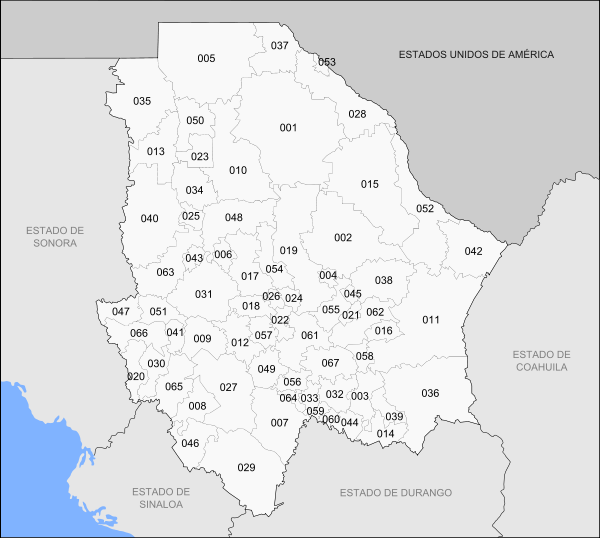
Number Municipality Municipal Seat Number Municipality Municipal Seat 001 Ahumada Villa Ahumada 035 Janos Janos 002 Aldama Aldama 036 Jiménez Ciudad Jiménez 003 Allende Valle de Allende 037 Juárez Ciudad Juárez 004 Aquiles Serdán Santa Eulalia 038 Julimes Julimes 005 Ascensión Ascensión 039 López Villa López 006 Bachíniva Bachíniva 040 Madera Ciudad Madera 007 Balleza Mariano Balleza 041 Maguarichi Maguarichi 008 Batopilas Batopilas 042 Manuel Benavides Manuel Benavides 009 Bocoyna Bocoyna 043 Matachí Matachí 010 Buenaventura San Buenaventura 044 Matamoros Villa Matamoros 011 Camargo Camargo 045 Meoqui Meoqui 012 Carichí Carichí 046 Morelos Morelos 013 Casas Grandes Casas Grandes 047 Moris Moris 014 Coronado Villa Coronado 048 Namiquipa Namiquipa 015 Coyame del Sotol Coyame 049 Nonoava Nonoava 016 La Cruz La Cruz 050 Nuevo Casas Grandes Nuevo Casas Grandes 017 Cuauhtémoc Cuauhtémoc 051 Ocampo Melchor Ocampo 018 Cusihuiriachi Cusihuiriachi 052 Ojinaga Ojinaga 019 Chihuahua Chihuahua 053 Práxedis G. Guerrero Práxedis G. Guerrero 020 Chínipas Villa Chínipas de Almada 054 Riva Palacio San Andrés 021 Delicias Delicias 055 Rosales Santa Cruz de Rosales 022 Dr. Belisario Domínguez San Lorenzo 056 Rosario Valle del Rosario 023 Galeana Hermenegildo Galeana 057 San Francisco de Borja San Francisco de Borja 024 Santa Isabel Santa Isabel 058 San Francisco de Conchos San Francisco de Conchos 025 Gómez Farías Valentín Gómez Farías 059 San Francisco del Oro San Francisco del Oro 026 Gran Morelos San Nicolás de Carretas 060 Santa Bárbara Santa Bárbara 027 Guachochi Guachochi 061 Satevó Satevó 028 Guadalupe Guadalupe 062 Saucillo Saucillo 029 Guadalupe y Calvo Guadalupe y Calvo 063 Temósachi Temósachi 030 Guazapares Témoris 064 El Tule El Tule 031 Guerrero Guerrero 065 Urique Urique 032 Hidalgo del Parral Hidalgo del Parral 066 Uruachi Uruachi 033 Huejotitán Huejotitán 067 Valle de Zaragoza Valle de Zaragoza 034 Ignacio Zaragoza Ignacio Zaragoza Chihuahua is subdivided into 67 municipios (municipalities).
Economy
As of 2005, Chihuahua's economy represents 4.5% of Mexico's total gross domestic product or 29,826 million USD.[52] Chihuahua's economy has a strong focus on export-oriented manufacturing (i.e. maquiladora). As of 2005, 329,939 people are employed in the manufacturing sector.[52] There are a more than 406 companies operating under the federal IMMEX or Prosec program in Chihuahua. The average wage for an employee in Chihuahua is approximately 193 pesos per day.[53]
Gallery
-

Metropolitan cathedral of Chihuahua, Chih.
-

Plaza de Armas of Chihuahua, Chih.
-

Chihuahua after a snowfall.
See also
References
- ^ "Las Diputaciones Provinciales" (in Spanish). p. 15. http://biblio.juridicas.unam.mx/libros/6/2920/11.pdf.
- ^ "Senadores por Chihuahua LXI Legislatura". Senado de la Republica. http://www.senado.gob.mx/index.php?ver=int&mn=4&sm=4&id=7. Retrieved October 4, 2010.
- ^ "Listado de Diputados por Grupo Parlamentario del Estado de Chihuahua". Camara de Diputados. http://sitl.diputados.gob.mx/LXI_leg/listado_diputados_gpnp.php?tipot=Edo&edot=6. Retrieved October 4, 2010.
- ^ a b "Resumen". Cuentame INEGI. http://cuentame.inegi.gob.mx/monografias/informacion/chih/default.aspx?tema=me&e=08. Retrieved October 4, 2010.
- ^ "Relieve". Cuentame INEGI. http://cuentame.inegi.gob.mx/monografias/informacion/chih/territorio/relieve.aspx?tema=me&e=08. Retrieved October 20, 2010.
- ^ a b "Mexico en Cifras". INEGI. http://www.inegi.org.mx/sistemas/mexicocifras/default.aspx?ent=8. Retrieved April 9, 2011.
- ^ "Reporte: Jueves 3 de Junio del 2010. Cierre del peso mexicano.". www.pesomexicano.com.mx. http://www.pesomexicano.com.mx/archivo/2010/junio/03/reporte-jueves-3-de-junio-del-2010--cierre-del-peso-mexicano.htm#leermas. Retrieved August 10, 2010.
- ^ "Prevencion de Incendios Forestales en Chihuahua.". Eduteka. http://www.eduteka.org/proyectos.php/1/2356. Retrieved April 13, 2010.
- ^ "Mapa del Area de Barrancas.". ViajesBarrancasDelCobre.com. http://viajesbarrancasdelcobre.com/canyonmap.htm. Retrieved April 13, 2010.
- ^ "Mapa del Area de Barrancas.". Coopper Canyon Insider. http://www.coppercanyoninsider.com. Retrieved April 13, 2010.
- ^ Correspondents (6 February 2010). "Trasladan Poderes de Chihuahua a Juárez" (in Spanish). El Universal. http://www.eluniversal.com.mx/notas/656753.html. Retrieved 2010-02-07.
- ^ Correspondents (12 February 2010). "Diputados dicen no al traslado de Poderes" (in Spanish). El Universal. http://www.eluniversal.com.mx/notas/658391.html. Retrieved 2010-02-12.
- ^ en Inglés
- ^ Fernández Tejedo, Isabel; and Carmen Nava Nava (2001). "Images of Independence in the Nineteenth Century: The Grito de Dolores, History and Myth". In William H. Beezley and David E. Lorey (eds.). ¡Viva Mexico! ¡Viva la independencia!: Celebrations of September 16. Latin American Silhouettes: studies in history and culture series. Margarita González Aredondo and Elena Murray de Parodi (Spanish-English trans.). Wilmington, Delaware: Scholarly Resources. pp. 1–42. ISBN 0-8420-2914-1. OCLC 248568379.
- ^ Fowler, Will (2006). Political Violence and the Construction of National Identity in Latin America.. Gordonsville, Virginia, USA: Palgrave Macmillan. ISBN 9781403973887.
- ^ a b c Vazquez-Gomez, Juana (1997). Dictionary of Mexican Rulers, 1325–1997. Westport, Connecticut, USA: Greenwood Publishing Group, Incorporated. ISBN 9780313300493.
- ^ a b c Sosa, Francisco (1985) (in Spanish). Biografias de Mexicanos Distinguidos-Miguel Hidalgo. 472. Mexico City: Editorial Porrua SA. pp. 288–292. ISBN 968 452 050 6.
- ^ Villalpando, Jose Manuel (4-December-2002). "Mitos del Padre de la Patria.(Cultura)" (in Spanish). Mexico City: La Reforma. p. 4.
- ^ a b c Van Young, Eric (2001). Other Rebellion : Popular Violence and Ideology in Mexico, 1810–1821. Palo Alto, California, USA: Stanford University Press. ISBN 9780804737401.
- ^ a b c "Quien fue Hidalgo? - Biografia" (in Spanish). Mexico: INAH. http://www.inah.gob.mx/Ninos/miguelhidalgo/index.html. Retrieved 27 November.
- ^ a b Vidali, Carlos (4-December 2008). "Fusilamiento Miguel Hidalgo" (in Spanish). San Antonio: La Prensa de San Antonio. p. 1.
- ^ a b c d Kirkwood, Burton (2000). History of Mexico. Westport, Connecticut, USA: Greenwood Publishing Group, Incorporated. ISBN 9780313303517.
- ^ a b Vanden, Harry E. (2001). Politics of Latin America : The Power Game. Cary, North Carolina, USA: Oxford University Press. ISBN 9780195123173.
- ^ a b Benjamin, Thomas (2000). Revolución : Mexico's Great Revolution as Memory, Myth, and History. Austin, Texas, USA: University of Texas Press. ISBN 9780292708808.
- ^ "Siqueiros & the Hero Priest". Time (Time/CNN). 18-May-1953. http://www.time.com/time/magazine/article/0,9171,818504,00.html.
- ^ a b c d e f g h i j History Of The North Mexican States And Texas, Vol. II 1801–1889, San Francisco, The History Company, Publishers, 1889, Chapter 24
- ^ "Mexican States A-J". WORLD STATESMEN.org: Ben Cahoon. http://www.worldstatesmen.org/Mexico_states.htm#Chihuahua. Retrieved 15 January.
- ^ "Seminole in Mexico". Oklahoma: Seminole Nation, I. T.. http://www.seminolenation-indianterritory.org/seminole_in_mexico.htm. Retrieved 15 January.
- ^ Sección en INEGI Estado Chihuahua,municipio Hidalgo del Parral, localidad 0001 Enero 7 2007
- ^ Riva Palacios, Vicente (1940). Revolución : México á través de los siglos: historia general y completa del desenvolvimiento social, político, religioso, militar, artístico, científico y literario de México desde a antigüedad más remota hasta la época actual. California. México.: University of California Libraries (G. S. López edición). México.. ISBN nrlf_ucd:DVXL-000648908.
- ^ [www.inegi.gob.mx] 'Archivo Histórico de Localidades'
- ^ "French intervention and the Second Mexican Empire 1864–1867". MexicanHistory.org: MexicanHistory.org. http://mexicanhistory.org/French.htm. Retrieved 16 January.
- ^ Skidmore, Thomas; Peter H. Smith (1989). Modern Latin America. Oxford, UK: Oxford University Press. ISBN 0195055349.
- ^ http://redalyc.uaemex.mx/redalyc/html/341/34100203/34100203.html
- ^ Chihuahua Desert Ecoregion, World Wild Fund for Nature
- ^ http://www.mexicodesconocido.com.mx/notas/7235-Candame%F1a-(Chihuahua)
- ^ http://www.inegi.org.mx/sistemas/biblioteca/detalle.aspx?c=16632&upc=702825494384&s=est&tg=0&f=2&pf=Pob
- ^ = mpob02&c = 3179 Población total por entidad federativa según sexo, 2000 y 2005 INEGI
- ^ = mpob07&c = 3184 Edad mediana por entidad federativa según sexo, 2000 y 2005 INEGI
- ^ = mpob11&c = 3188 Densidad de población por entidad federativa, 2000 INEGI
- ^ = mrel07&c = 4140&e = 08 Volumen y porcentaje de la población de 5 y más años católica por entidad federativa, 2000 INEGI
- ^ = mrel08&c = 4141&e = 08 Volumen y porcentaje de la población de 5 y más años protestante y evangélica por entidad federativa, 2000 INEGI
- ^ = mrel09&c = 4142&e = 08 Volumen y porcentaje de la población de 5 y más años con religión bíblica no evangélica por entidad federativa, 2000 INEGI
- ^ = mrel10&c = 4143&e = 08 Volumen y porcentaje de la población de 5 y más años sin religión por entidad federativa, 2000 INEGI
- ^ http://www.chron.com/disp/story.mpl/breaking/6679334.html
- ^ http://www.dallasfed.org/research/busfront/bus0102.html
- ^ a b http://sustainablecities.net/plusnetwork/plus-cities/chihuahua-mexico
- ^ = mpob00&c = 5262 Cuadro resumen INEGI
- ^ "Conteo de Población y Vivienda 2005". Instituto Nacional de Estadística y Geografía. INEG. http://www.inegi.org.mx/sistemas/biblioteca/detalle.aspx?c=16632&upc=702825494384&s=est&tg=0&f=2&pf=Pob. Retrieved 15 August 2010.
Select Estado (State), then Descargar (Download).
The city population data from the state of Chihuahua can be found here - ^ [1], "Perfil Sociodemográfico de Chihuahua" Conteo de Población y Vivienda 2005 Insitutio Nacional de Estadística, Geografía e Informática p 32-43 ISBN 978-970-13-4992-2
- ^ The New Cocaine Cowboys. Foreign Affairs July/August 2010.
- ^ a b Industrial Costs in Mexico - A Guide for Foreign Investors 2007. Mexico City: Bancomext. 2007. p. 92.
- ^ "Banco de Información Económica". Sistemas Nacionales Estadístico y de Información Geográfica. http://dgcnesyp.inegi.gob.mx/cgi-win/bdieintsi.exe/CONA1&I100285&130613,&nd&nd&nd&nd&nd&2002&2008. Retrieved 2008-03-18.
External links
- (Spanish) Chihuahua state government
- (Spanish) Secretariat of Industrial Development of Chihuahua State Government
- (Spanish) Chihuahua's municipal governments
- (Spanish) Chihuahua photos
- (English) Encyclopaedia Britannica, Chihuahua
- (English) Chihuahuan Frontier
 State of Chihuahua
Cities Ciudad Chihuahua • Ciudad Cuauhtémoc • Ciudad Juárez • Delicias • Parral
Municipalities Sights States of Mexico States Aguascalientes · Baja California · Baja California Sur · Campeche · Chiapas · Chihuahua · Coahuila · Colima · Durango · Guanajuato · Guerrero · Hidalgo · Jalisco · México · Michoacán · Morelos · Nayarit · Nuevo León · Oaxaca · Puebla · Querétaro · Quintana Roo · San Luis Potosí · Sinaloa · Sonora · Tabasco · Tamaulipas · Tlaxcala · Veracruz · Yucatán · Zacatecas

Federal District Categories:- States of Mexico
- Chihuahua
- Chihuahuan Desert
- States and territories established in 1824


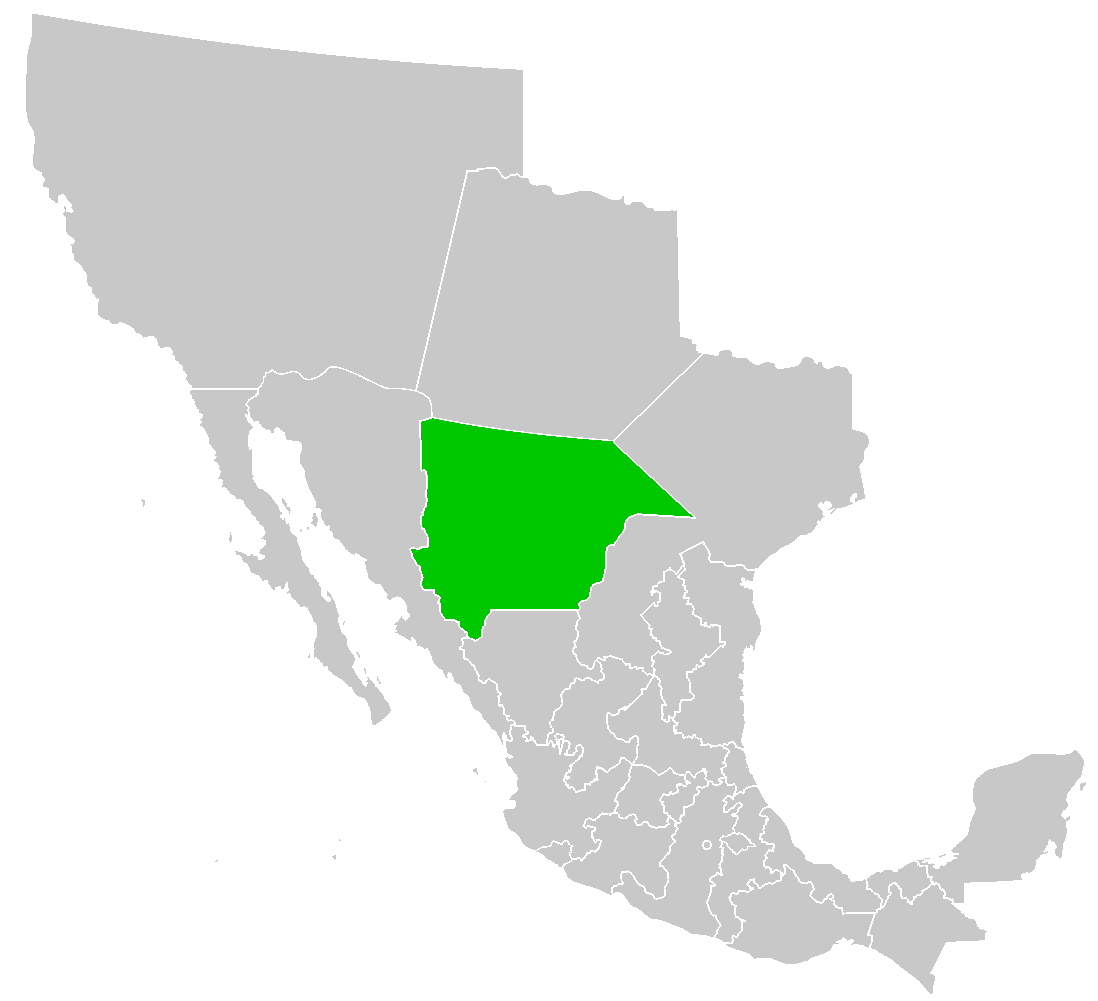


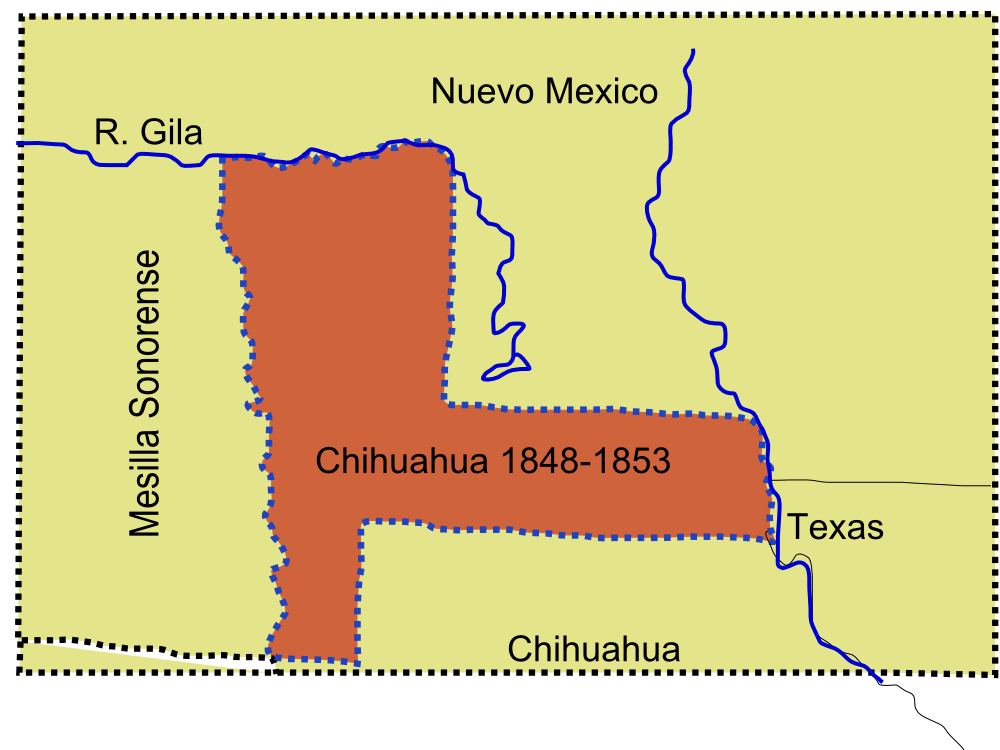

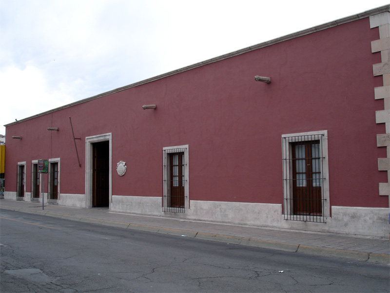


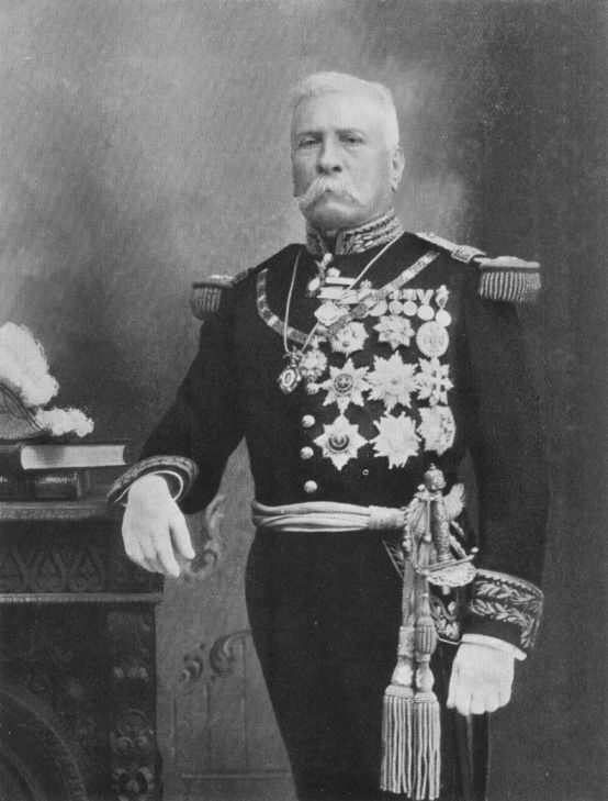

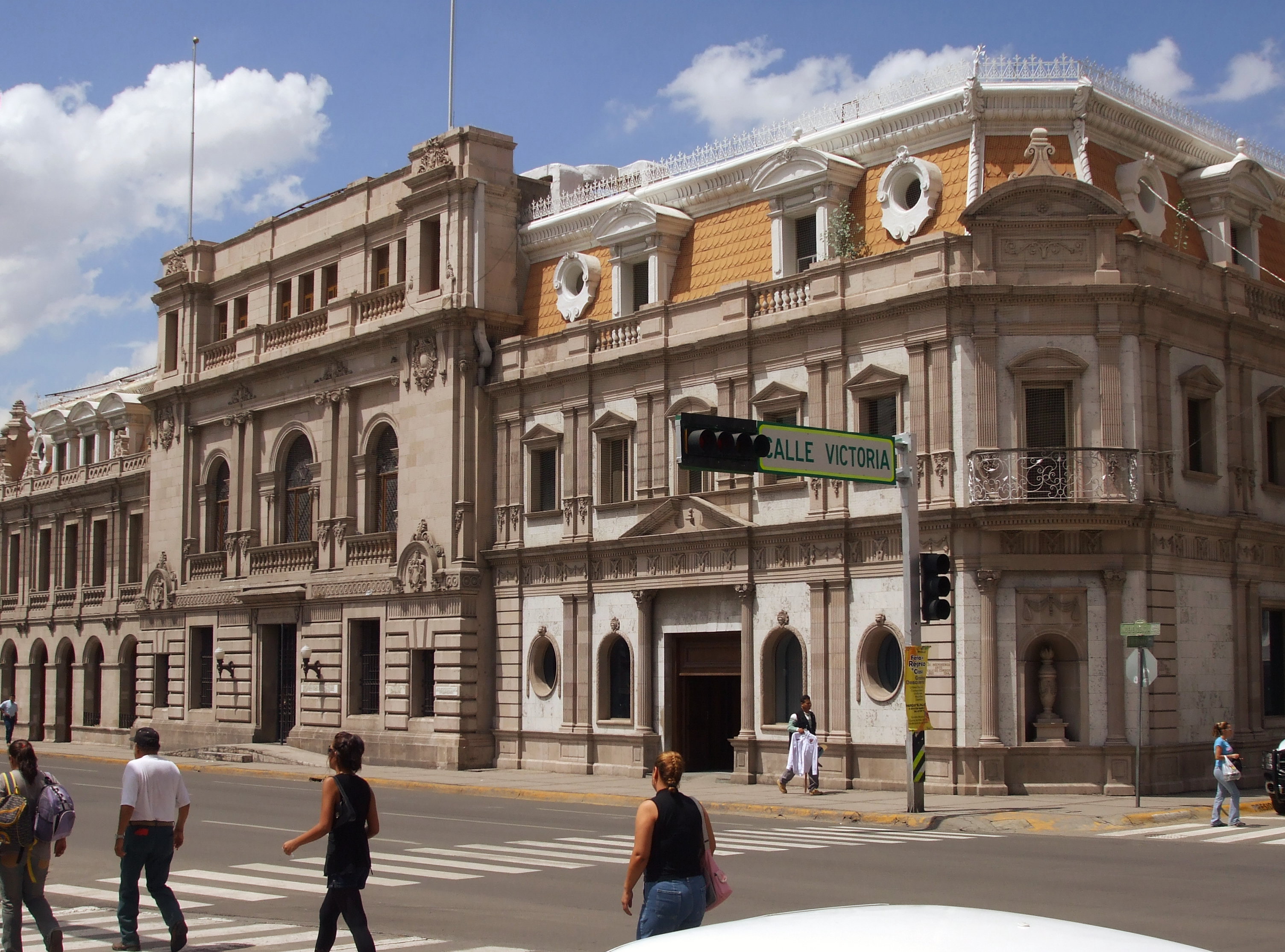
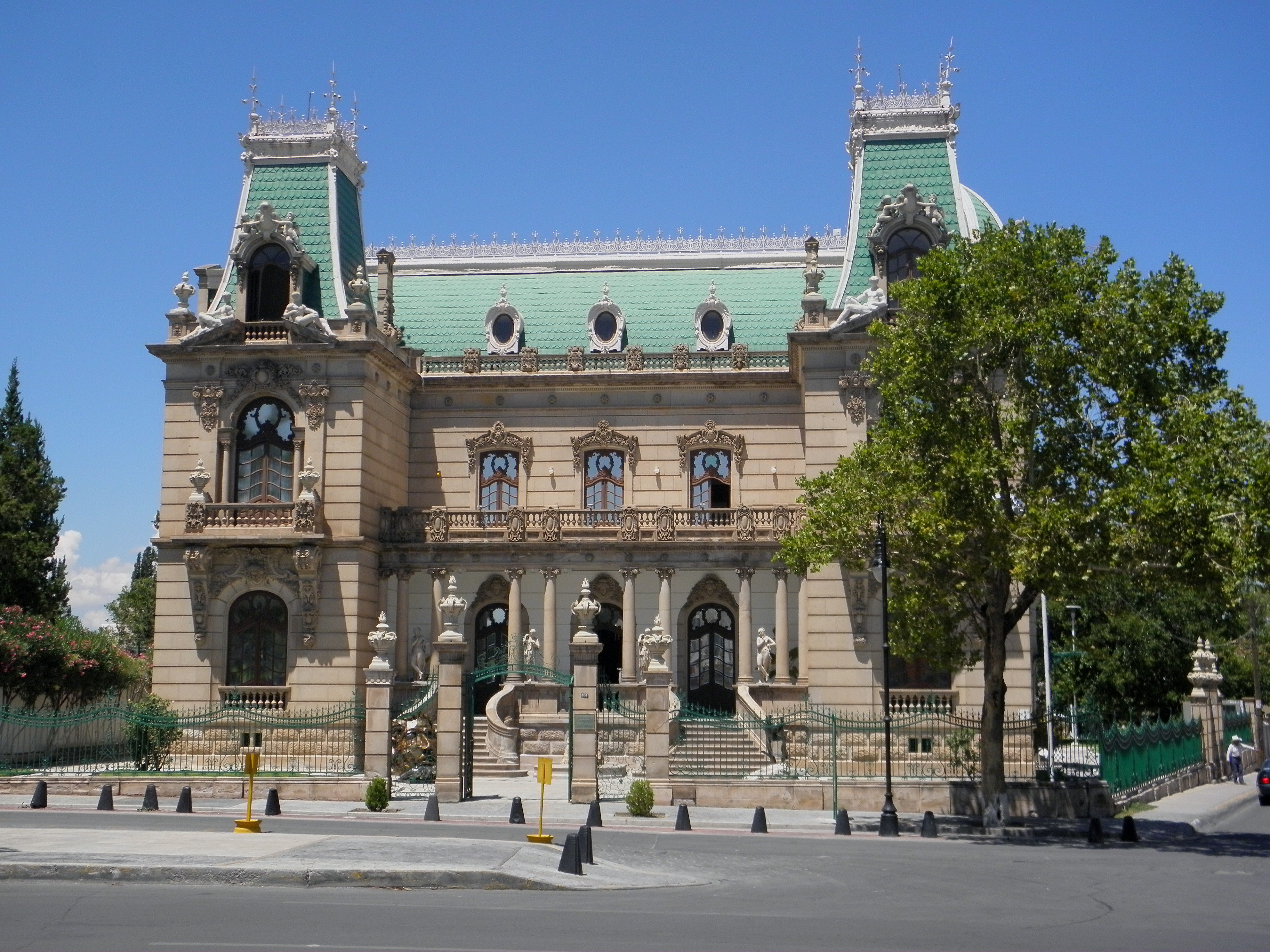


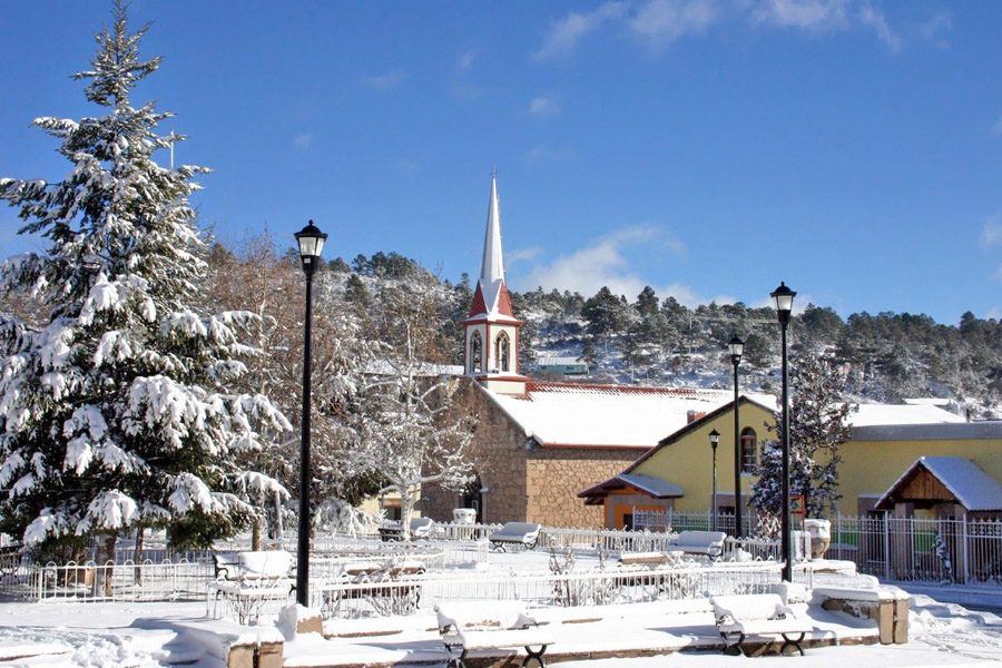


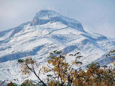

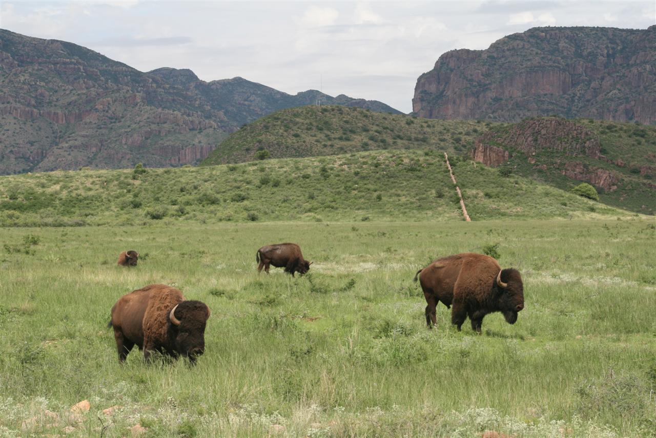


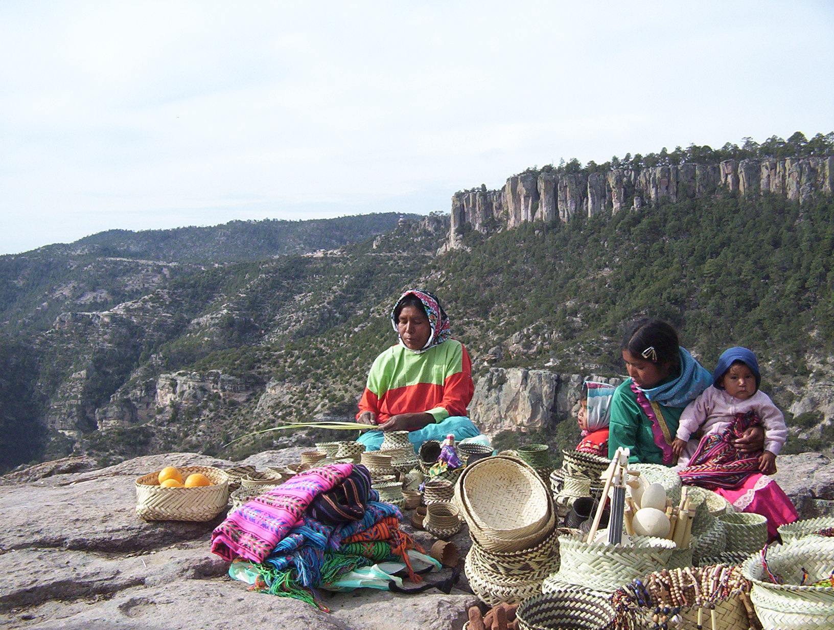


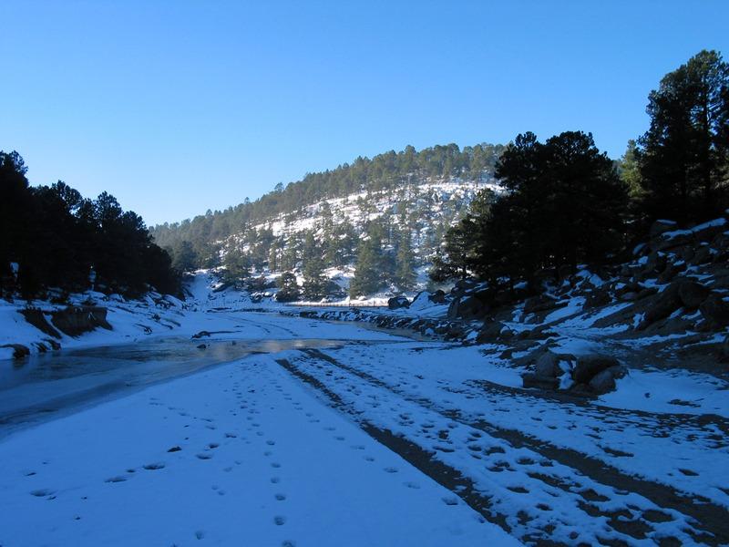
Wikimedia Foundation. 2010.