- Ozgoleh
-
For the administrative subdivision, see Ozgoleh District.
Ozgoleh
ازگله— city — 
 Ozgoleh
Coordinates: 34°49′57″N 45°50′36″E / 34.8325°N 45.84333°ECoordinates: 34°49′57″N 45°50′36″E / 34.8325°N 45.84333°E Country  Iran
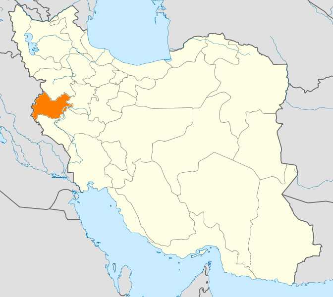
IranProvince Kermanshah County Salas-e Babajani Bakhsh Ozgoleh Population (2006) – Total 939 Time zone IRST (UTC+3:30) – Summer (DST) IRDT (UTC+4:30) Ozgoleh (Persian: ازگله; also Romanized as Asgaleh, Askīleh, Asqaīla, Asqaīleh, Azgaleh, and Ezgeleh; also known as Azgaleh-ye Sheykh Najm od Dīn)[1] is a city in and the capital of Ozgoleh District, in Salas-e Babajani County, Kermanshah Province, Iran. At the 2006 census, its population was 939, in 198 families.[2]
References
- ^ Ozgoleh can be found at GEOnet Names Server, at this link, by opening the Advanced Search box, entering "-3054155" in the "Unique Feature Id" form, and clicking on "Search Database".
- ^ "Census of the Islamic Republic of Iran, 1385 (2006)" (Excel). Islamic Republic of Iran. http://www.amar.org.ir/DesktopModules/FTPManager/upload/upload2360/newjkh/newjkh/05.xls.
 Kermanshah Province
Capital 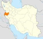
Counties and Cities Kerend-e Gharb · GahvarehEslamabad-e Gharb CountyEslamabad-e Gharb · HomeylGilan-e Gharb CountyGilan-e Gharb · SarmastHarsin · BisotunQasr-e Shirin CountyQasr-e Shirin · SumarRavansar CountySalas-e Babajani CountyTazehabad · OzgolehSarpol-e Zahab CountySonqor · SatarSights Kohneh Bridge · Behistun Inscription · Taq-e Bostan · Temple of Anahita · Dinavar · Ganj Dareh · Essaqwand Rock Tombs · Sorkh Deh chamber tomb · Malek Tomb · Hulwan · Median dakhmeh(Darbad,Sahneh) · Parav cave · Do-Ashkaft Cave · Tekyeh-e Moavenalmolk · Dokan Davood Inscription,Sar Pol-e-Zahab · Tagh e gara,Patagh pass · Sarab Niloufar · Ghoori Ghale Cave · Khaja Barookh's House · Chiyajani Tappe · Statue of Herakles in Behistun complex · Emad al doleh Mosque · Tekyeh-e Beglarbagi · Hunters cave,Behistun_complex · Jamé Mosque of Kermanshah · Godin Tepe · Bas relief of Gotarzes II of Parthia · Anobanini bas relief,Sarpol-e-Zahab ·Categories:- Salas-e Babajani County
- Cities in Iran
- Cities in Kermanshah Province
- Iran geography stubs

Wikimedia Foundation. 2010.