- Richmond District, San Francisco
-
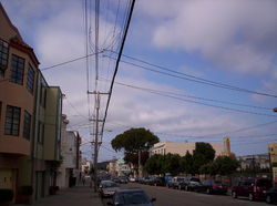
Richmond District — Neighborhood of San Francisco — Geary Boulevard, looking eastward from 36th Avenue in the "Outer Richmond."
Nickname(s): The Richmond, Outside Lands, Inner Richmond, Outer Richmond Location within San Francisco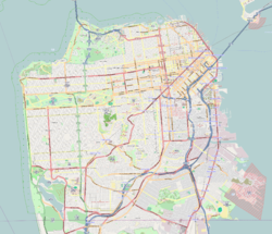
 Richmond District
Coordinates: 37°46.68′0″N 122°28.98′0″W / 37.778°N 122.483°W Government – Board of Supervisors Eric Mar – State Assembly Fiona Ma (D) – State Senate Leland Yee (D) – U.S. House Nancy Pelosi (D) Area – Total 7 km2 (2.705 sq mi) – Land 7 km2 (2.705 sq mi) Population – Total 59,297 – Density 8,463.4/km2 (21,920/sq mi) ZIP Code 94118, 94121 Area code(s) 415 [1] The Richmond District is a neighborhood in the northwest corner of San Francisco, California.
Contents
Location
Lying directly north of Golden Gate Park, "the Richmond" is bounded roughly by Fulton Street to the south, Arguello Boulevard and Laurel Heights to the east, The Presidio National Park and Lincoln Park to the north, and Ocean Beach and the Pacific Ocean to the west. Park Presidio Boulevard, a major thoroughfare, divides the Richmond into the western "Outer Richmond" and the eastern portion, called the "Inner Richmond." Geary Boulevard is a major east-west thoroughfare that runs through the Richmond and to downtown.
History
The district was given its name by Australian immigrant and Japanese fine art dealer George Turner Marsh, one of the neighborhood's earliest residents, who called his home "the Richmond House" after Richmond, a suburb of Melbourne, Australia.[2] The district was originally an expanse of rolling sand dunes. It was developed initially in the late 19th century.
The district became legally called the "Park-Presidio District" according to a city law that was passed back in 1917. Neighborhood clubs and real-estate agents urged the Board of Supervisors to change the name to Park-Presidio District. Due to the lack of zip codes at the time, they were worried there would be confusion between the district and the city of Richmond right across the bay. On January 27, 2009, Supervisor Eric Mar introduced his very first legislation that would rename the area north of Golden Gate Park and west of Arguello Boulevard as the Richmond District; basically, the area that is already commonly referred to as the Richmond District.[3]
After the 1906 earthquake, development increased with the need to provide replacement housing. The last of the sand dunes and coastal scrub that once dominated the area were built over to create a street car suburb.
The Russian Revolution and subsequent civil war brought many White Russian, Orthodox Russian refugees and immigrants into the neighborhood. Russian Orthodox Church Outside Russia briefly made its headquarters at the Holy Virgin Cathedral which still stands today on Geary Boulevard.
In the 1950s, and especially after the lifting of the Chinese Exclusion Act in 1965, Chinese immigrants began to replace the ethnic Jewish and Irish-Americans who had dominated the district before World War II. Chinese of birth or descent now make up nearly the majority of residents in the Richmond.[4]
Adolph Sutro was one of the first large-scale developers of the neighborhood. He is responsible for building the Sutro Baths, along with his mansion on the western end of the district, near Ocean Beach.
Attractions and characteristics
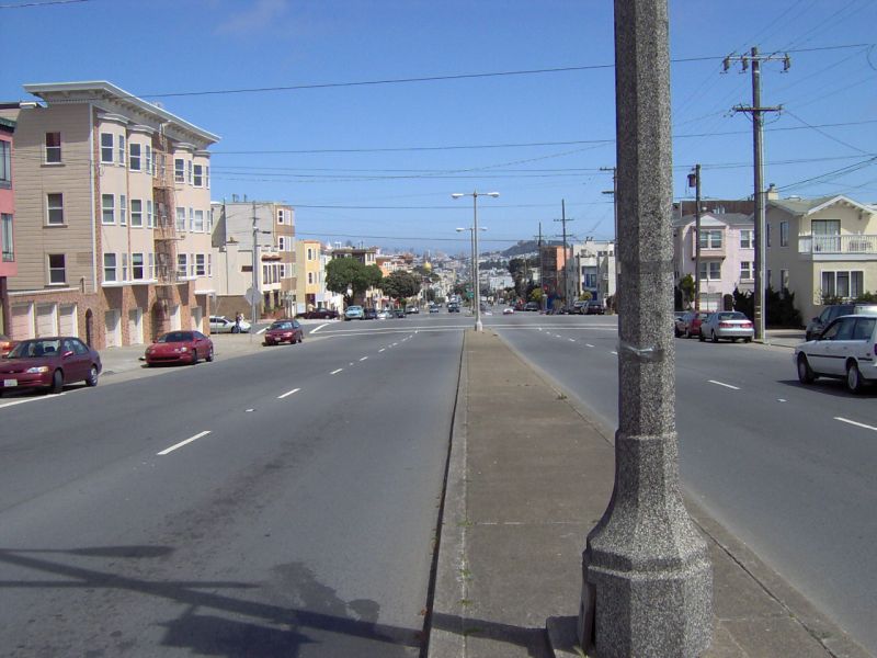
 19th Avenue in the Richmond District.
The Richmond District and the neighboring Sunset District (on the south side of Golden Gate Park) are often collectively known as "The Avenues", because a majority of both neighborhoods are spanned by numbered north-south avenues. When the city was originally laid out, the avenues were numbered from 1st to 49th and the east-west streets were lettered A to X. In 1909, to reduce confusion for mail carriers, the east-west streets and 1st Avenue and 49th Avenue were renamed. The east-west streets were named after Spanish explorers in ascending alphabetical order in a southward direction. First Avenue was renamed Arguello Boulevard and 49th Avenue was renamed La Playa Street.[5]
Today, the first numbered avenue is 2nd Avenue, starting one block west of Arguello Boulevard, and the last is 48th Avenue near Ocean Beach. The avenue numbers increase incrementally, with the exception that what would be 13th Avenue is called Funston Avenue named for Frederick Funston, a U.S. Army general, famous for his exploits during the Spanish-American War, the Philippine-American War, and the 1906 Earthquake.
Many of the east-west streets are still named after the Spanish Conquistadors, but there are exceptions. The creation of Golden Gate Park took out the streets previously lettered E through G. The former D Avenue became Fulton, which is the northern boundary of most of the Park. The southern boundary, the former H Avenue, was renamed Lincoln after President Abraham Lincoln.
North of the Park in the Richmond District, the streets are named Anza, Balboa and Cabrillo. South of the neighborhood there are called, Hugo (Inner Sunset only), Irving, Judah, Kirkham, Lawton, Moraga, Noriega, Ortega, Pacheco, Quintara, Rivera, Santiago, Taraval, Ulloa, Vicente, Wawona, and Yorba. "X" was originally proposed to be Xavier, but was changed to Yorba due to a pronunciation controversy.[6]
The commercial strip of restaurants, pubs, bars and shops along Clement Street between Arguello and Park Presidio Boulevard is referred to by some as "New Chinatown."
Successive waves of immigration from the former Soviet Union over the decades has made the Richmond home to a high concentration of Russian, Ukrainian, and Eastern European immigrants. The large Russian Orthodox Cathedral Holy Virgin Cathedral is one of the largest buildings in the neighborhood and contains the remains and relics of John of Shanghai and San Francisco. The area around the Cathedral is informally known as Little Russia, and has many Russian bakeries, groceries, and restaurants.
The Richmond is also one of the last major enclaves of Irish Americans left in San Francisco's originally large Irish American population. Many recent Irish immigrants also live in the area. Geary Boulevard and nearby Clement Street have many popular Irish pubs.
Education
The San Francisco Unified School District serves Richmond District. Alamo, Argonne, and Lafayette elementary schools are located in the Outer Richmond, and Sutro, Frank McCoppin and George Peabody are in the Inner Richmond. Presidio Middle School is located in the Outer Richmond District, while Roosevelt serves the Inner Richmond. George Washington High School is located in the district.[7]
The Richmond/Senator Milton Marks Branch and the Anza Branch of the San Francisco Public Library serve the Richmond District.[8][9] In 1930 voters approved a city charter amendment that would increase funding tot the library system so a new library could be built. John Reid, Jr., the architect, designed and landscaped the $57,117.29 new library, which was placed on the site of the former Lafayette School. On April 10, 1932 the Anza Library, the 17th municipal library branch, was dedicated. On May 2009 the library system closed the Anza Branch for repairs.[10] A rebuilt library opened on June 18, 2011. Jing Mo Athletic Association lion dancers provided entertainment at the ceremony.[9]
Parks and recreation
Sutro Heights Park is located in Richmond District.[11] Also in the Richmond District is Rochambeau playground. Located between 24th and 25th Avenue, the playground boasts tennis and basketball courts, as well as play structures.
Major Parks in the Richmond include Lincoln Park and Golf Course in the Outer Richmond which also contains the California Palace of the Legion of Honor. The former Fort Miley Military Reservation is now part of the Golden Gate National Recreation Area, a section of which contains a large Veterans Affairs Hospital. A small lake near Park Presidio and the Presidio Park forms part of the Mountain Lake Park.
External links
- Ocean Beach Bulletin, Neighborhood news organization covering the outer Richmond District
- Richmond SF Blog - news, info, events about the Richmond District of San Francisco
- "Anza Renovation." San Francisco Public Library.
- "Richmond Renovation." San Francisco Public Library.
- Park Presidio Neighbors Association
- Boulevard Neighbors BNUG
- Richmond district guided photo tour
- Photo of Richmond neighborhood at 19th Avenue and Geary Blvd.
- San Francisco's street naming controversy of 1909 - the story of how Anza through Yorba streets—and the numbered Avenues—got their names
- The Friends of Mountain Lake Park
- Central Richmond District Yahoo! Group
- Photo-set of about 70 images taken in the Richmond
- [3]
Coordinates: 37°46.68′N 122°28.98′W / 37.778°N 122.483°W
References
- ^ [1]
- ^ Lagos, Marisa (January 28, 2009) /cgi-bin/blogs/sfgate/detail?blogid=55&entry_id=35128 "Don't call that the Richmond!" San Francisco Chronicle. (Retrieved 1-28-09.)
- ^ Lagos, Marisa (January 28, 2009) "Richmond District name has never been official, but that soon may change" "San Francisco Chronicle." (Retrieved 1-28-09.)
- ^ http://www.city-data.com/neighborhood/Richmond-District-San-Francisco-CA.html city-data.com
- ^ http://www.sfhistoryencyclopedia.com/articles/s/streetNaming.html sfhistoryencyclopedia.com
- ^ Freeman, John (2003). "Street Naming Controversy - 1909". Encyclopedia of San Francisco. San Francisco Museum & Historical Society. http://www.sfhistoryencyclopedia.com/articles/s/streetNaming.html. Retrieved 2008-06-21.
- ^ "[2]."
- ^ "Richmond." San Francisco Public Library. Retrieved on November 13, 2011.
- ^ a b McDede, Holly. "Written on the Dock of the Bay: June 18, 2011." KALW. June 18, 2011. Retrieved on July 4, 2011. "Library re-opening // Library lovers! Residents of San Francisco's Richmond District! Residents of the world, rejoice! Another library is among us, and it is the reconstructed Anza Branch Library. Come for the re-opening ceremony. Lion dancers from the Jing Mo Athletic Association will be there to bless the building. // DETAILS: Saturday, June 18, 1pm. Anza Branch Library. 741 30th Avenue, San Francisco"
- ^ "Anza Library History." San Francisco Public Library. Retrieved on July 4, 2011.
- ^ "Richmond District is the true heart of San Francisco." The Washington Times. December 2, 2000. Retrieved on July 4, 2011. "Perhaps the Richmond District's bestkept secret is Sutro Heights Park a little gem on the hill high above Cliff House[...]"
Neighborhoods of San Francisco, California Downtown Chinatown · Civic Center · Financial District · Mid-Market · Nob Hill · North Beach · Mission Bay · South of Market · Telegraph Hill · Tenderloin · Union Square
North of Downtown Cow Hollow · Fisherman's Wharf · Marina District · Pacific Heights · Presidio · Russian Hill · Treasure Island · Yerba Buena Island
Outside Lands Forest Hill · Ingleside · Ingleside Terraces · Ocean View · Parkside · Richmond · Sea Cliff · St. Francis Wood · Sunset District · West Portal · Westwood Highlands · Westwood Park
Western Addition Alamo Square · Anza Vista · Cathedral Hill · Cole Valley · Corona Heights · Duboce Triangle · Fillmore · Haight-Ashbury · Hayes Valley · Japantown · Laurel Heights · Lower Haight · Pacific Heights · Presidio · Western Addition
Southern Bayview-Hunters Point · Bernal Heights · Castro · Crocker-Amazon · Diamond Heights · Dogpatch · Eureka Valley · Excelsior District · Glen Park · Mission District · Noe Valley · Outer Mission · Portola · Potrero Hill · Visitacion Valley
Categories:- Neighborhoods in San Francisco, California
- Russian communities in the United States


Wikimedia Foundation. 2010.