- Horsleys Green
-
Coordinates: 51°39′N 0°52′W / 51.65°N 0.86°W
Horsleys Green 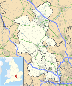
 Horsleys Green
Horsleys Green shown within BuckinghamshireOS grid reference SU7894 Shire county Buckinghamshire Region South East Country England Sovereign state United Kingdom Post town HIGH WYCOMBE Postcode district HP14 Dialling code 01494 Police Thames Valley Fire Buckinghamshire Ambulance South Central EU Parliament South East England List of places: UK • England • Buckinghamshire Horsleys Green (often incorrectly referred to as Horsley's Green) is a hamlet located on the A40 between Piddington and Stokenchurch in Buckinghamshire, England. It consists of a few houses situated either side of a narrow lane[1] and a 23-acre site currently used as the UK headquarters for Wycliffe Bible Translators.[2]
Contents
Geography
Horsleys Green is located about 2 miles east of the village of Stokenchurch, in a group of four hamlets either side of the A40 known collectively as 'Studley Green' - the other three hamlets are Beacon's Bottom, Studley Green and Water End.[3][4] It lies amongst woodland, within the Chiltern Area of Outstanding Natural Beauty: to the north is Third's Wood, with Fillington Wood to the east and Watercroft Wood and Dell's Wood to the south.[1]
History
Settlement at Horsleys Green dates back to at least the seventeenth century,[5] with some of these properties, such as Old Beckings[6] and Horsleys Green Manor,[1] still in use today. It was originally known as Ostlers Green[1][4], in reference to the 'ostlers' (stablemen) who operated stables at Horsleys Green for the refreshment of horses involved in transport along the London to Oxford road.[7] The name was later changed to Horslers Green, and then Horsleys Green.[1][4]
During the Second World War, a camp school for disabled evacuees from London was established in Horsleys Green,[1][4][8] run by the government-formed National Camps Corporation.[9] After the war, such camp schools were offered for sale, and ownership of the school at Horsleys Green passed into the hands of Lancashire County Council in 1947. From April of that year the Lancashire Education Committee ran an all-boys boarding school on the site.[8] Initially, this school was known as Stokenchurch School, but the name changed to Horsleys Green School in 1950.[9]
In 1971, the grounds were acquired by Wycliffe Bible Translators, as 'Reasonable Equivalent Accommodation' for their previous base in Bletchingley, which was subject to a compulsory purchase order for the construction of the M23.[10] Lancashire County Council had also had offers for the site from a government department, but Wycliffe's bid had been accepted by a majority of one vote.[10] After taking possession on November 8, Wycliffe expanded the site with additional wooden buildings bought from various sources, including Twickenham Grammar School.[10] A few years later, in May 1975, the kitchen and dining room complex had to be rebuilt following a fire.
Wycliffe Bible Translators continue to use the site as their UK headquarters. Known as 'The Wycliffe Centre', the site also serves as a base for training in cross-cultural language work under the 'European Training Programme',[11] and as a Christian conference centre with facilities for 160 guests.[2] The buildings have been named after individuals involved in Bible translation, such as William Carey, Henry Martyn and James O. Fraser. More recent buildings have been built on the site since the 1970s: Tyndale and Aylward were built in the 1980s, and Bede followed in 1998.
Government
Horsleys Green, together with the other hamlets within the Studley Green area, is within the civil parish of Stokenchurch, in the Stokenchurch and Radnage ward of Wycombe District Council.[12] It is in the parliamentary constituency of Aylesbury.
Amenities
Public transport
There are local bus services from nearby in Studley Green to High Wycombe, Stokenchurch, Thame, Lane End, and other villages in between. These services are operated by Arriva and Carousel Buses.[13] The services are fairly frequent, although Arriva reduced their evening and Sunday services in May 2011.[14]
Education
Wycliffe Bible Translators used to run a nursery school called Little Fishes Day Nursery at the Wycliffe Centre. This was originally started to provide care for children of linguistics students, but grew to accommodate 80 children from the local area. It closed in September 2005.[15]
A mobile library, operated by Buckinghamshire County Council, stops in the Wycliffe Centre on alternate Tuesdays.[16]
References
- ^ a b c d e f Edwards, Bernard (30 July 1993). "Enjoy green hamlet". Bucks Free Press.
- ^ a b "The Wycliffe Centre". Archived from the original on 7 May 2011. http://www.webcitation.org/5yVVGlirh. Retrieved 6 May 2011.
- ^ "Stokenchurch and Radnage Village Survey 2007" (PDF). Stokenchurch Parish Council. Archived from the original on 7 May 2011. http://www.webcitation.org/5yVVOnm8h. Retrieved 6 May 2011.
- ^ a b c d "Stokenchurch". Radnage.net. Archived from the original on 7 May 2011. http://www.webcitation.org/5yVVSpLqB. Retrieved 7 May 2011.
- ^ Page, William (1925), "Parishes: Stokenchurch", A History of the County of Buckingham: Volume 3, pp. 96–101, http://www.british-history.ac.uk/report.aspx?compid=42536
- ^ "Property details: Horsleys Green". Savills. Archived from the original on 7 May 2011. http://www.webcitation.org/5yVVWN76J. Retrieved 7 May 2011.
- ^ "Sought after village - semi-rural - Horsleys Green - Sold". Vendors Direct. Archived from the original on 7 May 2011. http://www.webcitation.org/5yVVZvpjm. Retrieved 7 May 2011.
- ^ a b "Horsleys Green School: Old Boys and Staff Website". Archived from the original on 7 May 2011. http://www.webcitation.org/5yVVcaOxd. Retrieved 5 May 2011.
- ^ a b "Old Boy's Recollections". Horsleys Green School: Old Boys and Staff Website. Archived from the original on 7 May 2011. http://www.webcitation.org/5yVViRb1h. Retrieved 7 May 2011.
- ^ a b c Thompson, Phyllis (1974). Matched with His Hour: The Story of the British Home Base of the Wycliffe Bible Translators. London: Word Books. pp. 98–114.
- ^ "ETP - Where We Train". http://www.eurotp.org/uk/locations.php. Retrieved 6 May 2011.
- ^ "The Village of Stokenchurch". Stokenchurch Parish Council. Archived from the original on 7 May 2011. http://www.webcitation.org/5yVVncT21. Retrieved 6 May 2011.
- ^ "The Wycliffe Centre - About Us - Getting Here by Public Transport". Archived from the original on 7 May 2011. http://www.webcitation.org/5yVVrgMlJ. Retrieved 6 May 2011.
- ^ "Changes to bus services in High Wycombe". Arriva. 2011. Archived from the original on 18 May 2011. http://www.webcitation.org/5ymJyvG00.
- ^ Leat, Paul (18 July 2005). "Parents told find new nursery by September". Bucks Free Press. http://www.bucksfreepress.co.uk/archive/2005/07/18/ZZZ_Education+%28education%29/614905.Parents_told_find_new_nursery_by_September/. Retrieved 11 May 2011.
- ^ "Wycombe, Chiltern, & South Bucks Mobile Library Timetable". Buckinghamshire County Council. Archived from the original on 18 May 2011. http://www.webcitation.org/5ymJpzaFl.
External links
Categories:- Villages in Buckinghamshire


Wikimedia Foundation. 2010.