Raspenava

Raspenava

Geobox | Settlement
name = Raspenava
other_name =
category = Town


image_caption =


symbol = Raspenava CoA CZ.svg
etymology =
official_name =
motto =
nickname =
country = Czech Republic
country_

state =
region = Liberec
region_type = Region
district = Liberec
district_type = District
commune = Frýdlant
municipality =
part =
river = Smědá
river1 = Lomnice
river2 = Sloupský potok
river3 = Libverdský potok
location =
elevation = 331
lat_d = 50
lat_m = 54
lat_s =
lat_NS = N
long_d = 15
long_m = 6
long_s =
long_EW = E
highest =
highest_elevation =
highest_lat_d =
highest_long_d =
lowest =
lowest_elevation =
lowest_lat_d =
lowest_long_d =
area = 41.22
area_round = 2
population = 2826
population_date = 2004-01
population_density = auto
established = 1343
established_type = First mentioned
mayor = Pavel Lžičař
timezone =


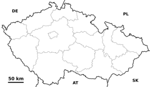
map_background = Czechia - background map.png map_caption = Location in the Czech Republic
map_locator = Czechia
commons = Raspenava
statistics = [http://www.statnisprava.cz/ebe/ciselniky.nsf/i/564371 statnisprava.cz]
website = [http://www.raspenava.cz/ www.raspenava.cz]
footnotes =

Raspenava (IPA2|ˈraspɛnava, German: "Raspenau") is a small town in the Liberec Region of the Czech Republic, just next to Frýdlant v Čechach. It has approximately 2,800 inhabitants.

External links

* [http://www.raspenava.cz/ Municipal website (in Czech)]


Wikimedia Foundation. 2010.

Игры ⚽ Нужен реферат?

Look at other dictionaries:

  • Raspenava — Raspenava …   Deutsch Wikipedia

  • Raspenava — Sp Rãspenava Ap Raspenava L Čekija …   Pasaulio vietovardžiai. Internetinė duomenų bazė

  • Raspenava — Original name in latin Raspenava Name in other language Raspenau State code CZ Continent/City Europe/Prague longitude 50.90415 latitude 15.11465 altitude 325 Population 2826 Date 2013 01 25 …   Cities with a population over 1000 database

  • Bahnstrecke Raspenava–Bílý Potok pod Smrkem — Raspenava–Bílý Potok pod Smrkem Kursbuchstrecke (SŽDC): 038 Streckenlänge: 6,213 km Spurweite: 1435 mm (Normalspur) Höchstgeschwindigkeit: 40 km/h Legende …   Deutsch Wikipedia

  • Buschullersdorf — Oldřichov v Hájích …   Deutsch Wikipedia

  • Philippsgrund — Filipka …   Deutsch Wikipedia

  • Liste der Naturschutzgebiete im Liberecký kraj — Lage des Liberecký kraj in Tschechien Die Liste der Naturschutzgebiete im Liberecký kraj umfasst kleinflächige geschützte Gebiete in der Region Liberec, Tschechien. Aufgenommen sind alle offiziell ausgewiesenen Naturreservate und Naturdenkmäler… …   Deutsch Wikipedia

  • Selbstentladewagen — Offener Güterwagen Gattung Ow der sächsischen Schmalspurbahnen mit Heberleinbremse …   Deutsch Wikipedia

  • Alt-Habendorf — Stráž nad Nisou …   Deutsch Wikipedia

  • Alt Habendorf — Stráž nad Nisou …   Deutsch Wikipedia

Share the article and excerpts

Direct link
Do a right-click on the link above
and select “Copy Link”