- Osage Village State Historic Site
-
Osage Village State Historic Site Missouri State Historic Site Country United States State Missouri County Vernon County Coordinates 37°58′52″N 94°12′35″W / 37.98111°N 94.20972°W Area 0.16 sq mi (0 km2) Founded 1984 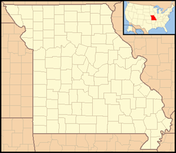

Website: http://mostateparks.com/osagevillage.htm Osage Village State Historic Site in Vernon County, Missouri, is maintained by the Missouri Department of Natural Resources as a state historic site. It was once the site of around 200 lodges and the home of 2,000 to 3,000 people.[1]
History
The Osage Indians were first recorded in 1673 by explorers Louis Joliet and Jacques Marquette. The territory claimed by the Osage at its greatest influence was vast and consisted of what is now southern Missouri, Arkansas, eastern Kansas and Oklahoma. Between 1700 and 1775, a group of the Osage lived on a high, open hilltop near the Osage River valley that today has been preserved as Osage Village State Historic Site.
At its height, the village contained 2,000 to 3,000 people and about 200 lodges. Pottery, weapons and tools excavated from the site have provided information about the daily lives of the villagers, who hunted, planted crops, processed hides and were very successful traders with the Europeans. In the late 18th and early 19th centuries, the Osage Indians accounted for more than half of the total trade in furs along the Missouri River.
After the United States government took control of the Louisiana Purchase territory in 1804, the Osage Indians were gradually forced to retreat to Oklahoma. Through excavations they obtained information that demonstrated the shape of the house, which was rectangular.
References
See also
Protected Areas of Missouri Federal National Wildlife Refuges:Big Muddy • Clarence Cannon • Great River • Middle Mississippi River • Mingo • Ozark Cavefish • Pilot Knob • Squaw Creek • Swan Lake • Two RiversNational Forests:State Babler • Sam A. Baker • Bennett Spring • Big Lake • Big Oak Tree • Big Sugar Creek • Castlewood • Crowder • Cuivre River • Current River • Elephant Rocks • Finger Lakes • Graham Cave • Grand Gulf • Ha Ha Tonka • Harry S Truman • Hawn • Johnson's Shut-Ins • Jones-Confluence Point • Katy Trail • Knob Noster • Lake of the Ozarks • Lake Wappapello • Lewis and Clark • Long Branch • Mark Twain • Meramec • Montauk • Morris • Onondaga Cave • Pershing • Pomme de Terre • Prairie • Roaring River • Robertville • Rock Bridge Memorial • Route 66 • St. Francois • St. Joe • Stockton • Table Rock • Taum Sauk Mountain • Thousand Hills • Trail of Tears • Van Meter • Wakonda • Wallace • Washington • Watkins Woolen Mill • Weston BendArrow Rock • Battle of Athens • Battle of Carthage • Battle of Lexington • Thomas Hart Benton Home and Studio • Bollinger Mill • Nathan Boone Homestead • Boone's Lick • Bothwell Lodge • Clark's Hill/Norton • Confederate Memorial • Deutschheim • Dillard Mill • Gov. Daniel Dunklin's Grave • Felix Vallé House • First Missouri State Capitol • Fort Davidson • Gen. John J. Pershing Boyhood Home • Harry S Truman Birthplace • Hunter-Dawson • Iliniwek Village • Jefferson Landing • Jewell Cemetery • Locust Creek Covered Bridge • Mark Twain Birthplace • Mastodon • Missouri Mines • Missouri State Capitol • Missouri State Museum • Osage Village • Sandy Creek Covered Bridge • Sappington Cemetery • Scott Joplin House • Towosahgy • Union Covered Bridge • Watkins Woolen MillConservation areas:List of Missouri conservation areasCategories:- Missouri state parks
- Geography of Vernon County, Missouri
- Protected areas established in 1984
- Missouri geography stubs

Wikimedia Foundation. 2010.