- Orne (Moselle)
-
For the river in Normandy, see Orne (river).
Orne 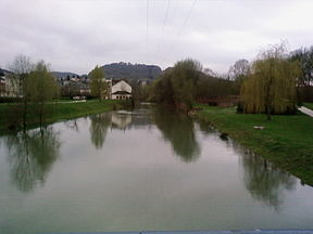
The Orne flooding at RombasOrigin Lorraine Mouth Moselle
49°17′15″N 6°10′55″E / 49.2875°N 6.18194°ECoordinates: 49°17′15″N 6°10′55″E / 49.2875°N 6.18194°EBasin countries France Length 85.8 km Source elevation 320 m Avg. discharge 12.4 m³/s Basin area 1,268 km² 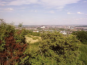 The Orne valley.
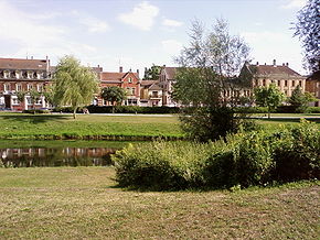 The Orne at Rombas.
The Orne is a river in Lorraine, north-eastern France, which is a left tributary of the Moselle and sub-tributary of the Rhine. Its source is in the hills northeast of Verdun. It flows east and joins the Moselle near Mondelange, between Metz and Thionville.
Contents
Name
"Orne" may originate from autura (a river, cf. Eure), or onna (a river)[citation needed] as mentioned in Endlicher's glossary of Gallic names De nominibus Gallicis, in which these words are translated into Latin as flumen.
If so, then there is no relationship with the name of the Orne river in Normandy, which is referred to as the Olina by Ptolemy, a homonym of Fluvius Olne, the Orne saosnoise in Sarthe, which Xavier Delamarre[1] traces back to the Celtic olīnā (elbow).
Geography
The length of the Orne is 85.8 km.[2] It rises at an altitude of 320 m in d'altitude in the Côtes de Meuse, in the commune of Ornes. It flows through Étain, Conflans-en-Jarnisy, Auboué, Homécourt, Jœuf, Moyeuvre-Grande, Rosselange, Rombas, Clouange, Vitry-sur-Orne, Gandrange and Richemont, where it joins the Moselle at an altitude of 155 m.
Tributaries
The Orne's principal tributaries and subtributaries are:
- Ruisseau de Vaux
- Moulin de Darmont
- Yron (sub-tributary Longeau)
- Rawé
- Woigot
- Conroy
The Orne is also fed by water pumped out of the mines at Jarny, Giraumont, Auboué and Orne-Roncourt.
Hydrology
The Orne is a substantial river, similar to its neighbours in the West Lorraine region which rise in the Côtes de Meuse.
Flow rates of the Orne at Rosselange
The Orne's flow rate has been measured over a period of 40 years (1967-2007) at Rosselange, located in the Moselle department a short way upstream of the confluence.[3] The watershed of the Orne at Rosselange is 1,226 km2, almost its entire watershed of 1,268 km2.
The mean annual flow rate, or discharge of the river at Rosselange is 12.6 m3/s.
The Orne exhibits strongly marked seasonal fluctuations, such as are very often found in the east of France, with high water in winter/spring bringing the monthly average up to between 20.2 and 26.9 m3/s from December to March inclusive, with a maximum in February. Summer low waters are quite prolonged, from June to early October, with a low monthly average of 2.81 m3/s in September. These monthly figures, however, are just averages, and conceal even more pronounced short-term variation.
Monthly average flow rate in m3/s measured at Rosselange hydrological station
Data taken over a 41 year period
At low water, the 3-year low instantaneous flow rate can drop to 0.56 m3/s, as is seen frequently for rivers of the region.
Flooding of the Orne can be very significant. The maximum instananeous flow rate ever recorded was 318 m3/s on 22 December 2003, while the maximum recorded daily average was 292 m3/s on the preceding day. The Orne's instantaneous maximum flow rate for 2 and 5 years (IMFR2 and IMFR5) are 170 and 230 m3/s respectively; the IMFR10 is 280 m3/s, the IMFR20 is 320 m3/s, and the IMFR50 is 370 m3/s. These figures indicate that the flood of December 2003 was, roughly speaking, a twenty-year event and thus not particularly unusual. The Orne's IMFRs are over half that of the Meurthe, the Moselle's most significant French tributary and whose basin is almost 2.5 time larger.
To compare with a significant river in the Paris basin, the Loing, a river known for its substantial flooding, has has an IMFR10 of 190 m3/s as against 280 m3/s for the Orne, and its IMFR50 reaches only 270 m3/s as against 370 m3/s for the Orne. This is despite the Loing's watershed being three and a half times larger than the Orne.
The Orne is fed by heavy rainfall in the western part of its watershed. The runoff curve number in its watershed is 326 mm annually, which is almost equal to the average of all France, but clearly less than the average in the French part of the Moselle basin (445 mm at Hauconcourt). The specific flow rate reaches 10.3 litres per second per square kilometre of watershed.
Flow rates of members of the Orne basin
Name Location Flow rates in m3/s Côte
max(m)Max.
instant.Max.
daily.Runoff
curve no.
(mm)Surface
(km2)Discharge VCN3
(low w.)IMFR2 IMFR5 IMFR10 IMFR20 IMFR50 Ruisseau de Vaux Morgemoulin 0.417 0.011 9.1 12 13 15 17 1.74 14.8 10.2 312 42 Orne Boncourt 3.73 0.030 59 84 100 120 140 4.59 125 99.7 286 412 Yron Jarny 4.01 0.130 82 120 140 170 200 3.53 169 139 332 383 Longeau Jarny 2.17 - - - - - - - - - 320 214 Woigot Briey 1.25 0.067 16 25 30 35 42 2.67 56.2 23.1 522 76 Orne Rosselange 12.6 0.560 170 230 270 320 370 3.98 318 292 326 1,226 Related articles
External links
References
- ^
Dictionnaire de la langue gauloise, éditions errance 2003. p. 240.
This article is part of the series on:
- Langues d'oïl
- Dialects
- Creoles
- Francophonie
- History
- Grammar
- Orthography
- Phonology
- Elision
- Liaison
- Aspirated h
- Wikipedia IPA for French
- ^ SANDRE. "Fiche rivière l'orne (A8--0100)". http://sandre.eaufrance.fr/app/chainage/courdo/htm/A8--0100.php?cg=A8--0100.
- ^ Banque Hydro - station A8431010 - L'Orne à Rosselange (option Synthèse) (Do not tick the box "Station en service")
Tributaries of the river Moselle From the left 
From the right Moselotte | Vologne | Meurthe | Seille | Saar | Olewiger Bach | Avelsbach | Ruwer | Feller Bach | Dhron | Ahringsbach | Kautenbach | Lützbach | Flaumbach | Altlayer Bach | Baybach | EhrbachCategories:- Articles in translation
- Rivers of France
- Moselle
- Meurthe-et-Moselle
- Moselle basin
- Lorraine geography stubs


Wikimedia Foundation. 2010.