- Ontario Highway 650
-
Highway 650
Route information Maintained by the Ministry of Transportation of Ontario Length: 7.6 km[2] (4.7 mi) Existed: April 1, 1964[1] – present Major junctions West end:  Highway 112 in Dane
East end: Adams Mine site Districts: Timiskaming Highway system Ontario provincial highways
400-series • Former←  Hwy 649
Hwy 651  →
→Secondary Highway 650, commonly referred to as Highway 650, is a provincially maintained highway in the Canadian province of Ontario. The highway is 7.6 kilometres (4.7 mi) in length, connecting Highway 112 in Dane with the now abandoned Adams Mine site. The route was designated in 1964, shortly after the mine opened. It is sparsely travelled, but paved throughout its length.
Contents
Route description
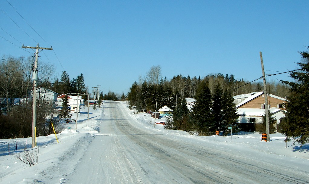
 Highway 650 through the community of Dane
Highway 650 begins in the west at Highway 112, travelling southeast through the community of Dane. It passes several residences and turns east. The highway exits the community and crosses the Ontario Northland Railway (ONR), east of which the road is sparsely travelled. It zig-zags southeast through dense forest. After crossing a swamp, the highway curves to the northeast and passes beneath two high-tension transmission lines.[3] It then curves to the south, crossing a spur of the ONR built to serve the mine, after which the road is privately maintained.[2] The entire length of the route is paved.[4]
History
Highway 650 was designated on April 1, 1964,[1] following an access road to the newly opened mine east from Dane. The route was gravel-surfaced at the time; it was paved in its entirety by mid-1967.[5] The route has remained unchanged since then. Despite the closure of the mine in 1990, the road remained a provincial route through the 1997 and 1998 highway transfers;[4] its annual average daily traffic is 30 vehicles, the second lowest of any provincially maintained highway.[2]
Major intersections
The following table lists the major junctions along Highway 650. The entirety of the highway is located within Timiskaming District.[4]
Location[4] km[2] Destinations Notes Dane 0.0 Highway 112 – Englehart, Kirkland LakeWest Unorganized Timiskaming District 7.6 Adams Mine site Highway ends at Ontario Northland Railway crossing[2] 1.000 mi = 1.609 km; 1.000 km = 0.621 mi References
- ^ a b A.A.D.T. Traffic Volumes 1955–1969 And Traffic Collision Data 1967–1969. Ontario Department of Highways. 1970. p. 145.
- ^ a b c d e Ministry of Transportation of Ontario (2007). "Annual Average Daily Traffic (AADT) counts". Government of Ontario. http://www.raqsb.mto.gov.on.ca/techpubs/TrafficVolumes.nsf/tvweb?OpenForm&Seq=5. Retrieved March 13, 2011.
- ^ Google, Inc. Google Maps – Highway 650 - Length and route (Map). Cartography by Google, Inc. http://maps.google.ca/maps?f=d&source=s_d&saddr=ON-650+E&daddr=ON-650+E&hl=en&geocode=Fb6J3QIdZsM6-w%3BFVxf3QIdFCs8-w&mra=dme&mrsp=1&sz=15&sll=48.057775,-79.949698&sspn=0.012936,0.038195&ie=UTF8&ll=48.064314,-79.983215&spn=0.051739,0.152779&t=h&z=13. Retrieved March 21, 2010.
- ^ a b c d Peter Heiler (2010). Ontario Back Road Atlas (Map). Cartography by MapArt. p. 105, section H17–18. ISBN 978-1-55198-226-7.
- ^ Annual Report. Department of Highways. April 1, 1968. p. 163.
Secondary highways of Ontario Secondary Highways 502 · 510 · 516 · 518 · 519 · 520 · 522 · 522B · 523 · 524 · 525 · 526 · 527 · 528 · 528A · 529 · 529A · 531 · 532 · 533 · 534 · 535 · 537 · 538 · 539 · 539A · 540 · 540A · 540B · 542 · 542A · 546 · 547 · 548 · 550 · 551 · 552 · 553 · 554 · 556 · 557 · 558 · 559 · 560 · 560A · 562 · 563 · 564 · 565 · 566 · 567 · 568 · 569 · 570 · 571 · 572 · 573 · 574 · 575 · 577 · 579 · 580 · 581 · 582 · 583 · 584 · 585 · 586 · 587 · 588 · 589 · 590 · 591 · 592 · 593 · 594 · 595 · 596 · 597 · 599 · 600 · 601 · 602 · 603 · 604 · 605 · 607 · 607A · 608 · 609 · 611 · 612 · 613 · 614 · 615 · 617 · 618 · 619 · 621 · 622 · 623 · 624 · 625 · 626 · 627 · 628 · 630 · 631 · 632 · 633 · 634 · 636 · 637 · 638 · 639 · 640 · 641 · 642 · 643 · 644 · 645 · 646 · 647 · 650 · 651 · 652 · 654 · 655 · 656 · 657 · 658 · 661 · 663 · 664 · 665 · 667 · 668 · 670 · 671 · 672 · 673
By district Algoma · Cochrane · Kenora · Manitoulin · Nipissing · Parry Sound · Sudbury · Thunder Bay · TimiskamingSee also County roads · Former highways · Historic Colonization Roads · List of Ontario provincial highways · Ministry of Transportation · Northern Ontario Resource Trail · Numbered highways in Canada · Tourist Routes · Trans-Canada HighwayCounty roads in Ontario · Ontario numbered highways · Expressways and 400-series highways · King's Highways · Secondary highways · Tertiary and 7000-series highways · List of Ontario provincial highways · List of former provincial highways in Ontario · Highways in Ontario · List of Ontario expressways · Trans-Canada Highway · Connecting Link · Emergency Detour Route Categories:- Ontario secondary highways
- Roads in Timiskaming District, Ontario


Wikimedia Foundation. 2010.