- Olivenhain Dam
-
Olivenhain Dam 
Olivenhain Dam and reservoir in 2011 as seen from a helicopterLocation of Olivenhain Dam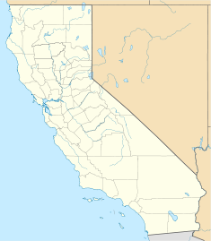

Location Encinitas, California Coordinates 33°04′12″N 117°08′18″W / 33.07°N 117.13833°WCoordinates: 33°04′12″N 117°08′18″W / 33.07°N 117.13833°W Status In use Construction began 1998 Opening date 2003 Construction cost $203 Million USD Owner(s) San Diego County Water Authority and Olivenhain Municipal Water District Dam and spillways Type of dam Gravity Height 318 ft (97 m) Length 2,400 ft (730 m) Volume 1,300,000 m3 (46,000,000 cu ft) Impounds None Reservoir Creates Olivenhain Reservoir Capacity 24,000 acre·ft (30,000,000 m3) Surface area 200 acres (0.81 km2) Max. water depth 300 ft (91 m) The Olivenhain Dam is a gravity dam near Encinitas, California. The dam was constructed between 1998 and 2003 as part of San Diego's Emergency Storage Project with the primary purpose of water supply for municipal use. It does not sit on a river or stream but is supplied with water by a system of pumps and pipes. The dam is connected to Lake Hodges and the Second San Diego Aqueduct. It is constructed of roller-compacted concrete and is the first of its type in California.
Contents
Construction
Ladd Associates excavated the dam's foundation and removed 700,000 cu yd (540,000 m3) of material on an $8.4 million contract. Construction on the actual dam began in 2000 by Kiewit Pacific and in 2001, Morrison Knudsen Corp received a $23 million contract to install the pipeline. Concrete was poured into the dam in 12 ft (3.7 m) lifts and it was "topped off" on October 31, 2002. The entire structure to include the inlet/outlet works, crest roadway and mechanical work was complete in August 2003.[1] A 750 acres (3.0 km2) park was also constructed around the dam and reservoir site.[2]
The dam was designed by JV Parsons Engineering Science Inc and Harza Engineering Co. while being owned by the San Diego County Water Authority and the Olivenhain Municipal Water District.[1]
See also
- List of reservoirs and dams in California
- San Vicente Dam
External links
- San Diego County Water Authority - Olivenhain Dam
- San Diego County Water Authority - Emergency Storage Project
- Consultant's project page for the dam, including gallery
References
- ^ a b "Olivenhain Dam, San Diego County, USA". Water Technology. http://www.water-technology.net/projects/olivenhain/. Retrieved 4 January 2011.
- ^ "Olivenhain Dam". Parson Engineering. December 2002. http://www.parsons.com/about/press_rm/potm/12-2002/index.html. Retrieved 4 January 2011.
Categories:- Dams in California
- Buildings and structures in San Diego County, California
- Gravity dams


Wikimedia Foundation. 2010.