- Nimule Airport
-
Nimule Airport IATA: n/a – ICAO: HSNM Location of Nimule Airport in South Sudan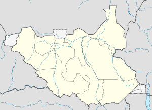
 Nimule
Summary Airport type Public, Civilian & Military Owner Civil Aviation Authority of South Sudan Serves Nimule, South Sudan Location Nimule,  South Sudan
Elevation AMSL 2,230 ft / 680 m Coordinates 03°35′53″N 32°05′24″E / 3.59806°N 32.09°E Runways Direction Length Surface ft m Unpaved Nimule Airport is an airport serving the town of Nimule, in South Sudan.
Contents
Location
Nimule Airport (IATA: n/a, ICAO: HSNM) is located in Magwi County in Eastern Equatoria State, in the town of Nimule, near the International border with Uganda. The airport is located approximately 4 kilometres (2.5 mi), southeast of the central business district of Nimule.
This location lies approximately 150 kilometres (93 mi), by air, southeast of Juba International Airport, South Sudan's largest airport.[1] The geographic coordinates of this airport are: 3° 35' 52.80"N, 32° 5' 24.00"E (Latitude: 3.5980; Longitude: 32.0900). Nimule Airport is situated 680 metres (2,230 ft) above sea level. The airport has a single unpaved runway, the dimensions of which are not publicly known at this time.
Overview
Nimule Airport is a small civilian and military airport that serves the town of Nimule and surrounding communities. The airport receives regular service from South Sudan's indigenous airline, Southern Sudan Airlines.[2]
External links
See also
- Nimule
- Eastern Equatoria
- List of airports in South Sudan
References
Counties 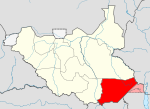
Principal towns Airports Torit · Kapoeta · NimuleRivers Mountains Communities Airports in South SudanCategories:- Airports in South Sudan
- Eastern Equatoria
- Equatoria


Wikimedia Foundation. 2010.