- Nikep, Maryland
-
Nikep — Unincorporated community — Location within the state of Maryland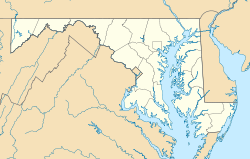

Coordinates: 39°33′02″N 78°59′50″W / 39.55056°N 78.99722°WCoordinates: 39°33′02″N 78°59′50″W / 39.55056°N 78.99722°W Country United States State Maryland County Allegany Time zone Eastern (EST) (UTC-5) – Summer (DST) EDT (UTC-4) ZIP codes FIPS code GNIS feature ID Nikep (also known as Pekin) is an unincorporated community in Allegany County, Maryland, United States.[1]
References
- ^ "Nikep (Populated Place)". Geographic Names Information System. U.S. Geological Survey. 2009-01-29. http://geonames.usgs.gov/pls/gnispublic/f?p=gnispq:3:::NO::P3_FID:590886.
Municipalities and communities of Allegany County, Maryland Cities 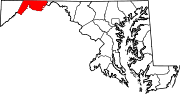
Towns Barton | Lonaconing | Luke | Midland | Westernport
CDPs Other
communitiesAmcelle | Barrelville | Bel Air | Bellegrove | Bier | Borden Shaft | Bowling Green | Carlos | Clarysville | Corriganville | Cresaptown | Danville | Dawson | Detmold | Dickens | Eckhart Mines | Ellerslie | Evitts Creek | Flintstone | Franklin | George's Creek | Klondike | Little Orleans | McCoole | McKenzie | Mexico | Midlothian | Moscow | Mount Savage | Narrows Park | Nikep | North Branch | Oldtown | Pekin | Pinto | Pleasant Valley | Potomac Park | Rawlings | Spring Gap | Town Creek | Vale Summit | Woodland | Zihlman
Categories:- Maryland geography stubs
- Populated places in Allegany County, Maryland
- Unincorporated communities in Maryland


Wikimedia Foundation. 2010.