- Nędza, Racibórz County
-
Nędza — Village — Church in Nędza
 Nędza
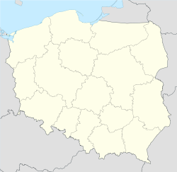
NędzaCoordinates: 50°9′N 18°18′E / 50.15°N 18.3°E Country  Poland
Voivodeship Silesian County Racibórz Gmina Nędza Elevation 198 m (650 ft) Population 3,344 Website http://www.nedza.pl nedza.pl Nędza [ˈnɛnd͡za] is a village in Racibórz County, Silesian Voivodeship, in southern Poland. It is the seat of the gmina (administrative district) called Gmina Nędza.[1] It lies approximately 9 kilometres (6 mi) north-east of Racibórz and 52 km (32 mi) west of the regional capital Katowice.
The village has a population of 3,344. It is a railroad junction, located on the main line from Kędzierzyn-Koźle to Racibórz. In Nędza, another line starts, which goes eastbound to Niedobczyce.
References
Seat NędzaOther villages Categories:- Racibórz County geography stubs
- Villages in Racibórz County


Wikimedia Foundation. 2010.