| [3] |
Landmark name[4] |
Image |
Date listed |
Location |
City or Town |
Summary |
| 1 |
1767 Milestones |
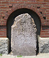 |
01971-04-07 April 7, 1971 |
Between Boston and Springfield along Old Post Rd.
42°19′48″N 71°5′29″W / 42.33°N 71.09139°W / 42.33; -71.09139 (1767 Milestones) |
Brookfield, Leicester, Shrewsbury, Spencer, Warren, and West Brookfield |
|
| 2 |
Nathan C. Aldrich House and Resthaven Chapel |
|
02006-05-17 May 17, 2006 |
111 Providence St.
42°5′13″N 71°31′57″W / 42.08694°N 71.5325°W / 42.08694; -71.5325 (Aldrich, Nathan C., House and Resthaven Chapel) |
Mendon |
|
| 3 |
Ethan Allen House and Gun Shop |
|
01995-10-12 October 12, 1995 |
37 Waterville St.
42°14′14″N 71°42′23″W / 42.23722°N 71.70639°W / 42.23722; -71.70639 (Allen, Ethan, House and Gun Shop) |
Grafton |
|
| 4 |
Ashburnham Center Historic District |
 |
01999-01-27 January 27, 1999 |
Roughly along MA 12 and MA 101 in Ashburnham
42°38′30″N 71°54′43″W / 42.64167°N 71.91194°W / 42.64167; -71.91194 (Ashburnham Center Historic District) |
Ashburnham |
|
| 5 |
Atherton Bridge |
 |
01979-09-19 September 19, 1979 |
Bolton Rd.
42°26′40″N 71°40′21″W / 42.44444°N 71.6725°W / 42.44444; -71.6725 (Atherton Bridge) |
Lancaster |
|
| 6 |
Athol High School |
|
02011-02-18 February 18, 2011 |
494 School St.
42°35′40″N 72°13′13″W / 42.59444°N 72.22028°W / 42.59444; -72.22028 (Athol High School) |
Athol |
|
| 7 |
Baldwinville Village Historic District |
|
01986-02-27 February 27, 1986 |
Roughly Elm and S. Main Sts. between Pleasant St. and Mt. View
42°36′18″N 72°4′38″W / 42.605°N 72.07722°W / 42.605; -72.07722 (Baldwinville Village Historic District) |
Templeton |
|
| 8 |
Bancroft Memorial Library |
 |
01999-02-12 February 12, 1999 |
50 Hopedale St.
42°7′49″N 71°32′30″W / 42.13028°N 71.54167°W / 42.13028; -71.54167 (Bancroft Memorial Library) |
Hopedale |
|
| 9 |
Barlin Acres |
|
01982-11-26 November 26, 1982 |
284 School St.
42°20′4″N 71°43′22″W / 42.33444°N 71.72278°W / 42.33444; -71.72278 (Barlin Acres) |
Boylston |
|
| 10 |
Barre Common District |
 |
01976-05-04 May 4, 1976 |
Bounded roughly by South, Exchange, Main, Pleasant, Broad, School and Grove Sts.
42°25′20″N 72°6′20″W / 42.42222°N 72.10556°W / 42.42222; -72.10556 (Barre Common District) |
Barre |
|
| 11 |
Bartlett's Bridge |
 |
02000-02-10 February 10, 2000 |
Clara Barton Rd. over the French River
42°9′17″N 71°52′59″W / 42.15472°N 71.88306°W / 42.15472; -71.88306 (Bartlett's Bridge) |
Oxford |
|
| 12 |
Clara Barton Homestead |
 |
01977-09-22 September 22, 1977 |
3 mi (4.8 km) west of Oxford on Clara Barton Rd.
42°9′12″N 71°53′45″W / 42.15333°N 71.89583°W / 42.15333; -71.89583 (Barton, Clara, Homestead) |
Oxford |
|
| 13 |
Berlin Town Hall |
 |
02011-09-15 September 15, 2011 |
12 Woodward Ave.
42°22′55″N 71°38′13″W / 42.38194°N 71.63694°W / 42.38194; -71.63694 (Berlin Town Hall) |
Oxford |
|
| 14 |
Bigelow Carpet Company Woolen Mills |
 |
01983-10-06 October 6, 1983 |
Main St.
42°25′1″N 71°41′26″W / 42.41694°N 71.69056°W / 42.41694; -71.69056 (Bigelow Carpet Company Woolen Mills) |
Clinton |
|
| 15 |
Bigelow Carpet Mill |
 |
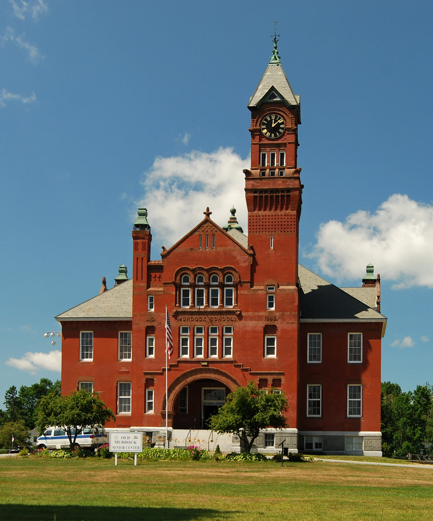
01978-12-22 December 22, 1978 |
Union and High Sts.
42°24′55″N 71°41′10″W / 42.41528°N 71.68611°W / 42.41528; -71.68611 (Bigelow Carpet Mill) |
Clinton |
|
| 16 |
Bigelow Tavern Historic District |
 |
01992-09-24 September 24, 1992 |
60, 64 and 65 Worcester St.
42°21′55″N 71°46′55″W / 42.36528°N 71.78194°W / 42.36528; -71.78194 (Bigelow Tavern Historic District) |
West Boylston |
|
| 17 |
Black Tavern |
|
01985-05-09 May 9, 1985 |
Dudley Center Rd.
42°2′44″N 71°55′48″W / 42.04556°N 71.93°W / 42.04556; -71.93 (Black Tavern)
Boundary increase (listed November 17, 2010): 140, 142 Center Road |
Dudley |
|
| 18 |
Blackstone Canal |
 |
01973-02-06 February 6, 1973 |
East of MA 122 between Northbridge and Uxbridge
42°5′31″N 71°37′46″W / 42.09194°N 71.62944°W / 42.09194; -71.62944 (Blackstone Canal) |
Northbridge and Uxbridge |
|
| 19 |
Blackstone Canal Historic District |
 |
01995-08-15 August 15, 1995 |
Address Restricted |
Blackstone, Grafton, Millbury, Millville, Northbridge, and Sutton |
|
| 20 |
Blackstone Manufacturing Company Historic District |
|
01995-08-25 August 25, 1995 |
Roughly the area surrounding Butler, Canal, Church, County, Ives, Main, Mendon, Old Mendon, and School Sts.
42°0′58″N 71°32′41″W / 42.01611°N 71.54472°W / 42.01611; -71.54472 (Blackstone Manufacturing Company Historic District) |
Blackstone |
|
| 21 |
Blackstone Viaduct |
|
02002-02-05 February 5, 2002 |
Canal, Farnum and Mill Sts.
42°0′55″N 71°32′0″W / 42.01528°N 71.533333°W / 42.01528; -71.533333 (Blackstone Viaduct) |
Blackstone |
|
| 22 |
Bolton Center Historic District |
 |
01997-11-17 November 17, 1997 |
Roughly along Main St. between Harvard Rd. and Interstate 495
42°26′7″N 71°36′35″W / 42.43528°N 71.60972°W / 42.43528; -71.60972 (Bolton Center Historic District) |
Bolton |
|
| 23 |
Bowers School |
 |
01983-11-10 November 10, 1983 |
411 Water St.
42°25′9″N 71°40′18″W / 42.41917°N 71.67167°W / 42.41917; -71.67167 (Bowers School) |
Clinton |
|
| 24 |
J.D.C. Bradley House |
|
01999-02-26 February 26, 1999 |
60 Sears Rd.
42°18′59″N 71°32′34″W / 42.31639°N 71.54278°W / 42.31639; -71.54278 (Bradley, J.D.C., House) |
Southborough |
|
| 25 |
Brookfield Cemetery |
 |
02003-05-09 May 9, 2003 |
Main St.
42°13′2″N 72°6′49″W / 42.21722°N 72.11361°W / 42.21722; -72.11361 (Brookfield Cemetery) |
Brookfield |
|
| 26 |
Brookfield Common Historic District |
 |
01990-02-23 February 23, 1990 |
Roughly Howard, Sherman, Prouty, W. Main, Main, and Upper River Sts.
42°12′51″N 72°6′9″W / 42.21417°N 72.1025°W / 42.21417; -72.1025 (Brookfield Common Historic District) |
Brookfield |
|
| 27 |
Brown-Davis-Frost Farm |
|
01995-12-13 December 13, 1995 |
17 Whitney St.
42°22′29″N 71°53′19″W / 42.37472°N 71.88861°W / 42.37472; -71.88861 (Brown-Davis-Frost Farm) |
Jefferson |
|
| 28 |
Bullard House |
|
02011-09-15 September 15, 2011 |
4 Woodward Ave.
42°22′54″N 71°38′14″W / 42.38167°N 71.63722°W / 42.38167; -71.63722 (Bullard House) |
Berlin |
|
| 29 |
Calvinistic Congregational Church |
|
01979-06-15 June 15, 1979 |
820 Main St.
42°35′6″N 71°48′19″W / 42.585°N 71.80528°W / 42.585; -71.80528 (Calvinistic Congregational Church) |
Fitchburg |
|
| 30 |
Cambridge Grant Historic District |
|
02001-08-20 August 20, 2001 |
205-287 Russell Hill Rd., 15 Wilker Rd.
42°38′41″N 71°51′44″W / 42.64472°N 71.86222°W / 42.64472; -71.86222 (Cambridge Grant Historic District) |
Ashburnham |
|
| 31 |
Camp Atwater |
|
01982-04-15 April 15, 1982 |
Shore Rd.
42°14′22″N 72°3′0″W / 42.23944°N 72.05°W / 42.23944; -72.05 (Camp Atwater) |
North Brookfield |
|
| 32 |
Cedar Swamp Archeological District |
|
01988-05-23 May 23, 1988 |
Along the border with Hopkinton in Middlesex County
42°15′36″N 71°35′6″W / 42.26°N 71.585°W / 42.26; -71.585 (Cedar Swamp Archeological District)[5] |
Westborough |
Extends into Middlesex County |
| 33 |
Center Village District |
 |
01977-09-15 September 15, 1977 |
Irregular pattern along Main St.
42°27′26″N 71°40′19″W / 42.45722°N 71.67194°W / 42.45722; -71.67194 (Center Village District) |
Lancaster |
|
| 34 |
Central Street Historic District |
 |
02003-06-20 June 20, 2003 |
Roughly bounded by Central, Quaker, West, Chesley, Bow, Prospect, and Fletcher Sts.
42°1′28.812″N 71°34′57.4422″W / 42.02467°N 71.582622833°W / 42.02467; -71.582622833 (Central Street Historic District) |
Millville |
|
| 35 |
Charlton Center Historic District |
 |
01995-10-20 October 20, 1995 |
Roughly Main St. from Mugget Hill Rd. to Masonic Home Rd. and adjacent roads
42°8′2″N 71°58′9″W / 42.13389°N 71.96917°W / 42.13389; -71.96917 (Charlton Center Historic District) |
Charlton |
|
| 36 |
Chestnut Hill Meetinghouse |
 |
01984-11-13 November 13, 1984 |
Chestnut and Thayer Sts.
42°2′27″N 71°34′58″W / 42.04083°N 71.58278°W / 42.04083; -71.58278 (Chestnut Hill Meetinghouse) |
Millville |
|
| 37 |
George Clapp House |
|
01997-08-21 August 21, 1997 |
44 North St.
42°12′43″N 71°40′51″W / 42.21194°N 71.68083°W / 42.21194; -71.68083 (Clapp, George, House) |
Grafton |
|
| 38 |
Cluett Peabody & Company |
 |
01989-06-08 June 8, 1989 |
123 1st St.
42°31′34″N 71°45′11″W / 42.52611°N 71.75306°W / 42.52611; -71.75306 (Cluett Peabody & Company) |
Leominster |
|
| 39 |
Corcoran School |
 |
02000-02-04 February 4, 2000 |
40 Walnut St.
42°25′0″N 71°41′3″W / 42.416667°N 71.68417°W / 42.416667; -71.68417 (Corcoran School) |
Clinton |
|
| 40 |
Crocker Field Historic District |
|
02001-06-14 June 14, 2001 |
River St.
42°35′44″N 71°48′34″W / 42.59556°N 71.80944°W / 42.59556; -71.80944 (Crocker Field Historic District) |
Fitchburg |
|
| 41 |
Crossman Bridge |
|
02010-12-27 December 27, 2010 |
Gilbert Rd. over Quaboag River
42°12′37″N 72°14′44″W / 42.21028°N 72.24556°W / 42.21028; -72.24556 (Crossman Bridge) |
Warren |
|
| 42 |
District Five Schoolhouse |
|
01991-06-05 June 5, 1991 |
School St. between Boyden and 1st Sts.
42°2′34″N 71°52′58″W / 42.04278°N 71.88278°W / 42.04278; -71.88278 (District Five Schoolhouse) |
Webster |
|
| 43 |
Downtown Clinton Historic District |
 |
01985-02-21 February 21, 1985 |
Roughly bounded by Union and Prospects Sts. on High and Church Sts.
42°25′2″N 71°40′59″W / 42.41722°N 71.68306°W / 42.41722; -71.68306 (Downtown Clinton Historic District) |
Clinton |
|
| 44 |
Frances H. and Jonathan Drake House |
 |
02008-01-29 January 29, 2008 |
21 Franklin St.
42°31′20.21″N 71°45′41.4″W / 42.5222806°N 71.7615°W / 42.5222806; -71.7615 (Drake, Frances H. and Jonathan, House) |
Leominster |
Underground Railroad in Massachusetts MPS |
| 45 |
Duck Mill |
 |
01985-05-09 May 9, 1985 |
60 Duck Mill Rd.
42°2′44″N 71°55′48″W / 42.04556°N 71.93°W / 42.04556; -71.93 (Duck Mill) |
Fitchburg |
|
| 46 |
Eagleville Historic District |
|
02010-09-24 September 24, 2010 |
Main St., Princeton St., High St
42°21′35″N 71°52′55″W / 42.35972°N 71.88194°W / 42.35972; -71.88194 (Eagleville Historic District) |
Holden |
|
| 47 |
East Blackstone Friends Meetinghouse |
|
01995-08-22 August 22, 1995 |
197 Elm St.
42°3′9″N 71°31′23″W / 42.0525°N 71.52306°W / 42.0525; -71.52306 (East Blackstone Friends Meetinghouse) |
Blackstone |
|
| 48 |
East Blackstone Village Historic District |
|
01995-09-06 September 6, 1995 |
Roughly the area along Elm St. at the junction with Summer St.
42°2′39″N 71°30′57″W / 42.04417°N 71.51583°W / 42.04417; -71.51583 (East Blackstone Village Historic District) |
Blackstone |
|
| 49 |
East Main Street-Cherry Street Historic District |
 |
01996-08-09 August 9, 1996 |
215-270 and 35-73 Main, 2-16 Linden, 3-24 Ash, 26-73 Cherry, 6–19 May, and 8 Park Sts.
42°14′46″N 71°59′14″W / 42.24611°N 71.98722°W / 42.24611; -71.98722 (East Main Street-Cherry Street Historic District) |
Spencer |
|
| 50 |
East Princeton Village Historic District |
 |
02004-03-18 March 18, 2004 |
Roughly Main St. and Leominster Rd.
42°28′23″N 71°50′14″W / 42.47306°N 71.83722°W / 42.47306; -71.83722 (East Princeton Village Historic District) |
Princeton |
|
| 51 |
Eddy Block |
 |
01980-12-03 December 3, 1980 |
119-131 Main St. and 4 Davis St.
42°2′56″N 71°53′5″W / 42.04889°N 71.88472°W / 42.04889; -71.88472 (Eddy Block) |
Webster |
|
| 52 |
Elm Hill Farm Historic District |
 |
01991-05-16 May 16, 1991 |
E. Main St. east of its junction with Brookfield Rd.
42°13′16″N 72°5′10″W / 42.22111°N 72.08611°W / 42.22111; -72.08611 (Elm Hill Farm Historic District) |
Brookfield |
|
| 53 |
Elm Street Fire Station |
|
01980-04-02 April 2, 1980 |
58 Elm St.
42°34′40″N 71°59′8″W / 42.57778°N 71.98556°W / 42.57778; -71.98556 (Elm Street Fire Station) |
Gardner |
|
| 54 |
Farnum's Gate Historic District |
|
01995-08-25 August 25, 1995 |
Roughly the area surrounding the junction of Main and Blackstone Sts.
42°1′8″N 71°31′56″W / 42.01889°N 71.53222°W / 42.01889; -71.53222 (Farnum's Gate Historic District) |
Blackstone |
|
| 55 |
Farnumsville Historic District |
|
01996-02-16 February 16, 1996 |
Roughly bounded by Providence Rd., Cross, Main, Harding and Depot Sts. and Maple Ave.
42°10′28″N 71°41′3″W / 42.17444°N 71.68417°W / 42.17444; -71.68417 (Farnumsville Historic District) |
Grafton |
|
| 56 |
Fay Club |
|
01978-01-31 January 31, 1978 |
658 Main St.
42°34′59″N 71°48′9″W / 42.58306°N 71.8025°W / 42.58306; -71.8025 (Fay Club) |
Fitchburg |
|
| 57 |
Fernside-Vacation House for Working Girls |
|
02002-06-27 June 27, 2002 |
162 Mountain Rd.
42°28′6″N 71°53′4″W / 42.46833°N 71.88444°W / 42.46833; -71.88444 (Fernside-Vacation House for Working Girls) |
Princeton |
|
| 58 |
First Church of Christ, Lancaster |
 |
01970-12-30 December 30, 1970 |
Facing the Common
42°27′21.9198″N 71°40′24.873″W / 42.456088833°N 71.67357583°W / 42.456088833; -71.67357583 (First Church of Christ, Lancaster) |
Lancaster |
National Historic Landmark |
| 59 |
First Methodist Church |
|
01990-11-02 November 2, 1990 |
75 Walnut St.
42°25′0″N 71°41′3″W / 42.416667°N 71.68417°W / 42.416667; -71.68417 (First Methodist Church) |
Clinton |
|
| 60 |
First Minister's House |
|
01979-11-14 November 14, 1979 |
186 Elm St.
42°34′26″N 71°59′0″W / 42.57389°N 71.983333°W / 42.57389; -71.983333 (First Minister's House) |
Gardner |
|
| 61 |
First Presbyterian Society Meeting House |
|
02010-09-09 September 9, 2010 |
20 Main St.
42°11′32″N 71°45′37″W / 42.19222°N 71.76028°W / 42.19222; -71.76028 (First Presbyterian Society Meeting House) |
Millbury |
|
| 62 |
Nathan Fisher House |
 |
01980-03-25 March 25, 1980 |
East of Shrewsbury on MA 9
42°17′3″N 71°37′30″W / 42.28417°N 71.625°W / 42.28417; -71.625 (Fisher, Nathan, House) |
Westborough |
|
| 63 |
Fisherville Historic District |
|
01996-02-16 February 16, 1996 |
Roughly bounded by Main, Elmwood, Ferry and Sampson Sts.
42°10′37″N 71°41′40″W / 42.17694°N 71.69444°W / 42.17694; -71.69444 (Fisherville Historic District) |
Grafton |
|
| 64 |
Fitchburg Historical Society |
|
02003-10-03 October 3, 2003 |
50 Grove St.
42°35′4″N 71°48′10″W / 42.58444°N 71.80278°W / 42.58444; -71.80278 (Fitchburg Historical Society) |
Fitchburg |
|
| 65 |
Fort Devens Historic District |
|
01993-06-10 June 10, 1993 |
Roughly bounded by El Caney St., Antietam St., Sherman Ave., MacArthur Ave. and Buena Vista St.
42°32′46″N 71°36′46″W / 42.54611°N 71.61278°W / 42.54611; -71.61278 (Fort Devens Historic District) |
Harvard |
|
| 66 |
Founder's Hall |
 |
01980-04-14 April 14, 1980 |
Atlantic Union College Campus
42°26′42″N 71°41′10″W / 42.445°N 71.68611°W / 42.445; -71.68611 (Founder's Hall) |
Lancaster |
|
| 67 |
Freegrace Marble Farm Historic District |
 |
01989-11-13 November 13, 1989 |
80 Burbank Rd.
42°9′44″N 71°45′2″W / 42.16222°N 71.75056°W / 42.16222; -71.75056 (Freegrace Marble Farm Historic District) |
Sutton |
|
| 68 |
Fruitlands |
 |
01974-03-19 March 19, 1974 |
Prospect Hill
42°30′34″N 71°36′45″W / 42.50944°N 71.6125°W / 42.50944; -71.6125 (Fruitlands) |
Harvard |
National Historic Landmark |
| 69 |
Fruitlands Museums Historic District |
 |
01997-05-23 May 23, 1997 |
102 Prospect Hill Rd.
42°29′37″N 71°36′47″W / 42.49361°N 71.61306°W / 42.49361; -71.61306 (Fruitlands Museums Historic District) |
Harvard |
|
| 70 |
Garbose Building |
|
01983-04-12 April 12, 1983 |
3 Pleasant St.
42°34′33″N 71°59′46″W / 42.57583°N 71.99611°W / 42.57583; -71.99611 (Garbose Building) |
Gardner |
|
| 71 |
Gardner News Building |
 |
01979-11-14 November 14, 1979 |
309 Central St.
42°34′35″N 71°59′44″W / 42.57639°N 71.99556°W / 42.57639; -71.99556 (Gardner News Building) |
Gardner |
|
| 72 |
Gardner Uptown Historic District |
 |
01999-06-03 June 3, 1999 |
Roughly along Central, Cross, Elm, Green. Glazier, Pearl and Woodland Sts.
42°34′40″N 71°59′4″W / 42.57778°N 71.98444°W / 42.57778; -71.98444 (Gardner Uptown Historic District) |
Gardner |
|
| 73 |
Gay Farm |
|
01977-09-22 September 22, 1977 |
South of Petersham off Nichewaug Rd.
42°27′50″N 72°11′6″W / 42.46389°N 72.185°W / 42.46389; -72.185 (Gay Farm) |
Petersham |
|
| 74 |
Rev. Samuel Gay House |
|
01997-11-24 November 24, 1997 |
10 Williamsville Rd.
42°28′44″N 72°0′55″W / 42.47889°N 72.01528°W / 42.47889; -72.01528 (Gay, Rev. Samuel, House) |
Hubbardston |
|
| 75 |
Gilbertville Historic District |
|
01991-12-26 December 26, 1991 |
Roughly Main, Church, High, North, Broad and Bridge Sts.
42°18′24″N 72°12′32″W / 42.30667°N 72.20889°W / 42.30667; -72.20889 (Gilbertville Historic District) |
Hardwick |
|
| 76 |
Gillon Block |
 |
01982-10-21 October 21, 1982 |
189 Main St.
42°8′26″N 71°31′15″W / 42.14056°N 71.52083°W / 42.14056; -71.52083 (Gillon Block) |
Milford |
|
| 77 |
Goddard Rocket Launching Site |
 |
01966-11-13 November 13, 1966 |
Ninth fairway, Pakachoag Golf Course, Pakachoag Rd.
42°13′6″N 71°48′46″W / 42.21833°N 71.81278°W / 42.21833; -71.81278 (Goddard Rocket Launching Site) |
Auburn |
National Historic Landmark |
| 78 |
John B. Gough House |
 |
01974-03-19 March 19, 1974 |
215 Main St.
42°19′42″N 71°45′22″W / 42.32833°N 71.75611°W / 42.32833; -71.75611 (Gough, John B., House) |
Boylston |
National Historic Landmark |
| 79 |
Grafton Common Historic District |
 |
01988-06-22 June 22, 1988 |
Roughly Worcester, Oak, Millbury, Church, South, Upton, and North Sts.
42°12′22″N 71°41′10″W / 42.20611°N 71.68611°W / 42.20611; -71.68611 (Grafton Common Historic District) |
Grafton |
|
| 80 |
Grafton Inn |
 |
01980-06-16 June 16, 1980 |
25 Central Sq.
42°12′23″N 71°41′8″W / 42.20639°N 71.68556°W / 42.20639; -71.68556 (Grafton Inn) |
Grafton |
|
| 81 |
Grove Street School |
 |
01996-07-05 July 5, 1996 |
23 Grove St.
42°14′48″N 71°59′34″W / 42.24667°N 71.99278°W / 42.24667; -71.99278 (Grove Street School) |
Spencer |
|
| 82 |
Hardwick Village Historic District |
 |
01991-12-19 December 19, 1991 |
Petersham, Barre, Greenwich, Ruggles Hill and Gilbertville Rds.
42°20′54″N 72°11′49″W / 42.34833°N 72.19694°W / 42.34833; -72.19694 (Hardwick Village Historic District) |
Hardwick |
|
| 83 |
Harvard Center Historic District |
 |
01997-09-22 September 22, 1997 |
Ayer, Still River, Old Littleton, Bolton and Oak Hill Rds, Elm and Fairbanks Sts, Lovers Ln., Mass. Ave. and Old Boston
42°29′52″N 71°35′1″W / 42.49778°N 71.58361°W / 42.49778; -71.58361 (Harvard Center Historic District) |
Harvard |
|
| 84 |
Harvard Shaker Village Historic District |
 |
01989-10-30 October 30, 1989 |
Roughly Shaker Rd., S. Shaker Rd., and Maple Ln.
42°31′57″N 71°33′33″W / 42.5325°N 71.55917°W / 42.5325; -71.55917 (Harvard Shaker Village Historic District) |
Harvard |
|
| 85 |
Hassanamisco Reservation |
|
02011-09-06 September 6, 2011 |
80 Brigham Hill Rd.
42°12′39″N 71°42′18″W / 42.21083°N 71.705°W / 42.21083; -71.705 (Hassanamisco Reservation) |
Grafton |
|
| 86 |
Stephen Hastings House |
|
02005-12-06 December 6, 2005 |
20 Squareshire Rd.
42°24′29″N 71°44′26″W / 42.40806°N 71.74056°W / 42.40806; -71.74056 (Hastings, Stephen, House) |
Sterling |
|
| 87 |
Hayward Mill |
 |
01991-06-17 June 17, 1991 |
Junction of North and Cook Sts., on the Mumford River
42°4′30″N 71°42′43″W / 42.075°N 71.71194°W / 42.075; -71.71194 (Hayward Mill) |
Douglas |
|
| 88 |
Levi Heywood Memorial Library Building |
|
01979-12-06 December 6, 1979 |
28 Pearl St.
42°34′46″N 71°59′9″W / 42.57944°N 71.98583°W / 42.57944; -71.98583 (Heywood, Levi, Memorial Library Building) |
Gardner |
|
| 89 |
Heywood-Wakefield Company Complex |
 |
01983-09-15 September 15, 1983 |
206 Central St.
42°34′35″N 71°59′27″W / 42.57639°N 71.99083°W / 42.57639; -71.99083 (Heywood-Wakefield Company Complex) |
Gardner |
|
| 90 |
Holden Center Historic District |
 |
01977-12-22 December 22, 1977 |
Main, Maple, Highland, and Reservoir Sts.
42°21′3″N 71°51′47″W / 42.35083°N 71.86306°W / 42.35083; -71.86306 (Holden Center Historic District) |
Holden |
|
| 91 |
Holland-Towne House |
|
01990-08-13 August 13, 1990 |
SR 32
42°30′1″N 72°11′6″W / 42.50028°N 72.185°W / 42.50028; -72.185 (Holland-Towne House) |
Petersham |
|
| 92 |
Hopedale Village Historic District |
 |
02002-06-12 June 12, 2002 |
Roughly bounded by Milford Town Line, Malquin Dr., Mendon Town Line and Upton Town Line
42°7′35.184″N 71°32′12.516″W / 42.12644°N 71.53681°W / 42.12644; -71.53681 (Hopedale Village Historic District) |
Hopedale |
|
| 93 |
Hubbard-Dawson House |
|
01995-12-13 December 13, 1995 |
925 Main St.
42°20′37″N 71°51′8″W / 42.34361°N 71.85222°W / 42.34361; -71.85222 (Hubbard-Dawson House) |
Holden |
|
| 94 |
Hubbardston Public Library |
 |
01998-08-19 August 19, 1998 |
7 Main St.
42°28′30″N 72°0′28″W / 42.475°N 72.00778°W / 42.475; -72.00778 (Hubbardston Public Library) |
Hubbardston |
|
| 95 |
Hubbardston Town Common Historic District |
 |
02000-11-22 November 22, 2000 |
Main and Brigham Sts.
42°28′30″N 72°0′22″W / 42.475°N 72.00611°W / 42.475; -72.00611 (Hubbardston Town Common Historic District) |
Hubbardston |
|
| 96 |
Hudson House |
 |
01978-02-08 February 8, 1978 |
Northeast of Oxford on Hudson Rd.
42°8′32″N 71°50′12″W / 42.14222°N 71.83667°W / 42.14222; -71.83667 (Hudson House) |
Oxford |
|
| 97 |
Huguenot Fort |
|
01988-04-27 April 27, 1988 |
Fort Hill Rd.
42°5′55″N 71°50′50″W / 42.09861°N 71.84722°W / 42.09861; -71.84722 (Huguenot Fort) |
Oxford |
|
| 98 |
E. N. Jenckes Store |
 |
01988-01-28 January 28, 1988 |
Main St.
42°4′18″N 71°42′51″W / 42.07167°N 71.71417°W / 42.07167; -71.71417 (Jenckes, E. N., Store) |
Douglas |
|
| 99 |
Knowlton Hat Factory |
 |
01982-06-01 June 1, 1982 |
134 Main St.
42°10′10″N 71°37′27″W / 42.16944°N 71.62417°W / 42.16944; -71.62417 (Knowlton Hat Factory) |
Upton |
|
| 100 |
Lake Street Fire Station |
|
01980-03-25 March 25, 1980 |
2 Lake St.
42°34′37″N 71°59′42″W / 42.57694°N 71.995°W / 42.57694; -71.995 (Lake Street Fire Station) |
Gardner |
|
| 101 |
Lancaster Industrial School for Girls |
|
01976-10-08 October 8, 1976 |
Southeast of Lancaster on Old Common Rd.
42°26′35″N 71°39′30″W / 42.44306°N 71.65833°W / 42.44306; -71.65833 (Lancaster Industrial School for Girls) |
Lancaster |
|
| 102 |
Lancaster Mills |
 |
02010-01-29 January 29, 2010 |
1-55, 75, 99, 1-R Green St., 20 Cameron St.
42°24′41.62″N 71°40′48.47″W / 42.4115611°N 71.6801306°W / 42.4115611; -71.6801306 (Lancaster Mills) |
Clinton |
|
| 103 |
Anthony Lane House |
|
01976-11-07 November 7, 1976 |
Northeast of Lancaster on Seven Bridge Rd.
42°27′54″N 71°39′58″W / 42.465°N 71.66611°W / 42.465; -71.66611 (Lane, Anthony, House) |
Lancaster |
|
| 104 |
Linwood Historic District |
 |
01989-06-16 June 16, 1989 |
Roughly Linwood Ave., Maple Ct., and Pine Ct.
42°5′54″N 71°38′49″W / 42.09833°N 71.64694°W / 42.09833; -71.64694 (Linwood Historic District) |
Northbridge |
|
| 105 |
Joseph Lothrop House |
|
01980-03-27 March 27, 1980 |
208 Turnpike Rd.
42°17′1″N 71°37′34″W / 42.28361°N 71.62611°W / 42.28361; -71.62611 (Lothrop, Joseph, House) |
Westborough |
Listed in the "Shrewsbury vicinity". |
| 106 |
Lunenburg Historic District |
 |
01988-08-24 August 24, 1988 |
Leominster Rd., Highland St., Oak and Massachusetts Aves., Main St., and Lancaster Ave.
42°35′42″N 71°43′32″W / 42.595°N 71.72556°W / 42.595; -71.72556 (Lunenburg Historic District) |
Lunenburg |
|
| 107 |
Lyman School for Boys |
 |
01994-07-25 July 25, 1994 |
Junction of Oak and South Sts.
42°17′24″N 71°37′50″W / 42.29°N 71.63056°W / 42.29; -71.63056 (Lyman School for Boys) |
Westborough |
|
| 108 |
Main Street Historic District |
 |
02006-05-10 May 10, 2006 |
Main, Lincoln, Preston, Walnut Sts., Chestnut Hill Rd., Burns Ave.
42°1′40″N 71°34′44″W / 42.02778°N 71.57889°W / 42.02778; -71.57889 (Main Street Historic District) |
Millville |
|
| 109 |
Main Street Historic District |
 |
01982-04-06 April 6, 1982 |
175-299 and 228-274 Main St.
42°2′57″N 71°52′56″W / 42.04917°N 71.88222°W / 42.04917; -71.88222 (Main Street Historic District) |
Webster |
|
| 110 |
Manning-Ball House |
|
01995-12-13 December 13, 1995 |
370 Manning St.
42°23′10″N 71°50′8″W / 42.38611°N 71.83556°W / 42.38611; -71.83556 (Manning-Ball House) |
Jefferson |
|
| 111 |
Maples Cottage |
|
01980-03-25 March 25, 1980 |
East of Shrewsbury on Oak St.
42°17′8″N 71°37′38″W / 42.28556°N 71.62722°W / 42.28556; -71.62722 (Maples Cottage) |
Westborough |
|
| 112 |
Marlborough Brook Filter Beds |
|
01990-01-18 January 18, 1990 |
Framingham Rd.
42°19′47″N 71°32′9″W / 42.32972°N 71.53583°W / 42.32972; -71.53583 (Marlborough Brook Filter Beds) |
Southborough |
Extends into Marlborough, Middlesex County. |
| 113 |
Matthews Fulling Mill Site |
 |
01975-11-12 November 12, 1975 |
Address Restricted |
North Brookfield |
|
| 114 |
Memorial Hall |
 |
01985-05-09 May 9, 1985 |
30 School St.
42°8′32.0274″N 71°31′9.5592″W / 42.142229833°N 71.519322°W / 42.142229833; -71.519322 (Memorial Hall) |
Milford |
|
| 115 |
Mendon Center Historic District |
 |
02003-06-19 June 19, 2003 |
Roughly bounded by Main, Hastings, Maple, North, Washington, and George Sts.
42°6′28.2168″N 71°33′12.8478″W / 42.107838°N 71.553568833°W / 42.107838; -71.553568833 (Mendon Center Historic District) |
Mendon |
|
| 116 |
Milford Town Hall |
 |
01977-09-22 September 22, 1977 |
52 Main St.
42°8′33″N 71°31′2″W / 42.1425°N 71.51722°W / 42.1425; -71.51722 (Milford Town Hall) |
Milford |
|
| 117 |
Miss Toy Town Diner |
|
02003-12-04 December 4, 2003 |
102 Main St.
42°34′27″N 71°59′41″W / 42.57417°N 71.99472°W / 42.57417; -71.99472 (Miss Toy Town Diner) |
Gardner |
|
| 118 |
Monument Park Historic District |
 |
01978-05-16 May 16, 1978 |
Monument Park and environs north of Main St.
42°35′1″N 71°48′6″W / 42.58361°N 71.80167°W / 42.58361; -71.80167 (Monument Park Historic District) |
Fitchburg |
|
| 119 |
Monument Square Historic District |
 |
01982-07-08 July 8, 1982 |
Main and Water Sts. and Grove Ave.
42°31′37″N 71°45′37″W / 42.52694°N 71.76028°W / 42.52694; -71.76028 (Monument Square Historic District) |
Leominster |
|
| 120 |
Moore State Park Historic District |
 |
02004-05-21 May 21, 2004 |
Address Restricted |
Paxton |
|
| 121 |
Mount Vernon Cemetery |
 |
02008-05-29 May 29, 2008 |
Church St.
42°21′52.4484″N 71°46′51.981″W / 42.364569°N 71.78110583°W / 42.364569; -71.78110583 (Mount Vernon Cemetery) |
West Boylston |
|
| 122 |
Murdock School |
 |
01988-01-28 January 28, 1988 |
Murdock Ave.
42°41′7″N 72°3′15″W / 42.68528°N 72.05417°W / 42.68528; -72.05417 (Murdock School) |
Winchendon |
|
| 123 |
Azariah Newton House |
|
01999-10-14 October 14, 1999 |
44 Silver Hill Rd.
42°10′2″N 71°32′8″W / 42.16722°N 71.53556°W / 42.16722; -71.53556 (Newton, Azariah, House) |
Milford |
|
| 124 |
No. 4 Schoolhouse |
|
01988-06-22 June 22, 1988 |
Farrington Rd.
42°26′43″N 72°5′5″W / 42.44528°N 72.08472°W / 42.44528; -72.08472 (No. 4 Schoolhouse) |
Barre |
|
| 125 |
North Avenue Rural Historic District |
|
02003-07-25 July 25, 2003 |
85-147 North Ave., 6-8 Trask Rd., 4-16 Hopedale St.
42°7′34″N 71°34′1″W / 42.12611°N 71.56694°W / 42.12611; -71.56694 (North Avenue Rural Historic District) |
Mendon |
|
| 126 |
North Brookfield Town House |
 |
02001-10-28 October 28, 2001 |
185 N. Main St.
42°16′7.3308″N 72°5′6.1938″W / 42.268703°N 72.085053833°W / 42.268703; -72.085053833 (North Brookfield Town House) |
North Brookfield |
|
| 127 |
North Village Historic District |
 |
01977-11-23 November 23, 1977 |
N. Main St.
42°28′16″N 71°40′45″W / 42.47111°N 71.67917°W / 42.47111; -71.67917 (North Village Historic District) |
Lancaster |
|
| 128 |
Northside Village Historic District |
 |
01977-10-05 October 5, 1977 |
Stafford St., Northside and Cemetery Rds.
42°9′53″N 71°57′24″W / 42.16472°N 71.95667°W / 42.16472; -71.95667 (Northside Village Historic District) |
Charlton |
|
| 129 |
Oakdale Village Historic District |
 |
01996-07-05 July 5, 1996 |
11-68 N. Main, 8–24 May, 6-10 Green, 12-23 High, 4-68 Laurel, 14-34 Waushacum, and park at Thomas and N. Main
42°23′20″N 71°47′48″W / 42.38889°N 71.79667°W / 42.38889; -71.79667 (Oakdale Village Historic District) |
West Boylston |
|
| 130 |
Old Centre Historic District |
 |
01987-09-18 September 18, 1987 |
Roughly Old County and Baldwinsville Rds., Hale St., and Teel Rd.
42°39′43″N 72°2′21″W / 42.66194°N 72.03917°W / 42.66194; -72.03917 (Old Centre Historic District) |
Winchendon |
|
| 131 |
Old Douglas Center Historic District |
 |
02001-10-28 October 28, 2001 |
Roughly bounded by Church, Common, Main, NW. Main, SW. Main, and Webster Sts.
42°3′13.572″N 71°44′22.8156″W / 42.05377°N 71.739671°W / 42.05377; -71.739671 (Old Douglas Center Historic District) |
Douglas |
|
| 132 |
Old Indian Cemetery |
|
02006-05-17 May 17, 2006 |
50 Cottage St.
42°14′12″N 72°8′47″W / 42.23667°N 72.14639°W / 42.23667; -72.14639 (Indian Cemetery, Old) |
West Brookfield |
|
| 133 |
Old Stone Church |
 |
01973-04-13 April 13, 1973 |
Off MA 140
42°22′29″N 71°46′59″W / 42.37472°N 71.78306°W / 42.37472; -71.78306 (Old Stone Church) |
West Boylston |
|
| 134 |
Old Town Hall |
|
01987-06-17 June 17, 1987 |
1307 Main St.
42°35′32″N 72°13′5″W / 42.59222°N 72.21806°W / 42.59222; -72.21806 (Old Town Hall) |
Athol |
|
| 135 |
Oxford Main Street Historic District |
|
02011-08-24 August 24, 2011 |
Barton, Charlton, Church, E. Main, Elm, Fremont, & Main Sts., Quobaug Ave., Sigourney St., Sutton Ave., West St. Jackson
42°7′1″N 71°51′53″W / 42.11694°N 71.86472°W / 42.11694; -71.86472 (Oxford Main Street Historic District) |
Oxford |
|
| 136 |
Paddock Farm |
|
01996-02-23 February 23, 1996 |
259 Salisbury St.
42°20′2″N 71°50′57″W / 42.33389°N 71.84917°W / 42.33389; -71.84917 (Paddock Farm) |
Holden |
|
| 137 |
Pan Burying Ground |
 |
02007-07-11 July 11, 2007 |
477 Main St.
42°25′50″N 71°35′24″W / 42.43056°N 71.59°W / 42.43056; -71.59 (Pan Burying Ground) |
Bolton |
|
| 138 |
Parkhill Mill |
|
02008-02-20 February 20, 2008 |
1 Oak Hill Rd.
42°34′50.6496″N 71°49′18.519″W / 42.580736°N 71.82181083°W / 42.580736; -71.82181083 (Parkhill Mill) |
Fitchburg |
|
| 139 |
Jabez Partridge Homestead |
|
01979-12-06 December 6, 1979 |
81 Partridge Rd.
42°33′30″N 71°58′15″W / 42.55833°N 71.97083°W / 42.55833; -71.97083 (Partridge, Jabez, Homestead) |
Gardner |
|
| 140 |
Pequoig Hotel |
|
01978-11-17 November 17, 1978 |
Main St.
42°35′39″N 72°13′53″W / 42.59417°N 72.23139°W / 42.59417; -72.23139 (Pequoig Hotel) |
Athol |
|
| 141 |
Petersham Common Historic District |
 |
01982-05-11 May 11, 1982 |
MA 32/122
42°29′25″N 72°11′8″W / 42.49028°N 72.18556°W / 42.49028; -72.18556 (Petersham Common Historic District) |
Petersham |
|
| 142 |
Phillipston Center Historic District |
 |
01999-11-22 November 22, 1999 |
Roughly along The Common, Baldwinville, Petersham and Templeton Rds.
42°33′3″N 72°8′13″W / 42.55083°N 72.13694°W / 42.55083; -72.13694 (Phillipston Center Historic District) |
Phillipston |
|
| 143 |
Pine Grove Cemetery |
 |
02008-03-12 March 12, 2008 |
Tremaine and Main Sts.
42°31′53.799″N 71°45′20.8476″W / 42.53161083°N 71.755791°W / 42.53161083; -71.755791 (Pine Grove Cemetery) |
Leominster |
|
| 144 |
Pleasant Street School |
 |
01996-07-05 July 5, 1996 |
54 Pleasant St.
42°14′54″N 71°59′51″W / 42.24833°N 71.9975°W / 42.24833; -71.9975 (Pleasant Street School) |
Spencer |
|
| 145 |
Ponakin Bridge |
 |
01979-09-10 September 10, 1979 |
North of Lancaster on Ponakin Rd.
42°28′52″N 71°41′9″W / 42.48111°N 71.68583°W / 42.48111; -71.68583 (Ponakin Bridge) |
Lancaster |
|
| 146 |
Prescott Town House |
|
01989-02-21 February 21, 1989 |
MA 32
42°29′56″N 72°11′1″W / 42.49889°N 72.18361°W / 42.49889; -72.18361 (Prescott Town House) |
Petersham |
|
| 147 |
Princeton Center Historic District |
 |
01999-02-26 February 26, 1999 |
Junction of Hubbardston and Mountain Rds.
42°26′57″N 71°52′43″W / 42.44917°N 71.87861°W / 42.44917; -71.87861 (Princeton Center Historic District) |
Princeton |
Boundary increase (added 2006-03-10): Princeton, MA |
| 148 |
Prospect Heights Historic District |
|
01990-09-05 September 5, 1990 |
Roughly bounded by Prospect Heights, Prospect, and Water Sts.
42°8′10″N 71°31′55″W / 42.13611°N 71.53194°W / 42.13611; -71.53194 (Prospect Heights Historic District) |
Milford |
|
| 149 |
Gen. Rufus Putnam House |
 |
01972-11-28 November 28, 1972 |
344 Main St.
42°22′29″N 71°58′15″W / 42.37472°N 71.97083°W / 42.37472; -71.97083 (Putnam, Gen. Rufus, House) |
Rutland |
National Historic Landmark |
| 150 |
Quinapoxet River Bridge |
 |
01990-04-08 April 8, 1990 |
Thomas St. over the Quinapoxet River at the Wachusett Reservoir
42°23′6″N 71°47′52″W / 42.385°N 71.79778°W / 42.385; -71.79778 (Quinapoxet River Bridge) |
West Boylston |
|
| 151 |
Rider Tavern |
 |
01976-05-19 May 19, 1976 |
Northeast of Charlton on Stafford St., off U.S. Route 90
42°9′52″N 71°57′14″W / 42.16444°N 71.95389°W / 42.16444; -71.95389 (Rider Tavern) |
Charlton |
|
| 152 |
Rock Castle School |
|
01989-06-07 June 7, 1989 |
Prospect St.
42°3′13″N 71°52′41″W / 42.05361°N 71.87806°W / 42.05361; -71.87806 (Rock Castle School) |
Webster |
|
| 153 |
Rockdale Common Housing District |
|
01983-03-31 March 31, 1983 |
4-20 McBride, 46-58 Plantation, and 37-42 Taft Sts.
42°9′9″N 71°38′50″W / 42.1525°N 71.64722°W / 42.1525; -71.64722 (Rockdale Common Housing District) |
Northbridge |
|
| 154 |
Rogers House |
|
01982-06-01 June 1, 1982 |
28 Boyden Rd.
42°20′59″N 71°51′29″W / 42.34972°N 71.85806°W / 42.34972; -71.85806 (Rogers House) |
Holden |
|
| 155 |
Royalston Common Historic District |
 |
01976-12-12 December 12, 1976 |
Main St., Frye Hill Rd., and Athol Rd.
42°40′39″N 72°11′18″W / 42.6775°N 72.18833°W / 42.6775; -72.18833 (Royalston Common Historic District) |
Royalston |
|
| 156 |
Russell Corner Historic District |
|
02006-02-22 February 22, 2006 |
Merriam, Gregory Hill, East Princeton and Sterling Rds. and Bullock Lane
42°27′14″N 71°52′6″W / 42.45389°N 71.86833°W / 42.45389; -71.86833 (Russell Corner Historic District) |
Princeton |
|
| 157 |
Safety Fund National Bank |
|
02009-04-30 April 30, 2009 |
470 Main St.
42°34′57.47″N 71°47′57.05″W / 42.5826306°N 71.7991806°W / 42.5826306; -71.7991806 (Safety Fund National Bank) |
Fitchburg |
|
| 158 |
Sawyer Homestead |
 |
02000-09-13 September 13, 2000 |
108 Maple St.
42°25′59″N 71°43′49″W / 42.43306°N 71.73028°W / 42.43306; -71.73028 (Sawyer Homestead) |
Sterling |
|
| 159 |
Searles Hill Cemetery |
|
02011-09-15 September 15, 2011 |
Searles Hill Rd. |
Phillipston |
|
| 160 |
Shrewsbury Historic District |
 |
01976-10-08 October 8, 1976 |
Church Rd., Main, Prospect, Boylston, and Grafton Sts.
42°17′53″N 71°42′50″W / 42.29806°N 71.71389°W / 42.29806; -71.71389 (Shrewsbury Historic District) |
Shrewsbury |
|
| 161 |
Shumway Block |
|
01980-12-03 December 3, 1980 |
112-116 Main St.
42°2′55″N 71°53′7″W / 42.04861°N 71.88528°W / 42.04861; -71.88528 (Shumway Block) |
Webster |
|
| 162 |
F.W. Smith Silver Company |
|
01979-11-14 November 14, 1979 |
60 Chestnut St.
42°34′43″N 71°59′14″W / 42.57861°N 71.98722°W / 42.57861; -71.98722 (Smith, F.W., Silver Company) |
Gardner |
|
| 163 |
South Lancaster Engine House |
 |
01976-10-22 October 22, 1976 |
283 S. Main St.
42°26′35″N 71°41′6″W / 42.44306°N 71.685°W / 42.44306; -71.685 (South Lancaster Engine House) |
South Lancaster |
|
| 164 |
South Union School |
|
02011-02-18 February 18, 2011 |
21 Highland St.
42°16′5″N 71°31′49″W / 42.26806°N 71.53028°W / 42.26806; -71.53028 (South Union School) |
Southborough |
|
| 165 |
Southwick-Daniels Farm |
|
01995-08-22 August 22, 1995 |
286 Mendon St.
42°3′26″N 71°32′54″W / 42.05722°N 71.54833°W / 42.05722; -71.54833 (Southwick-Daniels Farm) |
Blackstone |
|
| 166 |
Spaulding Block |
|
01980-12-03 December 3, 1980 |
141-143 Main St.
42°2′56″N 71°53′5″W / 42.04889°N 71.88472°W / 42.04889; -71.88472 (Spaulding Block) |
Webster |
|
| 167 |
Spencer Town Center Historic District |
 |
01986-06-26 June 26, 1986 |
Main between High and North Sts.; also 10-29 Grove, 1-51 High, 9-85 Mechanic, 13-72 Pleasant, 5-62 Wall Sts., and parts of Prouty, Lincoln, Cherry and Jones Sts.
42°14′42″N 71°59′33″W / 42.245°N 71.9925°W / 42.245; -71.9925 (Spencer Town Center Historic District) |
Spencer |
Second set of addresses represent a boundary increase, added on 02003-07-25 July 25, 2003 |
| 168 |
John Spurr House |
 |
01976-04-26 April 26, 1976 |
Main St.
42°8′6″N 71°58′10″W / 42.135°N 71.96944°W / 42.135; -71.96944 (Spurr, John, House) |
Charlton |
|
| 169 |
Sterling Center Historic District |
 |
01988-04-14 April 14, 1988 |
Roughly bounded by Meetinghouse Hill and Main, Maple and Kendall Hill, Boulding, Worcester and Princeton
42°26′10″N 71°45′41″W / 42.43611°N 71.76139°W / 42.43611; -71.76139 (Sterling Center Historic District) |
Sterling |
|
| 170 |
Stevens Linen Works Historic District |
|
02010-09-17 September 17, 2010 |
8–10 Mill St., 2 W. Main St., 2 Curfew Ln., Ardlock Pl.
42°3′1″N 71°53′24″W / 42.05028°N 71.89°W / 42.05028; -71.89 (Stevens Linen Works Historic District) |
Dudley |
|
| 171 |
Still River Baptist Church |
 |
01996-12-13 December 13, 1996 |
213 Still River Rd.
42°29′29″N 71°37′4″W / 42.49139°N 71.61778°W / 42.49139; -71.61778 (Still River Baptist Church) |
Harvard |
|
| 172 |
Joseph Stone House |
 |
01986-01-09 January 9, 1986 |
35 Stone St.
42°11′7″N 71°49′51″W / 42.18528°N 71.83083°W / 42.18528; -71.83083 (Stone, Joseph, House) |
Auburn |
|
| 173 |
Stony Farm |
|
01995-12-13 December 13, 1995 |
428 Salisbury St.
42°19′37″N 71°51′4″W / 42.32694°N 71.85111°W / 42.32694; -71.85111 (Stony Farm) |
Holden |
|
| 174 |
Sturbridge Common Historic District |
 |
01977-11-09 November 9, 1977 |
Main St. between Hall Rd. and Interstate 86
42°6′25″N 72°4′44″W / 42.10694°N 72.07889°W / 42.10694; -72.07889 (Sturbridge Common Historic District) |
Sturbridge |
|
| 175 |
Sudbury Dam Historic District |
|
01990-01-18 January 18, 1990 |
Southeastern end of Sudbury Reservoir off MA 30
42°18′21″N 71°29′30″W / 42.30583°N 71.49167°W / 42.30583; -71.49167 (Sudbury Dam Historic District) |
Southborough |
Extends into Framingham, Middlesex County. |
| 176 |
Sutton Center Historic District |
 |
02001-05-25 May 25, 2001 |
Roughly Boston Rd., Singletary Ave., and Uxbridge Rd.
42°9′5″N 71°45′54″W / 42.15139°N 71.765°W / 42.15139; -71.765 (Sutton Center Historic District) |
Sutton |
|
| 177 |
Tantiusques Reservation |
 |
01983-10-06 October 6, 1983 |
Leadmine Rd.
42°3′26″N 72°7′52″W / 42.05722°N 72.13111°W / 42.05722; -72.13111 (Tantiusques Reservation) |
Sturbridge |
|
| 178 |
Ted's Diner |
|
02000-11-29 November 29, 2000 |
67 Main St.
42°8′34″N 71°31′5″W / 42.14278°N 71.51806°W / 42.14278; -71.51806 (Ted's Diner) |
Milford |
|
| 179 |
Templeton Common Historic District |
 |
01983-07-07 July 7, 1983 |
Athol, Gardner, Hubbardston, Dudley, Wellington, and South Rds.
42°33′21″N 72°4′7″W / 42.55583°N 72.06861°W / 42.55583; -72.06861 (Templeton Common Historic District) |
Templeton |
|
| 180 |
Templeton Farm Colony |
|
01994-01-21 January 21, 1994 |
126 Royalston Rd.
42°35′59″N 72°7′8″W / 42.59972°N 72.11889°W / 42.59972; -72.11889 (Templeton Farm Colony) |
Templeton |
|
| 181 |
Benjamin Thayer Estate |
|
02009-12-30 December 30, 2009 |
200 Farm St.
42°2′49.1″N 71°31′46.78″W / 42.046972°N 71.5296611°W / 42.046972; -71.5296611 (Thayer, Benjamin, Estate) |
Blackstone |
|
| 182 |
Nathaniel Thayer Estate |
 |
01976-07-06 July 6, 1976 |
438 S. Main St.
42°26′59″N 71°40′43″W / 42.44972°N 71.67861°W / 42.44972; -71.67861 (Thayer, Nathaniel, Estate) |
Lancaster |
|
| 183 |
Thom Block |
 |
01983-06-23 June 23, 1983 |
83-89 Main St.
42°8′32″N 71°31′7″W / 42.14222°N 71.51861°W / 42.14222; -71.51861 (Thom Block) |
Milford |
|
| 184 |
Thompson School |
|
01989-06-07 June 7, 1989 |
Prospect St.
42°3′2″N 71°52′42″W / 42.05056°N 71.87833°W / 42.05056; -71.87833 (Thompson School) |
Webster |
|
| 185 |
Tuttle Square School |
 |
02002-03-08 March 8, 2002 |
41 South St.
42°11′29″N 71°50′6″W / 42.19139°N 71.835°W / 42.19139; -71.835 (Tuttle Square School) |
Auburn |
|
| 186 |
Upton Town Hall |
 |
01999-02-12 February 12, 1999 |
1 Main St.
42°10′26″N 71°35′32″W / 42.17389°N 71.59222°W / 42.17389; -71.59222 (Upton Town Hall) |
Upton |
|
| 187 |
US Post Office-Millbury Main |
 |
01987-10-15 October 15, 1987 |
119 Elm St.
42°11′27″N 71°44′59″W / 42.19083°N 71.74972°W / 42.19083; -71.74972 (US Post Office-Millbury Main) |
Millbury |
|
| 188 |
US Post Office-Whitinsville Main |
|
01987-10-15 October 15, 1987 |
58 Church St.
42°6′38″N 71°39′47″W / 42.11056°N 71.66306°W / 42.11056; -71.66306 (US Post Office-Whitinsville Main) |
Northbridge |
|
| 189 |
Vintonville Historic District |
 |
02006-08-23 August 23, 2006 |
Roughly bounded by Cottage, Green, Pine, Brigham, Beach Sts., and rear of properties along the east side of South St.
42°15′59″N 71°36′33″W / 42.26639°N 71.60917°W / 42.26639; -71.60917 (Vintonville Historic District) |
Westborough |
|
| 190 |
Wachusett Aqueduct Linear District |
 |
01990-01-18 January 18, 1990 |
Along Wachusett Aqueduct from Wachusett Reservoir to Sudbury Reservoir
42°20′1″N 71°35′27″W / 42.33361°N 71.59083°W / 42.33361; -71.59083 (Wachusett Aqueduct Linear District) |
Southborough, Northborough, Berlin, Clinton |
Extends into Marlborough in Middlesex County. |
| 191 |
Wachusett Dam Historic District |
 |
01990-01-18 January 18, 1990 |
Northern end of Wachusett Reservoir at Lancaster Millpond
42°24′17″N 71°41′17″W / 42.40472°N 71.68806°W / 42.40472; -71.68806 (Wachusett Dam Historic District) |
Clinton |
|
| 192 |
Wachusett Shirt Company |
 |
01982-07-08 July 8, 1982 |
97-100 Water St.
42°31′39″N 71°45′23″W / 42.5275°N 71.75639°W / 42.5275; -71.75639 (Wachusett Shirt Company) |
Leominster |
|
| 193 |
Gen. Artemas Ward Homestead |
 |
01976-05-04 May 4, 1976 |
Main St., opposite Dean Park
42°17′42″N 71°41′50″W / 42.295°N 71.69722°W / 42.295; -71.69722 (Ward, Gen. Artemas, Homestead) |
Shrewsbury |
|
| 194 |
Ware-Hardwick Covered Bridge |
 |
01986-05-08 May 8, 1986 |
Old Gilbertville Rd. and Bridge St.
42°18′37″N 72°12′45″W / 42.31028°N 72.2125°W / 42.31028; -72.2125 (Ware-Hardwick Covered Bridge) |
Hardwick |
|
| 195 |
Warren Public Library |
 |
02000-03-13 March 13, 2000 |
Main St. at Bacon St.
42°12′47.5734″N 72°11′35.214″W / 42.213214833°N 72.193115°W / 42.213214833; -72.193115 (Warren Public Library) |
Warren |
|
| 196 |
Warren Town Hall |
 |
02001-06-14 June 14, 2001 |
1 Main St.
42°12′46″N 72°11′43″W / 42.21278°N 72.19528°W / 42.21278; -72.19528 (Warren Town Hall) |
Warren |
|
| 197 |
Frederick Fiske and Gretchen Osgood Warren House |
|
01996-12-06 December 6, 1996 |
42 Bolton Rd.
42°29′21″N 71°35′6″W / 42.48917°N 71.585°W / 42.48917; -71.585 (Warren, Frederick Fiske and Gretchen Osgood, House) |
Harvard |
|
| 198 |
Jonah Warren House |
|
01998-11-05 November 5, 1998 |
64 Warren St.
42°14′54″N 71°36′12″W / 42.24833°N 71.60333°W / 42.24833; -71.60333 (Warren, Jonah, House) |
Westborough |
|
| 199 |
Washburn Square-Leicester Common Historic District |
 |
02006-02-22 February 22, 2006 |
Main St., Washburn Sq., 3 Paxton St.
42°14′46″N 71°54′13″W / 42.24611°N 71.90361°W / 42.24611; -71.90361 (Washburn Square-Leicester Common Historic District) |
Leicester |
|
| 200 |
Waters Farm |
|
01985-04-04 April 4, 1985 |
53 Waters Rd.
42°6′21″N 71°47′2″W / 42.10583°N 71.78389°W / 42.10583; -71.78389 (Waters Farm) |
Sutton |
|
| 201 |
Asa Waters Mansion |
 |
01978-02-14 February 14, 1978 |
123 Elm St.
42°11′24″N 71°45′46″W / 42.19°N 71.76278°W / 42.19; -71.76278 (Waters, Asa, Mansion) |
Millbury |
|
| 202 |
Wellington Piano Case Company Building |
 |
01984-05-31 May 31, 1984 |
54 Green St.
42°32′6″N 71°45′21″W / 42.535°N 71.75583°W / 42.535; -71.75583 (Wellington Piano Case Company Building) |
Leominster |
|
| 203 |
West Brick School |
|
02011-03-01 March 1, 2011 |
1592 Old Turnpike Rd.
42°21′44″N 72°4′54″W / 42.36222°N 72.08167°W / 42.36222; -72.08167 (West Brick School) |
Oakham |
|
| 204 |
West Brookfield Center Historic District |
|
01990-06-28 June 28, 1990 |
Roughly Central and Cottage Sts. from Sherman St. to Lake St. and west, N. and S. Main Sts. from Chapman Ave. to Maple St.
42°14′4″N 72°8′30″W / 42.23444°N 72.14167°W / 42.23444; -72.14167 (West Brookfield Center Historic District) |
West Brookfield |
|
| 205 |
West Gardner Square Historic District |
|
01985-12-30 December 30, 1985 |
Roughly bounded by City Hall Ave., Pleasant, Connors, Parker, and Central Sts., and [[Providence & Worcester Railroad tracks.
42°34′29″N 71°59′43″W / 42.57472°N 71.99528°W / 42.57472; -71.99528 (West Gardner Square Historic District) |
Gardner |
|
| 206 |
West Main Street Historic District |
 |
01987-06-16 June 16, 1987 |
Roughly bounded by Milk, Main, Blake, and Fay Sts.; also 83-118 W. Main St.; also roughly bounded by Charles, Forbes, South and Cross Sts.; also portions of E. Main St., High St., Lincoln St., Milk St., Prospect and Spring Sts.
42°16′7″N 71°37′4″W / 42.26861°N 71.61778°W / 42.26861; -71.61778 (West Main Street Historic District) |
Westborough |
Second, third, and fourth sets of boundaries represent boundary increases of 01990-12-06 December 6, 1990, 01987-06-16 June 16, 1987, and 02009-05-29 May 29, 2009 respectively |
| 207 |
West Sutton Historic District |
 |
02001-08-08 August 8, 2001 |
Central Turnpike and Douglas, Town Farm, and West Sutton Rds.
42°7′2″N 71°48′11″W / 42.11722°N 71.80306°W / 42.11722; -71.80306 (West Sutton Historic District) |
Sutton |
|
| 208 |
West Village Historic District |
|
02009-10-16 October 16, 2009 |
Allen Hill, Goodnow, Hubbardston, and Radford Rds.
42°27′6.33″N 71°53′5.01″W / 42.4517583°N 71.884725°W / 42.4517583; -71.884725 (West Village Historic District) |
Princeton |
|
| 209 |
Westborough State Hospital |
 |
01994-01-21 January 21, 1994 |
Along Lyman St. north of Chauncy Lake, and the junction of South St. and MA 9
42°18′4″N 71°36′37″W / 42.30111°N 71.61028°W / 42.30111; -71.61028 (Westborough State Hospital) |
Westborough |
|
| 210 |
Westminster Village-Academy Hill Historic District |
 |
01983-06-23 June 23, 1983 |
Bacon, Adams, Main, Dawley, Academy Hill, Leominster, and Pleasant Sts.
42°32′37″N 71°54′41″W / 42.54361°N 71.91139°W / 42.54361; -71.91139 (Westminster Village-Academy Hill Historic District) |
Westminster |
|
| 211 |
Weston Aqueduct Linear District |
|
01990-01-18 January 18, 1990 |
Along Weston Aqueduct from Sudbury Reservoir to Weston Reservoir
42°20′0″N 71°22′32″W / 42.333333°N 71.37556°W / 42.333333; -71.37556 (Weston Aqueduct Linear District) |
Southborough |
Extends into Middlesex County. |
| 212 |
Whitcomb Inn and Farm |
|
02002-05-02 May 2, 2002 |
43 Old Sugar Rd.
42°26′44″N 71°34′54″W / 42.44556°N 71.58167°W / 42.44556; -71.58167 (Whitcomb Inn and Farm) |
Bolton |
|
| 213 |
Whitinsville Historic District |
|
01983-04-07 April 7, 1983 |
Church, East, Fletcher, Hill, Woodland, Lake, and Water Sts., Castle Hill Rd., and Linwood Ave.
42°6′28″N 71°40′0″W / 42.10778°N 71.666667°W / 42.10778; -71.666667 (Whitinsville Historic District) |
Northbridge |
|
| 214 |
Enoch Whitmore House |
|
02008-01-09 January 9, 2008 |
12 Daniels Ln.
42°41′24.1368″N 71°58′15.3156″W / 42.690038°N 71.970921°W / 42.690038; -71.970921 (Enoch Whitmore House) |
Ashburnham |
Underground Railroad in Massachusetts MPS |
| 215 |
Whitney & Company |
 |
01989-06-08 June 8, 1989 |
142 Water St.
42°31′42″N 71°45′13″W / 42.52833°N 71.75361°W / 42.52833; -71.75361 (Whitney & Company) |
Leominster |
|
| 216 |
Whitney Tavern |
|
01996-06-12 June 12, 1996 |
11 Patriots Rd.
42°33′53″N 72°1′37″W / 42.56472°N 72.02694°W / 42.56472; -72.02694 (Whitney Tavern) |
Templeton and Gardner |
|
| 217 |
F. A. Whitney Carriage Company Complex Historic District |
 |
01988-06-23 June 23, 1988 |
Off 124 Water St.
42°31′45″N 71°45′18″W / 42.52917°N 71.755°W / 42.52917; -71.755 (Whitney, F. A., Carriage Company Complex Historic District) |
Leominster |
|
| 218 |
Wickaboag Valley Historic District |
|
02000-10-27 October 27, 2000 |
Roughly bounded by the Wickaboag Pond, Mill Stone Rd., Madden Rd., and the New Braintree border
42°15′10.9038″N 72°9′14.3136″W / 42.253028833°N 72.153976°W / 42.253028833; -72.153976 (Wickaboag Valley Historic District) |
West Brookfield |
|
| 219 |
Oliver Wight House |
 |
01982-06-01 June 1, 1982 |
Main St.
42°6′41″N 72°5′22″W / 42.11139°N 72.08944°W / 42.11139; -72.08944 (Wight, Oliver, House) |
Sturbridge |
|
| 220 |
Willard House and Clock Museum |
 |
01982-06-01 June 1, 1982 |
11 Willard St.
42°14′20″N 71°40′25″W / 42.23889°N 71.67361°W / 42.23889; -71.67361 (Willard House and Clock Museum) |
Grafton |
|
| 221 |
Willard-Fisk House |
|
01996-02-23 February 23, 1996 |
123 Whitney St.
42°22′44″N 71°53′11″W / 42.37889°N 71.88639°W / 42.37889; -71.88639 (Willard-Fisk House) |
Holden |
|
| 222 |
Ahijah Wood House |
|
01987-09-17 September 17, 1987 |
174 Worcester Rd.
42°31′21″N 71°53′35″W / 42.5225°N 71.89306°W / 42.5225; -71.89306 (Wood, Ahijah, House) |
Westminster |
|
| 223 |
Ezra Wood-Levi Warner Place |
|
01983-07-07 July 7, 1983 |
165 Depot Rd.
42°33′28″N 71°52′23″W / 42.55778°N 71.87306°W / 42.55778; -71.87306 (Wood, Ezra-Levi Warner Place) |
Westminster |
|
| 224 |
Nathan Wood House |
|
01987-09-16 September 16, 1987 |
164 Worcester Rd.
42°31′27″N 71°53′30″W / 42.52417°N 71.89167°W / 42.52417; -71.89167 (Wood, Nathan, House) |
Westminster |
|
 Location of Worcester County in Massachusetts