- National Register of Historic Places listings in Williams County, Ohio
-
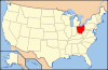
 Location of Williams County in Ohio
This is a list of the National Register of Historic Places listings in Williams County, Ohio.
It is intended to be a complete list of the properties and districts on the National Register of Historic Places in Williams County, Ohio, United States. The locations of National Register properties and districts for which the latitude and longitude coordinates are included below, may be seen in a Google map.[1]
There are 7 properties and districts listed on the National Register in the county.
-
- This National Park Service list is complete through NPS recent listings posted November 10, 2011.[2]
Current listings
[3] Landmark name [4] Image Date listed Location City or town Summary 1 Bryan Downtown Historic District 
December 29, 1983 Roughly bounded by Walnut, Beech, Maple, and Bryan Sts.
41°28′28″N 84°33′08″W / 41.474444°N 84.552222°WBryan 2 Fountain City Historic District 
October 1, 1990 Roughly bounded by Butler, Lynn, W. Wilson, Center, Portland, and Beech Sts.
41°28′16″N 84°33′12″W / 41.471111°N 84.553333°WBryan 3 James Delos Hill House 
May 30, 1997 201 E. Main St.
41°35′12″N 84°36′20″W / 41.586667°N 84.605556°WMontpelier 4 Kunkle Log House 
August 5, 1976 1 mile east of the junction of County Roads O and 17, near Kunkle
41°38′09″N 84°28′56″W / 41.635833°N 84.482222°WMadison Township 5 Nettle Lake Mound Group 
March 27, 1974 Eastern side of County Road 4-75, west of Nettle Lake
41°41′15.144″N 84°43′53.184″W / 41.68754°N 84.73144°W[5]Northwest Township 6 Stryker Depot 
August 7, 1989 N. Depot St.
41°30′10″N 84°25′01″W / 41.502778°N 84.416944°WStryker 7 Williams County Courthouse 
May 7, 1973 Main and High Sts.
41°28′26″N 84°33′45″W / 41.473889°N 84.5625°WBryan See also
References
- ^ The latitude and longitude information provided in this table was derived originally from the National Register Information System, which has been found to be fairly accurate for about 99% of listings. For about 1% of NRIS original coordinates, experience has shown that one or both coordinates are typos or otherwise extremely far off; some corrections may have been made. A more subtle problem causes many locations to be off by up to 150 yards, depending on location in the country: most NRIS coordinates were derived from tracing out latitude and longitudes off of USGS topographical quadrant maps created under North American Datum of 1927, which differs from the current, highly accurate GPS system used by Google maps. Chicago is about right, but NRIS longitudes in Washington are higher by about 4.5 seconds, and are lower by about 2.0 seconds in Maine. Latitudes differ by about 1.0 second in Florida. Some locations in this table may have been corrected to current GPS standards.
- ^ "National Register of Historic Places: Weekly List Actions". National Park Service, United States Department of the Interior. Retrieved on November 10, 2011.
- ^ Numbers represent an ordering by significant words. Various colorings, defined here, differentiate National Historic Landmark sites and National Register of Historic Places Districts from other NRHP buildings, structures, sites or objects.
- ^ "National Register Information System". National Register of Historic Places. National Park Service. . http://nrhp.focus.nps.gov/natreg/docs/All_Data.html.
- ^ Location derived from this WIlliams County Historical Society website; the NRIS lists it as "Address Restricted".
National Register of Historic Places in Ohio Lists by county Adams • Allen • Ashland • Ashtabula • Athens • Auglaize • Belmont • Brown • Butler • Carroll • Champaign • Clark • Clermont • Clinton • Columbiana • Coshocton • Crawford • Cuyahoga • Darke • Defiance • Delaware • Erie • Fairfield • Fayette • Franklin • Fulton • Gallia • Geauga • Greene • Guernsey • Hamilton • Hancock • Hardin • Harrison • Henry • Highland • Hocking • Holmes • Huron • Jackson • Jefferson • Knox • Lake • Lawrence • Licking • Logan • Lorain • Lucas • Madison • Mahoning • Marion • Medina • Meigs • Mercer • Miami • Monroe • Montgomery • Morgan • Morrow • Muskingum • Noble • Ottawa • Paulding • Perry • Pickaway • Pike • Portage • Preble • Putnam • Richland • Ross • Sandusky • Scioto • Seneca • Shelby • Stark • Summit • Trumbull • Tuscarawas • Union • Van Wert • Vinton • Warren • Washington • Wayne • Williams • Wood • Wyandot
Lists by city Other lists Municipalities and communities of Williams County, Ohio City 
Villages Blakeslee | Edgerton | Edon | Holiday City | Montpelier | Pioneer | Stryker | West Unity
Townships Brady | Bridgewater | Center | Florence | Jefferson | Madison | Mill Creek | Northwest | Pulaski | St. Joseph | Springfield | Superior
Unincorporated
communitiesAlvordton | Berlin | Kunkle | Melbern | Williams Center
Categories:- National Register of Historic Places in Ohio by county
- Williams County, Ohio
-


Wikimedia Foundation. 2010.