- National Register of Historic Places listings in Victoria County, Texas
-
List of Registered Historic Places in Victoria County, Texas
This is intended to be a complete list of properties and districts listed on the National Register of Historic Places in Victoria County, Texas. The locations of National Register properties and districts (at least for all showing latitude and longitude coordinates below) may be seen in a Google map by clicking on "Map of all coordinates".[1]
-
- This National Park Service list is complete through NPS recent listings posted November 10, 2011.[2]
[3] Landmark name [4] Image Date listed Location City or town Summary 1 C. R. Alden Building December 9, 1986 106-110 W. Juan Linn
28°47′51″N 97°00′24″W / 28.7975°N 97.006667°WVictoria 2 Frank Alonso House December 9, 1986 401 S. Cameron
28°47′37″N 97°00′01″W / 28.793611°N 97.000278°WVictoria 3 B'nai Israel December 9, 1986 604 N. Main
28°48′15″N 97°00′13″W / 28.804167°N 97.003611°WVictoria 4 Barden-O'Connor House December 9, 1986 305 N. Moody
28°47′36″N 97°00′29″W / 28.793333°N 97.008056°WVictoria 5 W. C. Barnes House December 9, 1986 106 W. Stayton
28°48′13″N 97°00′17″W / 28.803611°N 97.004722°WVictoria 6 E. H. D. Bendt House December 9, 1986 407 S. DeLeon
28°47′42″N 97°00′17″W / 28.795°N 97.004722°WVictoria 7 Max Bettin House December 9, 1986 602 E. Santa Rosa
28°47′47″N 97°00′01″W / 28.796389°N 97.000278°WVictoria 8 Braman House December 9, 1986 206 W. Stayton
28°48′14″N 97°00′20″W / 28.803889°N 97.005556°WVictoria 9 Theodore Buhler House December 9, 1986 202 W. Stayton
28°48′13″N 97°00′23″W / 28.803611°N 97.006389°WVictoria 10 Building at 205 East Constitution December 9, 1986 205 E. Constitution
28°47′53″N 97°00′16″W / 28.798056°N 97.004444°WVictoria 11 Burrough-Daniel House December 9, 1986 502 W. North
28°48′21″N 97°00′28″W / 28.805833°N 97.007778°WVictoria 12 Calhoun Bakery December 9, 1986 209 N. Wheeler
28°47′56″N 97°00′05″W / 28.798889°N 97.001389°WVictoria 13 Callender House September 26, 1979 404 W. Guadelupe St
28°48′28″N 97°00′25″W / 28.807778°N 97.006944°WVictoria 14 City of Victoria Pumping Plant-Waterworks December 9, 1986 105 W. Juan Linn
28°48′22″N 97°00′58″W / 28.806111°N 97.016111°WVictoria 15 Clark House December 9, 1986 606 S. Liberty
28°47′36″N 97°00′25″W / 28.793333°N 97.006944°WVictoria 16 Robert Clark House December 9, 1986 317 N. Main
28°48′05″N 97°00′18″W / 28.801389°N 97.005°WVictoria 17 John H. Clegg House December 9, 1986 507 N. Vine
28°48′15″N 97°00′29″W / 28.804167°N 97.008056°WVictoria 18 F. H. Crain House December 9, 1986 307 N. Vine
28°48′10″N 97°00′32″W / 28.802778°N 97.008889°WVictoria 19 DeLeon Plaza and Bandstand March 24, 1987 100 blk. W. Constitution
28°47′57″N 97°00′22″W / 28.799167°N 97.006111°WVictoria 20 Diebel-Hyak House December 12, 1986 501 S. Cameron
28°47′35″N 97°00′03″W / 28.793056°N 97.000833°WVictoria 21 Farmers and Merchants Cotton Gin Warehouse December 9, 1986 402 S. East
28°47′37″N 96°59′36″W / 28.793611°N 96.993333°WVictoria 22 Fleming-Welder House December 9, 1986 607 N. Craig
28°48′21″N 97°00′36″W / 28.805833°N 97.01°WVictoria 23 Fort St. Louis Site March 31, 1971 Address Restricted Inez 24 Fossati's 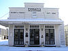
May 20, 1991 302 S. Main
28°47′50″N 97°00′24″W / 28.797222°N 97.006667°WVictoria 25 E. J. Fossati House December 9, 1986 607 S. DeLeon
28°47′34″N 97°00′19″W / 28.792778°N 97.005278°WVictoria 26 Jacob Fox House December 9, 1986 708 W. Power
28°48′17″N 97°00′39″W / 28.804722°N 97.010833°WVictoria 27 Gaylord-Levy House December 9, 1986 402 N. Bridge
28°48′06″N 97°00′20″W / 28.801667°N 97.005556°WVictoria 28 Gervais House July 5, 1990 507 W. Forrest
28°48′02″N 97°00′10″W / 28.800556°N 97.002778°WVictoria 29 Goldman's Cotton Gin Warehouse December 9, 1986 901 E. Murray
28°47′46″N 96°59′47″W / 28.796111°N 96.996389°WVictoria 30 Goldman, A., Building December 9, 1986 207 E. Constitution
28°47′53″N 97°00′16″W / 28.798056°N 97.004444°WVictoria 31 Gramann House December 9, 1986 302 E. Goodwin
28°48′00″N 97°00′10″W / 28.8°N 97.002778°WVictoria 32 George and Adele Hauschild House December 9, 1986 208 N. Liberty
28°48′03″N 97°00′40″W / 28.800833°N 97.011111°WVictoria 33 George H. Hauschild Building December 9, 1986 206 N. Liberty
28°47′59″N 97°00′15″W / 28.799722°N 97.004167°WVictoria 34 Hill-Howard House December 9, 1986 802 W. Power
28°48′18″N 97°00′42″W / 28.805°N 97.011667°WVictoria 35 Hiller House (N. Vine) December 9, 1986 3003 N. Vine
28°49′16″N 97°00′32″W / 28.821111°N 97.008889°WVictoria 36 Hiller House (E. Church) December 9, 1986 501 E. Church
28°47′45″N 97°00′10″W / 28.795833°N 97.002778°WVictoria 37 House at 1602 North Moody December 9, 1986 1602 N. Moody
28°48′32″N 97°00′23″W / 28.808889°N 97.006389°WVictoria 38 House at 1907 Southwest Ben Jordan December 9, 1986 1907 S.W. Ben Jordan
28°47′13″N 96°59′16″W / 28.786944°N 96.987778°WVictoria 39 House at 304 West Stayton December 9, 1986 304 W. Stayton
28°48′15″N 97°00′23″W / 28.804167°N 97.006389°WVictoria 40 House at 306 East Forrest December 9, 1986 306 E. Forrest
28°47′56″N 97°00′10″W / 28.798889°N 97.002778°WVictoria 41 House at 401 East Stayton December 9, 1986 401 E. Stayton
28°48′07″N 97°00′03″W / 28.801944°N 97.000833°WVictoria 42 House at 402 W. Colorado May 20, 1991 402 W. Colorado
28°48′32″N 97°00′24″W / 28.808889°N 97.006667°WVictoria 43 House at 407 East Convent December 9, 1986 407 E. Convent
28°47′38″N 97°00′14″W / 28.793889°N 97.003889°WVictoria 44 House at 4402 East Juan Linn December 9, 1986 4402 E. Juan Linn
28°47′01″N 96°57′51″W / 28.783611°N 96.964167°WVictoria 45 House at 604 East Santa Rosa December 9, 1986 604 E. Santa Rosa
28°47′47″N 97°00′02″W / 28.796389°N 97.000556°WVictoria 46 House at 702 Siegfried December 9, 1986 702 Siegfried
28°47′30″N 97°00′56″W / 28.791667°N 97.015556°WVictoria 47 House at 706 Siegfried December 9, 1986 706 Siegfried
28°47′30″N 97°00′57″W / 28.791667°N 97.015833°WVictoria 48 House at 804 Siegfried December 9, 1986 804 Siegfried
28°47′29″N 97°01′00″W / 28.791389°N 97.016667°WVictoria 49 Hull House December 9, 1986 1002 NE Water
28°47′27″N 96°59′50″W / 28.790833°N 96.997222°WVictoria 50 E. J. Jecker House December 9, 1986 201 N. Wheeler
28°47′55″N 97°00′06″W / 28.798611°N 97.001667°WVictoria 51 J. T. Jecker House March 24, 1987 104 N. Liberty
28°47′56″N 97°00′18″W / 28.798889°N 97.005°WVictoria 52 Jordan-Koch House December 9, 1986 307 N. DeLeon
28°48′01″N 97°00′08″W / 28.800278°N 97.002222°WVictoria 53 E. C. Kaufman House December 9, 1986 502 S. DeLeon
28°47′40″N 97°00′19″W / 28.794444°N 97.005278°WVictoria 54 Keef-Filley Building March 24, 1987 214 S. Main
28°47′50″N 97°00′22″W / 28.797222°N 97.006111°WVictoria 55 Lander-Hopkins House December 9, 1986 202 W. Power at N. Bridge
28°48′10″N 97°00′20″W / 28.802778°N 97.005556°WVictoria 56 Lane-Tarkington House December 9, 1986 1207 N. Bridge
28°48′21″N 97°00′17″W / 28.805833°N 97.004722°WVictoria 57 Lawrence House December 9, 1986 1203 N. Bridge
28°48′19″N 97°00′16″W / 28.805278°N 97.004444°WVictoria 58 Jules Leffland House May 20, 1991 302 E. Convent
28°47′42″N 97°00′17″W / 28.795°N 97.004722°WVictoria 59 Levi-Welder House December 9, 1986 403 N. Main
28°48′06″N 97°00′18″W / 28.801667°N 97.005°WVictoria 60 Little House December 9, 1986 502 N. Victoria
28°48′15″N 97°00′31″W / 28.804167°N 97.008611°WVictoria 61 Vera Martin-Fiek-Thumford House December 9, 1986 507 N. William
28°48′09″N 97°00′09″W / 28.8025°N 97.0025°WVictoria 62 McCabe Building December 19, 1986 508 N. Wheeler
28°48′05″N 96°59′23″W / 28.801389°N 96.989722°WVictoria 63 McCan-Nave House December 9, 1986 401 N. Glass
28°48′09″N 97°00′25″W / 28.8025°N 97.006944°WVictoria 64 McDonald House December 9, 1986 406 E. Constitution
28°47′52″N 97°00′08″W / 28.797778°N 97.002222°WVictoria 65 James McFaddin House March 24, 1987 207 W. Commercial
28°48′06″N 97°00′23″W / 28.801667°N 97.006389°WVictoria 66 McNamara-O'Conner House December 9, 1986 502 N. Liberty
28°48′07″N 97°00′11″W / 28.801944°N 97.003056°WVictoria 67 Mission Creek Dam and Acequia Site April 9, 1980 Address Restricted Victoria 68 Guy Mitchell House December 9, 1986 402 W. Goodwin
28°48′07″N 97°00′29″W / 28.801944°N 97.008056°WVictoria 69 Moeller House December 9, 1986 901 S. East
28°47′21″N 97°00′04″W / 28.789167°N 97.001111°WVictoria 70 Mohris-Abschier House December 9, 1986 101 N. DeLeon
28°47′53″N 97°00′11″W / 28.798056°N 97.003056°WVictoria 71 Mrs. J. V. Murphy House December 9, 1986 204 E. Santa Rosa
28°47′52″N 97°00′54″W / 28.797778°N 97.015°WVictoria 72 Nave, Royston, Memorial December 9, 1986 306 W. Commercial
28°48′10″N 97°00′26″W / 28.802778°N 97.007222°WVictoria 73 Thomas M. O'Connor House December 9, 1986 303 S. Bridge
28°47′50″N 97°00′29″W / 28.797222°N 97.008056°WVictoria 74 O'Connor-Proctor Building December 9, 1986 202 N. Main
28°48′32″N 97°00′18″W / 28.808889°N 97.005°WVictoria 75 Old Brownson School December 9, 1986 500 blk. of W. Power
28°48′12″N 97°00′31″W / 28.803333°N 97.008611°WVictoria 76 Old Federal Building and Post Office December 9, 1986 210 E. Constitution
28°47′55″N 97°00′15″W / 28.798611°N 97.004167°WVictoria 77 Old Municipal Assembly Hall December 9, 1986 800 E. Pine
28°48′14″N 96°59′48″W / 28.803889°N 96.996667°WVictoria 78 Old Nazareth Academy December 9, 1986 105 W. Church
28°47′46″N 97°00′28″W / 28.796111°N 97.007778°WVictoria 79 Old Victoria County Courthouse 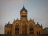
August 18, 1977 101 N. Bridge St.
28°47′59″N 97°00′26″W / 28.799722°N 97.007222°WVictoria 80 Our Lady of Lourdes Church December 9, 1986 105 N. William
28°47′57″N 97°00′18″W / 28.799167°N 97.005°WVictoria 81 Pela House December 9, 1986 309 E. Santa Rosa
28°47′49″N 97°00′13″W / 28.796944°N 97.003611°WVictoria 82 Judge Alexander H. Phillips House November 3, 1983 705 N. Craig St.
28°48′22″N 97°00′35″W / 28.806111°N 97.009722°WVictoria 83 Pickering House December 9, 1986 403 N. Glass
28°48′10″N 97°00′24″W / 28.802778°N 97.006667°WVictoria 84 Pippert House December 9, 1986 207 E. Third
28°47′28″N 97°00′26″W / 28.791111°N 97.007222°WVictoria 85 Presbyterian Iglesia Nicea October 28, 1992 401 S. DeLeon
28°47′43″N 97°00′16″W / 28.795278°N 97.004444°WVictoria 86 Proctor House December 6, 1986 507 N. Glass
28°48′09″N 97°00′25″W / 28.8025°N 97.006944°WVictoria 87 Proctor-Vandenberge House December 9, 1986 604 N. Craig
28°48′19″N 97°00′32″W / 28.805278°N 97.008889°WVictoria 88 Randall Building December 9, 1986 103-105 W. Santa Rosa
28°47′53″N 97°00′24″W / 28.798056°N 97.006667°WVictoria 89 D. H. Regan House December 9, 1986 507 S. DeLeon
28°47′38″N 97°00′21″W / 28.793889°N 97.005833°WVictoria 90 Roselle-Smith House July 5, 1990 301 E. Commercial
28°48′03″N 97°00′36″W / 28.800833°N 97.01°WVictoria 91 Saint Mary's Catholic Church December 9, 1986 101 W. Church
28°47′46″N 97°00′26″W / 28.796111°N 97.007222°WVictoria 92 Schroeder House December 9, 1986 1507 N. Vine
28°48′30″N 97°00′29″W / 28.808333°N 97.008056°WVictoria 93 Schummacker Company Building December 9, 1986 402 E. Power
28°48′05″N 97°00′04″W / 28.801389°N 97.001111°WVictoria 94 Alphonse T. Sengele House October 28, 1992 502 E. Juan Linn
28°47′45″N 97°00′08″W / 28.795833°N 97.002222°WVictoria 95 Henry Shrader House December 9, 1986 607 S. Cameron
28°47′31″N 97°00′41″W / 28.791944°N 97.011389°WVictoria 96 Sigmund House December 9, 1986 508 E. Santa Rosa
28°47′48″N 97°00′05″W / 28.796667°N 97.001389°WVictoria 97 South Bridge Street Historic District September 24, 1986 W side 700 blk. of S. Bridge and N side 700 blk. of W. Water Sts.
28°47′37″N 97°00′35″W / 28.793611°N 97.009722°WVictoria 98 Stuart House December 9, 1986 506 S. Bridge
28°47′43″N 97°00′29″W / 28.795278°N 97.008056°WVictoria 99 Tasin House December 9, 1986 202 N. Wheeler
28°47′55″N 97°00′04″W / 28.798611°N 97.001111°WVictoria 100 Texas Company Filling Station December 9, 1986 102 S. Williams St.
28°47′53″N 97°00′13″W / 28.798056°N 97.003611°WVictoria 101 Tonkawa Bank Site February 13, 1981 Address Restricted Victoria 102 Townsend-Wilkins House December 9, 1986 106 N. Navarro
28°47′52″N 97°00′02″W / 28.797778°N 97.000556°WVictoria 103 Trinity Lutheran Church December 9, 1986 402 E. Constitution
28°47′53″N 97°00′10″W / 28.798056°N 97.002778°WVictoria 104 Fred Urban House October 28, 1992 501 E. River
28°47′31″N 97°00′15″W / 28.791944°N 97.004167°WVictoria 105 J. V. Vandenberge House December 9, 1986 301 N. Vine
28°48′07″N 97°00′33″W / 28.801944°N 97.009167°WVictoria 106 Victoria Colored School December 9, 1986 702 E. Convent
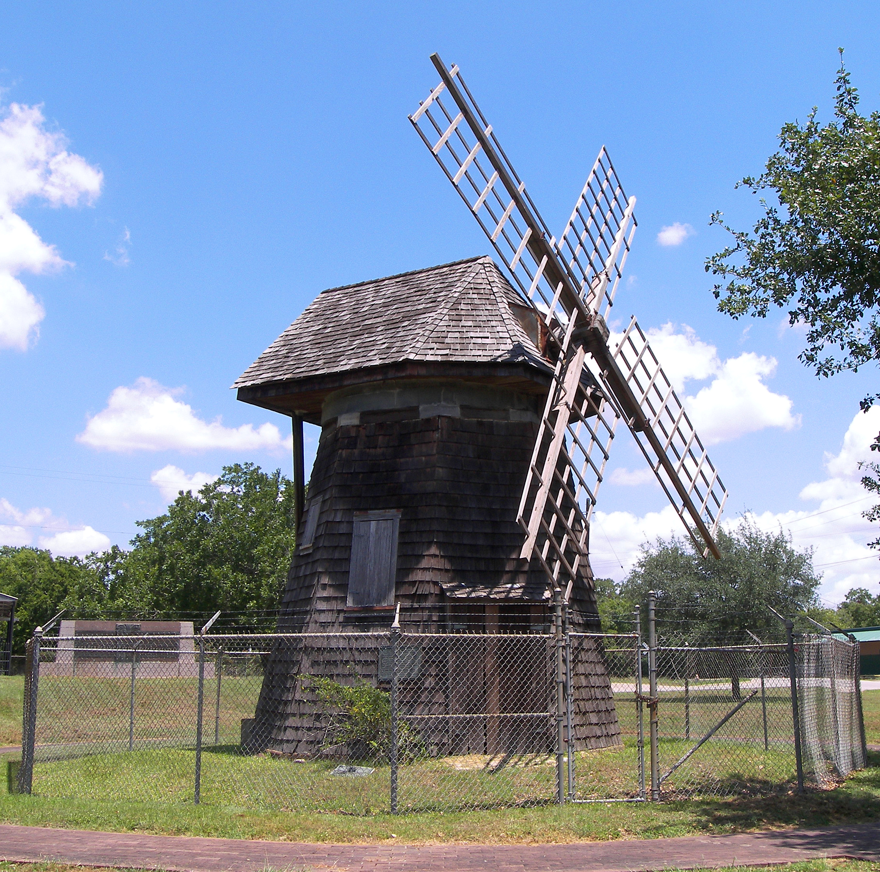
28°47′37″N 97°00′03″W / 28.793611°N 97.000833°WVictoria 107 Victoria Grist Windmill 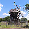
April 30, 1976 Memorial Park in Victoria
28°48′03″N 97°00′05″W / 28.800972°N 97.001389°WVictoria 108 Weber-Schuchert House December 9, 1986 302 E. Constitution
28°47′54″N 97°00′13″W / 28.798333°N 97.003611°WVictoria 109 Webster Chapel United Methodist Church December 9, 1986 405 S. Wheeler
28°47′40″N 97°00′13″W / 28.794444°N 97.003611°WVictoria 110 Robert H. Welder House March 12, 1999 210 E. Juan Linn
28°47′49″N 97°00′17″W / 28.796944°N 97.004722°WVictoria 111 William Wheeler House December 9, 1986 303 N. William St.
28°48′02″N 97°00′12″W / 28.800556°N 97.003333°WVictoria 112 Willeke Site November 20, 1978 Address Restricted Victoria 113 B. F. Williams House December 9, 1986 401 E. Murray
28°47′38″N 97°00′18″W / 28.793889°N 97.005°WVictoria 114 Woodhouse House December 9, 1986 609 N. Wheeler
28°48′09″N 96°59′23″W / 28.8025°N 96.989722°WVictoria 115 Herman and Alvina Zahn House December 9, 1986 107 S. DeLeon
28°47′49″N 97°00′13″W / 28.796944°N 97.003611°WVictoria Former listings
[3] Landmark name Image Date listed Location City or town Summary 1 Krenek House July 19, 2010 607 N. Main
28°48′15″N 97°0′14″W / 28.80417°N 97.00389°WVictoria Listed 12/9/1986. Demolished April 9–10, 2010[5]. See also
- Registered Historic Places in Texas, Counties T-Z
References
- ^ The latitude and longitude information provided in this table was derived originally from the National Register Information System, which has been found to be fairly accurate for about 99% of listings. For about 1% of NRIS original coordinates, experience has shown that one or both coordinates are typos or otherwise extremely far off; some corrections may have been made. A more subtle problem causes many locations to be off by up to 150 yards, depending on location in the country: most NRIS coordinates were derived from tracing out latitude and longitudes off of USGS topographical quadrant maps created under North American Datum of 1927, which differs from the current, highly accurate GPS system used by Google maps. Chicago is about right, but NRIS longitudes in Washington are higher by about 4.5 seconds, and are lower by about 2.0 seconds in Maine. Latitudes differ by about 1.0 second in Florida. Some locations in this table may have been corrected to current GPS standards.
- ^ "National Register of Historic Places: Weekly List Actions". National Park Service, United States Department of the Interior. Retrieved on November 10, 2011.
- ^ a b Numbers represent an ordering by significant words. Various colorings, defined here, differentiate National Historic Landmark sites and National Register of Historic Places Districts from other NRHP buildings, structures, sites or objects.
- ^ "National Register Information System". National Register of Historic Places. National Park Service. . http://nrhp.focus.nps.gov/natreg/docs/All_Data.html.
- ^ Vanished from Victoria: Dr. J. F. Krenek house , 607 N. Main St.
U.S. National Register of Historic Places Topics Lists by states Alabama • Alaska • Arizona • Arkansas • California • Colorado • Connecticut • Delaware • Florida • Georgia • Hawaii • Idaho • Illinois • Indiana • Iowa • Kansas • Kentucky • Louisiana • Maine • Maryland • Massachusetts • Michigan • Minnesota • Mississippi • Missouri • Montana • Nebraska • Nevada • New Hampshire • New Jersey • New Mexico • New York • North Carolina • North Dakota • Ohio • Oklahoma • Oregon • Pennsylvania • Rhode Island • South Carolina • South Dakota • Tennessee • Texas • Utah • Vermont • Virginia • Washington • West Virginia • Wisconsin • WyomingLists by territories Lists by associated states Other  Category:National Register of Historic Places •
  Portal:National Register of Historic PlacesCategories:
- Victoria County, Texas
- National Register of Historic Places in Texas
- Buildings and structures in Victoria County, Texas
-


Wikimedia Foundation. 2010.