- National Register of Historic Places listings in Tooele County, Utah
-
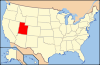
 Location of Tooele County in Utah
This is a list of the National Register of Historic Places listings in Tooele County, Utah.
This is intended to be a complete list of the properties and districts on the National Register of Historic Places in Tooele County, Utah, United States. Latitude and longitude coordinates are provided for many National Register properties and districts; these locations may be seen together in a Google map.[1]
There are 23 properties listed on the National Register in the county, including 1 National Historic Landmark.
-
- This National Park Service list is complete through NPS recent listings posted November 10, 2011.[2]
Contents
Current listings
[3] Landmark name [4] Image Date listed Location City or town Summary 1 Anderson-Clark Farmstead 
February 3, 2006 378 W. Clark St.
40°36′10″N 112°28′37″W / 40.602778°N 112.476944°WGrantsville 2 Benson Mill 
April 14, 1972 325 S. State Route 138
40°39′03″N 112°17′47″W / 40.650833°N 112.296389°WStansbury Park 3 Bonneville Salt Flats Race Track 
December 18, 1975 3 miles east of Wendover off U.S. Route 40
40°47′41″N 113°47′37″W / 40.794722°N 113.793611°WWendover 4 Danger Cave 
October 15, 1966 1 mile east of Wendover on U.S. Route 40
40°44′58″N 114°00′51″W / 40.749444°N 114.014167°WWendover 5 David E. Davis House November 8, 2007 400 E. State Route 199 Rush Valley 6 Hilda Erickson House 
July 11, 2006 247 W. Main St.
40°35′59″N 112°28′15″W / 40.599722°N 112.470833°WGrantsville 7 GAPA Launch Site and Blockhouse August 26, 1980 Northeast of Knolls
40°49′40″N 113°12′04″W / 40.827778°N 113.201111°WKnolls 8 Grantsville First Ward Meetinghouse 
February 11, 1982 297 W. Clark St.
40°36′07″N 112°28′21″W / 40.601944°N 112.4725°WGrantsville 9 Grantsville School and Meetinghouse 
December 13, 1995 90 N. Cooley St..
40°36′08″N 112°28′22″W / 40.602222°N 112.472778°WGrantsville 10 Iosepa Settlement Cemetery 
August 12, 1971 Skull Valley
40°32′25″N 112°43′57″W / 40.540278°N 112.7325°WIosepa 11 Johnson Hall-Deseret Mercantile Building 
February 3, 2006 4 W. Main St.
40°36′00″N 112°27′49″W / 40.6°N 112.463611°WGrantsville 12 Alex and Mary Alice Johnson House 
December 13, 1995 5 W. Main St.
40°35′59″N 112°27′47″W / 40.599722°N 112.463056°WGrantsville 13 Lincoln Highway Bridge May 21, 1975 In Ditto Area on 2nd St. over Government Creek, just south of Tucker St.
40°10′58″N 112°55′23″W / 40.182778°N 112.923056°WDugway Proving Ground 14 Ophir Town Hall 
June 9, 1983 43 S. Main St.
40°22′12″N 112°15′10″W / 40.37°N 112.252778°WOphir 15 John T. Rich House 
May 2, 1984 275 W. Clark St.
40°36′07″N 112°28′18″W / 40.601944°N 112.471667°WGrantsville 16 John C. Sharp House July 13, 1984 Off State Route 36
40°05′16″N 112°26′03″W / 40.087778°N 112.434167°WVernon 17 Soldier Creek Kilns 
August 19, 1980 Address Restricted[5] Stockton 18 Stockton Jail 
May 9, 1985 38 W. Clark St.
40°27′14″N 112°21′47″W / 40.453889°N 112.363056°WStockton 19 Tooele Carnegie Library 
October 29, 1984 47 E. Vine St.
40°31′52″N 112°17′48″W / 40.531111°N 112.296667°WTooele 20 Tooele County Courthouse and City Hall 
July 21, 1983 41 E. Vine St.
40°31′52″N 112°17′49″W / 40.531111°N 112.296944°WTooele 21 Tooele Valley Railroad Complex 
May 17, 1984 35 N. Broadway
40°31′52″N 112°17′17″W / 40.531111°N 112.288056°WTooele 22 Wendover Air Force Base 
July 1, 1975 South of Wendover off U.S. Route 40
40°43′14″N 114°01′29″W / 40.720556°N 114.024722°WWendover 23 James and Penninah Wrathall House 
February 3, 2006 5 N. Center St.
40°36′01″N 112°28′10″W / 40.600278°N 112.469444°WGrantsville See also
References
- ^ The latitude and longitude information provided in this table was derived originally from the National Register Information System, which has been found to be fairly accurate for about 99% of listings. For about 1% of NRIS original coordinates, experience has shown that one or both coordinates are typos or otherwise extremely far off; some corrections may have been made. A more subtle problem causes many locations to be off by up to 150 yards, depending on location in the country: most NRIS coordinates were derived from tracing out latitude and longitudes off of USGS topographical quadrant maps created under North American Datum of 1927, which differs from the current, highly accurate GPS system used by Google maps. Chicago is about right, but NRIS longitudes in Washington are higher by about 4.5 seconds, and are lower by about 2.0 seconds in Maine. Latitudes differ by about 1.0 second in Florida. Some locations in this table may have been corrected to current GPS standards.
- ^ "National Register of Historic Places: Weekly List Actions". National Park Service, United States Department of the Interior. Retrieved on November 10, 2011.
- ^ Numbers represent an ordering by significant words. Various colorings, defined here, differentiate National Historic Landmark sites and National Register of Historic Places Districts from other NRHP buildings, structures, sites or objects.
- ^ "National Register Information System". National Register of Historic Places. National Park Service. . http://nrhp.focus.nps.gov/natreg/docs/All_Data.html.
- ^ Some listings on the NRHP are highly sensitive sites and may be subject to looting or vandalism. The NRHP lists this site as "Address Restricted."
External links
 Media related to National Register of Historic Places in Tooele County, Utah at Wikimedia Commons
Properties on the National Register of Historic Places in Utah 
U.S. National Register of Historic Places Topics Lists by states Alabama • Alaska • Arizona • Arkansas • California • Colorado • Connecticut • Delaware • Florida • Georgia • Hawaii • Idaho • Illinois • Indiana • Iowa • Kansas • Kentucky • Louisiana • Maine • Maryland • Massachusetts • Michigan • Minnesota • Mississippi • Missouri • Montana • Nebraska • Nevada • New Hampshire • New Jersey • New Mexico • New York • North Carolina • North Dakota • Ohio • Oklahoma • Oregon • Pennsylvania • Rhode Island • South Carolina • South Dakota • Tennessee • Texas • Utah • Vermont • Virginia • Washington • West Virginia • Wisconsin • WyomingLists by territories Lists by associated states Other  Category:National Register of Historic Places •
  Portal:National Register of Historic Places
Municipalities and communities of Tooele County, Utah County seat: Tooele Cities 
Towns Ophir | Rush Valley | Stockton | Vernon
CDPs Dugway | Erda | Stansbury Park
Unincorporated
communitiesBurmester | Ibapah | Lake Point
Ghost towns Categories:- National Register of Historic Places in Utah by county
- Tooele County, Utah
-


Wikimedia Foundation. 2010.