- National Register of Historic Places listings in Tippecanoe County, Indiana
-
 Location of Tippecanoe County in Indiana
This is a list of the National Register of Historic Places listings in Tippecanoe County, Indiana.
This is intended to be a complete list of the properties and districts on the National Register of Historic Places in Tippecanoe County, Indiana, United States. Latitude and longitude coordinates are provided for many National Register properties and districts; these locations may be seen together in a Google map.[1]
There are 42 properties and districts listed on the National Register in the county, including 1 National Historic Landmark.
-
- This National Park Service list is complete through NPS recent listings posted November 10, 2011.[2]
Current listings
[3] Landmark name [4] Image Date listed Location City or town Summary 1 Alpha Tau Omega Fraternity House 
March 20, 2002 314 Russell St.
40°25′39″N 86°55′07″W / 40.4275°N 86.918611°WWest Lafayette 2 Jesse Andrew House 
August 11, 1983 123 Andrew Pl.
40°25′28″N 86°54′34″W / 40.424444°N 86.909444°WWest Lafayette 3 Judge Cyrus Ball House 
May 3, 1984 402 S. 9th St.
40°24′49″N 86°53′12″W / 40.413611°N 86.886667°WLafayette 4 Battle Ground Historic District 
July 23, 1985 Roughly bounded by Burnett Creek, Sherman Dr., and an open ridge on the southeast
40°30′35″N 86°50′21″W / 40.509722°N 86.839167°WBattle Ground 5 Big Four Depot 
June 22, 2003 200 N. 2nd St.
40°25′07″N 86°53′44″W / 40.418611°N 86.895556°WLafayette 6 Cairo Skywatch Tower 
March 21, 2002 County Road 850N at County Road 100W
40°32′26″N 86°55′30″W / 40.540694°N 86.925°WCairo 7 Centennial Neighborhood District 
June 16, 1983 Roughly bounded by Union, 3rd, 4th, Ferry, and 9th Sts.
40°25′21″N 86°53′25″W / 40.4225°N 86.890278°WLafayette 8 Chauncey-Stadium Avenues Historic District 
December 20, 2002 Roughly bounded by Meridian, Lincoln, River Rd., Fowler, Quincy, Northwestern, and Allen Sts.
40°25′52″N 86°54′22″W / 40.431111°N 86.906111°WWest Lafayette 9 John E. and Catherine E. Christian House 
June 16, 1992 1301 Woodland Ave.
40°26′18″N 86°54′59″W / 40.438333°N 86.916389°WWest Lafayette 10 Dayton Historic District 
March 26, 2003 Roughly bounded by Walnut, Harrison, and Pennsylvania Sts.
40°22′35″N 86°46′03″W / 40.376389°N 86.7675°WDayton 11 Downtown Lafayette Historic District 
November 28, 1980 Roughly bounded by 2nd, Ferry, 6th, and South Sts.
40°25′08″N 86°53′33″W / 40.418889°N 86.8925°WLafayette 12 Ellsworth Historic District 
December 30, 1986 Roughly bounded by Columbia, the Norfolk Southern railroad tracks, Alabama, 7th, South, and 6th Sts.
40°24′55″N 86°53′20″W / 40.415278°N 86.888889°WLafayette 13 Ely Homestead 
October 8, 1976 4106 E. 200N, northeast of Lafayette
40°26′53″N 86°49′37″W / 40.448056°N 86.826944°WLafayette 14 Enterprise Hotel 
June 21, 1984 1015 Main St.
40°25′08″N 86°53′06″W / 40.418889°N 86.885°WLafayette 15 Falley Home 
July 15, 1982 601 New York St.
40°24′52″N 86°53′24″W / 40.414444°N 86.89°WLafayette 16 Farmers Institute 
March 27, 1986 4626 W. County Road 660S
40°19′18″N 86°59′29″W / 40.321667°N 86.991389°WShadeland 17 Fort Ouiatenon 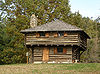
February 16, 1970 Along River Rd. and the Wabash River, west of the Purdue University Airport
40°24′23″N 86°57′50″W / 40.40639°N 86.96389°W[5]Lafayette 18 Moses Fowler House 
August 5, 1971 Corner of 10th and South Sts.
40°25′00″N 86°53′10″W / 40.416667°N 86.886111°WLafayette 19 Hershey House 
November 28, 1978 East of Lafayette on East Rd.
40°26′42″N 86°45′59″W / 40.445°N 86.766389°WLafayette 20 Highland Park Neighborhood Historic District 
March 14, 1996 Roughly bounded by Kossuth St., S. 9th St., Cherokee Ave., and 4th St.
40°24′22″N 86°53′21″W / 40.406111°N 86.889167°WLafayette 21 Hills and Dales Historic District 
June 27, 2002 Roughly bounded by Northwestern Ave., Meridian St., Hillcrest Rd., and Grant St.
40°26′07″N 86°54′49″W / 40.435278°N 86.913611°WWest Lafayette 22 Indiana State Soldiers Home Historic District 
January 2, 1974 North of Lafayette off State Road 43
40°28′08″N 86°53′15″W / 40.468889°N 86.8875°WLafayette 23 Jefferson Historic District 
September 16, 2001 Roughly bounded by 9th, Erie, Elizabeth, and Ferry Sts.
40°25′19″N 86°53′04″W / 40.421944°N 86.884444°WLafayette 24 Marian Apartments 
June 30, 1983 615 North St.
40°25′15″N 86°53′23″W / 40.420833°N 86.889722°WLafayette 25 Mars Theatre 
January 26, 1981 11 N. 6th St.
40°25′06″N 86°53′25″W / 40.418333°N 86.890278°WLafayette 26 Morton School 
September 9, 1999 222 N. Chauncey Ave.
40°25′31″N 86°54′23″W / 40.425278°N 86.906389°WWest Lafayette 27 Ninth Street Hill Neighborhood Historic District 
April 14, 1997 Roughly 9th St. from South to Kossuth Sts. and State St. from 9th to Kossuth Sts.
40°24′48″N 86°53′09″W / 40.413333°N 86.885833°WLafayette 28 Park Mary Historic District 
June 15, 2001 Roughly bounded by Union, Hartford, N. 6th, and N. 14th Sts.
40°25′33″N 86°53′01″W / 40.425833°N 86.883611°WLafayette 29 Perrin Historic District 
September 10, 1979 Roughly bounded by Murdock Park, Sheridan Rd., Columbia, Main, and Union Sts.
40°25′14″N 86°52′47″W / 40.420556°N 86.879722°WLafayette 30 James Pierce Jr. House 
June 17, 1982 4624 N. 140W
40°29′06″N 86°55′56″W / 40.485°N 86.932222°WWest Lafayette 31 William Potter House 
January 6, 1983 915 Columbia St.
40°25′05″N 86°53′08″W / 40.418056°N 86.885556°WLafayette 32 St. John's Episcopal Church 
September 20, 1978 315 N. 6th St.
40°25′13″N 86°53′25″W / 40.420278°N 86.890278°WLafayette 33 St. Mary Historic District 
June 14, 2001 Roughly bounded by Main, South, 10th, and 14th Sts.
40°25′01″N 86°52′51″W / 40.416944°N 86.880833°WLafayette 34 Scott Street Pavilion 
September 27, 1984 Columbian Park
40°24′54″N 86°52′18″W / 40.415°N 86.871667°WLafayette 35 Stidham United Methodist Church 
November 27, 1992 5300 S. 175W
40°20′30″N 86°56′17″W / 40.341667°N 86.938056°WShadeland 36 Temple Israel 
February 19, 1982 17 S. 7th St.
40°25′00″N 86°53′16″W / 40.416667°N 86.887778°WLafayette 37 Tippecanoe Battlefield 
October 15, 1966 7 miles northeast of Lafayette on State Road 25
40°28′08″N 86°50′43″W / 40.468889°N 86.845278°WLafayette 38 Tippecanoe County Courthouse 
October 31, 1972 Public Square
40°25′05″N 86°53′20″W / 40.418056°N 86.888889°WLafayette 39 Upper Main Street Historic District 
May 24, 1990 Roughly bounded by Ferry St., 6th St., Columbia St., and the Norfolk Southern railroad tracks
40°25′09″N 86°53′14″W / 40.419167°N 86.887222°WLafayette 40 The Varsity 
December 7, 2001 101 Andrew Place
40°25′27″N 86°54′33″W / 40.424167°N 86.909167°WWest Lafayette 41 Waldron-Beck House and Carriage House 
February 9, 1984 829 N. 21st St.
40°25′33″N 86°52′21″W / 40.425833°N 86.8725°WLafayette 42 James H. Ward House 
April 7, 1988 1116 Columbia St.
40°25′06″N 86°53′02″W / 40.418333°N 86.883889°WLafayette See also
- List of National Historic Landmarks in Indiana
- National Register of Historic Places listings in Indiana
References
- ^ The latitude and longitude information provided in this table was derived originally from the National Register Information System, which has been found to be fairly accurate for about 99% of listings. For about 1% of NRIS original coordinates, experience has shown that one or both coordinates are typos or otherwise extremely far off; some corrections may have been made. A more subtle problem causes many locations to be off by up to 150 yards, depending on location in the country: most NRIS coordinates were derived from tracing out latitude and longitudes off of USGS topographical quadrant maps created under the North American Datum of 1927, which differs from the current, highly accurate WGS84 GPS system used by Google maps. Chicago is about right, but NRIS longitudes in Washington are higher by about 4.5 seconds, and are lower by about 2.0 seconds in Maine. Latitudes differ by about 1.0 second in Florida. Some locations in this table may have been corrected to current GPS standards.
- ^ "National Register of Historic Places: Weekly List Actions". National Park Service, United States Department of the Interior. Retrieved on November 10, 2011.
- ^ Numbers represent an ordering by significant words. Various colorings, defined here, differentiate National Historic Landmark sites and National Register of Historic Places Districts from other NRHP buildings, structures, sites or objects.
- ^ "National Register Information System". National Register of Historic Places. National Park Service. . http://nrhp.focus.nps.gov/natreg/docs/All_Data.html.
- ^ Location derived from its GNIS feature record; the NRIS lists the site as "Address Restricted"
U.S. National Register of Historic Places Topics Lists by states Alabama • Alaska • Arizona • Arkansas • California • Colorado • Connecticut • Delaware • Florida • Georgia • Hawaii • Idaho • Illinois • Indiana • Iowa • Kansas • Kentucky • Louisiana • Maine • Maryland • Massachusetts • Michigan • Minnesota • Mississippi • Missouri • Montana • Nebraska • Nevada • New Hampshire • New Jersey • New Mexico • New York • North Carolina • North Dakota • Ohio • Oklahoma • Oregon • Pennsylvania • Rhode Island • South Carolina • South Dakota • Tennessee • Texas • Utah • Vermont • Virginia • Washington • West Virginia • Wisconsin • WyomingLists by territories Lists by associated states Other Municipalities and communities of Tippecanoe County, Indiana Cities 
Towns Battle Ground | Clarks Hill | Dayton | Otterbein‡ | Shadeland
Townships Unincorporated
communitiesAmericus | Ash Grove | Buck Creek | Cairo | Colburn | Concord | Monitor | Monroe | Montmorenci | North Crane | Odell | Pettit | Romney | South Raub | Stockwell | Westpoint
Ghost towns Footnotes ‡This populated place also has portions in an adjacent county or counties
Categories:- National Register of Historic Places in Tippecanoe County, Indiana
- National Register of Historic Places in Indiana by county
-


Wikimedia Foundation. 2010.