There are 118 properties and districts listed on the National Register in the county, including 5 National Historic Landmarks.
| [3] |
Landmark name[4] |
Image |
Date listed |
Location |
City or Town |
Summary |
| 1 |
Frederic C. Adams Public Library |
 |
02001-06-06 June 6, 2001 |
33 Summer St.
41°59′45″N 70°43′48″W / 41.99583°N 70.73°W / 41.99583; -70.73 (Adams, Frederic C., Public Library) |
Kingston |
|
| 2 |
John and Priscilla Alden Family Sites |
 |
01978-12-14 December 14, 1978 |
105 Alden St.
42°2′42″N 70°41′9″W / 42.045°N 70.68583°W / 42.045; -70.68583 (Alden, John and Priscilla, Family Sites) |
Duxbury |
|
| 3 |
Bartlett-Russell-Hedge House |
 |
01976-04-30 April 30, 1976 |
32 Court St.
41°57′27″N 70°40′2″W / 41.9575°N 70.66722°W / 41.9575; -70.66722 (Bartlett-Russell-Hedge House) |
Plymouth |
|
| 4 |
Bethel African Methodist Episcopal Church and Parsonage |
|
02007-03-19 March 19, 2007 |
6 Sever St.
41°57′25″N 70°40′8″W / 41.95694°N 70.66889°W / 41.95694; -70.66889 (Bethel African Methodist Episcopal Church and Parsonage) |
Plymouth |
|
| 5 |
Bird Island Light |
 |
01987-09-28 September 28, 1987 |
Sippican Harbor
41°40′7″N 70°43′4″W / 41.66861°N 70.71778°W / 41.66861; -70.71778 (Bird Island Light) |
Marion |
|
| 6 |
Boston Harbor Islands Archeological District |
|
01985-12-21 December 21, 1985 |
Address restricted |
Hingham |
Extends into Quincy in Norfolk County and Boston in Suffolk County |
| 7 |
Bradford House |
 |
02006-03-15 March 15, 2006 |
50 Landing Rd.
41°59′17″N 70°43′27″W / 41.98806°N 70.72417°W / 41.98806; -70.72417 (Bradford House) |
Kingston |
|
| 8 |
Captain Daniel Bradford House |
|
01986-02-20 February 20, 1986 |
251 Harrison St.
42°2′21″N 70°41′8″W / 42.03917°N 70.68556°W / 42.03917; -70.68556 (Bradford, Captain Daniel, House) |
Duxbury |
|
| 9 |
Capt. Gamaliel Bradford House |
|
01978-02-17 February 17, 1978 |
West of Duxbury at 942 Tremont St.
42°2′18″N 70°41′22″W / 42.03833°N 70.68944°W / 42.03833; -70.68944 (Bradford, Capt. Gamaliel, House) |
Duxbury |
|
| 10 |
Capt. Gershom Bradford House |
 |
01978-02-08 February 8, 1978 |
West of Duxbury at 931 Tremont St.
42°2′16″N 70°41′21″W / 42.03778°N 70.68917°W / 42.03778; -70.68917 (Bradford, Capt. Gershom, House) |
Duxbury |
|
| 11 |
Bradford-Union Street Historic District |
|
01983-11-10 November 10, 1983 |
Bradford, Union, Emerald, Water Cure, and Freedom Sts.
41°57′19″N 70°39′38″W / 41.95528°N 70.66056°W / 41.95528; -70.66056 (Bradford-Union Street Historic District) |
Plymouth |
|
| 12 |
Bridgewater Iron Works |
 |
02002-02-28 February 28, 2002 |
High Street |
Bridgewater |
|
| 13 |
Brockton City Hall |
 |
01976-03-26 March 26, 1976 |
45 School St.
42°4′56″N 71°1′7″W / 42.08222°N 71.01861°W / 42.08222; -71.01861 (Brockton City Hall) |
Brockton |
|
| 14 |
Brockton Edison Electric Illuminating Company Power Station |
 |
01987-09-17 September 17, 1987 |
70 School St.
42°5′0″N 70°59′46″W / 42.083333°N 70.99611°W / 42.083333; -70.99611 (Brockton Edison Electric Illuminating Company Power Station) |
Brockton |
|
| 15 |
Bryant-Cushing House |
 |
01976-03-26 March 26, 1976 |
768 Main St.
42°9′35″N 70°47′14″W / 42.15972°N 70.78722°W / 42.15972; -70.78722 (Bryant-Cushing House) |
Norwell |
|
| 16 |
Camp Kiwanee Historic District |
|
02005-02-24 February 24, 2005 |
1 Camp Kiwanee Rd.
42°3′34″N 70°50′50″W / 42.05944°N 70.84722°W / 42.05944; -70.84722 (Camp Kiwanee Historic District) |
Hanson |
|
| 17 |
Central Fire Station |
 |
01977-07-25 July 25, 1977 |
40 Pleasant St.
42°5′6″N 71°1′17″W / 42.085°N 71.02139°W / 42.085; -71.02139 (Central Fire Station) |
Brockton |
|
| 18 |
Thomas Chubbuck, Jr. House |
|
01992-08-07 August 7, 1992 |
1191 Main St.
42°10′37″N 70°53′9″W / 42.17694°N 70.88583°W / 42.17694; -70.88583 (Chubbuck, Thomas, Jr., House) |
Hingham |
|
| 19 |
Clifford-Warren House |
|
01980-04-08 April 8, 1980 |
East of Plymouth at 3 Clifford Rd.
41°56′20″N 70°37′4″W / 41.93889°N 70.61778°W / 41.93889; -70.61778 (Clifford-Warren House) |
Plymouth |
|
| 20 |
Cole's Hill |
 |
01966-10-15 October 15, 1966 |
Carver St.
41°57′27″N 70°39′46″W / 41.9575°N 70.66278°W / 41.9575; -70.66278 (Cole's Hill) |
Plymouth |
|
| 21 |
Conant's Hill Site |
|
01983-11-25 November 25, 1983 |
Address restricted |
Wareham |
|
| 22 |
Curtis Building |
|
01982-04-15 April 15, 1982 |
105-109 Main St.
42°4′59″N 71°1′15″W / 42.08306°N 71.02083°W / 42.08306; -71.02083 (Curtis Building) |
Brockton |
|
| 23 |
Cushing Homestead |
|
01973-06-04 June 4, 1973 |
West of Cohasset on MA 128
42°14′25″N 70°51′45″W / 42.24028°N 70.8625°W / 42.24028; -70.8625 (Cushing Homestead) |
Hingham |
|
| 24 |
Dr. Edgar Everett Dean House |
 |
01978-05-05 May 5, 1978 |
81 Green St.
42°5′5″N 71°1′22″W / 42.08472°N 71.02278°W / 42.08472; -71.02278 (Dean, Dr. Edgar Everett, House) |
Brockton |
|
| 25 |
District 7 School House |
|
02005-08-11 August 11, 2005 |
565 Main St.
42°2′25″N 70°51′46″W / 42.04028°N 70.86278°W / 42.04028; -70.86278 (District 7 School House) |
Hanson |
|
| 26 |
East Bridgewater Common Historic District |
 |
01999-05-12 May 12, 1999 |
Central and Plymouth Sts, and Morse Ave.
42°1′47″N 70°57′9″W / 42.02972°N 70.9525°W / 42.02972; -70.9525 (East Bridgewater Common Historic District) |
East Bridgewater |
|
| 27 |
East Rochester Church and Cemetery Historic District |
|
02008-01-09 January 9, 2008 |
355 County Rd.
41°47′5″N 70°46′39″W / 41.78472°N 70.7775°W / 41.78472; -70.7775 (East Rochester Church and Cemetery Historic District) |
Rochester |
|
| 28 |
D.W. Field Park |
 |
02000-11-24 November 24, 2000 |
Between Pond St., Avon St., and Pleasant St.
42°6′17″N 71°2′47″W / 42.10472°N 71.04639°W / 42.10472; -71.04639 (Field, D.W., Park) |
Brockton |
|
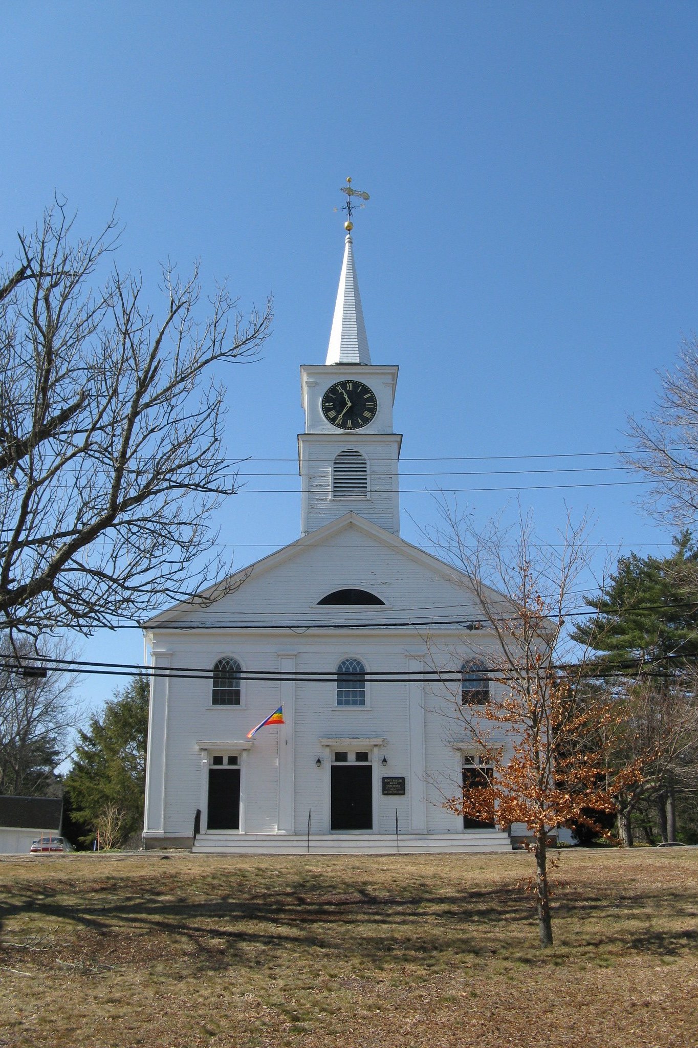
| 29 |
First Parish Church |
 |
01978-07-21 July 21, 1978 |
Southwest of Duxbury at Tremont and Depot Sts.
42°2′6″N 70°41′33″W / 42.035°N 70.6925°W / 42.035; -70.6925 (First Parish Church) |
Duxbury |
|
| 30 |
First Trinitarian Congregational Church |
|
02002-09-12 September 12, 2002 |
381 Country Way
42°12′0″N 70°45′37″W / 42.2°N 70.76028°W / 42.2; -70.76028 (First Trinitarian Congregational Church) |
Scituate |
|
| 31 |
Forest Avenue School |
|
01982-07-15 July 15, 1982 |
Concord Ave.
42°4′11″N 71°2′27″W / 42.06972°N 71.04083°W / 42.06972; -71.04083 (Forest Avenue School) |
Brockton |
|
| 32 |
Franklin Block |
 |
01989-02-21 February 21, 1989 |
1102-1110 Main St.
42°3′49″N 71°0′57″W / 42.06361°N 71.01583°W / 42.06361; -71.01583 (Franklin Block) |
Brockton |
|
| 33 |
Goldthwaite Block |
|
01982-04-15 April 15, 1982 |
99-103 Main St.
42°5′0″N 71°1′15″W / 42.083333°N 71.02083°W / 42.083333; -71.02083 (Goldthwaite Block) |
Brockton |
|
| 34 |
Grand Army of the Republic Hall |
 |
01997-05-16 May 16, 1997 |
34 School St.
42°7′36″N 70°54′52″W / 42.12667°N 70.91444°W / 42.12667; -70.91444 (Grand Army of the Republic Hall) |
Rockland |
|
| 35 |
Hanover Center Historic District |
 |
01996-05-09 May 9, 1996 |
Roughly Silver St. from Lantern Ln. to Hanover St.
42°7′6″N 70°50′40″W / 42.11833°N 70.84444°W / 42.11833; -70.84444 (Hanover Center Historic District) |
Hanover |
|
| 36 |
Harlow Old Fort House |
 |
01974-12-27 December 27, 1974 |
119 Sandwich St.
41°57′7″N 70°39′26″W / 41.95194°N 70.65722°W / 41.95194; -70.65722 (Harlow Old Fort House) |
Plymouth |
|
| 37 |
Sgt. William Harlow Family Homestead |
 |
01982-04-15 April 15, 1982 |
8 Winter St.
41°57′6″N 70°39′15″W / 41.95167°N 70.65417°W / 41.95167; -70.65417 (Harlow, Sgt. William, Family Homestead) |
Plymouth |
|
| 38 |
Hatch Homestead and Mill Historic District |
|
02009-09-11 September 11, 2009 |
385 Union St..
42°7′21.31″N 70°46′11.91″W / 42.1225861°N 70.769975°W / 42.1225861; -70.769975 (Hatch Homestead and Mill Historic District) |
Marshfield |
|
| 39 |
Hillside |
|
01975-09-18 September 18, 1975 |
230 Summer St.
41°56′54″N 70°40′48″W / 41.94833°N 70.68°W / 41.94833; -70.68 (Hillside) |
Plymouth |
|
| 40 |
Howard Block |
|
01982-04-15 April 15, 1982 |
93-97 Main St.
42°5′0″N 71°1′15″W / 42.083333°N 71.02083°W / 42.083333; -71.02083 (Howard Block) |
Brockton |
|
| 41 |
Jabez Howland House |
 |
01974-10-09 October 9, 1974 |
33 Sandwich St.
41°57′16″N 70°39′47″W / 41.95444°N 70.66306°W / 41.95444; -70.66306 (Howland, Jabez, House) |
Plymouth |
|
| 42 |
Hull Shore Drive, Nantasket Avenue, Metropolitan Park System of Greater Boston MPS |
|
02004-01-21 January 21, 2004 |
Hull Shore Dr., Nantasket Ave.
42°16′20″N 70°51′39″W / 42.27222°N 70.86083°W / 42.27222; -70.86083 (Hull Shore Drive, Nantasket Avenue, Metropolitan Park System of Greater Boston MPS) |
Hull |
|
| 43 |
Island Grove Park National Register District |
 |
02002-03-06 March 6, 2002 |
Park Ave.
42°6′46″N 70°51′40″W / 42.11278°N 70.86111°W / 42.11278; -70.86111 (Island Grove Park National Register District) |
Abington |
|
| 44 |
Capt. Benjamin James House |
|
01983-11-29 November 29, 1983 |
301 Driftway
42°10′37″N 70°44′35″W / 42.17694°N 70.74306°W / 42.17694; -70.74306 (James, Capt. Benjamin, House) |
Scituate |
|
| 45 |
King Caesar House |
 |
01978-03-29 March 29, 1978 |
King Caesar Rd.
42°2′43″N 70°39′52″W / 42.04528°N 70.66444°W / 42.04528; -70.66444 (King Caesar House) |
Duxbury |
|
| 46 |
Gardner J. Kingman House |
 |
01977-07-25 July 25, 1977 |
309 Main St.
42°4′45″N 71°1′15″W / 42.07917°N 71.02083°W / 42.07917; -71.02083 (Kingman, Gardner J., House) |
Brockton |
|
| 47 |
Kingston Center Historic District |
 |
02002-10-04 October 4, 2002 |
Main and Green Sts
41°59′42″N 70°44′0″W / 41.995°N 70.733333°W / 41.995; -70.733333 (Kingston Center Historic District) |
Kingston |
|
| 48 |
Lawson Tower |
 |
01976-09-28 September 28, 1976 |
Off First Parish Rd.
42°12′1″N 70°45′21″W / 42.20028°N 70.75583°W / 42.20028; -70.75583 (Lawson Tower) |
Scituate |
|
| 49 |
Lincoln Historic District |
 |
01991-01-07 January 7, 1991 |
Roughly North and South Sts. from West to Water Sts., Main St. south to Garrison Rd., and Lincoln St. and Fearing Rd. north to Miles
42°14′23″N 70°53′27″W / 42.23972°N 70.89083°W / 42.23972; -70.89083 (Lincoln Historic District) |
Hingham |
|
| 50 |
Gen. Benjamin Lincoln House |
 |
01972-11-28 November 28, 1972 |
181 North St.
42°14′35″N 70°53′35″W / 42.24306°N 70.89306°W / 42.24306; -70.89306 (Lincoln, Gen. Benjamin, House) |
Hingham |
|
| 51 |
Lower Union Street Historic District |
 |
01989-04-07 April 7, 1989 |
Union St. from Water St. to Market St.
42°7′38″N 70°54′57″W / 42.12722°N 70.91583°W / 42.12722; -70.91583 (Lower Union Street Historic District) |
Rockland |
|
| 52 |
Lyman Block |
|
01982-04-15 April 15, 1982 |
83-91 Main St.
42°5′1″N 71°1′15″W / 42.08361°N 71.02083°W / 42.08361; -71.02083 (Lyman Block) |
Brockton |
|
| 53 |
Marshfield Hills Historic District |
|
02009-12-18 December 18, 2009 |
Bow, Highland, Main, Old Main, Pleasant, and Prospect Sts., Glen
42°8′45.37″N 70°44′23.15″W / 42.1459361°N 70.7397639°W / 42.1459361; -70.7397639 (Marshfield Hills Historic District) |
Marshfield |
|
| 54 |
Middleborough Center Historic District |
 |
02000-06-15 June 15, 2000 |
Roughly bounded by the former Conrail tracks, Frank, Pierce, School, and North Sts., the Nemasket River, and East Grove St.
41°53′32″N 70°54′43″W / 41.89222°N 70.91194°W / 41.89222; -70.91194 (Middleborough Center Historic District) |
Middleborough |
|
| 55 |
Middleborough Waterworks |
|
01990-03-02 March 2, 1990 |
E. Grove St. at the Nesmasket River and Wareham St. at Barden Hill Rd.
41°53′11″N 70°53′46″W / 41.88639°N 70.89611°W / 41.88639; -70.89611 (Middleborough Waterworks) |
Middleborough |
|
| 56 |
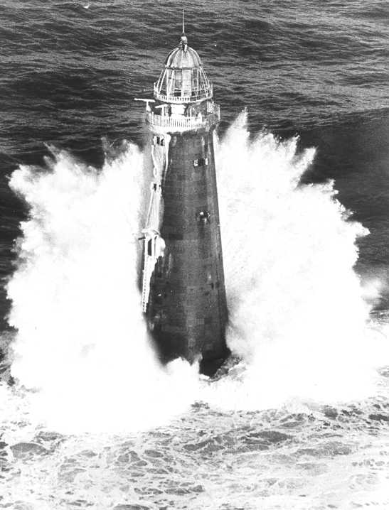
Minot's Ledge Light |
 |
01987-06-15 June 15, 1987 |
Minot's Ledge
42°16′4″N 70°45′38″W / 42.26778°N 70.76056°W / 42.26778; -70.76056 (Minot's Ledge Light) |
Scituate |
|
| 57 |
Muttock Historic and Archeological District |
|
02000-05-18 May 18, 2000 |
Address restricted |
Middleborough |
|
| 58 |
National Monument to the Forefathers |
 |
01974-08-30 August 30, 1974 |
Allerton St.
41°57′36″N 70°40′36″W / 41.96°N 70.67667°W / 41.96; -70.67667 (National Monument to the Forefathers) |
Plymouth |
|
| 59 |
Ned Point Light |
 |
01987-06-15 June 15, 1987 |
Ned Point Rd.
41°38′53″N 70°46′16″W / 41.64806°N 70.77111°W / 41.64806; -70.77111 (Ned Point Light) |
Mattapoisett |
|
| 60 |
North Abington Depot |
 |
01976-05-13 May 13, 1976 |
Railroad St.
42°7′45″N 70°56′32″W / 42.12917°N 70.94222°W / 42.12917; -70.94222 (North Abington Depot) |
Abington |
|
| 61 |
North Rochester Congregational Church |
|
02008-03-21 March 21, 2008 |
289 North Ave.
41°46′57″N 70°53′39″W / 41.7825°N 70.89417°W / 41.7825; -70.89417 (North Rochester Congregational Church) |
Rochester |
|
| 62 |
Norwell Village Area Historic District |
 |
01982-06-02 June 2, 1982 |
MA 123
42°9′41″N 70°47′28″W / 42.16139°N 70.79111°W / 42.16139; -70.79111 (Norwell Village Area Historic District) |
Norwell |
|
| 63 |
Old County Courthouse |
 |
01972-02-23 February 23, 1972 |
Leyden and Market Sts.
41°57′20″N 70°39′53″W / 41.95556°N 70.66472°W / 41.95556; -70.66472 (Old County Courthouse) |
Plymouth |
|
| 64 |
Old Post Office Building |
 |
01978-03-08 March 8, 1978 |
Crescent St.
42°4′51″N 71°1′10″W / 42.08083°N 71.01944°W / 42.08083; -71.01944 (Old Post Office Building) |
Brockton |
|
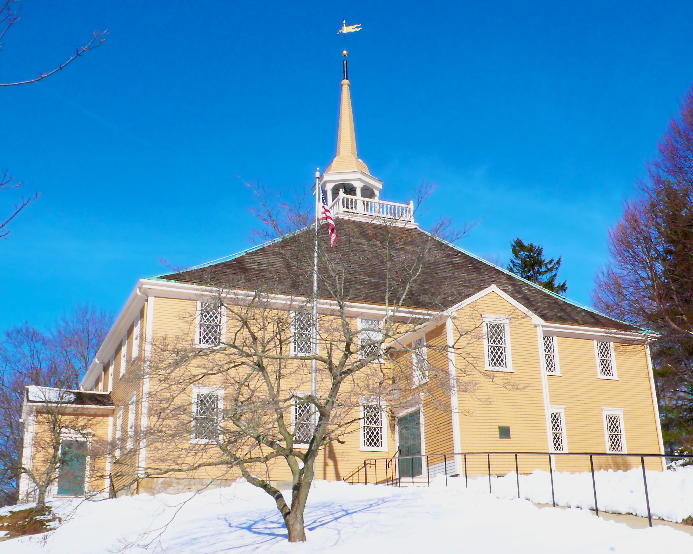
| 65 |
Old Ship Meetinghouse |
 |
01966-10-15 October 15, 1966 |
Main St.
42°14′28″N 70°53′16″W / 42.24111°N 70.88778°W / 42.24111; -70.88778 (Old Ship Meetinghouse) |
Hingham |
|
| 66 |
Old Shipbuilder's Historic District |
 |
01986-08-21 August 21, 1986 |
Both sides of Washington St. from Powder Point Ave. to north of South Duxbury
42°2′17″N 70°40′31″W / 42.03806°N 70.67528°W / 42.03806; -70.67528 (Old Shipbuilder's Historic District) |
Duxbury |
|
| 67 |
Moses Packard House |
 |
01978-02-17 February 17, 1978 |
647 Main St.
42°4′20″N 71°1′11″W / 42.07222°N 71.01972°W / 42.07222; -71.01972 (Packard, Moses, House) |
Brockton |
|
| 68 |
Paragon Park Carousel |
 |
01999-09-14 September 14, 1999 |
1 Wharf Ave.
42°16′12″N 70°51′26″W / 42.27°N 70.85722°W / 42.27; -70.85722 (Paragon Park Carousel) |
Hull |
|
| 69 |
Parting Ways Archeological District |
|
01979-03-19 March 19, 1979 |
Address restricted |
Plymouth |
|
| 70 |
Pembroke Friends Meetinghouse |
 |
02006-09-06 September 6, 2006 |
Washington St. and Schoosett St.
42°6′17″N 70°48′18″W / 42.10472°N 70.805°W / 42.10472; -70.805 (Pembroke Friends Meetinghouse) |
Pembroke |
|
| 71 |
Phoenix Building |
 |
01989-04-07 April 7, 1989 |
315-321 Union St.
42°8′16″N 70°54′59″W / 42.13778°N 70.91639°W / 42.13778; -70.91639 (Phoenix Building) |
Rockland |
|
| 72 |
Peter Pierce Store |
|
01976-04-30 April 30, 1976 |
N. Main and Jackson Sts.
41°53′35″N 70°54′28″W / 41.89306°N 70.90778°W / 41.89306; -70.90778 (Pierce, Peter, Store) |
Middleborough |
|
| 73 |
Pilgrim Hall |
 |
01972-04-11 April 11, 1972 |
75 Court St.
41°57′33″N 70°40′8″W / 41.95917°N 70.66889°W / 41.95917; -70.66889 (Pilgrim Hall) |
Plymouth |
|
| 74 |
Pillsbury Summer House |
|
02004-11-27 November 27, 2004 |
45 Old Cove Rd.
42°3′4″N 70°40′15″W / 42.05111°N 70.67083°W / 42.05111; -70.67083 (Pillsbury Summer House) |
Duxbury |
|
| 75 |
Pinewoods Camp |
|
02009-12-16 December 16, 2009 |
80 Cornish Field Rd.
41°51′16.89″N 70°36′15.83″W / 41.8546917°N 70.6043972°W / 41.8546917; -70.6043972 (Pinewoods Camp) |
Plymouth |
|
| 76 |
Plymouth Antiquarian House |
 |
01974-12-27 December 27, 1974 |
126 Water St.
41°57′37″N 70°40′4″W / 41.96028°N 70.66778°W / 41.96028; -70.66778 (Plymouth Antiquarian House) |
Plymouth |
|
| 77 |
Plymouth Light Station |
 |
01977-03-08 March 8, 1977 |
Southeast of Duxbury at Gurnet Point
42°0′12″N 70°36′4″W / 42.00333°N 70.60111°W / 42.00333; -70.60111 (Plymouth Light Station) |
Plymouth |
|
| 78 |
Plymouth Post Office Building |
 |
01986-10-23 October 23, 1986 |
5 Main St.
41°57′21″N 70°39′50″W / 41.95583°N 70.66389°W / 41.95583; -70.66389 (Plymouth Post Office Building) |
Plymouth |
|
| 79 |
Plymouth Rock |
 |
01970-07-01 July 1, 1970 |
Water St.
41°57′29″N 70°39′45″W / 41.95806°N 70.6625°W / 41.95806; -70.6625 (Plymouth Rock) |
Plymouth |
|
| 80 |
Plymouth Village Historic District |
 |
01982-06-02 June 2, 1982 |
Roughly bounded by Water, Main, and Brewster Sts.
41°57′26″N 70°39′49″W / 41.95722°N 70.66361°W / 41.95722; -70.66361 (Plymouth Village Historic District) |
Plymouth |
|
| 81 |
Plympton Village Historic District |
 |
02007-03-07 March 7, 2007 |
Main St., Elm St., Parsonage Rd., Mayflower Rd.
41°57′10.8″N 70°48′50.98″W / 41.953°N 70.8141611°W / 41.953; -70.8141611 (Plympton Village Historic District) |
Plympton |
|
| 82 |
Point Allerton Lifesaving Station |
 |
01981-06-11 June 11, 1981 |
Nantasket Ave.
42°18′20″N 70°54′1″W / 42.30556°N 70.90028°W / 42.30556; -70.90028 (Point Allerton Lifesaving Station) |
Hull |
|
| 83 |
Rockland Almshouse |
|
01983-04-28 April 28, 1983 |
198 Spring St.
42°6′52″N 70°54′45″W / 42.11444°N 70.9125°W / 42.11444; -70.9125 (Rockland Almshouse) |
Rockland |
|
| 84 |
Rockland High School |
 |
01989-03-23 March 23, 1989 |
394 Union St.
42°8′56″N 70°55′5″W / 42.14889°N 70.91806°W / 42.14889; -70.91806 (Rockland High School) |
Rockland |
|
| 85 |
Rockland Memorial Library |
 |
01989-03-23 March 23, 1989 |
382 Union St.
42°8′20″N 70°55′4″W / 42.13889°N 70.91778°W / 42.13889; -70.91778 (Rockland Memorial Library) |
Rockland |
|
| 86 |
Rockland Trust Company |
 |
01989-04-07 April 7, 1989 |
288 Union St.
42°8′10″N 70°54′59″W / 42.13611°N 70.91639°W / 42.13611; -70.91639 (Rockland Trust Company) |
Rockland |
|
| 87 |
Sachem Rock Farm |
 |
02006-12-11 December 11, 2006 |
355 Plymouth St.
42°1′6″N 70°57′6″W / 42.01833°N 70.95167°W / 42.01833; -70.95167 (Sachem Rock Farm) |
East Bridgewater |
|
| 88 |
Scituate Light |
 |
01987-06-15 June 15, 1987 |
Cedar Pt.
42°12′7″N 70°42′55″W / 42.20194°N 70.71528°W / 42.20194; -70.71528 (Scituate Light) |
Scituate |
|
| 89 |
Snow Fountain and Clock |
 |
01977-07-25 July 25, 1977 |
N. Main and E. Main Sts.
42°5′45″N 71°1′11″W / 42.09583°N 71.01972°W / 42.09583; -71.01972 (Snow Fountain and Clock) |
Brockton |
|
| 90 |
South Hingham Historic District |
 |
01998-07-24 July 24, 1998 |
Roughly along Main St. from Cushing St. to Tower Brook Rd.
42°12′40″N 70°53′6″W / 42.21111°N 70.885°W / 42.21111; -70.885 (South Hingham Historic District) |
Hingham |
|
| 91 |
South Middleborough Historic District |
|
02009-06-19 June 19, 2009 |
Locust, Spruce, and Wareham Sts.
41°49′26.83″N 70°49′38.06″W / 41.8241194°N 70.8272389°W / 41.8241194; -70.8272389 (South Middleborough Historic District) |
Middleborough |
|
| 92 |
South Street Historic District |
|
01983-10-06 October 6, 1983 |
Roughly South St. from Main St. to Warren Ave.
42°3′47″N 71°1′11″W / 42.06306°N 71.01972°W / 42.06306; -71.01972 (South Street Historic District) |
Brockton |
|
| 93 |
Richard Sparrow House |
 |
01974-10-09 October 9, 1974 |
42 Summer St.
41°57′15″N 70°39′54″W / 41.95417°N 70.665°W / 41.95417; -70.665 (Sparrow, Richard, House) |
Plymouth |
|
| 94 |
Alexander Standish House |
 |
01978-07-12 July 12, 1978 |
341 Standish St.
42°0′30″N 70°40′45″W / 42.00833°N 70.67917°W / 42.00833; -70.67917 (Standish, Alexander, House) |
Duxbury |
|
| 95 |
Stetson House |
 |
01979-09-07 September 7, 1979 |
Hanover St.
42°6′58″N 70°50′39″W / 42.11611°N 70.84417°W / 42.11611; -70.84417 (Stetson House) |
Hanover |
|
| 96 |
Stetson-Ford House |
 |
01998-03-09 March 9, 1998 |
2 Meadow Farms Way
42°7′18″N 70°47′5″W / 42.12167°N 70.78472°W / 42.12167; -70.78472 (Stetson-Ford House) |
Norwell |
|
| 97 |
The Tack Factory |
|
01980-12-03 December 3, 1980 |
Southwest of Norwell at 49 Tiffany Rd.
42°7′21″N 70°48′33″W / 42.1225°N 70.80917°W / 42.1225; -70.80917 (Tack Factory, The) |
Norwell |
|
| 98 |
Tarklin School |
|
02009-08-26 August 26, 2009 |
245 Summer Street
42°2′9″N 70°44′27″W / 42.03583°N 70.74083°W / 42.03583; -70.74083 (Tarklin School) |
Duxbury |
|
| 99 |
Telegraph Hill |
 |
01976-07-12 July 12, 1976 |
Address restricted |
Hull |
|
| 100 |
Third Meetinghouse |
 |
01976-01-02 January 2, 1976 |
1 Fairhaven Rd.
41°39′43″N 70°49′13″W / 41.66194°N 70.82028°W / 41.66194; -70.82028 (Third Meetinghouse) |
Mattapoisett |
|
| 101 |
Thomas-Webster Estate |
|
01993-04-05 April 5, 1993 |
238 Webster St.
42°4′46″N 70°40′46″W / 42.07944°N 70.67944°W / 42.07944; -70.67944 (Thomas-Webster Estate) |
Marshfield |
|
| 102 |
Tom Thumb House |
 |
01993-04-16 April 16, 1993 |
351 Plymouth St.
41°55′16″N 70°55′8″W / 41.92111°N 70.91889°W / 41.92111; -70.91889 (Thumb, Tom, House) |
Middleborough |
|
| 103 |
Tobey Homestead |
|
01986-06-05 June 5, 1986 |
Main St. and Sandwich Rd.
41°45′24″N 70°42′51″W / 41.75667°N 70.71417°W / 41.75667; -70.71417 (Tobey Homestead) |
Wareham |
|
| 104 |
Town Brook Historic and Archeological District |
 |
01995-10-12 October 12, 1995 |
Address restricted
41°57′1″N 70°40′8″W / 41.95028°N 70.66889°W / 41.95028; -70.66889 (Town Brook Historic and Archeological District) |
Plymouth |
|
| 105 |
Town Hall |
 |
01976-10-22 October 22, 1976 |
Bedford St.
41°50′45″N 70°57′2″W / 41.84583°N 70.95056°W / 41.84583; -70.95056 (Town Hall) |
Lakeville |
|
| 106 |
Tremont Nail Factory District |
 |
01976-10-22 October 22, 1976 |
21 Elm St.
41°45′59″N 70°43′20″W / 41.76639°N 70.72222°W / 41.76639; -70.72222 (Tremont Nail Factory District) |
Wareham |
|
| 107 |
US Post Office-Middleborough Main |
|
01987-10-19 October 19, 1987 |
90 Center St.
41°53′33″N 70°54′40″W / 41.8925°N 70.91111°W / 41.8925; -70.91111 (US Post Office-Middleborough Main) |
Middleborough |
|
| 108 |
WPA Field House and Pump Station |
|
02009-05-29 May 29, 2009 |
7-19 Henry Turner Bailey Rd.
42°13′5.988″N 70°47′15.828″W / 42.21833°N 70.78773°W / 42.21833; -70.78773 (WPA Field House and Pump Station) |
Scituate |
|
| 109 |
Wampanoag Royal Cemetery |
|
01975-11-11 November 11, 1975 |
Address restricted |
Middleborough |
|
| 110 |
Wampanucket Site |
|
01973-06-04 June 4, 1973 |
Address restricted |
Middleborough |
|
| 111 |
War Memorial Park |
 |
02008-05-21 May 21, 2008 |
River St.
42°9′46.44″N 71°0′30.888″W / 42.1629°N 71.00858°W / 42.1629; -71.00858 (War Memorial Park) |
West Bridgewater |
|
| 112 |
C.P. Washburn Grain Mill |
|
01980-04-08 April 8, 1980 |
Central and Cambridge Sts.
41°53′37″N 70°55′10″W / 41.89361°N 70.91944°W / 41.89361; -70.91944 (Washburn, C.P., Grain Mill) |
Middleborough |
|
| 113 |
Daniel Webster Law Office and Library |
 |
01974-05-30 May 30, 1974 |
Careswell and Webster Sts.
42°4′18″N 70°40′26″W / 42.07167°N 70.67389°W / 42.07167; -70.67389 (Webster, Daniel, Law Office and Library) |
Marshfield |
|
| 114 |
Whitman Park |
 |
02004-03-18 March 18, 2004 |
Park, Maple, Whitman, and Hayden Aves.
42°4′59″N 70°55′6″W / 42.08306°N 70.91833°W / 42.08306; -70.91833 (Whitman Park) |
Whitman |
|
| 115 |
Isaac Winslow House |
|
02000-08-15 August 15, 2000 |
634 Careswell St.
42°4′50″N 70°40′25″W / 42.08056°N 70.67361°W / 42.08056; -70.67361 (Winslow, Isaac, House) |
Marshfield |
|
| 116 |
Wareham |
|
| 117 |
Woodworth House |
|
01996-04-09 April 9, 1996 |
47 Old Oaken Bucket Rd.
42°10′39″N 70°45′23″W / 42.1775°N 70.75639°W / 42.1775; -70.75639 (Woodworth House) |
Scituate |
|
| 118 |
Wright Memorial Library |
 |
02007-07-11 July 11, 2007 |
147 St. George St.
42°2′55″N 70°40′48″W / 42.04861°N 70.68°W / 42.04861; -70.68 (Wright Memorial Library) |
Duxbury |
|
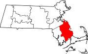
 Location of Plymouth County in Massachusetts
 Category:National Register of Historic Places •
  Portal:National Register of Historic Places