- National Register of Historic Places listings in Pittsburg County, Oklahoma
-
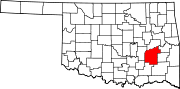
 Location of Pittsburg County in Oklahoma
This is a list of the National Register of Historic Places listings in Pittsburg County, Oklahoma.
This is intended to be a complete list of the properties and districts on the National Register of Historic Places in Pittsburg County, Oklahoma, United States. The locations of National Register properties and districts for which the latitude and longitude coordinates are included below, may be seen in a Google map.[1]
There are 28 properties and districts listed on the National Register in the county.
-
- This National Park Service list is complete through NPS recent listings posted November 10, 2011.[2]
Current listings
[3] Landmark name [4] Image Date listed Location City or town Summary 1 Aldridge Hotel December 7, 1995 200 E. Carl Albert Parkway
34°55′56″N 95°46′00″W / 34.932222°N 95.766667°WMcAlester 2 Blackburn's Station Site March 7, 1973 9 miles southeast of Pittsburg
34°41′05″N 95°44′39″W / 34.684722°N 95.744167°WPittsburg 3 Busby Office Building December 6, 1979 113 E. Carl Albert Parkway
34°55′59″N 95°46′03″W / 34.933056°N 95.7675°WMcAlester 4 Busby Theatre December 6, 1979 Washington Ave. and 2nd St.
34°56′01″N 95°46′00″W / 34.933611°N 95.766667°WMcAlester 5 Canadian Jail and Livery Stable November 6, 1980 Off State Highway 113
35°10′43″N 95°39′22″W / 35.178611°N 95.656111°WCanadian 6 Choate Cabin October 3, 1979 2nd and Walnut Sts.
35°09′36″N 95°46′24″W / 35.16°N 95.773333°WIndianola 7 Cole Chapel School September 8, 1988 North of Hartshorne
34°54′19″N 95°32′32″W / 34.905278°N 95.542222°WHartshorne 8 Federal Building and US Courthouse March 24, 2000 Junction of 3rd and Carl Albert Parkway
34°55′56″N 95°45′54″W / 34.932222°N 95.765°WMcAlester 9 First Presbyterian Church December 11, 1979 101 E. Washington Ave.
34°56′03″N 95°46′41″W / 34.934167°N 95.778056°WMcAlester 10 Hokey's Drugstore December 6, 1979 Main and Washington Sts.
34°55′38″N 95°42′55″W / 34.927222°N 95.715278°WKrebs 11 L'Ouverture Gymnasium May 26, 2006 Junction of S. 14th St. and E Chickasaw Ave.
34°55′32″N 95°45′02″W / 34.925556°N 95.750556°WMcAlester 12 Jeff Lee Park Bath House and Pool September 8, 1988 3rd and Fillmore Sts.
34°56′41″N 95°45′37″W / 34.944722°N 95.760278°WMcAlester 13 Mass Grave of the Mexican Miners November 14, 1980 Mount Calvary Cemetery
34°55′39″N 95°44′32″W / 34.9275°N 95.742222°WMcAlester 14 McAlester Armory September 8, 1988 3rd and Polk Sts.
34°56′36″N 95°45′38″W / 34.943333°N 95.760556°WMcAlester 15 McAlester DX August 29, 1980 5th St. and Carl Albert Parkway
34°55′56″N 95°45′50″W / 34.932222°N 95.763889°WMcAlester 16 McAlester House August 29, 1980 14 E. Smith Ave.
34°57′20″N 95°45′38″W / 34.955556°N 95.760556°WMcAlester 17 McAlester Scottish Rite Temple November 22, 1980 2nd St. and Adams Ave.
34°56′07″N 95°45′56″W / 34.935278°N 95.765556°WMcAlester 18 Mine Rescue Station Building March 13, 1980 507-509 E. 3rd St.
34°55′34″N 95°46′05″W / 34.926111°N 95.768056°WMcAlester 19 New State School September 8, 1988 South of Hartshorne near North Fork Elm Creek
34°43′50″N 95°36′05″W / 34.730556°N 95.601389°WHartshorne 20 OKLA Theater June 5, 2003 18 E. Choctaw
34°56′25″N 95°46′45″W / 34.940278°N 95.779167°WMcAlester 21 Perryville May 5, 1972 Southwest of McAlester on U.S. Route 69
34°52′08″N 95°48′54″W / 34.868889°N 95.815°WMcAlester 22 Pittsburg County Courthouse August 23, 1984 Washington Ave.
34°55′59″N 95°46′00″W / 34.933056°N 95.766667°WMcAlester 23 Pittsburg School and Gymnasium September 8, 1988 Off State Highway 63
34°42′55″N 95°51′14″W / 34.715278°N 95.853889°WPittsburg 24 Rock Creek Bridge September 4, 2008 Carries County Road NS-409.7 over Rock Creek Blanco 25 St. Joseph's Catholic Church November 12, 1980 Off State Highway 31
34°55′56″N 95°43′05″W / 34.932222°N 95.718056°WKrebs 25 Southern Ice and Cold S6orage Company October 11, 1979 338 E. Choctaw Ave.
34°55′51″N 95°45′49″W / 34.930833°N 95.763611°WPittsburg 27 Tipton Ridge School September 8, 1988 North of Blocker
35°07′15″N 95°30′26″W / 35.120833°N 95.507222°WBlocker 28 Warden's House June 17, 2005 Penitentiary Boulevard and West St.
34°57′09″N 95°46′55″W / 34.9525°N 95.781944°WMcAlester See also
- List of National Historic Landmarks in Oklahoma
- National Register of Historic Places listings in Oklahoma
References
- ^ The latitude and longitude information provided in this table was derived originally from the National Register Information System, which has been found to be fairly accurate for about 99% of listings. For about 1% of NRIS original coordinates, experience has shown that one or both coordinates are typos or otherwise extremely far off; some corrections may have been made. A more subtle problem causes many locations to be off by up to 150 yards, depending on location in the country: most NRIS coordinates were derived from tracing out latitude and longitudes off of USGS topographical quadrant maps created under the North American Datum of 1927, which differs from the current, highly accurate WGS84 GPS system used by Google maps. Chicago is about right, but NRIS longitudes in Washington are higher by about 4.5 seconds, and are lower by about 2.0 seconds in Maine. Latitudes differ by about 1.0 second in Florida. Some locations in this table may have been corrected to current GPS standards.
- ^ "National Register of Historic Places: Weekly List Actions". National Park Service, United States Department of the Interior. Retrieved on November 10, 2011.
- ^ Numbers represent an ordering by significant words. Various colorings, defined here, differentiate National Historic Landmark sites and National Register of Historic Places Districts from other NRHP buildings, structures, sites or objects.
- ^ "National Register Information System". National Register of Historic Places. National Park Service. . http://nrhp.focus.nps.gov/natreg/docs/All_Data.html.
U.S. National Register of Historic Places Topics Lists by states Alabama • Alaska • Arizona • Arkansas • California • Colorado • Connecticut • Delaware • Florida • Georgia • Hawaii • Idaho • Illinois • Indiana • Iowa • Kansas • Kentucky • Louisiana • Maine • Maryland • Massachusetts • Michigan • Minnesota • Mississippi • Missouri • Montana • Nebraska • Nevada • New Hampshire • New Jersey • New Mexico • New York • North Carolina • North Dakota • Ohio • Oklahoma • Oregon • Pennsylvania • Rhode Island • South Carolina • South Dakota • Tennessee • Texas • Utah • Vermont • Virginia • Washington • West Virginia • Wisconsin • WyomingLists by territories Lists by associated states Other Municipalities and communities of Pittsburg County, Oklahoma Cities Haileyville | Hartshorne | Krebs | McAlester
Towns CDP Unincorporated
communitiesGhost town Adamson
Categories:- Pittsburg County, Oklahoma
- National Register of Historic Places in Oklahoma by county
- Buildings and structures in Pittsburg County, Oklahoma
-

Wikimedia Foundation. 2010.