- National Register of Historic Places listings in Olmsted County, Minnesota
-
This is a list of entries on the National Register of Historic Places in Olmsted County, Minnesota.
Olmsted County is located in the southeastern part of the U.S. state of Minnesota.
Contents
Current listings
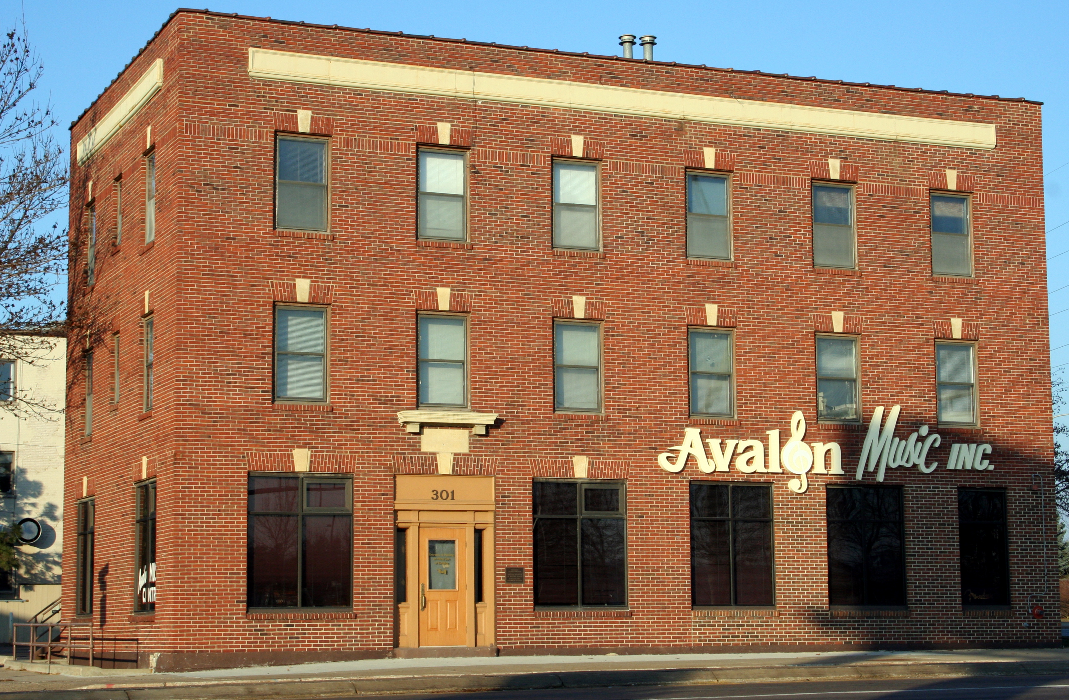
[1] Landmark name Image Date listed Location City or town Summary 1 Avalon Hotel 
March 19, 1982 301 North Broadway
44°01′35″N 92°27′47″W / 44.026389°N 92.463056°WRochester Currently Avalon Music 2 Dr. Donald C. Balfour House 
July 21, 2004 427 6th Avenue, SW.
44°01′06″N 92°28′17″W / 44.018333°N 92.471389°WRochester 3 Benike Family Barn October 7, 2011 5209 County Road 21 NE, Farmington Township
44°08′13″N 92°22′30″W / 44.136944°N 92.375°WElgin vicinity 4 John G. Bush House 
July 2, 1980 223 East Center Street
43°58′29″N 92°08′11″W / 43.974722°N 92.136389°WDover 5 Chateau Dodge Theatre 
July 17, 1980 15 1st Street, SW.
44°01′22″N 92°27′50″W / 44.022778°N 92.463889°WRochester 6 Coan House 
July 2, 1980 118 West 5th Street
43°59′04″N 92°14′00″W / 43.984444°N 92.233333°WEyota Built 1857 7 Eyota Farmers Cooperative Creamery Association 
July 2, 1980 222 Washington Avenue, South
43°59′10″N 92°13′36″W / 43.986111°N 92.226667°WEyota Built 1924 8 Frank's Ford Bridge 
July 8, 1980 County Road 121 over the South Branch of the Zumbro River
44°07′47″N 92°27′45″W / 44.129722°N 92.4625°WOronoco 9 Christopher Krause Farmstead 
October 10, 1980 County Highway 30
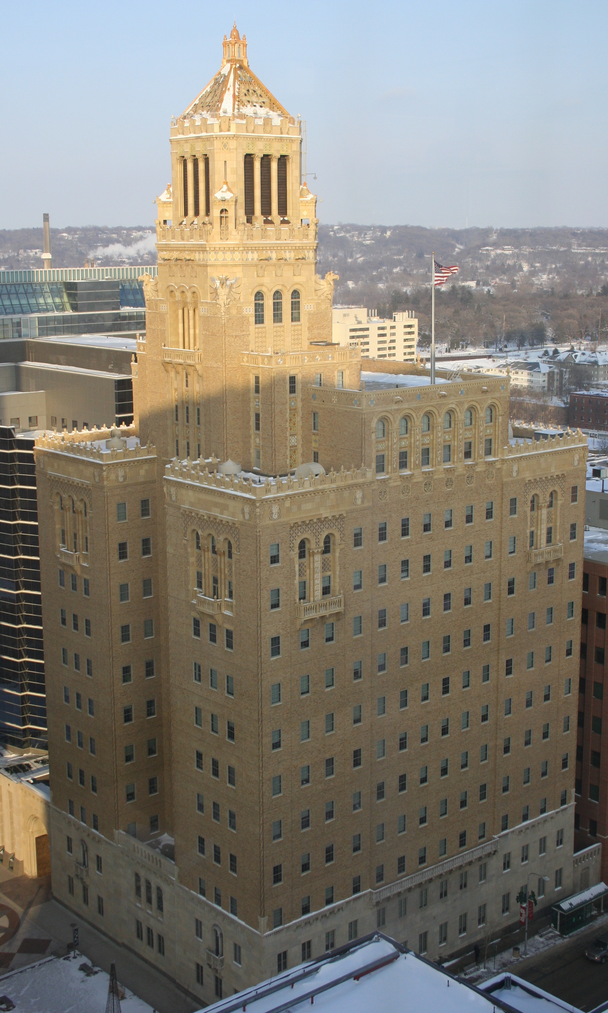
43°57′31″N 92°08′17″W / 43.958611°N 92.138056°WDover 10 Mayo Clinic Buildings 
August 4, 1969 110 and 115 2nd Avenue, SW.
44°00′55″N 92°27′49″W / 44.015278°N 92.463611°WRochester 11 Dr. William J. Mayo House 
March 26, 1975 701 4th Street, SW.
44°01′08″N 92°28′15″W / 44.018889°N 92.470833°WRochester Called the Mayo Foundation House 12 Mayowood Historic District 
September 22, 1970 3720 Mayowood Road, SW.
43°59′41″N 92°31′03″W / 43.994722°N 92.5175°WRochester 13 Oronoco School 
July 2, 1980 County Highway 18
44°09′43″N 92°32′02″W / 44.161944°N 92.533889°WOronoco 14 Pierce House 
July 21, 1980 426 2nd Avenue, SW.
44°01′06″N 92°27′55″W / 44.018333°N 92.465278°WRochester Maxwell Guest House. Demolished June 5, 2007. 15 Pill Hill Residential Historic District 
November 29, 1990 Roughly bounded by 3rd and 9th Streets and 7th and 10th Avenues, SW.
44°01′05″N 92°28′29″W / 44.018056°N 92.474722°WRochester 16 Pleasant Grove Masonic Lodge 
October 10, 1980 Off County Highway 1
43°52′12″N 92°23′04″W / 43.87°N 92.384444°WStewartville 17 Henry S. Plummer House 
May 21, 1975 1091 Plummer Lane
44°00′37″N 92°28′47″W / 44.010278°N 92.479722°WRochester 18 Main Street Armory 
December 2, 1980 121 North Broadway
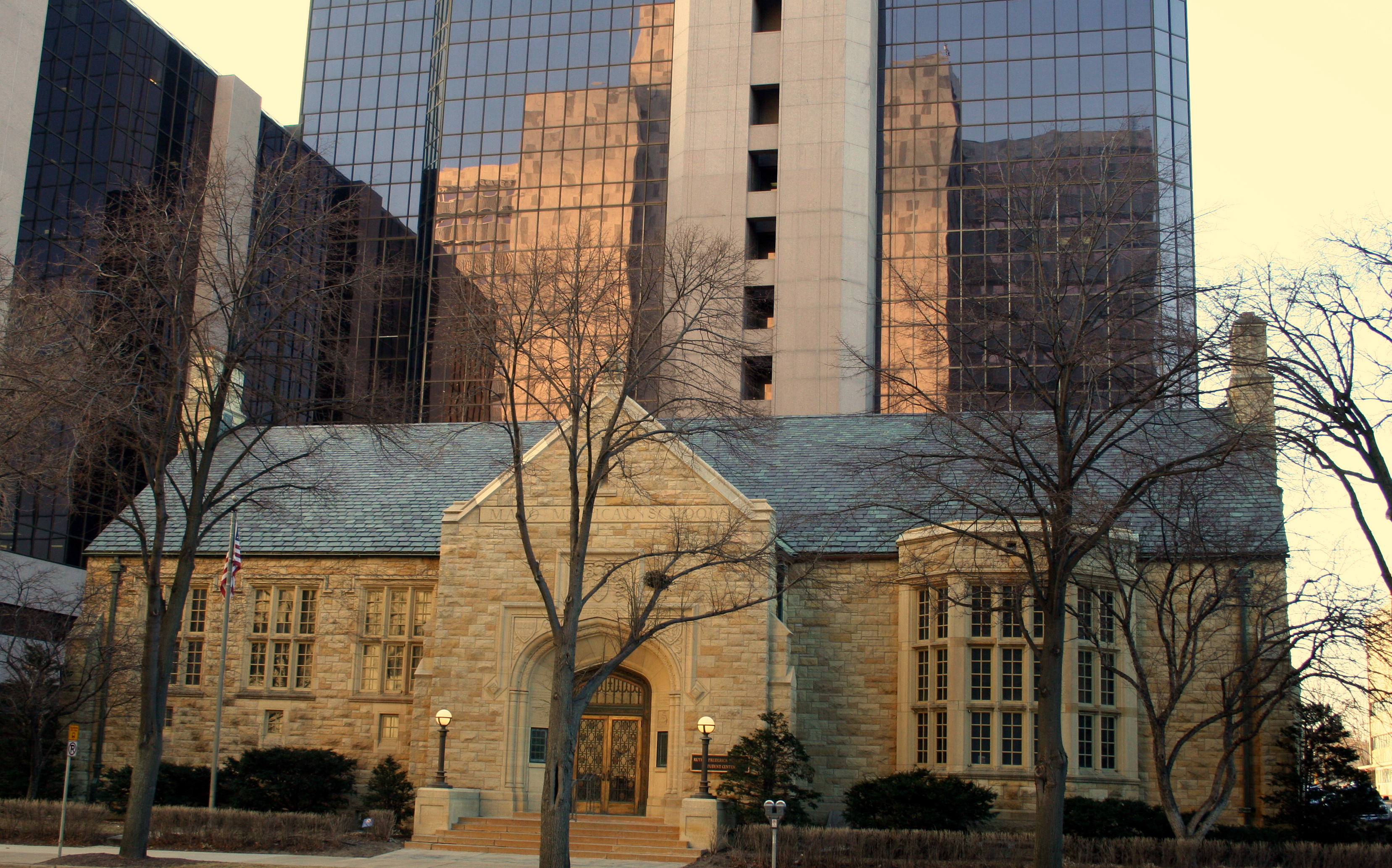
44°01′31″N 92°27′48″W / 44.025278°N 92.463333°WRochester Senior Citizens Center, also called the "Castle" 19 Rochester Public Library 
July 2, 1980 226 2nd Street, SW.
44°01′16″N 92°28′01″W / 44.021111°N 92.466944°WRochester Now the Mayo Medical School Student Center 20 St. Mary's Hospital Dairy Farmstead 
July 2, 1980 East of Rochester on County Highway 104
44°01′29″N 92°33′21″W / 44.024722°N 92.555833°WRochester 21 George Stoppel Farmstead 
May 12, 1975 County Highways 25 and 122
44°00′37″N 92°30′40″W / 44.010278°N 92.511111°WRochester 22 Toogood Barns 
June 26, 1975 Mayowood Road
44°00′05″N 92°28′28″W / 44.001389°N 92.474444°WRochester 23 Viola Cooperative Creamery 
November 12, 1999 10500 Viola Road, NE.
44°03′53″N 92°16′10″W / 44.064722°N 92.269444°WViola 24 Milo White House 
March 19, 1982 122 Burr Oak Street
43°51′02″N 92°11′18″W / 43.850556°N 92.188333°WChatfield 25 Timothy A. Whiting House 
December 4, 1980 225 1st Avenue, NW.
44°01′34″N 92°27′52″W / 44.026111°N 92.464444°WRochester Also called Heritage House, in Central Park. See also
References
- ^ Numbers represent an ordering by significant words. Various colorings, defined here, differentiate National Historic Landmark sites and National Register of Historic Places Districts from other NRHP buildings, structures, sites or objects.
Further reading
- Nord, Mary Ann (2003). The National Register of Historic Places in Minnesota. Minnesota Historical Society. ISBN 0-87351-448-3.
External links
- A list of the above sites, with street addresses and other information, is available at Olmsted County, MN listing of National Register of Historic Places.Com, a private site serving up NRHP information.
U.S. National Register of Historic Places Topics Lists by states Alabama • Alaska • Arizona • Arkansas • California • Colorado • Connecticut • Delaware • Florida • Georgia • Hawaii • Idaho • Illinois • Indiana • Iowa • Kansas • Kentucky • Louisiana • Maine • Maryland • Massachusetts • Michigan • Minnesota • Mississippi • Missouri • Montana • Nebraska • Nevada • New Hampshire • New Jersey • New Mexico • New York • North Carolina • North Dakota • Ohio • Oklahoma • Oregon • Pennsylvania • Rhode Island • South Carolina • South Dakota • Tennessee • Texas • Utah • Vermont • Virginia • Washington • West Virginia • Wisconsin • WyomingLists by territories Lists by associated states Other Categories:- Olmsted County, Minnesota
- National Register of Historic Places in Minnesota by county
- Buildings and structures in Olmsted County, Minnesota


Wikimedia Foundation. 2010.