- National Register of Historic Places listings in Norfolk, Virginia
-
This list includes properties and districts listed on the National Register of Historic Places in the independent city of Norfolk, Virginia. Click the "Map of all coordinates" link to the right to view a Google map of all properties and districts with latitude and longitude coordinates in the table below.[1]
-
- This National Park Service list is complete through NPS recent listings posted November 10, 2011.[2]
[3] Landmark name [4] Image Date listed Location City or town Summary 1 Allmand-Archer House September 22, 1971 327 Duke St.
36°51′04″N 76°17′35″W / 36.851111°N 76.293056°WNorfolk 2 American Cigar Company September 3, 2009 1148 E. Princess Anne Rd.
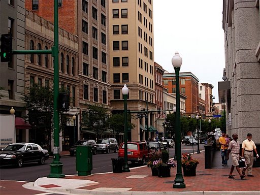
36°51′20″N 76°16′14″W / 36.8556°N 76.270642°WNorfolk 3 Attucks Theatre September 16, 1982 1008-1012 Church St.
36°51′23″N 76°16′45″W / 36.856389°N 76.279167°WNorfolk 4 Ballentine Place Historic District May 22, 2003 Roughly bounded by Cromwell Ave., Cape Henry Ave., McKann Ave., and Lafayette Boulevard
36°52′01″N 76°15′11″W / 36.866944°N 76.253056°WNorfolk 5 Berkley North Historic District November 22, 2000 Roughly bounded by Bellamy Ave., Pescara Creek, Berkley Ave., and I-464
36°50′05″N 76°16′55″W / 36.834722°N 76.281944°WNorfolk 6 Boush-Tazewell House July 18, 1974 6225 Powhaten Ave.
36°53′52″N 76°18′49″W / 36.897778°N 76.313611°WNorfolk 7 Chesterfield Heights Historic District June 10, 2003 Roughly bounded by the E Branch of Elizabeth R, Ballentine Boulevard, Sedgewick St. and I-264
36°50′34″N 76°15′28″W / 36.842778°N 76.257778°WNorfolk 8 Christ and St. Luke's Church June 18, 1979 560 W. Olney Rd.
36°51′35″N 76°17′54″W / 36.859722°N 76.298333°WNorfolk 9 Colonial Place May 22, 2002 Roughly bounded by the Lafayette R., Knitting Mill Creek, East Haven Creek and 38th St.
36°53′05″N 76°17′20″W / 36.884722°N 76.288889°WNorfolk 10 Downtown Norfolk Historic District 
March 20, 1987 Granby, Main, and Plume Sts., City Hall Ave., and Bank St.; also Granby, Freemason, Charlotte, Bute, and York Sts., College Pl., and Monticello Ave.
36°50′53″N 76°17′28″W / 36.848056°N 76.291111°WNorfolk Second set of boundaries represents a boundary increase of May 30, 2001 11 Epworth United Methodist Church August 21, 1997 124 W. Freemason St.
36°51′06″N 76°17′29″W / 36.851667°N 76.291389°WNorfolk 12 First Baptist Church July 21, 1983 418 E. Bute St.
36°51′09″N 76°17′04″W / 36.8525°N 76.284444°WNorfolk 13 First Calvary Baptist Church October 15, 1987 1036-1040 Wide St.
36°51′22″N 76°16′41″W / 36.856111°N 76.278056°WNorfolk 14 Fort Norfolk October 29, 1976 803 Front St.
36°51′24″N 76°18′24″W / 36.856667°N 76.306667°WNorfolk 15 Freemason Street Baptist Church 
September 22, 1971 NE corner of Freemason and Bank Sts.
36°51′01″N 76°17′14″W / 36.850278°N 76.287222°WNorfolk 16 Ghent Historic District July 4, 1980 Roughly bounded by Olney Rd., Virginia Beach Boulevard, Smith's Creek, and Brambleton Ave.
36°51′24″N 76°17′50″W / 36.856667°N 76.297222°WNorfolk 17 HUNTINGTON (Tugboat) August 5, 1999 1 Waterside Dr.- Nauticus Pier
36°50′46″N 76°17′46″W / 36.846111°N 76.296111°WNorfolk 18 James Blair Junior High School February 4, 2000 730 Spotswood Ave.
36°52′05″N 76°17′49″W / 36.868056°N 76.296944°WNorfolk 19 Jamestown Exposition Site Buildings October 20, 1975 Bounded by Bacon, Powhatan, Farragut, Gilbert, Bainbridge, and the harbor
36°57′07″N 76°18′47″W / 36.951944°N 76.313056°WNorfolk 20 Kenmure June 1, 1988 420 W. Bute St.
36°51′10″N 76°17′49″W / 36.852778°N 76.296944°WNorfolk 21 Lafayette Grammar and High School February 10, 1983 3109 Tidewater Dr.
36°52′36″N 76°15′54″W / 36.876667°N 76.265°WNorfolk 22 Lafayette Residence Park January 27, 1999 Roughly bounded by Tidewater Dr., Dupont C., Fontainbleau Crescent, La Salle Ave., Orleans C., and Lafayette R.
36°52′33″N 76°16′10″W / 36.875833°N 76.269444°WNorfolk 23 Lambert's Point Knitting Mill (122-0934) February 1, 2006 808 W. 44th St.
36°53′11″N 76°17′45″W / 36.886389°N 76.295833°WNorfolk 24 Monticello Arcade 
May 21, 1975 In 200 block E. City Hall Ave.; between City Hall Ave. and Plume St.
36°50′50″N 76°17′27″W / 36.847222°N 76.290833°WNorfolk 25 Moses Myers House February 16, 1970 SW corner of E. Freemason and N. Bank Sts.
36°51′00″N 76°17′17″W / 36.85°N 76.288056°WNorfolk 26 Norfolk Academy 
November 12, 1969 420 Bank St.
36°51′04″N 76°17′09″W / 36.851078°N 76.285789°WNorfolk 27 Norfolk Azalea Garden 
August 17, 2005 6700 Azalea Garden rd.
36°54′10″N 76°12′22″W / 36.902778°N 76.206111°WNorfolk 28 Norfolk City Hall 
March 16, 1972 421 E. City Hall Ave.
36°50′50″N 76°17′21″W / 36.847222°N 76.289167°WNorfolk General Douglas MacArthur Memorial 29 North Ghent July 11, 2001 Bounded by Princess Anne Rd., Olney Rd., Colonia Ave., and Colley Ave.
36°51′45″N 76°17′53″W / 36.8625°N 76.298056°WNorfolk 30 Old Norfolk City Hall October 29, 1981 235 E. Plume St.
36°50′47″N 76°17′27″W / 36.846389°N 76.290833°WNorfolk 31 Park Place Historic District February 10, 2006 Roughly bounded by Hampton Boulevard, 23rd St., Granby St. and 38th St.
36°52′34″N 76°17′25″W / 36.876111°N 76.290278°WNorfolk 32 Poplar Hall November 7, 1997 400 Stuart Cir.
36°50′44″N 76°12′41″W / 36.845556°N 76.211389°WNorfolk 33 Queen Street Baptist Church March 15, 2006 413 Brambleton Ave.
36°51′19″N 76°17′03″W / 36.855278°N 76.284167°WNorfolk 34 Riverview September 24, 1999 Roughly bounded by LaVallette Ave., Beach Ave. on the Lafayette River, and Columbus Ave.
36°52′58″N 76°16′45″W / 36.882778°N 76.279167°WNorfolk 35 St. John's African Methodist Episcopal Church December 4, 1986 539-545 E. Bute St.
36°51′06″N 76°16′58″W / 36.851667°N 76.282778°WNorfolk 36 Saint Mary's Catholic Cemetery July 13, 2001 3000 Church St.
36°52′28″N 76°16′49″W / 36.874444°N 76.280278°WNorfolk 37 St. Mary's Church May 25, 1979 232 Chapel St.
36°50′49″N 76°16′56″W / 36.846944°N 76.282222°WNorfolk 38 St. Paul's Church 
July 2, 1971 201 St. Paul's Boulevard
36°50′51″N 76°17′09″W / 36.8475°N 76.285833°WNorfolk 39 St. Peter's Episcopal Church July 8, 2010 1625 Brown Ave.
36°50′38″N 76°16′24″W / 36.843889°N 76.273333°WNorfolk 40 Southern Bagging Company August 8, 2007 1900 Monticello Ave.
36°51′56″N 76°17′02″W / 36.865556°N 76.283889°WNorfolk 41 Taylor-Whittle House September 22, 1971 225 W. Freemason St.
36°51′05″N 76°17′33″W / 36.851389°N 76.2925°WNorfolk 42 U.S. Customhouse 
April 17, 1970 101 E. Main St.
36°50′45″N 76°17′34″W / 36.845833°N 76.292778°WNorfolk 43 US Post Office and Courthouse 
October 10, 1984 600 Granby St.
36°51′13″N 76°17′19″W / 36.853611°N 76.288611°WNorfolk 44 Virginia Bank and Trust Building February 23, 1984 101 Granby St.
36°50′46″N 76°17′36″W / 36.846111°N 76.293333°WNorfolk 45 Virginia Ice & Freezing Corporation Cold Storage Warehouse November 13, 2009 835 Southampton Ave.
36°51′28″N 76°18′18″W / 36.857897°N 76.304892°WNorfolk 46 Wells Theatre 
May 19, 1980 Tazewell St. and Monticello Ave.
36°50′56″N 76°17′26″W / 36.848889°N 76.290556°WNorfolk 47 West Freemason Street Area Historic District November 7, 1972 Both sides of Bute and Freemason Sts. between Elizabeth River, and York and Duke Sts.
36°51′08″N 76°17′40″W / 36.852222°N 76.294444°WNorfolk 48 West Point Cemetery May 3, 2007 238 E. Princess Anne Rd.
36°51′36″N 76°17′03″W / 36.859961°N 76.28405°WNorfolk 49 Willoughby-Baylor House September 22, 1971 601 Freemason St.
36°50′58″N 76°17′09″W / 36.849444°N 76.285833°WNorfolk 50 Winona July 5, 2001 Roughly bounded by Ashland Circle, Ashland Ave., Elmere Place, Huntington Crescent, Holland Ave., and the Lafayette
36°52′51″N 76°16′10″W / 36.880833°N 76.269444°WNorfolk 51 Zion Methodist Church April 4, 2007 2729 Bowden's Ferry Rd.
36°52′41″N 76°18′15″W / 36.878056°N 76.304167°WNorfolk See also
- National Register of Historic Places listings in Virginia
- List of National Historic Landmarks in Virginia
References
- ^ The latitude and longitude information provided in this table was derived originally from the National Register Information System, which has been found to be fairly accurate for about 99% of listings. For about 1% of NRIS original coordinates, experience has shown that one or both coordinates are typos or otherwise extremely far off; some corrections may have been made. A more subtle problem causes many locations to be off by up to 150 yards, depending on location in the country: most NRIS coordinates were derived from tracing out latitude and longitudes off of USGS topographical quadrant maps created under the North American Datum of 1927, which differs from the current, highly accurate WGS84 GPS system used by Google maps. Chicago is about right, but NRIS longitudes in Washington are higher by about 4.5 seconds, and are lower by about 2.0 seconds in Maine. Latitudes differ by about 1.0 second in Florida. Some locations in this table may have been corrected to current GPS standards.
- ^ "National Register of Historic Places: Weekly List Actions". National Park Service, United States Department of the Interior. Retrieved on November 10, 2011.
- ^ Numbers represent an ordering by significant words. Various colorings, defined here, differentiate National Historic Landmark sites and National Register of Historic Places Districts from other NRHP buildings, structures, sites or objects.
- ^ "National Register Information System". National Register of Historic Places. National Park Service. . http://nrhp.focus.nps.gov/natreg/docs/All_Data.html.
U.S. National Register of Historic Places Topics Lists by states Alabama • Alaska • Arizona • Arkansas • California • Colorado • Connecticut • Delaware • Florida • Georgia • Hawaii • Idaho • Illinois • Indiana • Iowa • Kansas • Kentucky • Louisiana • Maine • Maryland • Massachusetts • Michigan • Minnesota • Mississippi • Missouri • Montana • Nebraska • Nevada • New Hampshire • New Jersey • New Mexico • New York • North Carolina • North Dakota • Ohio • Oklahoma • Oregon • Pennsylvania • Rhode Island • South Carolina • South Dakota • Tennessee • Texas • Utah • Vermont • Virginia • Washington • West Virginia • Wisconsin • WyomingLists by territories Lists by associated states Other City of Norfolk Topics Downtown · History · Neighborhoods · Culture · People · Sports · Media · Education · Economy · Transportation · Elizabeth River
Attractions Military Neighborhoods Berkley • Colonial Place • Downtown Norfolk • Ghent • Highland Park • Huntersville • Larchmont-Edgewater • Lochhaven • Ocean View • Park Place • Sewell's Point • Willoughby SpitCategories:- National Register of Historic Places in Virginia
- Virginia-related lists
- History of Norfolk, Virginia
-


Wikimedia Foundation. 2010.