- National Register of Historic Places listings in Mendocino County, California
-
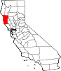
This list includes properties and districts listed on the National Register of Historic Places in Mendocino County, California. Click the "Map of all coordinates" link to the right to view a Google map of all properties and districts with latitude and longitude coordinates in the table below.[1]
-
- This National Park Service list is complete through NPS recent listings posted November 10, 2011.[2]
[3] Landmark name [4] Image Date listed Location City or town Summary 1 Arena Cove Historic District September 13, 1990 Arena Cove
38°54′54″N 123°42′28″W / 38.915°N 123.707778°WPoint Arena 2 Dr. Raymond Babcock House August 19, 2004 96 S. Humboldt St.
39°24′45″N 123°21′07″W / 39.4125°N 123.351944°WWillits 3 Buckridge Ranch House September 13, 1990 On the Garcia River near Buckridge Rd.
38°55′35″N 123°37′33″W / 38.926389°N 123.625833°WPoint Arena 4 Con Creek School October 18, 1979 2 miles (3.2 km) north of Boonville on State Route 128
39°01′47″N 123°23′07″W / 39.029722°N 123.385278°WBoonville Also known as the Little Red Schoolhouse, the Con Creek School is a schoolhouse built in the Greek Revival style by J.D. Ball in 1891. Used as a classroom for eight grade levels for 50 years, it was trimmed down to only 7th and 8th grades by 1941. In 1958 its use changed again to that of a kindergarten, and remained so until 1979, when it was donated to the local historical society. The Little Red Schoolhouse is located near the community of Boonville[5] 5 Jerome B. Ford House 
June 23, 2010 735 Main St.
39°18′19″N 123°47′50″W / 39.305278°N 123.797222°WMendocino 6 FROLIC (brig) May 16, 1991 Northeast of Pt. Cabrillo
39°21′18″N 123°49′15″W / 39.355°N 123.820833°WCaspar 7 O. W. Getchell House October 3, 1980 State Route 1
38°47′48″N 123°34′05″W / 38.796667°N 123.568056°WAnchor Bay Located in the community of Anchor Bay, the Getchell house was built by Osgood W. Getchel c.1870. A prominent location on a bluff and near a trade route established the Getchell house as a popular landmark for both land and sea travelers. The Getchell house was also one of the only wood structures to survive the 1906 earthquake.[6] 8 E. P. and Clara Gillmore House September 13, 1990 40 Mill St.
38°55′04″N 123°41′25″W / 38.917778°N 123.690278°WPoint Arena The Gillmore house is one of the few houses in Point Arena that was designed in an architectural style, specifically Second Empire. Built in the 1870s, the house was the residence of E.P. Gillmore, a one time county supervisor and the owner of a local livery stable and general store.[7] 9 Sid Groshon House September 13, 1990 50 Mill St.
38°54′32″N 123°41′24″W / 38.908889°N 123.69°WPoint Arena A small Victorian cottage, and the only Queen Anne style home in Point Arena.[8] 10 Held-Poage House 
January 7, 1988 603 W. Perkins St.
39°08′55″N 123°12′40″W / 39.148611°N 123.211111°WUkiah A Queen Anne Victorian house located near downtown Ukiah, the building was the home of William D.L. and Ethel Poage Held, who took residence in 1903. William D.L. Held numerous positions in public service, including serving in the California State Legislature and as the Mayor of the City of Ukiah. In 1969, the building was donated to the Mendocino County Historical Society by William P. Held[9] and now serves as a research library.[10] 11 Charles Hofman House September 30, 1993 308 S. School St.
39°08′54″N 123°12′26″W / 39.148333°N 123.207222°WUkiah A Stick-Eastlake style Victorian home that sits just blocks south of the Mendocino County courthouse in downtown Ukiah.[11] 12 Hoyt-Scott House September 13, 1990 10 Riverside Dr.
38°54′40″N 123°41′28″W / 38.911111°N 123.691111°WPoint Arena 13 Italian Hotel September 13, 1990 105 Main St.
38°54′25″N 123°42′08″W / 38.906944°N 123.702222°WPoint Arena A Classical Revival style home built in the early 19th century for the owner of local brewery. The Italian Hotel has the dubious distinction of being used as a brothel in the small red-light district of Point Arena during World War II.[12] 14 Iverson House September 13, 1990 40 Iverson Ave.
38°54′29″N 123°41′33″W / 38.908056°N 123.6925°WPoint Arena A small Greek Revival style house build in Point Arena in 1875 for the local Iverson family.[13] 15 Billy Ketchum House September 13, 1990 10 Scott Pl.
38°54′42″N 123°41′28″W / 38.911667°N 123.691111°WPoint Arena A bungalow/Craftsman home built for the local manager of the Point Arena Hot Springs in the early 20th century.[14] 16 Larsen Family House October 5, 1995 84 State St.
39°24′49″N 123°21′09″W / 39.413611°N 123.3525°WWillits 17 Lovejoy Homestead April 26, 1978 North of Branscomb
39°44′52″N 123°38′00″W / 39.747778°N 123.633333°WBranscomb 18 Main Street Historic Commercial District September 13, 1990 165-265 Main St.
38°54′35″N 123°41′29″W / 38.909722°N 123.691389°WPoint Arena Thirty buildings on either side of California State Highway 1 in Point Arena.[15] 19 Manchester Schoolhouse June 26, 1979 19750 State Route 1
38°58′01″N 123°41′10″W / 38.966944°N 123.686111°WManchester 20 Mendocino and Headlands Historic District 
July 14, 1971 Bounded roughly by the Pacific Ocean on the west and south, Little Lake St. on the north, and State Route 1 on the east
39°18′30″N 123°48′23″W / 39.308333°N 123.806389°WMendocino 21 Mendocino Woodlands Recreational Demonstration Area September 25, 1997 11301 Little Lake Rd.
39°19′39″N 123°41′54″W / 39.3275°N 123.698333°WMendocino 22 Milano Hotel June 23, 1978 38300 State Route 1, S.
38°46′40″N 123°32′27″W / 38.777778°N 123.540833°WGualala 23 LeGrand Morse House September 13, 1990 365 Main St.
38°54′50″N 123°41′28″W / 38.913889°N 123.691111°WPoint Arena A Classical Revival style house build c.1870 for LeGrand Morse, a local teacher, clerk, lawyer and legislator.[16] 24 Navarro December 21, 2009 Navarro Beach Rd.
39°01′22″N 123°40′26″W / 39.022686°N 123.673878°WAlbion 25 Olinsky Building August 4, 1995 401 N. Main St.
39°26′45″N 123°48′19″W / 39.445833°N 123.805278°WFort Bragg 26 Palace Hotel October 2, 1979 272 N. State St.
39°09′04″N 123°12′26″W / 39.151111°N 123.207222°WUkiah 27 Annie Palmer House September 13, 1990 284 Main St.
38°54′39″N 123°41′30″W / 38.910833°N 123.691667°WPoint Arena A small Greek Revival house in Point Arena, named for its notorious one-time owner Annie Palmer. Palmer was a teacher at a local Methodist school until she was convicted of murdering her lover.[17] 28 Point Arena High School September 13, 1990 200 Lake St.
38°54′53″N 123°41′54″W / 38.914722°N 123.698333°WPoint Arena 29 Point Arena Light Station 
July 16, 1991 Lighthouse Rd.
38°57′18″N 123°44′24″W / 38.955°N 123.74°WPoint Arena 30 Point Arena Rancheria Roundhouse September 13, 1990 On the Garcia River at the end of Rancheria Rd.
38°57′02″N 123°39′41″W / 38.950556°N 123.661389°WPoint Arena 31 Point Cabrillo Light Station 
September 3, 1991 45300 Lighthouse Rd.
39°20′53″N 123°49′23″W / 39.348056°N 123.823056°WCaspar 32 Point Cabrillo Site February 23, 1972 Address Restricted Pine Grove 33 Round Valley Flour Mills November 10, 1980 Main and Greely Sts.
39°47′35″N 123°14′57″W / 39.793056°N 123.249167°WCovelo 34 St. Paul's Methodist Episcopal Church September 13, 1990 40 School St.
38°54′50″N 123°41′32″W / 38.913889°N 123.692222°WPoint Arena 35 Spotswood House September 27, 2007 11820 West Rd.
39°19′46″N 123°07′52″W / 39.329451°N 123.131161°WPotter Valley 36 Sun House 
September 2, 1981 431 S. Main St.
39°08′51″N 123°12′16″W / 39.1475°N 123.204444°WUkiah 37 Town Creek Archeological Site May 17, 1976 Address Restricted Covelo 38 Weller House 
July 19, 1976 524 Stewart St.
39°26′50″N 123°48′25″W / 39.447222°N 123.806944°WFort Bragg Built in Fort Bragg for Horace Weller in 1886, the Weller House is the oldest existing house in the city. Expanded a year later, it came to include three stories with 10 rooms, including a 40 square feet (3.7 m2) ballroom. It is now a bed & breakfast.[18] 39 Willits Carnegie Library January 7, 1993 85 E. Commercial St.
39°24′43″N 123°21′09″W / 39.411944°N 123.3525°WWillits A Classical Revival building built in 1915 by Dan Deshiell.[19] 40 Willits Depot October 20, 1999 East Commercial St.
39°24′45″N 123°20′59″W / 39.4125°N 123.349722°WWillits See also
- National Register of Historic Places listings in California
- List of National Historic Landmarks in California
References
- ^ The latitude and longitude information provided in this table was derived originally from the National Register Information System, which has been found to be fairly accurate for about 99% of listings. For about 1% of NRIS original coordinates, experience has shown that one or both coordinates are typos or otherwise extremely far off; some corrections may have been made. A more subtle problem causes many locations to be off by up to 150 yards, depending on location in the country: most NRIS coordinates were derived from tracing out latitude and longitudes off of USGS topographical quadrant maps created under North American Datum of 1927, which differs from the current, highly accurate GPS system used by Google maps. Chicago is about right, but NRIS longitudes in Washington are higher by about 4.5 seconds, and are lower by about 2.0 seconds in Maine. Latitudes differ by about 1.0 second in Florida. Some locations in this table may have been corrected to current GPS standards.
- ^ "National Register of Historic Places: Weekly List Actions". National Park Service, United States Department of the Interior. Retrieved on November 10, 2011.
- ^ Numbers represent an ordering by significant words. Various colorings, defined here, differentiate National Historic Landmark sites and National Register of Historic Places Districts from other NRHP buildings, structures, sites or objects.
- ^ "National Register Information System". National Register of Historic Places. National Park Service. . http://nrhp.focus.nps.gov/natreg/docs/All_Data.html.
- ^ http://www.noehill.com/mendocino/nat1979000498.asp
- ^ http://www.noehill.com/mendocino/nat1980000819.asp
- ^ http://www.noehill.com/mendocino/nat1990001355.asp
- ^ http://www.noehill.com/mendocino/nat1990001356.asp
- ^ http://www.pacificsites.com/~mchs/about.htm
- ^ http://www.ukiahdailyjournal.com/reminisce/ci_5308219
- ^ http://www.noehill.com/mendocino/nat1993001022.asp
- ^ http://www.noehill.com/mendocino/nat1990001361.asp
- ^ http://www.noehill.com/mendocino/nat1990001353.asp
- ^ http://www.noehill.com/mendocino/nat1990001358.asp
- ^ http://www.noehill.com/mendocino/nat1990001364.asp
- ^ http://www.noehill.com/mendocino/nat1990001362.asp
- ^ http://www.noehill.com/mendocino/nat1990001357.asp
- ^ http://www.noehill.com/mendocino/nat1976000499.asp
- ^ http://www.noehill.com/mendocino/nat1992001756.asp
U.S. National Register of Historic Places Topics Lists by states Alabama • Alaska • Arizona • Arkansas • California • Colorado • Connecticut • Delaware • Florida • Georgia • Hawaii • Idaho • Illinois • Indiana • Iowa • Kansas • Kentucky • Louisiana • Maine • Maryland • Massachusetts • Michigan • Minnesota • Mississippi • Missouri • Montana • Nebraska • Nevada • New Hampshire • New Jersey • New Mexico • New York • North Carolina • North Dakota • Ohio • Oklahoma • Oregon • Pennsylvania • Rhode Island • South Carolina • South Dakota • Tennessee • Texas • Utah • Vermont • Virginia • Washington • West Virginia • Wisconsin • WyomingLists by territories Lists by associated states Other  Category:National Register of Historic Places •
  Portal:National Register of Historic Places
Municipalities and communities of Mendocino County, California County seat: Ukiah Cities Fort Bragg | Point Arena | Ukiah | Willits
CDPs Albion | Anchor Bay | Boonville | Brooktrails | Calpella | Caspar | Cleone | Comptche | Covelo | Hopland | Laytonville | Leggett | Little River | Manchester | Mendocino | Philo | Potter Valley | Redwood Valley | Talmage
Unincorporated
communitiesAlpine | Andersonia | Arnold | Asylum | Bell Springs | Bowman Place | Branscomb | Bredehoft Place | Burbeck | Cameron | Cape Horn | Card Place | Carpenter Place | Clare Mill | Cooks Valley | Crowley | Cubbler Place | Cummings | Dawes | DeCamp | DeHaven | Delmonico Place | Dos Rios | Duncan Springs | Dunlap Place | El Roble | Elk | Fair Oaks | Farley | Fish Rock | Flumeville | Four Pines | Gallaway | Glenblair | Grove | Gualala | Hales Grove | Hardy | Hardy Place | Hays Place | Hearst | Heath Place | Heeser Addition | Hendy Grove | Indian Springs | Inglenook | Ingram | Irmulco | Jim Leggett Place | Kibesillah | Largo | Laughlin | Little Penny | Longvale | Marble Place | Marks Place | McClure Place | Melbourne | Mina | Montgomery | Nacomis Indian Rancheria | Nashmead | Navarro | Newport | Northspur | Noyo | Oasis | Old Bailey Place | Old Hopland | Old Ornbaun Hot Springs | Old Red Rock Place | O'Neil Place | Orrs Springs | Philbrick Mill | Piercy | Pieta | Pine Grove | Pomo | Pratt Place | Presswood | Ralph Leggett Place | Ramsey | Redwood Lodge | Reeves Place | Regina Heights | Reilly Heights | Reyes Place | Ridge | Ridgewood Park | Riverdale | Shake City | Simerson | Soda Springs (Boonville) | Soda Springs (Burbeck) | South Fork | South Leggett | Spyrock | Stronetta | Tan Oak Park | Tatu | The Forks | The Oaks | Twin Rocks | Ukiah Rancheria | Underwood Park | Union Landing | Upp | Vichy Springs | Wanhala | Westport | Whiskey Springs | Whitesboro | Woodman | Yorkville
Indian
reservationsCoyote Valley Reservation | Guidiville Rancheria | Hopland Rancheria | Iverson Indian Rancheria | Manchester-Point Arena Rancheria | Pinoleville Rancheria | Potter Valley Rancheria | Sherwood Valley Rancheria | Redwood Valley Rancheria | Round Valley Indian Reservation
Former
settlementsAnderson | Arthur | Bentley | Bokea | Bucknell | Buldam | Cahto | Carbon | Carey | Chomchadila | Christine | Christine Junction | Clearbrook | Comfort | Crittendon | Dapishul | Dellavan | Duffey | Dunlap | Echo | Empire | En Cimo | Fairbanks | Fountain | Gracy | Half Way | Hardin | Hermitage | Iverson | Junction | Kenny | Lane Redwood Flat | Lema | Masut | Melborne Camp | Moiya | Muir Springs | North Fork House | Northwestern | Noyo Lodge | Ornbaun | Poonkiny | Rankin | Redwine | Reynolds | River Garden | Rockport | Rodgers | Rowes | Salmon Creek | Salsig | Sawyers | Sherburns | Shiegho | Signal Port | Sunnyside | Sylvandale | Tilly | Tolson | Tomki | Tomkiah | Ubakhea | Ulco | Usal | Wendling | Wheeler | Whitehall
Categories:- History of Mendocino County, California
- National Register of Historic Places in California by county
- Lists of National Register of Historic Places in California
- Mendocino County, California
-


Wikimedia Foundation. 2010.