- National Register of Historic Places listings in Linn County, Oregon
-
This is a list of properties and districts in Linn County, Oregon that are listed on the National Register of Historic Places.
Contents
Current listings
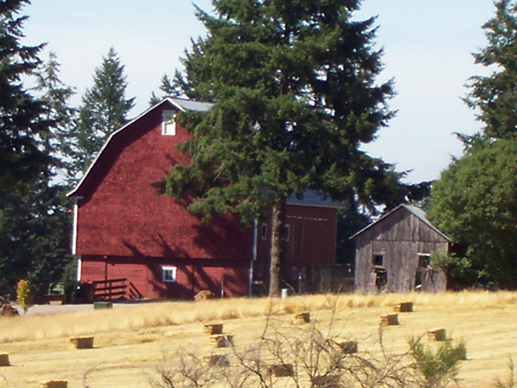
Landmark name Image Date listed Location City or Town Summary 1 David and Maggie Aegerter Barn 
July 15, 1999 41915 Ridge Dr.
44°44′54″N 122°44′37″W / 44.74833°N 122.74361°WScio 2 Albany Custom Mill 
February 12, 1980 213 Water St.
44°38′18″N 123°6′23″W / 44.63833°N 123.10639°WAlbany 3 Albany Downtown Commercial Historic District 
December 9, 1982 Roughly bounded by the Willamette River and Montgomery, Washington, and 5th Sts.
44°38′12″N 123°6′22″W / 44.63667°N 123.10611°WAlbany 4 Albany Monteith Historic District 
February 29, 1980 Roughly bounded by 2nd, Lyon, 12th and Elm Sts.; also Elm St. southwest to Calapooia and 19th Ave., SW. to 11th and 12th Aves., SW.
44°37′55″N 123°6′31″W / 44.63194°N 123.10861°WAlbany Second set of boundaries represents a boundary increase of November 13, 2008 5 Albany Municipal Airport 
June 3, 1998 3510 Knox Butte Rd.
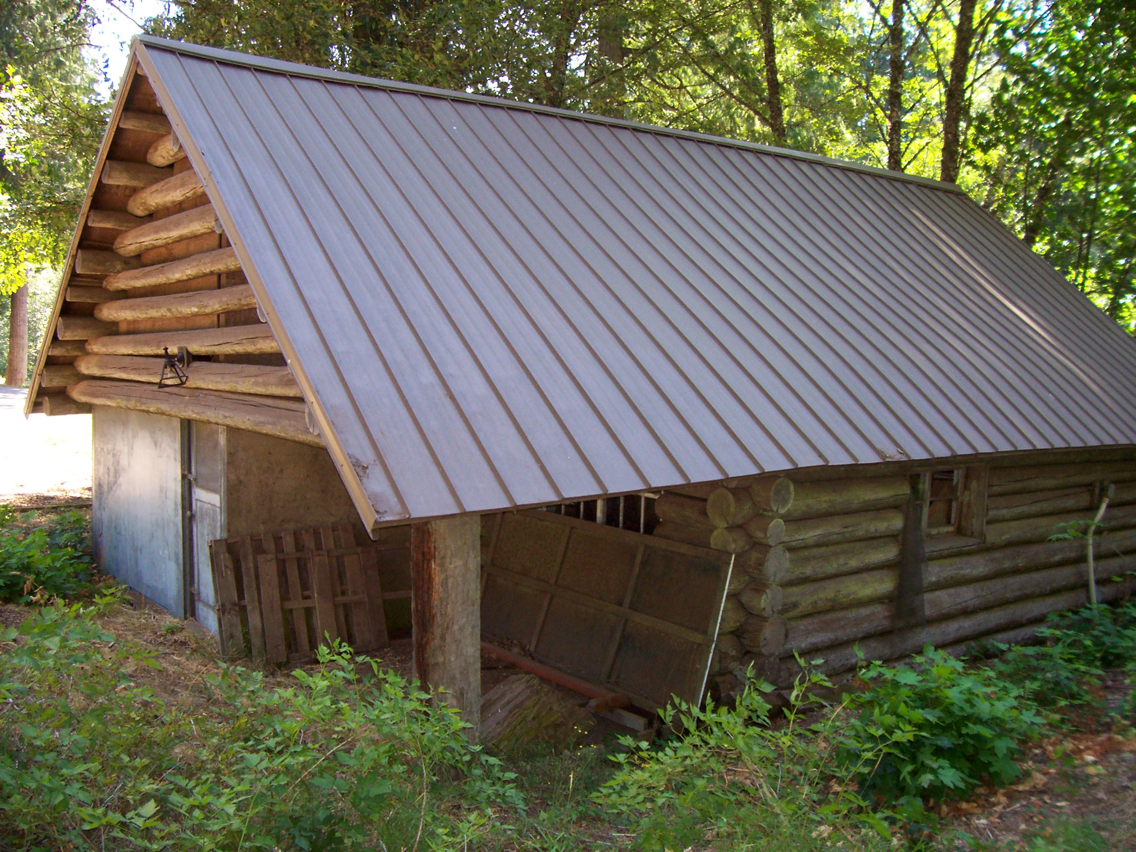
44°38′24″N 123°3′29″W / 44.64°N 123.05806°WAlbany 6 Steven and Elizabeth Archibald Farmstead 
September 22, 2004 31888 Wirth Rd.
44°30′47″N 123°4′46″W / 44.51306°N 123.07944°WTangent 7 Jerry Andrus House October 25, 2011 1638 1st Ave. E.
44°38′22″N 123°5′6″W / 44.63944°N 123.085°WAlbany 8 Granville H. Baber House 
October 29, 1975 Northeast of Albany off U.S. 99
44°40′43″N 123°1′18″W / 44.67861°N 123.02167°WAlbany 9 Hiram Baker House 
June 3, 1996 515 E. Grant St.
44°32′18″N 122°53′53″W / 44.53833°N 122.89806°WLebanon 10 Dr. J. C. Booth House 
April 1, 1980 486 Park St.
44°32′29″N 122°54′17″W / 44.54139°N 122.90472°WLebanon 11 Boston Flour Mill 
August 21, 1979 E of Shedd on Boston Mill Rd.
44°27′41″N 123°4′47″W / 44.46139°N 123.07972°WShedd 12 Hugh Leeper Brown Barn 
November 15, 1979 SE of Brownsville on OR 228
44°22′52″N 122°57′28″W / 44.38111°N 122.95778°WBrownsville 13 John and Amelia Brown Farmhouse 
November 22, 1978 SE of Brownsville on OR 228
44°22′56″N 122°57′53″W / 44.38222°N 122.96472°WBrownsville 14 Cascadia Cave 
October 25, 1990 Address Restricted Cascadia 15 George Earle Chamberlain House 
February 22, 1980 208 SE 7th St.
44°37′58″N 123°6′3″W / 44.63278°N 123.10083°WAlbany 16 Matthew C. Chambers Barn 
September 27, 1996 .4 mi. N of jct. of Knox Butte Rd. and Scravel Hill Rd.
44°39′11″N 123°1′23″W / 44.65306°N 123.02306°WAlbany 17 William Cochran Barn 
July 8, 1999 28485 Brownsville Rd.
44°25′18″N 122°59′13″W / 44.42167°N 122.98694°WBrownsville 18 George C. Cooley House 
May 9, 1983 220 Blakely Ave.
44°23′6″N 122°58′53″W / 44.385°N 122.98139°WBrownsville 19 Crabtree Creek-Hoffman Covered Bridge 
February 17, 1987 Hungry Hill Dr., 1.8 mi. N of Crabtree
44°39′13″N 122°53′21″W / 44.65361°N 122.88917°WCrabtree 20 Louis A. Crandall House 
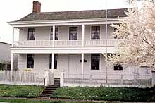
October 25, 1990 959 Main St.
44°32′13″N 122°54′20″W / 44.53694°N 122.90556°WLebanon 21 Crawfordsville Bridge 
November 29, 1979 SR 228
44°21′28″N 122°51′32″W / 44.35778°N 122.85889°WCrawfordsville 22 Alfred Dawson House 
February 12, 1980 731 SW Broadalbin St.
44°38′28″N 123°6′18″W / 44.64111°N 123.105°WAlbany 23 Elkins Flour Mill 
June 9, 1995 Bounded by US 20, Industrial Way, the Santiam-Albany Canal and the Callaghan RR tracks
44°32′52″N 122°54′19″W / 44.54778°N 122.90528°WLebanon 24 Hugh Fields House 
July 19, 1989 36176 OR 228
44°22′51″N 122°56′29″W / 44.38083°N 122.94139°WBrownsville 25 First Baptist Church of Brownsville 
June 19, 1991 515 N. Main St.
44°23′44″N 122°59′1″W / 44.39556°N 122.98361°WBrownsville 26 First Evangelical Church of Albany 
August 1, 1984 1120 SW. 12th Ave.
44°37′38″N 123°6′52″W / 44.62722°N 123.11444°WAlbany 27 Flinn Block 
March 2, 1979 222 SW. 1st Ave.
44°38′13″N 123°6′21″W / 44.63694°N 123.10583°WAlbany 28 Hackleman Historic District March 15, 1982 Roughly bounded by Pacific Boulevard and Lyons, 2nd and Madison Sts.
44°38′6″N 123°5′54″W / 44.635°N 123.09833°WAlbany 29 Hannah Bridge 
November 29, 1979 Burmester Creek Rd.
44°42′44″N 122°43′4″W / 44.71222°N 122.71778°WScio 30 Harrisburg Odd Fellows Hall 
October 15, 1992 190 Smith St.
44°16′20″N 123°10′12″W / 44.27222°N 123.17°WHarrisburg 31 George Hochstedler House 
October 10, 1980 237 SE 6th Ave.
44°38′2″N 123°6′2″W / 44.63389°N 123.10056°WAlbany 32 C. J. Howe Building 
April 1, 1980 104 Spaulding Ave.
44°23′38″N 122°59′0″W / 44.39389°N 122.983333°WBrownsville 33 Independence Prairie Ranger Station 
March 29, 1983 Williamette National Forest
44°37′2″N 121°56′22″W / 44.61722°N 121.93944°WMarion Forks 34 Larwood Bridge 
November 29, 1979 E of Crabtree
44°37′48″N 122°44′21″W / 44.63°N 122.73917°WCrabtree 35 Lebanon Pioneer Cemetery 
March 5, 1998 200 Dodge St.
44°32′40″N 122°54′14″W / 44.54444°N 122.90389°WLebanon 36 Lebanon Southern Pacific Railroad Depot 
June 13, 1997 735 Third St.
44°32′19.8″N 122°54′36.3″W / 44.538833°N 122.910083°WLebanon 37 Hector and Margaret Macpherson Barn 
July 8, 1999 29780 Church Dr.
44°30′42″N 123°11′32″W / 44.51167°N 123.19222°WAlbany 38 Marion Forks Guard Station 
March 6, 1991 OR 22, Willamette NF
44°36′51″N 121°56′56″W / 44.61417°N 121.94889°WMarion Forks 39 Joseph and Barbara Maurer House 
September 27, 1996 35168 Tennessee Rd.
44°36′14″N 122°55′21″W / 44.60389°N 122.9225°WLebanon 40 Methodist Episcopal Church South 
November 16, 1979 238 E. 3rd St
44°38′10″N 123°6′4″W / 44.63611°N 123.10111°WAlbany 41 Gottlieb and Della Milde Barn 
July 15, 1999 36898 Northern Dr.
44°22′34″N 122°54′55″W / 44.37611°N 122.91528°WBrownsville 42 Thomas and Walter Monteith House 
May 21, 1975 518 W. 2nd Ave.
44°38′10″N 123°6′33″W / 44.63611°N 123.10917°WAlbany 43 John and Mary Moore House 
October 1, 2001 320 Kirk Ave.
44°23′33″N 122°58′49″W / 44.3925°N 122.98028°WBrownsville 44 John M. Moyer House 
January 21, 1974 204 Main St.
44°23′35″N 122°59′3″W / 44.39306°N 122.98417°WBrownsville 45 Mt. Pleasant Presbyterian Church 
January 24, 1974 S of Stayton on Stayton-Jordan Rd.
44°45′31″N 122°44′38″W / 44.75861°N 122.74389°WStayton 46 Moses Parker House 
August 25, 1980 638 SE 5th St.
44°38′9″N 123°5′45″W / 44.63583°N 123.09583°WAlbany 47 Oregon Pacific Railroad Linear Historic District 
October 29, 1999 Roughly a 20 mile section of the old railroad grade between Indanha and the Cascade Range summit
44°27′10″N 121°53′57″W / 44.45278°N 121.89917°WSantiam Junction Apparently in three counties: Jefferson, Linn, and Marion County. 48 E. C. Perry Building 
May 29, 1998 38731 N. Main St.
44°42′18″N 122°50′50″W / 44.705°N 122.84722°WScio 49 Porter-Brasfield House 
November 25, 1980 31838 Fayetteville Dr.
44°27′41″N 123°6′36″W / 44.46139°N 123.11°WShedd 50 John and Lottie Ralston Cottage 
March 5, 1998 481 Main St.
44°32′29″N 122°54′20″W / 44.54139°N 122.90556°WLebanon 51 John Ralston House 
December 9, 1981 632 SE Baker St.
44°37′59″N 123°6′6″W / 44.63306°N 123.10167°WAlbany 52 Rock Hill School 
June 4, 1992 Rock Hill Dr., 2.2 mi. E of Sand Ridge Rd.
44°28′59″N 122°56′50″W / 44.48306°N 122.94722°WLebanon 53 Ross-Averill House 
February 20, 1991 420 Averill St.
44°23′41″N 122°59′4″W / 44.39472°N 122.98444°WBrownsville 54 Michael and Mary Ryan Barn 
July 15, 1999 40363 Huntley Rd.
44°45′7″N 122°44′26″W / 44.75194°N 122.74056°WScio 55 Santiam Wagon Road[1] 
September 23, 2010[1] Willamette National Forest and Deschutes National Forest[1] Cascadia and Sisters vicinity[1] Extends into Deschutes County.[2] 56 Short Bridge 
November 29, 1979 High Deck Rd.
44°23′30″N 122°30′31″W / 44.39167°N 122.50861°WCascadia 57 James Alexander and Elmarion Smith Barn and Lame-Smith House 
July 15, 1999 28020 Powerline Rd.
44°24′18″N 123°7′6″W / 44.405°N 123.11833°WHalsey 58 Starr and Blakely Drug Store 
October 29, 1982 421 N. Main St.
44°23′40″N 122°59′1″W / 44.39444°N 122.98361°WBrownsville 59 Gus and Emma Stellmacher Farmstead 
August 28, 1998 32404 Tangent Loop
44°31′29″N 123°5′36″W / 44.52472°N 123.09333°WTangent 60 Thomas Creek-Gilkey Covered Bridge 
February 19, 1987 Goar Rd., 3 mi. N of Crabtree
44°41′17″N 122°54′8″W / 44.68806°N 122.90222°WCrabtree 61 Thomas Creek-Shimanek Covered Bridge 
February 19, 1987 Richardson Gap Rd., 2 mi. E of Scio
44°42′57″N 122°48′12″W / 44.71583°N 122.80333°WScio 62 United Presbyterian Church and Rectory 
April 18, 1979 510 SW 5th Ave.
44°38′5″N 123°6′27″W / 44.63472°N 123.1075°WAlbany 63 United Presbyterian Church of Shedd 
March 5, 1998 30045 OR 99 E
44°27′38″N 123°6′31″W / 44.46056°N 123.10861°WShedd 64 Joseph Wesely House and Barn 
October 23, 1986 38791 OR 226
44°41′51″N 122°50′52″W / 44.6975°N 122.84778°WScio 65 Wigle Cemetery 
September 22, 2004 Belts Dr.
44°18′17″N 123°1′0″W / 44.30472°N 123.016667°WHarrisburg 66 Abraham and Mary Wigle House 
May 1, 2003 34050 Belts Dr.
44°18′5″N 123°1′26″W / 44.30139°N 123.02389°WHarrisburg 67 Jacob and Maranda K. Wigle Farmstead 
March 5, 1992 1119 Kirk Ave.
44°23′35″N 122°57′59″W / 44.39306°N 122.96639°WBrownsville 68 Z.C.B.J. Tolstoj Lodge No. 224 
September 14, 1995 37091 Richardson Gap Rd.
44°39′37″N 122°48′10″W / 44.66028°N 122.80278°WScio Former listings
Landmark name Image Date listed/removed Location City or Town Summary 1 Angell-Brewster House 
Listed October 8, 1992
Removed April 20, 201134191 Brewster Rd.
44°34′46″N 122°52′12″W / 44.57944°N 122.87°WLebanon vicinity References
- ^ a b c d National Park Service (2010-10-01). "Weekly List of Actions Taken on Properties: 9/20/10 through 9/24/10". http://www.nps.gov/history/nr/listings/20101001.htm. Retrieved 2010-10-01.
- ^ State Advisory Committee on Historic Preservation (2009-10-22). "Draft Meeting Minutes" (PDF). http://www.oregon.gov/OPRD/HCD/NATREG/docs/sachp_docs/october_sachp_meetingminutes.pdf?ga=t. Retrieved 2010-10-01.
External links
 Media related to National Register of Historic Places in Linn County, Oregon at Wikimedia Commons
U.S. National Register of Historic Places in Oregon Lists by county Baker • Benton • Clackamas • Clatsop • Columbia • Coos • Crook • Curry • Deschutes • Douglas • Gilliam • Grant • Harney • Hood River • Jackson • Jefferson • Josephine • Klamath • Lake • Lane • Lincoln • Linn • Malheur • Marion • Morrow • Multnomah: Portland North • Multnomah: Portland Northeast • Multnomah: Portland Northwest • Multnomah: Portland Southeast • Multnomah: Portland Southwest • Multnomah: Other • Polk • Sherman • Tillamook • Umatilla • Union • Wallowa • Wasco • Washington • Wheeler • Yamhill
Other lists Categories:- National Register of Historic Places in Linn County, Oregon
- Linn County, Oregon


Wikimedia Foundation. 2010.