There are 49 properties and districts listed on the National Register in the county. More may be added; properties and districts nationwide are added to the Register weekly.[2]
| [4] |
Landmark name [5] |
Image |
Date listed |
Location |
City or town |
Summary |
| 1 |
Administration Building, University of Idaho |
|
01978-02-14February 14, 1978 |
University of Idaho campus
46°43′33″N 117°00′36″W / 46.725833°N 117.01°W / 46.725833; -117.01 (Administration Building, University of Idaho) |
Moscow |
|
| 2 |
American Legion Cabin |
|
01986-09-11September 11, 1986 |
Alternate U.S. Route 95
46°55′16″N 116°53′21″W / 46.921111°N 116.889167°W / 46.921111; -116.889167 (American Legion Cabin) |
Potlatch |
|
| 3 |
Bank of Juliaetta |
|
01998-01-15January 15, 1998 |
301 Main St.
46°34′41″N 116°42′22″W / 46.578056°N 116.706111°W / 46.578056; -116.706111 (Bank of Juliaetta) |
Juliaetta |
|
| 4 |
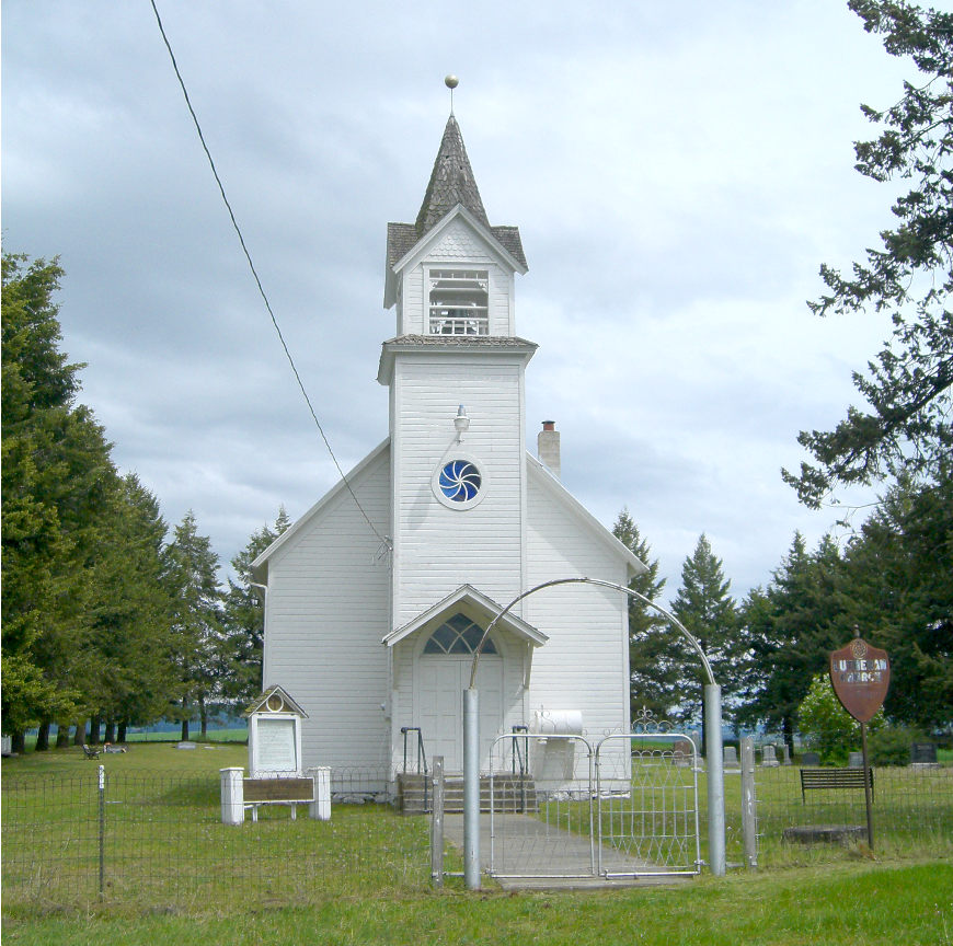
Bethany Memorial Chapel |
|
01979-12-06December 6, 1979 |
Kendrick-Deary Highway
46°39′52″N 116°37′22″W / 46.664444°N 116.622778°W / 46.664444; -116.622778 (Bethany Memorial Chapel) |
Kendrick |
|
| 5 |
Boarding House |
|
01986-09-11September 11, 1986 |
850 Pine St.
46°55′28″N 116°53′59″W / 46.924444°N 116.899722°W / 46.924444; -116.899722 (Boarding House) |
Potlatch |
|
| 6 |
Axel Bohman House |
|
02011-08-10August 10, 2011 |
116 N. Main St.
46°44′18″N 116°46′17″W / 46.738333°N 116.771389°W / 46.738333; -116.771389 (Axel Bohman House) |
Troy |
|
| 7 |
Bovill Opera House |
|
02010-01-27January 27, 2010 |
412 2nd Ave.
46°51′34″N 116°23′42″W / 46.859486°N 116.394933°W / 46.859486; -116.394933 (Bovill Opera House) |
Bovill |
|
| 8 |
Commercial Historic District |
|
01986-09-11September 11, 1986 |
Roughly Pine St. between 7th and 5th Sts.
46°55′18″N 116°54′01″W / 46.921667°N 116.900278°W / 46.921667; -116.900278 (Commercial Historic District) |
Potlatch |
|
| 9 |
Cordelia Lutheran Church |
|
01995-08-31August 31, 1995 |
South of the junction of Genesee-Troy and Danielson Rds.
46°39′54″N 116°54′17″W / 46.665°N 116.904722°W / 46.665; -116.904722 (Cordelia Lutheran Church) |
Moscow |
|
| 10 |
Mason Cornwall House |
|
01977-12-02December 2, 1977 |
308 S. Hayes St.
46°43′56″N 116°59′14″W / 46.732222°N 116.987222°W / 46.732222; -116.987222 (Mason Cornwall House) |
Moscow |
|
| 11 |
Cox Barn |
|
02010-02-01February 1, 2010 |
1290 American Ridge Rd.
46°36′25″N 116°42′53″W / 46.606839°N 116.714708°W / 46.606839; -116.714708 (Cox Barn) |
Kendrick |
|
| 12 |
Davids' Building |
|
01979-12-11December 11, 1979 |
3rd and Main Sts.
46°43′56″N 117°00′01″W / 46.732222°N 117.000278°W / 46.732222; -117.000278 (Davids' Building) |
Moscow |
|
| 13 |
Deesten Farmstead |
|
02008-04-02April 2, 2008 |
3611 U.S. Route 95, S.
46°48′38″N 117°00′29″W / 46.81062°N 117.00818°W / 46.81062; -117.00818 (Deesten Farmstead) |
Moscow |
|
| 14 |
First Methodist Church |
|
01978-10-05October 5, 1978 |
322 E. 3rd St.
46°43′57″N 116°59′48″W / 46.7325°N 116.996667°W / 46.7325; -116.996667 (First Methodist Church) |
Moscow |
|
| 15 |
Fort Russell Neighborhood Historic District |
|
01980-11-26November 26, 1980 |
Roughly bounded by Jefferson, Monroe, 2nd, and D Sts.
46°44′07″N 116°58′51″W / 46.735278°N 116.980833°W / 46.735278; -116.980833 (Fort Russell Neighborhood Historic District) |
Moscow |
|
| 16 |
Four-Room House |
|
01986-09-11September 11, 1986 |
1015 Pine St.
46°55′34″N 116°53′56″W / 46.926111°N 116.898889°W / 46.926111; -116.898889 (Four-Room House) |
Potlatch |
|
| 17 |
Freeze Community Church |
|
01990-05-03May 3, 1990 |
1 mile west of U.S. Route 95
46°57′23″N 116°57′34″W / 46.956389°N 116.959444°W / 46.956389; -116.959444 (Freeze Community Church) |
Potlatch |
|
| 18 |
Genesee Exchange Bank |
|
01979-01-08January 8, 1979 |
Walnut St.
46°33′04″N 116°55′23″W / 46.551111°N 116.923056°W / 46.551111; -116.923056 (Genesee Exchange Bank) |
Genesee |
|
| 19 |
Hotel Bovill |
|
01994-06-23June 23, 1994 |
602 Park St. (State Highway 3)
46°51′40″N 116°23′43″W / 46.861111°N 116.395278°W / 46.861111; -116.395278 (Hotel Bovill) |
Bovill |
|
| 20 |
Hotel Moscow |
|
01978-11-30November 30, 1978 |
4th and Main Sts.
46°43′55″N 117°00′03″W / 46.731944°N 117.000833°W / 46.731944; -117.000833 (Hotel Moscow) |
Moscow |
|
| 21 |
Hotel Rietmann |
|
02001-11-29November 29, 2001 |
525 and 529 S. Main St.
46°44′03″N 116°45′58″W / 46.734167°N 116.766111°W / 46.734167; -116.766111 (Hotel Rietmann) |
Troy |
|
| 22 |
Kappa Sigma Fraternity, Gamma Theta Chapter |
|
01996-09-03September 3, 1996 |
918 Blake St.
46°43′35″N 117°00′25″W / 46.726389°N 117.006944°W / 46.726389; -117.006944 (Kappa Sigma Fraternity, Gamma Theta Chapter) |
Moscow |
|
| 23 |
Kenworthy Theatre |
|
02001-11-29November 29, 2001 |
508 S. Main St.
46°43′52″N 117°00′01″W / 46.731111°N 117.000278°W / 46.731111; -117.000278 (Kenworthy Theatre) |
Moscow |
|
| 24 |
Thomas Kirby House |
|
01999-04-01April 1, 1999 |
102 N. 9th St.
46°36′51″N 116°38′41″W / 46.614167°N 116.644722°W / 46.614167; -116.644722 (Thomas Kirby House) |
Kendrick |
|
| 25 |
Almon Asbury Lieuallen House |
|
01978-01-03January 3, 1978 |
101 S. Almon St.
46°44′01″N 117°00′12″W / 46.733611°N 117.003333°W / 46.733611; -117.003333 (Almon Asbury Lieuallen House) |
Moscow |
|
| 26 |
W.J. McConnell House |
|
01974-11-21November 21, 1974 |
110 S. Adams St.
46°43′59″N 116°59′45″W / 46.733056°N 116.995833°W / 46.733056; -116.995833 (W.J. McConnell House) |
Moscow |
|
| 27 |
McConnell-McGuire Building |
|
01978-02-07February 7, 1978 |
Main and 1st Sts.
46°44′01″N 117°00′01″W / 46.733611°N 117.000278°W / 46.733611; -117.000278 (McConnell-McGuire Building) |
Moscow |
|
| 28 |
Memorial Gymnasium |
|
01977-10-05October 5, 1977 |
University of Idaho campus
46°43′36″N 117°00′46″W / 46.726667°N 117.012778°W / 46.726667; -117.012778 (Memorial Gymnasium) |
Moscow |
|
| 29 |
Moscow Carnegie Library |
|
01979-06-18June 18, 1979 |
110 S. Jefferson St.
46°44′00″N 116°59′51″W / 46.733333°N 116.9975°W / 46.733333; -116.9975 (Moscow Carnegie Library) |
Moscow |
|
| 30 |
Moscow Downtown Historic District |
|
02005-07-22July 22, 2005 |
Generally bounded by 1st St., 6th St., Washington St., and the alley between Main and Jackson
46°43′55″N 117°00′01″W / 46.731944°N 117.000278°W / 46.731944; -117.000278 (Moscow Downtown Historic District) |
Moscow |
|
| 31 |
Moscow High School |
|
01992-05-05May 5, 1992 |
410 3rd E.
46°44′30″N 116°59′46″W / 46.741667°N 116.996111°W / 46.741667; -116.996111 (Moscow High School) |
Moscow |
|
| 32 |
Moscow Post Office and Courthouse |
|
01973-07-03July 3, 1973 |
Washington and 3rd Sts.
46°43′58″N 116°59′55″W / 46.732778°N 116.998611°W / 46.732778; -116.998611 (Moscow Post Office and Courthouse) |
Moscow |
Moscow City Hall |
| 33 |
Nob Hill Historic District |
|
01986-09-11September 11, 1986 |
Roughly bounded by 4th, Spruce, 3rd, and Cedar Sts.
46°55′12″N 116°53′46″W / 46.92°N 116.896111°W / 46.92; -116.896111 (Nob Hill Historic District) |
Potlatch |
|
| 34 |
Nordby Farmstead |
|
02009-05-15May 15, 2009 |
1301 Old U.S. Route 95
46°33′49″N 116°54′29″W / 46.563511°N 116.908139°W / 46.563511; -116.908139 (Nordby Farmstead) |
Genesee |
|
| 35 |
Nu Art Theatre |
|
02001-11-29November 29, 2001 |
516 S. Main St.
46°43′52″N 117°00′01″W / 46.731111°N 117.000278°W / 46.731111; -117.000278 (Nu Art Theatre) |
Moscow |
|
| 36 |
Ridenbaugh Hall |
|
01977-09-14September 14, 1977 |
University of Idaho campus
46°43′28″N 117°00′28″W / 46.724444°N 117.007778°W / 46.724444; -117.007778 (Ridenbaugh Hall) |
Moscow |
|
| 37 |
St. Joseph's Catholic Church |
|
01982-11-17November 17, 1982 |
1st and Cedar
46°51′31″N 116°23′42″W / 46.858611°N 116.395°W / 46.858611; -116.395 (St. Joseph's Catholic Church) |
Bovill |
|
| 38 |
Sigma Alpha Epsilon Fraternity House |
|
01993-12-02December 2, 1993 |
920 Deakin St.
46°43′34″N 117°00′20″W / 46.726111°N 117.005556°W / 46.726111; -117.005556 (Sigma Alpha Epsilon Fraternity House) |
Moscow |
|
| 39 |
Skattaboe Block |
|
01978-05-22May 22, 1978 |
Main and 4th Sts.
46°43′53″N 117°00′03″W / 46.731389°N 117.000833°W / 46.731389; -117.000833 (Skattaboe Block) |
Moscow |
|
| 40 |
Arthur Snow House |
|
02009-05-05May 5, 2009 |
2949 Clyde Rd.
46°41′34″N 117°00′38″W / 46.692914°N 117.010489°W / 46.692914; -117.010489 (Arthur Snow House) |
Moscow |
|
| 41 |
Edward and Ida Soncarty Barn |
|
02008-04-02April 2, 2008 |
1671 Deep Creek Rd.
47°01′34″N 116°53′36″W / 47.02618°N 116.89344°W / 47.02618; -116.89344 (Edward and Ida Soncarty Barn) |
Potlatch |
|
| 42 |
Joseph A. Terteling House |
|
01986-09-11September 11, 1986 |
1015 Fir St.
46°55′34″N 116°54′01″W / 46.926111°N 116.900278°W / 46.926111; -116.900278 (Joseph A. Terteling House) |
Potlatch |
|
| 43 |
Three-Room House |
|
01986-09-11September 11, 1986 |
940 Cedar St.
46°55′31″N 116°53′51″W / 46.925278°N 116.8975°W / 46.925278; -116.8975 (Three-Room House) |
Potlatch |
|
| 44 |
Troy Downtown Historic District |
|
02010-03-11March 11, 2010 |
339 S. Main St. through 527 S. Main St.
46°44′04″N 116°46′01″W / 46.734444°N 116.766944°W / 46.734444; -116.766944 (Troy Downtown Historic District) |
Troy |
|
| 45 |
Troy Hospital |
|
02011-08-10August 10, 2011 |
604 S. Main St.
46°44′00″N 116°45′56″W / 46.733333°N 116.765556°W / 46.733333; -116.765556 (Troy Hospital) |
Troy |
|
| 46 |
University of Idaho Gymnasium and Armory |
|
01983-01-03January 3, 1983 |
University of Idaho campus
46°43′35″N 117°00′40″W / 46.726389°N 117.011111°W / 46.726389; -117.011111 (University of Idaho Gymnasium and Armory) |
Moscow |
|
| 47 |
Vollmer Building |
|
01979-01-08January 8, 1979 |
Walnut St.
46°33′04″N 116°55′16″W / 46.551111°N 116.921111°W / 46.551111; -116.921111 (Vollmer Building) |
Genesee |
|
| 48 |
White Spring Ranch |
|
02004-01-06January 6, 2004 |
1004 Lorang Rd.
46°38′38″N 116°56′53″W / 46.643889°N 116.948056°W / 46.643889; -116.948056 (White Spring Ranch) |
Genesee |
|
| 49 |
Workers' Neighborhood Historic District |
|
01986-09-11September 11, 1986 |
Roughly Spruce St. between 8th and 5th
46°55′21″N 116°53′44″W / 46.9225°N 116.895556°W / 46.9225; -116.895556 (Workers' Neighborhood Historic District) |
Potlatch |
|
 Location of Latah County in Idaho
 Ada • Adams • Bannock • Bear Lake • Benewah • Bingham • Blaine • Boise • Bonner • Bonneville • Boundary • Butte • Camas • Canyon • Caribou • Cassia • Clark • Clearwater • Custer • Elmore • Franklin • Fremont • Gem • Gooding • Idaho • Jefferson • Jerome • Kootenai • Latah • Lemhi • Lewis • Lincoln • Madison • Minidoka • Nez Perce • Oneida • Owyhee • Payette • Power • Shoshone • Teton • Twin Falls • Valley • Washington
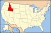
 Category:National Register of Historic Places •
  Portal:National Register of Historic Places