- National Register of Historic Places listings in Lake County, Oregon
-
This is a list of properties and districts in Lake County, Oregon that are listed on the National Register of Historic Places.
Current listings
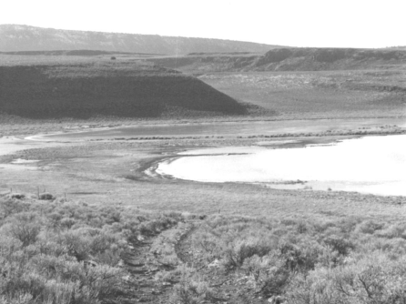
[1] Landmark name Image Date listed Location City or town Summary 1 Abert Lake Petroglyphs November 20, 1974 Address Restricted Lakeview 2 Bailey and Massingill Store October 25, 1984 4 N. E St.
42°11′23″N 120°20′37″W / 42.189722°N 120.343611°WLakeview 3 Cabin Lake Guard Station 
April 11, 1986 Deschutes National Forest
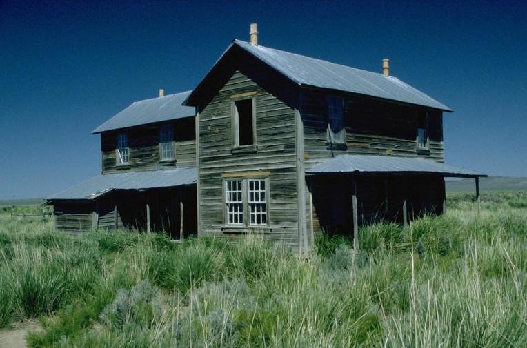
43°29′27″N 121°03′22″W / 43.490833°N 121.056111°WBend 4 East Lake Abert Archeological District November 29, 1978 Address Restricted Valley Falls 5 Ed Eskelin Ranch Complex February 25, 1991 HC 61, Fort Rock Valley
43°15′02″N 120°54′39″W / 43.250556°N 120.910833°WSilver Lake 6 Fort Rock Cave 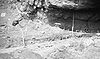
October 15, 1966 Address Restricted Fort Rock 7 Greaser Petroglyph Site 
November 20, 1974 Address Restricted Adel 8 Heryford Brothers Building 
April 30, 1980 524 Center St.
42°11′23″N 120°20′40″W / 42.189722°N 120.344444°WLakeview 9 William P. Heryford House May 22, 1980 108 S. F St.
42°11′18″N 120°20′42″W / 42.188333°N 120.345°WLakeview 10 Lake County Round Sale Barn November 21, 2003 3531 S. 6th St.
42°11′43″N 120°21′37″W / 42.195278°N 120.360278°WLakeview 11 Mitchell Recreation Area 
February 20, 2003 Forest Service Rd. 34, Fremont National Forest
42°25′52″N 120°51′27″W / 42.431111°N 120.8575°WBly 12 Nevada-California-Oregon Railway Passenger Station August 22, 1983 1400 Center St.
42°11′22″N 120°21′17″W / 42.189444°N 120.354722°WLakeview 13 Picture Rock Pass Petroglyphs Site August 28, 1975 Address Restricted Silver Lake 14 David L. Shirk Ranch 
November 4, 2009 Guano Valley
42°18′N 119°29′W / 42.3°N 119.483°WAdel 15 Post and King Saloon March 17, 1977 N. 2nd and E Sts.
42°11′27″N 120°20′38″W / 42.190833°N 120.343889°WLakeview 16 Stone Bridge and the Oregon Central Military Wagon Road 
November 8, 1974 The Narrows S of Plush
42°21′05″N 119°50′26″W / 42.351389°N 119.840556°WPlush 17 John N. and Cornelia Watson House February 21, 1989 5 N. H St.
42°11′23″N 120°20′51″W / 42.189722°N 120.3475°WLakeview References
- ^ Numbers represent an ordering by significant words. Various colorings, defined here, differentiate National Historic Landmark sites and National Register of Historic Places Districts from other NRHP buildings, structures, sites or objects.
U.S. National Register of Historic Places in Oregon Lists by county Baker • Benton • Clackamas • Clatsop • Columbia • Coos • Crook • Curry • Deschutes • Douglas • Gilliam • Grant • Harney • Hood River • Jackson • Jefferson • Josephine • Klamath • Lake • Lane • Lincoln • Linn • Malheur • Marion • Morrow • Multnomah: Portland North • Multnomah: Portland Northeast • Multnomah: Portland Northwest • Multnomah: Portland Southeast • Multnomah: Portland Southwest • Multnomah: Other • Polk • Sherman • Tillamook • Umatilla • Union • Wallowa • Wasco • Washington • Wheeler • Yamhill
Other lists Keeper of the Register • History of the National Register of Historic Places • Property types • Historic district • Contributing property Categories:- National Register of Historic Places listings by county in Oregon
- Lake County, Oregon


Wikimedia Foundation. 2010.