- National Register of Historic Places listings in Jerome County, Idaho
-
 Location of Jerome County in Idaho
This is a list of the National Register of Historic Places listings in Jerome County, Idaho.
This is intended to be a complete list of the properties on the National Register of Historic Places in Jerome County, Idaho, United States. Latitude and longitude coordinates are provided for many National Register properties and districts; these locations may be seen together in a Google map.[1]
There are 65 properties listed on the National Register in the county. More can be added; properties and districts nationwide are added to the Register weekly.[2]
-
- This National Park Service list is complete through NPS recent listings posted November 10, 2011.[3]
Current listings
[4] Landmark name [5] Image Date listed Location City or town Summary 1 Allton Building September 8, 1983 160 E. Main St.
42°43′28″N 114°30′58″W / 42.724444°N 114.516111°WJerome 2 Tom Barnes Barn September 8, 1983 East of Jerome
42°39′53″N 114°17′46″W / 42.664722°N 114.296111°WJerome 3 Bethune-Ayres House September 8, 1983 East of Jerome
42°41′00″N 114°21′50″W / 42.683333°N 114.363889°WJerome 4 Carl Blessing Outbuildings September 8, 1983 Northwest of Jerome
42°45′11″N 114°35′26″W / 42.753056°N 114.590556°WJerome 5 James Bothwell Water Tank House September 8, 1983 North of Jerome
42°46′06″N 114°31′00″W / 42.768333°N 114.516667°WJerome 6 Charles Bower House September 8, 1983 North of Jerome
42°48′58″N 114°32′14″W / 42.816111°N 114.537222°WJerome 7 Frank J. Brick House September 8, 1983 300 N. Fillmore St.
42°43′35″N 114°30′28″W / 42.726389°N 114.507778°WJerome 8 Caldron Linn June 27, 1972 2 miles east of Murtaugh
42°29′53″N 114°09′46″W / 42.498056°N 114.162778°WMurtaugh Extends into Twin Falls County 9 Dick Callen House September 8, 1983 South of Jerome
42°40′36″N 114°31′02″W / 42.676667°N 114.517222°WJerome 10 Canyonside School October 14, 1983 South of Jerome
42°40′00″N 114°31′05″W / 42.666667°N 114.518056°WJerome 11 William H. Cook Water Tank House September 8, 1983 Southeast of Jerome
42°40′00″N 114°24′25″W / 42.666667°N 114.406944°WJerome 12 E.V. Cooke House September 8, 1983 Northeast of Jerome
42°45′19″N 114°28′16″W / 42.755278°N 114.471111°WJerome 13 O.J. Daniels House September 8, 1983 South of Jerome
42°39′16″N 114°31′04″W / 42.654444°N 114.517778°WJerome 14 George V. Doughty House and Garage September 15, 1983 Northeast of Jerome
42°46′58″N 114°28′40″W / 42.782778°N 114.477778°WJerome 15 George Epperson House September 8, 1983 Southeast of Jerome
42°40′12″N 114°27′47″W / 42.67°N 114.463056°WJerome 16 G.H. Erdman House September 8, 1983 West of Jerome
42°43′31″N 114°36′06″W / 42.725278°N 114.601667°WJerome 17 Falls City School House September 8, 1983 Southeast of Jerome
42°40′51″N 114°25′24″W / 42.680833°N 114.423333°WJerome 18 Merrit Fry Farm September 8, 1983 West of Jerome
42°41′58″N 114°36′51″W / 42.699444°N 114.614167°WJerome 19 F.C. Gleason House September 8, 1983 209 E. Ave. A
42°43′22″N 114°30′54″W / 42.722778°N 114.515°WJerome 20 Hugh and Susie Goff House September 8, 1983 Northeast of Jerome
42°48′42″N 114°28′19″W / 42.811667°N 114.471944°WJerome 21 Lulu Graves Farm September 8, 1983 Northwest of Jerome
42°45′34″N 114°32′15″W / 42.759444°N 114.5375°WJerome 22 Edward M. Gregg Farm September 8, 1983 Southeast of Jerome
42°40′49″N 114°30′02″W / 42.680278°N 114.500556°WJerome 23 Bert and Fay Havens House September 8, 1983 North of Hazelton
42°36′18″N 114°07′58″W / 42.605°N 114.132778°WHazelton 24 Hazelton Presbyterian Church April 26, 1991 310 Park Ave.
42°35′42″N 114°08′05″W / 42.595°N 114.134722°WHazelton 25 Huer Well House/Water Tank September 8, 1983 Northeast of Jerome
42°46′02″N 114°26′38″W / 42.767222°N 114.443889°WJerome 26 Jerome City Pump House September 8, 1983 600 block of E. B St.
42°43′22″N 114°30′32″W / 42.722778°N 114.508889°WJerome 27 Jerome Cooperative Creamery September 8, 1983 313 S. Birch St.
42°43′21″N 114°31′18″W / 42.7225°N 114.521667°WJerome 28 Jerome County Courthouse 
September 28, 1987 N. Lincoln
42°43′36″N 114°31′01″W / 42.726667°N 114.516944°WJerome 29 Jerome First Baptist Church September 8, 1983 1st Ave., E.
42°43′32″N 114°30′50″W / 42.725556°N 114.513889°WJerome 30 Jerome National Bank 
January 9, 1978 100 E. Main St.
42°43′27″N 114°31′06″W / 42.72414°N 114.51842°WJerome 31 Edgar Johnson House September 8, 1983 South of Jerome
42°40′50″N 114°30′27″W / 42.680556°N 114.5075°WJerome 32 Clarence Keating House September 8, 1983 Northeast of Jerome
42°45′26″N 114°27′41″W / 42.757222°N 114.461389°WJerome 33 Thomas J. Kehrer House September 8, 1983 North of Jerome
42°48′59″N 114°31′42″W / 42.816389°N 114.528333°WJerome 34 Marion and Julia Kelley House September 8, 1983 450 4th St., E.
42°35′31″N 114°07′56″W / 42.591944°N 114.132222°WHazelton 35 Ben Laughlin Water Tank House-Garage September 8, 1983 East of Jerome
42°40′29″N 114°23′06″W / 42.674722°N 114.385°WJerome 36 George Lawshe Well House September 8, 1983 Southeast of Jerome
42°39′59″N 114°25′27″W / 42.666389°N 114.424167°WJerome 37 J.O. Lee House September 8, 1983 5th Ave., E.
42°43′45″N 114°30′46″W / 42.729167°N 114.512778°WJerome 38 J.O. Lee Honey House September 8, 1983 5th Ave., E.
42°43′45″N 114°30′47″W / 42.729167°N 114.513056°WJerome 39 Joseph Mandl House September 8, 1983 800 N. Fillmore St.
42°43′52″N 114°30′28″W / 42.731111°N 114.507778°WJerome 40 Milner Dam and the Twin Falls Main Canal 
July 10, 1986 Twin Falls Main Canal between Murtaugh and Milner Lakes
42°29′58″N 114°04′50″W / 42.499444°N 114.080556°WMilner Butte Extends into Twin Falls County 41 Minidoka Internment National Monument 
July 10, 1979 Hunt Rd.
42°40′42″N 114°15′00″W / 42.678333°N 114.25°WHunt 42 J.W. and Rachel Newman House and Bunkhouse September 8, 1983 East of Jerome
42°39′53″N 114°19′28″W / 42.664722°N 114.324444°WJerome 43 North Side Canal Company Slaughter House September 8, 1983 Northeast of Jerome
42°44′46″N 114°30′51″W / 42.746111°N 114.514167°WJerome 44 Jessie Osborne House September 8, 1983 West of Jerome
42°43′33″N 114°36′28″W / 42.725833°N 114.607778°WJerome 45 Greer and Jennie Quay House September 8, 1983 Northeast of Jerome
42°45′50″N 114°30′03″W / 42.763889°N 114.500833°WJerome 46 Julian T. Ricketts House September 8, 1983 Southeast of Jerome
42°40′51″N 114°25′15″W / 42.680833°N 114.420833°WJerome 47 John F. Schmerschall House September 8, 1983 248 E. Ave. A
42°43′27″N 114°30′53″W / 42.724167°N 114.514722°WJerome 48 L. Fay Shepard House September 8, 1983 South of Hazelton
42°30′41″N 114°08′57″W / 42.511389°N 114.149167°WHazelton 49 Shoshone Falls Power Plant Caretaker's House September 8, 1983 Southeast of Jerome
42°35′50″N 114°24′08″W / 42.597222°N 114.402222°WJerome 50 W.H. Silbaugh House September 8, 1983 West of Jerome
42°43′26″N 114°35′31″W / 42.723889°N 114.591944°WJerome 51 Edward S. Spencer House and Garage and the Fred Nelson Barn September 8, 1983 North of Jerome
42°49′27″N 114°30′10″W / 42.824167°N 114.502778°WJerome 52 Arnold Stevens House September 8, 1983 West of Jerome
42°43′32″N 114°35′12″W / 42.725556°N 114.586667°WJerome 53 John Stickel House September 8, 1983 West of Jerome
42°42′42″N 114°34′39″W / 42.711667°N 114.5775°WJerome 54 Sugarloaf School September 8, 1983 East of Jerome
42°41′26″N 114°21′54″W / 42.690556°N 114.365°WJerome 55 Thomason Rice Barn September 8, 1983 East of Jerome
42°41′40″N 114°23′00″W / 42.694444°N 114.383333°WJerome 56 Don Tooley House September 8, 1983 Northeast of Jerome
42°46′35″N 114°28′30″W / 42.776389°N 114.475°WJerome 57 Jay Van Hook Potato Cellar September 8, 1983 South of Jerome
42°41′50″N 114°31′05″W / 42.697222°N 114.518056°WJerome 58 Jacob B. Van Wagener Barn September 8, 1983 Southeast of Jerome
42°40′53″N 114°26′38″W / 42.681389°N 114.443889°WJerome 59 Jacob B. Van Wagener Caretaker's House September 8, 1983 Southeast of Jerome
42°41′01″N 114°26′35″W / 42.683611°N 114.443056°WJerome 60 William T. and Clara H. Veazie House September 8, 1983 Southwest of Jerome
42°40′30″N 114°34′33″W / 42.675°N 114.575833°WJerome 61 Charles C. Vineyard House September 8, 1983 Southwest of Eden
42°35′29″N 114°19′36″W / 42.591389°N 114.326667°WEden 62 Thomas Vipham House September 8, 1983 313 E. Ave. D
42°43′12″N 114°30′47″W / 42.72°N 114.513056°WJerome 63 Archie Webster House September 8, 1983 West Ave. and W. Ave. B
42°43′19″N 114°31′50″W / 42.721944°N 114.530556°WJerome 64 William Weigle House and Water Tank September 8, 1983 Northwest of Jerome
42°45′36″N 114°35′45″W / 42.76°N 114.595833°WJerome 65 Wilson Butte Cave 
November 21, 1974 Address Restricted Hunt See also
References
- ^ The latitude and longitude information provided in this table was derived originally from the National Register Information System, which has been found to be fairly accurate for about 99% of listings. For about 1% of NRIS original coordinates, experience has shown that one or both coordinates are typos or otherwise extremely far off; some corrections may have been made. A more subtle problem causes many locations to be off by up to 150 yards, depending on location in the country: most NRIS coordinates were derived from tracing out latitude and longitudes off of USGS topographical quadrant maps created under the North American Datum of 1927, which differs from the current, highly accurate WGS84 GPS system used by Google maps. Chicago is about right, but NRIS longitudes in Washington are higher by about 4.5 seconds, and are lower by about 2.0 seconds in Maine. Latitudes differ by about 1.0 second in Florida. Some locations in this table may have been corrected to current GPS standards.
- ^ "National Register of Historic Places: Weekly List Actions". National Park Service. http://www.cr.nps.gov/nr/nrlist.htm. Retrieved March 29, 2009.
- ^ "National Register of Historic Places: Weekly List Actions". National Park Service, United States Department of the Interior. Retrieved on November 10, 2011.
- ^ Numbers represent an ordering by significant words. Various colorings, defined here, differentiate National Historic Landmark sites and National Register of Historic Places Districts from other NRHP buildings, structures, sites or objects.
- ^ "National Register Information System". National Register of Historic Places. National Park Service. . http://nrhp.focus.nps.gov/natreg/docs/All_Data.html.
Properties on the National Register of Historic Places in Idaho  Ada • Adams • Bannock • Bear Lake • Benewah • Bingham • Blaine • Boise • Bonner • Bonneville • Boundary • Butte • Camas • Canyon • Caribou • Cassia • Clark • Clearwater • Custer • Elmore • Franklin • Fremont • Gem • Gooding • Idaho • Jefferson • Jerome • Kootenai • Latah • Lemhi • Lewis • Lincoln • Madison • Minidoka • Nez Perce • Oneida • Owyhee • Payette • Power • Shoshone • Teton • Twin Falls • Valley • Washington
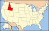
U.S. National Register of Historic Places Topics Lists by states Alabama • Alaska • Arizona • Arkansas • California • Colorado • Connecticut • Delaware • Florida • Georgia • Hawaii • Idaho • Illinois • Indiana • Iowa • Kansas • Kentucky • Louisiana • Maine • Maryland • Massachusetts • Michigan • Minnesota • Mississippi • Missouri • Montana • Nebraska • Nevada • New Hampshire • New Jersey • New Mexico • New York • North Carolina • North Dakota • Ohio • Oklahoma • Oregon • Pennsylvania • Rhode Island • South Carolina • South Dakota • Tennessee • Texas • Utah • Vermont • Virginia • Washington • West Virginia • Wisconsin • WyomingLists by territories Lists by associated states Other Municipalities and communities of Jerome County, Idaho Cities 
Unincorporated
communityCategories:- National Register of Historic Places in Idaho by county
- Jerome County, Idaho
-


Wikimedia Foundation. 2010.