- National Register of Historic Places listings in Jay County, Indiana
-
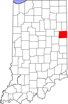 Location of Jay County in Indiana
This is a list of the National Register of Historic Places listings in Jay County, Indiana.
This is intended to be a complete list of the properties and districts on the National Register of Historic Places in Jay County, Indiana, United States. Latitude and longitude coordinates are provided for many National Register properties and districts; these locations may be seen together in a Google map.[1]
There are 8 properties and districts listed on the National Register in the county.
-
- This National Park Service list is complete through NPS recent listings posted November 10, 2011.[2]
Current listings
[3] Landmark name [4] Image Date listed Location City or town Summary 1 Floral Hall September 1, 1983 E. Votaw and Morton Sts. at the Jay County Fairgrounds
40°26′29″N 84°58′4″W / 40.44139°N 84.96778°W[5]Portland 2 Grouping of Religious Buildings at Trinity 
October 23, 1980 Northeast of Portland
40°32′29″N 84°50′28″W / 40.541389°N 84.841111°WPortland 3 James Haines Farm March 15, 2000 County Road 869E 200S
40°23′39″N 84°57′25″W / 40.394167°N 84.956944°WPortland 4 Jay County Courthouse 
May 12, 1981 U.S. Route 27
40°26′01″N 84°58′43″W / 40.433611°N 84.978611°WPortland 5 Portland Commercial Historic District 
May 30, 1996 Roughly Meridian St. from Arch St. to the S. Meridian St. Bridge, and Main and Walnut Sts. from Ship to Court Sts.
40°26′00″N 84°58′48″W / 40.433333°N 84.98°WPortland 6 Rebecca Rankin Round Barn 
April 2, 1993 State Road 18, ¼ mile west of its junction with County Road 75E
40°33′16″N 85°06′40″W / 40.554444°N 85.111111°WPoling 7 Redkey Historic District September 17, 1992 Roughly High St. between Oak and Meridian Sts.
40°20′59″N 85°09′07″W / 40.349722°N 85.151944°WRedkey 8 Jonas Votaw House December 6, 2004 1525 S. Meridian St.
40°24′47″N 84°58′34″W / 40.413056°N 84.976111°WPortland See also
- List of National Historic Landmarks in Indiana
- National Register of Historic Places listings in Indiana
References
- ^ The latitude and longitude information provided in this table was derived originally from the National Register Information System, which has been found to be fairly accurate for about 99% of listings. For about 1% of NRIS original coordinates, experience has shown that one or both coordinates are typos or otherwise extremely far off; some corrections may have been made. A more subtle problem causes many locations to be off by up to 150 yards, depending on location in the country: most NRIS coordinates were derived from tracing out latitude and longitudes off of USGS topographical quadrant maps created under North American Datum of 1927, which differs from the current, highly accurate GPS system used by Google maps. Chicago is about right, but NRIS longitudes in Washington are higher by about 4.5 seconds, and are lower by about 2.0 seconds in Maine. Latitudes differ by about 1.0 second in Florida. Some locations in this table may have been corrected to current GPS standards.
- ^ "National Register of Historic Places: Weekly List Actions". National Park Service, United States Department of the Interior. Retrieved on November 10, 2011.
- ^ Numbers represent an ordering by significant words. Various colorings, defined here, differentiate National Historic Landmark sites and National Register of Historic Places Districts from other NRHP buildings, structures, sites or objects.
- ^ "National Register Information System". National Register of Historic Places. National Park Service. . http://nrhp.focus.nps.gov/natreg/docs/All_Data.html.
- ^ Division of Historic Preservation and Archaeology. Jay County Interim Report. Indianapolis: Indiana Department of Natural Resources, 1985-07, 18. The NRIS lists the site at the nonexistent intersection of W. Votaw and Moton [sic] Sts.
U.S. National Register of Historic Places Topics Lists by states Alabama • Alaska • Arizona • Arkansas • California • Colorado • Connecticut • Delaware • Florida • Georgia • Hawaii • Idaho • Illinois • Indiana • Iowa • Kansas • Kentucky • Louisiana • Maine • Maryland • Massachusetts • Michigan • Minnesota • Mississippi • Missouri • Montana • Nebraska • Nevada • New Hampshire • New Jersey • New Mexico • New York • North Carolina • North Dakota • Ohio • Oklahoma • Oregon • Pennsylvania • Rhode Island • South Carolina • South Dakota • Tennessee • Texas • Utah • Vermont • Virginia • Washington • West Virginia • Wisconsin • WyomingLists by territories Lists by associated states Other  Category:National Register of Historic Places •
  Portal:National Register of Historic Places
Municipalities and communities of Jay County, Indiana County seat: Portland Cities 
Towns Townships Unincorporated
communitiesAntioch | Antiville | Balbec | Blaine | Bloomfield | Bluff Point | Boundary City | Brice | Center | College Corner | Collett | Como | Corkwell | Fiat | Greene | Jay City | Kitt | Liber | New Corydon | New Mount Pleasant | Pleasant Ridge | Poling | Pony | Powers | Ridertown | Salem | Trinity | West Liberty | Westchester
Footnotes ‡This populated place also has portions in an adjacent county or counties
Categories:- Jay County, Indiana
- National Register of Historic Places in Indiana by county
-


Wikimedia Foundation. 2010.