- National Register of Historic Places listings in Glacier National Park
-
This is a list of the National Register of Historic Places listings in Glacier National Park.
This is intended to be a complete list of the properties and districts on the National Register of Historic Places in Glacier National Park, United States. The locations of National Register properties and districts for which the latitude and longitude coordinates are included below, may be seen in a Google map.[1]
There are 17 properties and districts listed on the National Register in the park, five of which are National Historic Landmarks.
-
- This National Park Service list is complete through NPS recent listings posted November 10, 2011.[2]
Current listings
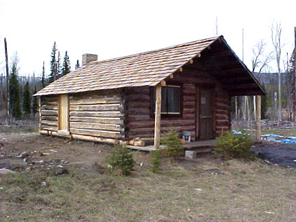
[3] Landmark name[4] Image Date listed Location City or Town Summary 1 Apgar Fire Lookout 
December 16, 1986 Near Lake McDonald
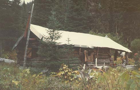
48°31′5″N 114°1′10″W / 48.51806°N 114.01944°WWest Glacier 2 Alice Beck Cabin December 26, 2008 South of Kelly's Camp Rd. and east of McDonald Creek in Glacier National Park Lake McDonald 3 Belly River Ranger Station Historic District 
February 14, 1986 Head of Belly River Valley
48°55′56″N 113°42′40″W / 48.93222°N 113.71111°WWest Glacier 4 Bowman Lake Patrol Cabin 
February 14, 1986 Lower end of Bowman Lake, ½ mile east of the Bowman Lake Ranger Station
48°49′40″N 114°11′31″W / 48.82778°N 114.19194°WWest Glacier 5 Bowman Lake Road 
January 19, 1996 North Fork drainage between Polebridge and Bowman ranger stations in Glacier National Park
48°49′39″N 114°12′8″W / 48.8275°N 114.20222°WWest Glacier 6 Cattle Queen Snowshoe Cabin July 1, 1999 McDonald Subdistrict
48°48′38″N 113°49′15″W / 48.81056°N 113.82083°WWest Glacier 7 Chief Mountain Border Station and Quarters May 20, 2008 Montana Highway 17 at the Canadian border in Glacier National Park Babb 8 Coal Creek Patrol Cabin 
July 1, 1999 U.S. Route 2
48°25′0″N 113°38′56″W / 48.416667°N 113.64889°WWest Glacier 9 Cut Bank Ranger Station Historic District 
January 19, 1996 Northern side of Cut Bank Creek in Glacier National Park
48°36′22″N 113°22′34″W / 48.60611°N 113.37611°WEast Glacier 10 East Glacier Ranger Station Historic District 
December 16, 1986 ¾ mile north of East Glacier Park on Montana Highway 49
48°26′51″N 113°13′25″W / 48.4475°N 113.22361°WWest Glacier 11 Fielding Snowshoe Patrol Cabin 
February 14, 1986 Off U.S. Route 2
48°17′11″N 113°27′22″W / 48.28639°N 113.45611°WWest Glacier 12 Fish Creek Bay Boathouse 
January 19, 1996 Fish Creek Campground on the western shore of Lake McDonald in Glacier National Park
48°33′4″N 113°58′48″W / 48.55111°N 113.98°WWest Glacier 13 Ford Creek Patrol Cabin 
February 14, 1986 Glacier Route 7
48°37′33″N 113°56′36″W / 48.62583°N 113.94333°WWest Glacier 14 Glacier National Park Tourist Trails-Inside Trail, South Circle, North Circle January 19, 1996 Inside Trail, South Circle and North Circle Trails
48°41′41″N 113°33′46″W / 48.69472°N 113.56278°WSt. Mary 15 Goathaunt Bunkhouse 
January 19, 1996 Southern end of Waterton Lake in Glacier National Park
48°57′39″N 113°53′53″W / 48.96083°N 113.89806°WSt. Mary 16 Going-to-the-Sun Road 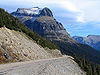
June 16, 1983 Glacier Route 1
48°38′48″N 113°46′48″W / 48.64667°N 113.78°WWest Glacier Extends into Flathead County. National Historic Landmark. 17 Going-to-the-Sun Road 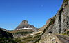
February 18, 1997 Glacier National Park
48°38′1″N 113°47′15″W / 48.63361°N 113.7875°WWest Glacier Extends into Glacier County 18 Granite Park Chalet 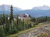
June 27, 1983 Glacier National Park
48°46′12″N 113°46′11″W / 48.77°N 113.76972°WWest Glacier 19 Great Northern Railway Buildings May 28, 1987 Glacier National Park
48°38′29″N 113°32′17″W / 48.64139°N 113.53806°WGlacier National Park National Historic Landmark. 20 Greve's Tourist Cabins 
December 26, 2008 Western side of Going-to-the-Sun Road in Glacier National Park Lake McDonald 21 Gunsight Pass Shelter 
February 14, 1986 Junction of Gunsight Pass Trail and the Continental Divide
48°36′34″N 113°44′16″W / 48.60944°N 113.73778°WWest Glacier 22 Harrison Lake Patrol Cabin 
February 16, 2001 U.S. Route 2
48°31′39″N 113°45′18″W / 48.5275°N 113.755°WGlacier National Park 23 Headquarters Historic District 
January 19, 1996 East of Glacier Route 1 at the crossing of the Middle Fork of the Flathead River in Glacier National Park
48°30′6″N 113°58′47″W / 48.50167°N 113.97972°WWest Glacier 24 Heaven's Peak Fire Lookout 
December 19, 1986 Mount Cannon
48°31′5″N 114°1′10″W / 48.51806°N 114.01944°WWest Glacier 25 Howes' Lake McDonald Cottage Sites Historic District December 26, 2008 Northern side of Apgar Loop Rd. in Glacier National Park West Glacier 26 Huckleberry Fire Outlook 
February 14, 1986 Summit of Huckleberry Mountain
48°36′1″N 114°8′1″W / 48.60028°N 114.13361°WWest Glacier 27 Kelly's Camp Historic District December 23, 2009 South of Kelly's Camp Rd. between Kelly's Creek and south of cabins in Glacier National Park Lake McDonald 28 Kintla Lake Ranger Station 
February 14, 1986 Southern shore of Kintla Lake
48°56′4″N 114°20′25″W / 48.93444°N 114.34028°WWest Glacier 29 Kishenehn Ranger Station Historic District 
February 14, 1986 3 miles south of the Canadian border near the confluence of the northern fork of the Flathead River and Kishenehn Creek
48°57′37″N 114°25′14″W / 48.96028°N 114.42056°WWest Glacier 30 Kootenai Creek Snowshoe Cabin 
July 1, 1999 Flattop Mountain along Kootenai Creek
48°51′55″N 113°54′28″W / 48.86528°N 113.90778°WSt. Mary 31 Lake McDonald Lodge Coffee Shop 
October 14, 2008 Lake McDonald Lodge Boulevard Lake McDonald 32 Lake McDonald Lodge Historic District 
May 28, 1987 Off Going-to-the-Sun Road
48°37′2″N 113°52′41″W / 48.61722°N 113.87806°WWest Glacier National Historic Landmark. 33 Lee Creek Snowshoe Cabin 
March 2, 2001 Northeastern corner of Glacier National Park
48°59′10″N 113°37′20″W / 48.98611°N 113.62222°WGlacier National Park 34 Lincoln Creek Snowshoe Cabin February 2, 2001 U.S. Route 2
48°29′53″N 113°52′41″W / 48.49806°N 113.87806°WWest Glacier 35 Logan Creek Patrol Cabin 
February 14, 1986 Eastern side of Going-to-the-Sun Road at the crossing of Logan Creek
48°43′25″N 113°45′48″W / 48.72361°N 113.76333°WWest Glacier 36 Logan Pass Visitor Center 
April 15, 2008 Going-to-the-Sun Rd., 18 miles west of U.S. Route 89 St. Mary 37 Logging Creek Ranger Station Historic District 
December 16, 1986 Glacier Route 7 near Logging Creek
48°41′51″N 114°11′34″W / 48.6975°N 114.19278°WWest Glacier 38 Loneman Fire Lookout 
February 14, 1986 Access via Loneman Mountain Trail
48°29′21″N 113°46′4″W / 48.48917°N 113.76778°WWest Glacier 39 Lower Logging Lake Snowshoe Cabin and Boathouse 
December 16, 1986 Near the foot of Logging Lake West Glacier 40 Lower Nyack Snowshoe Cabin 
February 14, 1986 Western side of Nyack Creek Trail
48°29′47″N 113°41′16″W / 48.49639°N 113.68778°WWest Glacier 41 Lower Park Creek Patrol Cabin 
December 16, 1986 Eastern side of Park Creek Trail past the crossing of Fielding-Coal Creek Trail
48°20′8″N 113°32′37″W / 48.33556°N 113.54361°WWest Glacier 42 Margaret McCarthy Homestead July 21, 1988 Glacier National Park
48°48′27″N 114°19′20″W / 48.8075°N 114.32222°WBig Prairie 43 McCarthy Homestead Cabin 
December 16, 1986 On the northern fork of the Flathead River
48°48′27″N 114°19′21″W / 48.8075°N 114.3225°WWest Glacier 44 Many Glacier Barn and Bunkhouse 
January 19, 1996 Glacier Route 3 at Apikuni Flat in Glacier National Park
48°48′4″N 113°38′33″W / 48.80111°N 113.6425°WSt. Mary 45 Many Glacier Campground Camptender's Cabin 
January 19, 1996 Many Glacier in Glacier National Park
48°47′49″N 113°40′37″W / 48.79694°N 113.67694°WSt. Mary 46 Many Glacier Hotel Historic District 
January 19, 1996 West of Babb
48°47′54″N 113°39′12″W / 48.79833°N 113.65333°WBabb 47 Mount Brown Fire Lookout 
December 16, 1986 Off Route 1 near Snyder Lake
48°37′44″N 113°49′58″W / 48.62889°N 113.83278°WWest Glacier 48 North Fork Road 
January 19, 1996 North Fork drainage, Fish Creek to Kintla Lake in Glacier National Park
48°32′53″N 113°59′11″W / 48.54806°N 113.98639°WWest Glacier 49 Numa Ridge Fire Lookout 
February 14, 1986 Near Bowman Lake
48°53′1″N 114°10′43″W / 48.88361°N 114.17861°WWest Glacier 50 Nyack Ranger Station Historic District 
February 14, 1986 Nyack Ranger Station
48°26′24″N 113°47′43″W / 48.44°N 113.79528°WWest Glacier 51 Pass Creek Snowshoe Cabin 
December 19, 1986 Confluence of the Waterton River and Pass Creek
48°53′47″N 113°54′23″W / 48.89639°N 113.90639°WWest Glacier 52 Polebridge Ranger Station Historic District 
February 14, 1986 Near the northeastern end of Henshaw Bridge on Route 7
48°46′56″N 114°16′43″W / 48.78222°N 114.27861°WWest Glacier 53 Polebridge to Numa Ridge Phoneline 
April 4, 1996 North Fork drainage, Polebridge to Numa Ridge in Glacier National Park
48°49′59″N 114°13′10″W / 48.83306°N 114.21944°WWest Glacier 54 Ptarmigan Tunnel 
February 14, 1986 North of Ptarmigan Lake
48°51′13″N 113°42′24″W / 48.85361°N 113.70667°WWest Glacier 55 Quartz Lake Patrol Cabin 
February 14, 1986 Foot of Quartz Lake
48°49′19″N 114°8′5″W / 48.82194°N 114.13472°WWest Glacier 56 William Raftery Homestead July 21, 1988 Glacier National Park
48°48′34″N 114°17′30″W / 48.80944°N 114.29167°WBig Prairie 57 Rising Sun Auto Camp 
January 19, 1996 500 feet north of Going-to-the-Sun Rd. at St. Mary Lake in Glacier National Park
48°41′46″N 113°31′6″W / 48.69611°N 113.51833°WSt. Mary 58 Roes Creek Campground Camptender's Cabin 
April 4, 1996 North of Going-to-the-Sun Rd. at St. Mary Lake in Glacier National Park
48°41′39″N 113°31′13″W / 48.69417°N 113.52028°WSt. Mary 59 Saint Mary Ranger Station 
February 14, 1986 Eastern end of Upper Saint Mary Lake
48°44′16″N 113°25′40″W / 48.73778°N 113.42778°WWest Glacier 60 St. Mary Utility Area Historic District 
January 19, 1996 East of St. Mary at Divide Creek in Glacier National Park
48°44′17″N 113°25′45″W / 48.73806°N 113.42917°WSt. Mary 61 Saint Mary Visitor Center, Entrance Station and Checking Stations 
April 15, 2008 Going-to-the-Sun Rd., 5 miles east of U.S. Route 89 St. Mary 62 Scalplock Mountain Fire Lookout February 14, 1986 Accessible by trail connecting to Boundary Trail near the Walton Ranger Station
48°18′1″N 113°34′24″W / 48.30028°N 113.57333°WWest Glacier 113 Anton Schoenberger Homestead July 21, 1988 Glacier National Park
48°48′34″N 114°17′30″W / 48.80944°N 114.29167°WBig Prairie 114 Charlie Schoenberger Homestead July 21, 1988 Glacier National Park
48°48′31″N 114°19′23″W / 48.80861°N 114.32306°WBig Prairie 63 Sherburne Ranger Station Historic District 
December 16, 1986 Glacier Route 3 near Glacier Entrance
48°49′19″N 113°34′45″W / 48.82194°N 113.57917°WWest Glacier 64 Sherwood Lodge December 26, 2008 Grist Rd. in Glacier National Park West Glacier 65 Skyland Camp-Bowman Lake Ranger Station 
February 14, 1986 Southwestern shore of Bowman Lake
48°49′44″N 114°12′13″W / 48.82889°N 114.20361°WWest Glacier 66 Slide Lake-Otatso Creek Patrol Cabin and Woodshed 
February 14, 1986 Northern side of Otatso Creek
48°54′36″N 113°35′56″W / 48.91°N 113.59889°WWest Glacier 67 Sperry Chalet 
August 2, 1977 East of West Glacier
48°36′16″N 113°47′3″W / 48.60444°N 113.78417°WWest Glacier 68 Stillwater Ranger Station Historic District July 8, 1981 U.S. Route 93
48°32′33″N 114°34′3″W / 48.5425°N 114.5675°WOlney 69 Sun Camp Fireguard Cabin 
July 1, 1999 Going-to-the-Sun Rd.
48°41′11″N 113°35′13″W / 48.68639°N 113.58694°WSt. Mary 70 Swanson Boathouse 
January 19, 1996 Eastern shore of Two Medicine Lake in Glacier National Park
48°28′59″N 113°22′7″W / 48.48306°N 113.36861°WEast Glacier 71 Swiftcurrent Auto Camp Historic District 
January 19, 1996 Western end of Glacier Route 3 in Glacier National Park
48°47′54″N 113°40′33″W / 48.79833°N 113.67583°WMany Glacier 72 Swiftcurrent Fire Lookout 
December 16, 1986 Near the Continental Garden Wall in the vicinity of Swiftcurrent Mountain
48°47′8″N 113°45′58″W / 48.78556°N 113.76611°WWest Glacier 73 Swiftcurrent Ranger Station Historic District 
December 19, 1986 Off Route 3 near Swiftcurrent Lake
48°47′48″N 113°40′26″W / 48.79667°N 113.67389°WWest Glacier 74 Two Medicine Campground Camptender's Cabin 
January 19, 1996 Two Medicine Lake in Glacier National Park
48°29′18″N 113°21′54″W / 48.48833°N 113.365°WEast Glacier 75 Two Medicine General Store 
February 14, 1986 Eastern shore of Two Medicine Lake
48°29′6″N 113°22′8″W / 48.485°N 113.36889°WWest Glacier 76 Upper Kintla Lake Patrol Cabin 
February 14, 1986 Head of Kintla Lake
48°58′38″N 114°14′47″W / 48.97722°N 114.24639°WWest Glacier 77 Upper Lake McDonald Ranger Station Historic District 
December 16, 1986 Northern shore of Lake McDonald
48°38′23″N 113°52′21″W / 48.63972°N 113.8725°WWest Glacier 78 Upper Logging Lake Snowshoe Cabin 
February 14, 1986 Near the head of Logging Lake
48°46′36″N 114°1′22″W / 48.77667°N 114.02278°WWest Glacier 79 Upper Nyack Snowshoe Cabin 
February 14, 1986 Northern side of Nyack Creek
48°32′52″N 113°34′0″W / 48.54778°N 113.566667°WWest Glacier 80 Upper Park Creek Patrol Cabin 
December 16, 1986 Junction of Park Creek and Two Medicine Pass Trails
48°24′54″N 113°27′34″W / 48.415°N 113.45944°WWest Glacier 140 Johnnie Walsh's Guest Lodge July 21, 1988 Glacier National Park
48°48′14″N 114°19′2″W / 48.80389°N 114.31722°WBig Prairie 141 Johnnie Walsh Homestead July 21, 1988 Glacier National Park
48°48′29″N 114°18′26″W / 48.80806°N 114.30722°WBig Prairie 81 Walton Ranger Station Historic District 
December 16, 1986 U.S. Route 2 near Essex
48°16′25″N 113°36′8″W / 48.27361°N 113.60222°WWest Glacier 81 West Entrance Station 
April 4, 1996 Going-to-the-Sun Road, near West Glacier in Glacier National Park
48°30′23″N 113°59′12″W / 48.50639°N 113.98667°WWest Glacier See also
- National Register of Historic Places listings in Flathead County, Montana
- National Register of Historic Places listings in Glacier County, Montana
- List of National Historic Landmarks in Montana
- National Register of Historic Places listings in Montana
References
- Historical Research Associates. National Register of Historic Places Multiple Property Documentation Form: Multiple Resource Submission for Historically and Architecturally Significant Resources in Glacier National Park, Montana. National Park Service 1987 [1]
- ^ The latitude and longitude information provided in this table was derived originally from the National Register Information System, which has been found to be fairly accurate for about 99% of listings. For about 1% of NRIS original coordinates, experience has shown that one or both coordinates are typos or otherwise extremely far off; some corrections may have been made. A more subtle problem causes many locations to be off by up to 150 yards, depending on location in the country: most NRIS coordinates were derived from tracing out latitude and longitudes off of USGS topographical quadrant maps created under the North American Datum of 1927, which differs from the current, highly accurate WGS84 GPS system used by Google maps. Chicago is about right, but NRIS longitudes in Washington are higher by about 4.5 seconds, and are lower by about 2.0 seconds in Maine. Latitudes differ by about 1.0 second in Florida. Some locations in this table may have been corrected to current GPS standards.
- ^ "National Register of Historic Places: Weekly List Actions". National Park Service, United States Department of the Interior. Retrieved on November 10, 2011.
- ^ Numbers represent an ordering by significant words. Various colorings, defined here, differentiate National Historic Landmark sites and National Register of Historic Places Districts from other NRHP buildings, structures, sites or objects.
- ^ "National Register Information System". National Register of Historic Places. National Park Service. 2008-04-24. http://nrhp.focus.nps.gov/natreg/docs/All_Data.html.
Going-to-the-Sun Road Big Drift · Bird Woman Falls · Garden Wall · Going to the Sun Mountain · Heavens Peak · Highline Trail · Jackson Glacier · Lake McDonald · Lake McDonald Lodge · Logan Pass · Rising Sun · Saint Mary Lake · Trail of the Cedars · Weeping WallMany Glacier Two Medicine Waterton-Glacier International Peace Park National Register of Historic Places in Glacier National Park National Historic Landmarks National Historic Landmark District Other historic districts Belly River Ranger Station Historic District | Cut Bank Ranger Station Historic District | East Glacier Ranger Station Historic District | Glacier National Park Tourist Trails--Inside Trail, South Circle, North Circle | Headquarters Historic District | Howes' Lake McDonald Cottage Sites Historic District | Kelly's Camp Historic District | Kintla Lake Ranger Station | Kishenehn Ranger Station Historic District | Logging Creek Ranger Station Historic District | Many Glacier Hotel Historic District | Nyack Ranger Station Historic District | Polebridge Ranger Station Historic District | Rising Sun Auto Camp | St. Mary Utility Area Historic District | Sherburne Ranger Station Historic District | Stillwater Ranger Station Historic District | Swiftcurrent Ranger Station Historic District | Upper Lake McDonald Ranger Station Historic District | Walton Ranger Station Historic District
Other properties Apgar Fire Lookout | Alice Beck Cabin | Bowman Lake Patrol Cabin | Bowman Lake Road | Cattle Queen Snowshoe Cabin | Chief Mountain Border Station and Quarters | Coal Creek Patrol Cabin | Fielding Snowshoe Patrol Cabin | Fish Creek Bay Boathouse | Ford Creek Patrol Cabin | Goathaunt Bunkhouse | Granite Park Chalet | Greve's Tourist Cabins | Gunsight Pass Shelter | Harrison Lake Patrol Cabin | Heaven's Peak Fire Lookout | Huckleberry Fire Outlook | Kootenai Creek Snowshoe Cabin | Lake McDonald Lodge Coffee Shop | Lee Creek Snowshoe Cabin | Lincoln Creek Snowshoe Cabin | Logan Creek Patrol Cabin | Logan Pass Visitor Center | Loneman Fire Lookout | Lower Logging Lake Snowshoe Cabin and Boathouse | Lower Nyack Snowshoe Cabin | Lower Park Creek Patrol Cabin | Margaret McCarthy Homestead | McCarthy Homestead Cabin | Many Glacier Barn and Bunkhouse | Many Glacier Campground Camptender's Cabin Mount Brown Fire Lookout | North Fork Road | Numa Ridge Fire Lookout | Pass Creek Snowshoe Cabin | Polebridge to Numa Ridge Phoneline | Ptarmigan Tunnel | Quartz Lake Patrol Cabin | William Raftery Homestead | Roes Creek Campground Camptender's Cabin | Saint Mary Ranger Station | Saint Mary Visitor Center, Entrance Station and Checking Stations | Scalplock Mountain Fire Lookout | Anton Schoenberger Homestead | Charlie Schoenberger Homestead | Sherwood Lodge | Skyland Camp-Bowman Lake Ranger Station | Slide Lake-Otatso Creek Patrol Cabin and Woodshed | Sperry Chalet | Sun Camp Fireguard Cabin | Swanson Boathouse | Swiftcurrent Auto Camp Historic District | Swiftcurrent Fire Lookout | Two Medicine Campground Camptender's Cabin | Two Medicine General Store | Upper Kintla Lake Patrol Cabin | Upper Logging Lake Snowshoe Cabin | Upper Nyack Snowshoe Cabin | Upper Park Creek Patrol Cabin | Johnnie Walsh's Guest Lodge | Johnnie Walsh Homestead | West Entrance Station
See also: National Register of Historic Places listings in Glacier National ParkU.S. National Register of Historic Places Topics Lists by states Alabama • Alaska • Arizona • Arkansas • California • Colorado • Connecticut • Delaware • Florida • Georgia • Hawaii • Idaho • Illinois • Indiana • Iowa • Kansas • Kentucky • Louisiana • Maine • Maryland • Massachusetts • Michigan • Minnesota • Mississippi • Missouri • Montana • Nebraska • Nevada • New Hampshire • New Jersey • New Mexico • New York • North Carolina • North Dakota • Ohio • Oklahoma • Oregon • Pennsylvania • Rhode Island • South Carolina • South Dakota • Tennessee • Texas • Utah • Vermont • Virginia • Washington • West Virginia • Wisconsin • WyomingLists by territories Lists by associated states Other Categories:- National Register of Historic Places lists in the National Park Service
- Buildings and structures in Glacier National Park (U.S.)
-


Wikimedia Foundation. 2010.