- National Register of Historic Places listings in DuPage County, Illinois
-
Contents: List of Registered Historic Places in DuPage County, Illinois, USA:
-
- This National Park Service list is complete through NPS recent listings posted November 10, 2011.[1]
Contents
Current listings
Landmark name Image Date listed Location City or Town Summary 1 Adams Memorial Library 
June 4, 1981 102 East Wesley St.
41°51′57″N 88°6′23″W / 41.86583°N 88.10639°WWheaton The library was designed by Charles Sumner Frost in 1891. It was the only library in the area until 1965. Later that year it was converted to the DuPage County Historical Museum. 2 Ardmore Avenue Train Station 
November 21, 1980 10 W. Park Ave.
41°53′1″N 87°58′47″W / 41.88361°N 87.97972°WVilla Park One of the few Chicago Aurora and Elgin Railroad stations still standing. 3 George Baker House 
March 1, 2010 1 S. 500 Taylor Rd.
41°51′2.16″N 88°3′19.8″W / 41.8506°N 88.0555°WMilton Township The house of an early settler to DuPage County. 4 Orland P. Bassett House 
December 7, 2004 329 E. Sixth St.
41°47′55″N 87°55′18″W / 41.79861°N 87.92167°WHinsdale Home of Orland P. Bassett, who is credited as the first person to distribute the American Beauty rose. His company became the largest employer in Hinsdale. 5 Blanchard Hall 
November 14, 1979 Wheaton College campus
41°52′7″N 88°5′58″W / 41.86861°N 88.09944°WWheaton The oldest building at Wheaton College, named after its founder Jonathan Blanchard. The architecture is meant to evoke the buildings at Oxford University. 6 Bloomingdale School–Village Hall 
October 28, 1994 108 E. Lake St.
41°57′26″N 88°4′56″W / 41.95722°N 88.08222°WBloomingdale A two-story, two-classroom schoolhouse from the early 20th century. It was used as the Bloomingdale Village Hall from 1938 to 1977. 7 Butler School 
May 9, 2003 1200 31st. St. (Oak Brook Rd.)
41°50′5″N 87°56′46″W / 41.83472°N 87.94611°WOak Brook A two-room schoolhouse in the Georgian Revival style. The term "Oak Brook" for the surrounding community was first used in a meeting in the building. 8 Robert A. and Mary Childs House 
May 11, 2000 318 S. Garfield Ave.
41°47′56″N 87°55′40″W / 41.79889°N 87.92778°WHinsdale Home of Civil War veteran and U.S. Representative Robert A. Childs and his wife Mary. 9 Churchville School 
February 5, 1999 3N 784 Church Rd.
41°56′8″N 87°57′14″W / 41.93556°N 87.95389°WBensenville A schoolhouse constructed in 1846. 10 Avery Coonley School 
August 8, 2007 1400 Maple Ave.
41°47′18.17″N 88°1′13.17″W / 41.7883806°N 88.020325°WDowners Grove A progressive school landscaped by Jens Jensen. 11 Dell Rhea's Chicken Basket 
May 5, 2006 645 Joliet Rd.
41°44′51″N 87°56′22″W / 41.7475°N 87.93944°WWillowbrook A restaurant on historic U.S. Route 66. Part of the Route 66 through Illinois Multiple Property Submission. 12 Downtown Hinsdale Historic District 
May 30, 2006 Roughly Bounded by Maple St., Lincoln St., Garfield St. and Second St.
41°48′9.14″N 87°55′45.4″W / 41.8025389°N 87.929278°WHinsdale 13 DuPage County Courthouse 
June 7, 1978 200 Reber St.
41°51′50″N 88°6′14″W / 41.86389°N 88.10389°WWheaton 14 DuPage Theatre and DuPage Shoppes 
November 20, 1987 101-109 S. Main St.
41°53′9″N 88°1′4″W / 41.88583°N 88.01778°WLombard Demolished in 2007 by the Board of Trustees of the Village of Lombard.[2] 15 William H. Emery, Jr. House 
May 12, 2004 281 Arlington
41°53′39″N 87°56′18″W / 41.89417°N 87.93833°WElmhurst 16 First Church of Lombard 
August 10, 1978 Maple and Main Sts.
41°52′59″N 88°1′7″W / 41.88306°N 88.01861°WLombard 17 Glen Ellyn Main Street Historic District 
October 29, 1984 Main St. between Cottage Ave. and Hawthorne St.
41°52′49″N 88°4′0″W / 41.88028°N 88.066667°WGlen Ellyn 18 Grand Theatre 
August 12, 2005 123 N. Hale St.
41°51′56″N 88°6′29″W / 41.86556°N 88.10806°WWheaton 19 Graue Mill 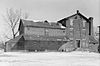
May 12, 1975 NW of jct. of Spring and York Rds.
41°49′15″N 87°55′45″W / 41.82083°N 87.92917°WOak Brook 20 William L. Gregg House 
October 3, 1980 115 S. Linden
41°47′34″N 87°58′30″W / 41.79278°N 87.975°WWestmont 21 Hauptgebaude 
August 13, 1976 190 Prospect St.
41°53′45″N 87°56′43″W / 41.89583°N 87.94528°WElmhurst 22 Frank B. Henderson House 
August 9, 2002 301 S. Kenilworth
41°53′39″N 87°56′18″W / 41.89417°N 87.93833°WElmhurst 23 Immanuel Evangelical Church 
February 9, 2001 302 S. Grant St.
41°47′57″N 87°55′56″W / 41.79917°N 87.93222°WHinsdale 24 McAuley School District No. 27 
June 3, 1982 Roosevelt Rd.
41°52′40″N 88°14′24″W / 41.87778°N 88.24°WWest Chicago 25 Naperville Historic District 
September 29, 1977 Roughly bounded by Juilian, Highland, Chicago, Jackson, Eagle, and 5th Sts.
41°46′32″N 88°9′7″W / 41.77556°N 88.15194°WNaperville 26 Francis Stuyvesant Peabody Estate 
February 18, 1994 1717 W. 31st St.
41°49′44″N 87°57′31″W / 41.82889°N 87.95861°WOak Brook 27 Francis Stuyvesant Peabody House 
November 8, 2000 8 E. Third St.
41°47′59″N 87°55′44″W / 41.79972°N 87.92889°WHinsdale 28 John L. Pentecost House 
September 13, 2003 259 Cottage Hill Ave.
41°53′38″N 87°56′31″W / 41.89389°N 87.94194°WElmhurst 29 Pine Craig 
August 15, 1975 Aurora Rd. (Rte. 65)
41°46′10″N 88°9′13″W / 41.76944°N 88.15361°WNaperville 30 Randecker's Hardware Store 
October 28, 1994 112 S. Bloomingdale Rd.
41°57′23″N 88°4′53″W / 41.95639°N 88.08139°WBloomingdale 31 Robinwood 
January 21, 2004 208 Arlington
41°53′49″N 87°56′14″W / 41.89694°N 87.93722°WElmhurst 32 Robbins Park Historic District 
November 26, 2008 Bounded by Chicago Av, 8th St, County Line Rd, Garfield St
41°47′54″N 87°55′18″W / 41.79833°N 87.92167°WHinsdale 33 Alfred A. Schiller House 
September 3, 2008 734 Lenox Rd.
41°53′11″N 88°3′39″W / 41.88639°N 88.06083°WGlen Ellyn 34 Stacy's Tavern 
October 29, 1974 Geneva Rd. and Main St.
41°53′23″N 88°3′53″W / 41.88972°N 88.06472°WGlen Ellyn 35 Trinity Episcopal Church 
January 9, 1978 130 N. West St.
41°51′57″N 88°6′43″W / 41.86583°N 88.11194°WWheaton 36 Turner Town Hall 
May 13, 1991 132 Main St.
41°53′1″N 88°12′15″W / 41.88361°N 88.20417°WWest Chicago 37 Villa Avenue Train Station 
August 22, 1986 220 S. Villa Ave.
41°53′42″N 87°58′13″W / 41.895°N 87.97028°WVilla Park 38 Wayne Village Historic District 
December 29, 1978 Irregular pattern along Army Trail Rd.
41°57′4″N 88°14′46″W / 41.95111°N 88.24611°WWayne 39 William Whitney House 
October 19, 1989 142 E. First St.
41°48′5″N 87°55′28″W / 41.80139°N 87.92444°WHinsdale Formerly listed properties
Landmark name Image Date delisted Location City or Town Summary 1 Henry C. Middaugh House August 14, 1994 66 Norfolk Ave.
41°48′7″N 87°57′1″W / 41.80194°N 87.95028°WClarendon Hills Demolished in 2002.[3] See also
References
- ^ "National Register of Historic Places: Weekly List Actions". National Park Service, United States Department of the Interior. Retrieved on November 10, 2011.
- ^ Ortiz, Vikki (2009) "DuPage Theatre gone, not forgotten", Chicago Tribune, July 31, 2009.
- ^ http://nl.newsbank.com/nl-search/we/Archives?p_product=ADHB&p_theme=adhb&p_action=search&p_maxdocs=200&p_topdoc=1&p_text_direct-0=0F414F6A9CD139D2&p_field_direct-0=document_id&p_perpage=10&p_sort=YMD_date:D&s_trackval=GooglePM
External links
U.S. National Register of Historic Places Topics Lists by states Alabama • Alaska • Arizona • Arkansas • California • Colorado • Connecticut • Delaware • Florida • Georgia • Hawaii • Idaho • Illinois • Indiana • Iowa • Kansas • Kentucky • Louisiana • Maine • Maryland • Massachusetts • Michigan • Minnesota • Mississippi • Missouri • Montana • Nebraska • Nevada • New Hampshire • New Jersey • New Mexico • New York • North Carolina • North Dakota • Ohio • Oklahoma • Oregon • Pennsylvania • Rhode Island • South Carolina • South Dakota • Tennessee • Texas • Utah • Vermont • Virginia • Washington • West Virginia • Wisconsin • WyomingLists by territories Lists by associated states Other Municipalities and communities of DuPage County, Illinois Cities Aurora‡ | Batavia‡ | Chicago‡ | Darien | Elmhurst‡ | Naperville‡ | Oakbrook Terrace | St. Charles‡ | Warrenville | West Chicago | Wheaton | Wood Dale

Villages Addison | Bartlett‡ | Bensenville‡ | Bloomingdale | Bolingbrook‡ | Burr Ridge‡ | Carol Stream | Clarendon Hills | Downers Grove | Elk Grove Village‡ | Glendale Heights | Glen Ellyn | Hanover Park‡ | Hinsdale‡ | Itasca | Lemont‡ | Lisle | Lombard | Oak Brook‡ | Roselle‡ | Schaumburg‡ | Villa Park | Wayne‡ | Westmont | Willowbrook | Willow Springs‡ | Winfield | Woodridge‡
Townships Addison | Bloomingdale | Downers Grove | Lisle | Milton | Naperville | Wayne | Winfield | York
Unincorporated
communitiesCloverdale | Eola | Flowerfield | Keeneyville | Lakewood | Medinah | Palisades | York Center
Footnotes ‡This populated place also has portions in an adjacent county or counties
Categories:- DuPage County, Illinois
- National Register of Historic Places in DuPage County, Illinois
- National Register of Historic Places in Illinois by county
-


Wikimedia Foundation. 2010.