- National Register of Historic Places listings in Bell County, Kentucky
-
 Location of Bell County in Kentucky
This is a list of the National Register of Historic Places listings in Bell County, Kentucky.
It is intended to be a complete list of the properties on the National Register of Historic Places in Bell County, Kentucky, United States. The locations of National Register properties for which the latitude and longitude coordinates are included below, may be seen in a Google map.[1]
There are 9 properties listed on the National Register in the county.
-
- This National Park Service list is complete through NPS recent listings posted November 10, 2011.[2]
Current listings
[3] Landmark name Image Date listed Location City or town Summary 1 American Association, Limited, Office Building December 29, 1978 2215 Cumberland Ave.
36°36′23″N 83°43′04″W / 36.606389°N 83.717778°WMiddlesboro 2 Brooks House December 23, 2009 210 Arthur Heights
36°36′35″N 83°42′59″W / 36.609831°N 83.716378°WMiddlesboro 3 Cumberland Gap Historic District 
May 28, 1980 East of Middlesboro
36°36′14″N 83°40′28″W / 36.603889°N 83.674444°WMiddlesboro Extends into Claiborne County, Tennessee and Lee County, Virginia 4 Cumberland Gap National Historical Park 
October 15, 1966 East of Middlesboro along Kentucky-Virginia state line
36°36′14″N 83°40′28″W / 36.603889°N 83.674444°WMiddlesboro Extends into Claiborne County, Tennessee and Lee County, Virginia 5 Hensley Settlement 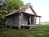
January 8, 1980 Cumberland Gap National Historical Park
36°40′10″N 83°31′42″W / 36.669444°N 83.528333°WCubage 6 Middlesboro Downtown Commercial District January 10, 1983 Roughly bounded by Cumberland Ave., 19th, 20th Sts., and Edgewood Rd.
36°36′30″N 83°42′50″W / 36.608333°N 83.713889°WMiddlesboro 7 Mt. Moriah Baptist Church August 8, 1985 314 N. Main St.
36°36′39″N 83°42′48″W / 36.610833°N 83.713333°WMiddlesboro 8 Pineville Courthouse Square Historic District 
July 19, 1990 Along Kentucky, Pine, Virginia, and Walnut Sts.
36°45′41″N 83°41′44″W / 36.761389°N 83.695556°WPineville 9 St. Mary's Episcopal Church November 15, 1984 131 Edgewood Rd.
36°36′30″N 83°43′40″W / 36.608333°N 83.727778°WMiddlesboro See also
- List of National Historic Landmarks in Kentucky
- National Register of Historic Places listings in Kentucky
References
- ^ The latitude and longitude information provided in this table was derived originally from the National Register Information System, which has been found to be fairly accurate for about 99% of listings. For about 1% of NRIS original coordinates, experience has shown that one or both coordinates are typos or otherwise extremely far off; some corrections may have been made. A more subtle problem causes many locations to be off by up to 150 yards, depending on location in the country: most NRIS coordinates were derived from tracing out latitude and longitudes off of USGS topographical quadrant maps created under the North American Datum of 1927, which differs from the current, highly accurate WGS84 GPS system used by Google maps. Chicago is about right, but NRIS longitudes in Washington are higher by about 4.5 seconds, and are lower by about 2.0 seconds in Maine. Latitudes differ by about 1.0 second in Florida. Some locations in this table may have been corrected to current GPS standards.
- ^ "National Register of Historic Places: Weekly List Actions". National Park Service, United States Department of the Interior. Retrieved on November 10, 2011.
- ^ Numbers represent an ordering by significant words. Various colorings, defined here, differentiate National Historic Landmark sites and National Register of Historic Places Districts from other NRHP buildings, structures, sites or objects.
U.S. National Register of Historic Places Topics Lists by states Alabama • Alaska • Arizona • Arkansas • California • Colorado • Connecticut • Delaware • Florida • Georgia • Hawaii • Idaho • Illinois • Indiana • Iowa • Kansas • Kentucky • Louisiana • Maine • Maryland • Massachusetts • Michigan • Minnesota • Mississippi • Missouri • Montana • Nebraska • Nevada • New Hampshire • New Jersey • New Mexico • New York • North Carolina • North Dakota • Ohio • Oklahoma • Oregon • Pennsylvania • Rhode Island • South Carolina • South Dakota • Tennessee • Texas • Utah • Vermont • Virginia • Washington • West Virginia • Wisconsin • WyomingLists by territories Lists by associated states Other Municipalities and communities of Bell County, Kentucky Cities  Categories:
- National Register of Historic Places in Kentucky by county
- Bell County, Kentucky
-


Wikimedia Foundation. 2010.