- Najaf Shahr
-
Najaf Shahr
نجف شهر— city — 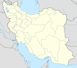
 Najaf Shahr
Coordinates: 29°23′00″N 55°43′02″E / 29.3833333°N 55.71722°ECoordinates: 29°23′00″N 55°43′02″E / 29.3833333°N 55.71722°E Country  Iran
IranProvince Kerman County Sirjan Bakhsh Central Population (2006) - Total 6,768 Time zone IRST (UTC+3:30) - Summer (DST) IRDT (UTC+4:30) Najaf Shahr (Persian: نجف شهر; formerly, Najafābād and Nejafābād)[1] is a city in the Central District of Sirjan County, Kerman Province, Iran. At the 2006 census, its population was 6,768, in 1,606 families.[2]
References
- ^ Najaf Shahr can be found at GEOnet Names Server, at this link, by opening the Advanced Search box, entering "-3076281" in the "Unique Feature Id" form, and clicking on "Search Database".
- ^ "Census of the Islamic Republic of Iran, 1385 (2006)" (Excel). Islamic Republic of Iran. http://www.amar.org.ir/DesktopModules/FTPManager/upload/upload2360/newjkh/newjkh/08.xls.
 Kerman Province
Capital 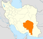
Counties (A-L)
and CitiesAnar CountyAnar • AminshahrAnbarabad • MardehekBaft CountyBam • BaravatFahraj CountyFahrajFaryab CountyFaryabJiroft • Darb-e Behesht • JebalbarezKahnuj CountyKuhbanan CountyKuhbanan • Kian ShahrCounties (M-Z)
and CitiesQaleh Ganj CountyQaleh GanjRabor CountyRaborRafsanjan • Bahreman • Koshkuiyeh • Mes-e Sarcheshmeh • SafayyehRavar • HojedkRigan CountyRudbar Jonubi CountyShahr-e Babak CountyShahr-e Babak • Dehaj • Jowzam • Khatunabad • KhorsandSirjan • Najaf Shahr • Pariz • ZeydabadZarand • Khanuk • Reyhan Shahr • Yazdan ShahrSights Arg-é Bam · Bardsir citadel · Carpet Museum, Kerman · Dinosaur remnants, Zarand · Dousari waterfall · Ganjali Khan Complex · Hajagha-ali historical complex · Ibrahim Khan's school · Jamé Mosque of Kerman · Kerman's grand Bazzar · Kerman's museum of industry · Khanqah of Sheykh Saeid · Konar Sandal · Maymand · Naderi Milestone, Fahraj · Pid-e Nekooieh · Presidential museum of Rafsanjan · Rayen Castle · Shazdeh Garden · Sirjan's Yakhchals · Torang cave · Shah Nematollah Vali Shrine · Vakil bath, Kerman
Categories:- Sirjan County
- Cities in Iran
- Cities in Kerman Province
- Iran geography stubs


Wikimedia Foundation. 2010.