- Naqadeh
-
For the administrative subdivision, see Naqadeh County.
Naqadeh
نقده— city — 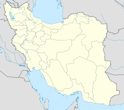
 Naqadeh
Coordinates: 36°57′19″N 45°23′17″E / 36.95528°N 45.38806°ECoordinates: 36°57′19″N 45°23′17″E / 36.95528°N 45.38806°E Country  Iran
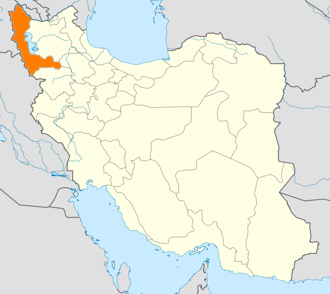
IranProvince West Azerbaijan County Naqadeh Bakhsh Central Population (2006) – Total 72,975 Time zone IRST (UTC+3:30) – Summer (DST) IRDT (UTC+4:30) Naqadeh (Persian: نقده; also Romanized as Nagadeh, Naghadeh, Naghdeh, and Nākhuda; formerly known as Sulduz (Persian: سولدوز), also Romanized as Solduz and Suldoz)[1] is a city in and the capital of Naqadeh County, West Azerbaijan Province, Iran. At the 2006 census, its population was 72,975, in 18,320 families.[2]
The city is located in the Gadar River valley, 23 kilometres (14 mi) southeast of Lake Urmia at an elevation of 1,300 metres (4,300 ft) above sea-level. The region's economy is based around agriculture, particularly the production of fruit, grain, and timber. Naqadehis nicknamed as the ulduz city of Azerbaijan.
The town is inhabited mainly by Azeris and Kurds, although it was once home to a large number of Assyrians who perished during the Assyrian Genocide.[3] The main religion is Shia Islam.[4]
Contents
Historical places
Naqadeh has several cultural and recreational attractions like "Yeddi göz" or in Kurdish "Hawt kani" and "Sultan Yaghoob". The most important worth seeing and historical places of the city are as follows:
- Important archaeological sites in the vicinity of Naqadeh include Teppe Hasanlu, 12 kilometres (7.5 mi) northwest of Naqadeh and famous for its "Golden Cup", and Hajji Firuz Tepe where some of the oldest evidence for winemaking has been uncovered.
- Keleshin historical inscriptions in south-west to Lake Urmia.
- Several wetlands.
- Zendan and Baha Hasan caves.
- tepe bashi central and old park of the city that has big history and american researchers believe there is a big castle under ground of it.
- Qal'a Paswe is a very small village near Naqadeh whose name according to the Iranist Vladimir Minorsky has kept the memory of the Iranian settlements from the 9th century BCE and reminds of the "Parswa tribes" mentioned in the records of the Assyrian ruler Shalmaneser III (reign 858-824 BCE)..[5]
Education
- Payam Noor University
- Azad University of Naghadeh
Language
Turks and Kurds live in this city, but Turks are the majority and Kurd who comprise 20-25% of the population, come in after Turks to this area that calls Mahal Sulduz.
Economy
The regional economy greatly depends on agricultural products, and cattle and sheep are raised both for meat and for wool. Some of this production is exported. The region's farmers also raise apples, grapes, tomatoes, potatoes, onions, peas, and other fruits. The high farm production results from the fertile soil and the use of modern machinery and scientific farming methods.
References
- ^ Naqadeh can be found at GEOnet Names Server, at this link, by opening the Advanced Search box, entering "-3076454" in the "Unique Feature Id" form, and clicking on "Search Database".
- ^ "Census of the Islamic Republic of Iran, 1385 (2006)" (Excel). Islamic Republic of Iran. http://www.amar.org.ir/DesktopModules/FTPManager/upload/upload2360/newjkh/newjkh/04.xls.
- ^ Familiar Faces in Unfamiliar Places:Assyrians in the California Heartland 1911 - 2010, Arianne Ishaya
- ^ [1]
- ^ page 78 of Minorsky, V. (1957), "Mongol Place-Names in Mukri Kurdistan (Mongolica, 4)", Bulletin of the School of Oriental and African Studies, University of London 19 (1): 58-81, ISSN 0041-977X, http://www.jstor.org/stable/609632
 West Azerbaijan Province
Capital 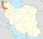
Counties and Cities Bukan · SimminehSiah Cheshmeh · AvajiqQarah Zia od DinNaqadeh · MohammadyarPiranshahr · Gerd KashanehPoldasht CountySalmas · Tazeh ShahrShahin Dezh CountyShowt CountyVillages List of cities, towns and villages in West Azarbaijan ProvinceSights Shalmash Waterfall · Old bazaar of Khoy · Ghoutour Bridge · Khoshku ski resort · Teppe Hasanlu · Takht-e Soleymān · Farhad's rock grave (Dakhmeh) · Lake Urmia · Bastam Citadel · Zarrineh River dam · Sahulan cave · Fakhrigah cave · Faghrgah · Saint Thaddeus Monastery · Baghchejogh museum and palace · Koleshin Inscription · Nanehmaryam monastery · Baand park · Sir park · Sardar mosque · Urmia museum · Salmas Sassanid relief · SegonbadCategories:- Naqadeh County
- Cities in Iran
- Cities in West Azerbaijan Province

Wikimedia Foundation. 2010.