- Tulum Municipality
-
Tulum — Municipality — 
Flag
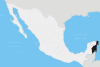
EmblemLocation of Tulum Municipality in Quintana Roo Location of Tulum Municipality in Quintana Roo
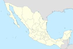
 Tulum
TulumCoordinates: 20°12′43″N 87°27′57″W / 20.21194°N 87.46583°WCoordinates: 20°12′43″N 87°27′57″W / 20.21194°N 87.46583°W Country  Mexico
State  Quintana Roo
Municipal Seat Tulum Government - Municipal President[1] Marciano Dzul Caamal Area[2] - Land 2,040 km2 (787.6 sq mi) Elevation 10 m (33 ft) Population (2010) - Municipality 28,263 - Urban 18,233 - Demonym Tulumense Time zone Central Standard Time (UTC-6) - Summer (DST) Central Daylight Time (UTC-5) INEGI Code 009 Major Airport Cancún International Airport IATA Code CUN ICAO Code MMUN Website Official Site Municipalities of Quintana Roo Tulum is one of the ten municipalities that make up the Mexican state of Quintana Roo. It became one of the newest municipalities in the country when it was formed on March 13, 2008 as a result of its separation from Solidaridad Municipality.[3]
Tulum is home to the Maya archaeological sites of Tulum, and Cobá.
Contents
Geography
The municipality of Tulum borders the municipalities of Solidaridad to the north and Felipe Carrillo Puerto to the south, in the state of Quintana Roo. It also borders Chemax Municipality and Valladolid Municipality in the state of Yucatán on the northwest, and the Caribbean Sea on the east.
Orography and hydrography
Like most of the Yucatan Peninsula Tulum is entirely flat with a gentle slope towards the sea, so from west to east, the area never reaches a higher altitude than 25 meters above sea level . The municipality is five meters above sea level on average. [4]
Like the rest of the peninsula's surface the land has a limestone base that does not allow the formation of surface water flows such as rivers and streams; the water instead flows in underground rivers that sometimes rise to the surface in the cenotes. Lakes and cenotes are the major bodies of water in the municipality.
Population
Tulum has 28,263 inhabitants according to the 2010 census, a figure that has more than doubled in the last five years. [5] There is an additional 15,000 to 20,000 people living and working in Tulum as part of its floating population. That number rises and falls with the tourist season and is not reflected in the census figures. [6]
Communities
The municipality consists of 170 populated localities, plus an additional 224 unpopulated localities, and includes part of a biosphere reserve (Sian Ka'an, which lies mostly in neighboring Felipe Carrillo Puerto Municipality). The largest localities (cities, towns, and villages) are:[7]
Name 2010 Census Population Tulum 18,233 Ciudad Chemuyil 1,377 Akumal 1,310 Cobá 1,278 Chanchen Primero 875 Francisco Uh May 655 San Juan 599 Macario Gómez 510 Chanchén Palmar 469 Javier Rojo Gómez (Punta Allen) 469 Sahcab Mucuy 456 Manuel Antonio Ay 407 Hondzonot 368 Yaxché 335 Total Municipality 28,263 References
- ^ "Municipio de Tulum" (HTML). http://www.tulum.gob.mx. Retrieved 2009-11-14.
- ^ "Discuten por nuevo municipio" (HTML). http://www.noticaribe.com.mx/rivieramaya/2008/02/discuten_por_nuevo_municipio.html. Retrieved 2009-11-05.
- ^ Javier Chávez. "Tulum se convierte en el noveno municipio de Quintana Roo" (HTML). http://www.jornada.unam.mx/ultimas/2008/03/13/tulum-se-convierte-en-el-noveno-municipio-de-quintana-roo/?searchterm=Municipio%20de%20Tulum. Retrieved 2008-03-13.[dead link]
- ^ http://www.municipios.mx/Quintana-Roo/Municipio-de-Tulum-en-Quintana-Roo.html
- ^ http://www.municipios.mx/Quintana-Roo/Municipio-de-Tulum-en-Quintana-Roo.html
- ^ http://www.noticaribe.com.mx/rivieramaya/2010/01/esperan_beneficios_presupuestales_tras_resultados_del_censo_en_tulum.html
- ^ 2010 census tables: INEGI
 State of Quintana Roo
Chetumal (capital) Municipalities (seats) Bacalar (Bacalar) · Cozumel (San Miguel de Cozumel) · Felipe Carrillo Puerto (Felipe Carrillo Puerto) · Isla Mujeres (Isla Mujeres) · Othón P. Blanco (Chetumal) · Benito Juárez (Cancún) · José María Morelos (José María Morelos) · Lázaro Cárdenas (Kantunilkín) · Solidaridad (Playa del Carmen) · Tulum (Tulum)
Places of interest Akumal · Arrecifes de Cozumel National Park · Banco Chinchorro · Chacchoben · Coba · Isla Contoy · Isla Holbox · Kohunlich · Mahahual · Muyil · Puerto Morelos · Punta Allen · Punta Sur · Riviera Maya · San Gervasio · Sian Ka'an · Tulum · Xcalak · Xcaret · Xelha · Yo'okop
Categories:


Wikimedia Foundation. 2010.