- Espita Municipality, Yucatan
-
Espita — Municipality — 
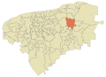
Coat of armsLocation of the Municipality
Country  Mexico
State  Yucatán
Mexico Ind. 1821 Yucatan Est. 1824 Municipality Est. 1921[1] Government – Municipal President José Luis Uc Moo (2010-2012)[2][3] (  [4])
[4])Area – Total 496.91 km2 (191.9 sq mi) [1] Elevation 15 m (49 ft) Population (2005 [5][6]) – Total 14,432 – Demonym espitan Time zone Central Standard Time (UTC-6) – Summer (DST) Central Daylight Time (UTC-5) Postal Code 97730 Area code(s) 986 INEGI Code 31032 Website Official Website The municipality of Espita is one of the 106 subdivisions of the State of Yucatán in Mexico.[7] Its municipal seat is located in the City of Espita and is located on the Litoral Oriente (East Coast) or Region 1 of the state.[8] In 2005 was the 77th municipality with the highest HDI in the state with 0.7320,[9] same as obtained Honduras in 2007.[10]
Contents
Location
This municipality is located in the eastern part of the state. It is located between latitudes 20º 53' and 21º 08' north and longitudes 88º 16' and 88º 27' west.[1]
It borders the following municipalities: to the north Sucilá to the south Tinum and Uayma, on the east Temozón and Calotmul and the west Dzitas - Cenotillo.[1]
Demography
Education
Main article: List of schools in Espita Municipality, YucatanType Students Teachers Schools Preschool education 807 33 12 Primary education 2 566 87 16 Secondary education 808 63 5 High school 396 25 1 Total 4 577 208 34 Source: Secretaría de Educación de Yucatán.[11] Communities
The municipality is responsible Espita 17 commissariats and the municipal seat,[12] in 2005 only 7 of its 17 commissariats exceeded 200 inhabitants and the sum of its population was 3,605 which together with the municipal seat (10,758) the population was of 14,363, ie the 99.52% of the municipal population.
Towns over 200 people and its distance from the municipal seat Code Commissariat Coordinates Population Distance 310320002[13] Holcá 21°05′28″N 88°16′07″W / 21.09111°N 88.26861°W 501 9,95 km 310320003[14] Kunché 20°54′35″N 88°18′16″W / 20.90972°N 88.30444°W 698 10,84 km 310320004[15] Nacuché 20°55′22″N 88°17′45″W / 20.92278°N 88.29583°W 1.130 9,36 km 310320005[16] San Pedro Chenchelá 20°52′29″N 88°18′51″W / 20.87472°N 88.31417°W 261 14,58 km 310320007[17] Tuzik 21°06′44″N 88°28′18″W / 21.11222°N 88.47167°W 384 20,91 km 310320008[18] X-Ualtez 21°07′20″N 88°28′22″W / 21.12222°N 88.47278°W 262 21,77 km 310320009[19] Xuilub 20°55′00″N 88°25′12″W / 20.9166667°N 88.42°W 369 15,72 km Source: INEGI,[6] Archivo Histórico de Localidaes.[20] Landmarks
Architectural
St. Joseph's Temple, built in the eighteenth century the former Franciscan convent at the beginning of the sixteenth century, and the Municipal Palace.[1]
Archaeological
The area called Pom.[1]
References
- ^ a b c d e f "Nuestros municipios - Espita". http://www.yucatan.gob.mx/estado/municipios/31032a.htm. Retrieved 2009-11-11.
- ^ PorEsto! (May 20, 2010). "Oficial el triunfo de José Luis Uc Moo". Yucatanalamano.com. http://yucatanalamano.com/noticia/oficial-el-triunfo-de-jos-luis-uc-moo.
- ^ IPEPAC. "Directorio de alcaldes electos". http://www.ipepac.org.mx/resultados-electorales/2010/directorio-regidores-electos.pdf. Retrieved July 31, 2010.
- ^ IPEPAC. "Alcaldías de Yucatán por partido político". http://www.ipepac.org.mx/resultados-electorales/2010/computoRegidores2010.pdf. Retrieved July 31, 2010.
- ^ "Encyclopedia of the Municipalities of Mexico: Yucatan". http://www.e-local.gob.mx/wb2/ELOCAL/EMM_yucatan. Retrieved 2009-11-01.
- ^ a b INEGI (2005). "Census Results by Locality". http://www.inegi.org.mx/est/contenidos/espanol/sistemas/conteo2005/localidad/iter/default.asp?s=est&c=10395.
- ^ Instituto Nacional de Estadística y Geografía. "Aspectos geográficos de Yucatán. División Municipal" (in spanish). http://mapserver.inegi.gob.mx/geografia/espanol/estados/yuc/divismpal.cfm?c=1206&e=31&CFID=1993439&CFTOKEN=83113576. Retrieved August 17, 2010.
- ^ Instituto Nacional para el Federalismo y el Desarrollo Municipal. "Regionalización de Yucatán" (in spanish). Enciclopedia de los Municipios de México. http://www.e-local.gob.mx/work/templates/enciclo/yucatan/regi.htm. Retrieved May 10, 2010.
- ^ United Nations Development Programme. "Indicadores de Desarrollo Humano y Género en México 2000-2005" (in spanish). http://www.undp.org.mx/IMG/pdf/Yucatan.pdf. Retrieved August 12, 2010.
- ^ United Nations Development Programme. "2009 Human Development Report". p. 182. http://hdr.undp.org/en/media/HDR_2009_EN_Complete.pdf. Retrieved August 12, 2010.
- ^ SEEY. "Concentrado estadístico por Municipio". http://www.educacion.yucatan.gob.mx/plantilla/EstadisticaSE/concenM.php?pinicio=2009&fciclo=INICIO&pag=4. Retrieved November 19, 2010.
- ^ www.yucatan.gob.mx. "Información del municipio". http://www.yucatan.gob.mx/estado/municipios/ver_municipio.jsp?id=32. Retrieved August 18, 2010.
- ^ INEGI. "Archivo Histórico de Localidades. Holcá". http://mapserver.inegi.org.mx/AHL/realizaBusquedaurl.do?cvegeo=310320002. Retrieved August 18, 2010.
- ^ INEGI. "Archivo Histórico de Localidades. Kunché". http://mapserver.inegi.org.mx/AHL/realizaBusquedaurl.do?cvegeo=310320003. Retrieved August 18, 2010.
- ^ INEGI. "Archivo Histórico de Localidades. Nacuché". http://mapserver.inegi.org.mx/AHL/realizaBusquedaurl.do?cvegeo=310320004. Retrieved August 18, 2010.
- ^ INEGI. "Archivo Histórico de Localidades. San Pedro Chenchelá". http://mapserver.inegi.org.mx/AHL/realizaBusquedaurl.do?cvegeo=310320005. Retrieved August 18, 2010.
- ^ INEGI. "Archivo Histórico de Localidades. Tuzik". http://mapserver.inegi.org.mx/AHL/realizaBusquedaurl.do?cvegeo=310320007. Retrieved August 18, 2010.
- ^ INEGI. "Archivo Histórico de Localidades. X-Ualtez". http://mapserver.inegi.org.mx/AHL/realizaBusquedaurl.do?cvegeo=310320008. Retrieved August 18, 2010.
- ^ INEGI. "Archivo Histórico de Localidades. Xuilub". http://mapserver.inegi.org.mx/AHL/realizaBusquedaurl.do?cvegeo=310320009. Retrieved August 18, 2010.
- ^ INEGI. "Archivo Histórico de Localidades". http://mapserver.inegi.org.mx/dsist/ahl2003/. Retrieved August 18, 2010.
Municipal seat: EspitaUrban areas Espita | Holca | Kunche | Nacuche
Rural areas San Pedro Chenchela | Tuzik | X-Ualtez | Xuilub
Demography List of schools
Topics 
Metros Larger cities Smaller cities Akil · Tzucacab · Tekit · Halachó · Tecoh · Dzidzantún · Seyé · Buctzotz · Caucel · Conkal · Cacalchén · Celestún · Temax · Temozón · Homún · Dzilam González · Kinchil · Teabo · Sotuta · Panabá · Cholul · Chichimilá · Itzincab · Hoctún · X-Can · Dzan · Pisté · Huhí · Cansahcab · Baca · Chocholá · Opichén · Hocabá · Maní · Chicxulub · Popolá · Komchén · Tetiz · Sucilá · Cuzamá · Timucuy · Ixil · Kimbilá · Kantunil · Sacalum · Tahmek · Telchac Pueblo · Tixpéhual · Santa Elena · Tahdziú · Popolnáh · Tixcacalcupul · Chablecal · Tekantó · Cenotillo · San José Tzal · Dzemul · Chelem
Municipalities Abalá · Acanceh · Akil · Baca · Bokobá · Buctzotz · Cacalchén · Calotmul · Cansahcab · Cantamayec · Celestún · Cenotillo · Chacsinkín · Chankom · Chapab · Chemax · Chicxulub Pueblo · Chichimilá · Chikindzonot · Chocholá · Chumayel · Conkal · Cuncunul · Cuzamá · Dzan · Dzemul · Dzidzantún · Dzilam de Bravo · Dzilam González · Dzitás · Dzoncauich · Espita · Halachó · Hocabá · Hoctún · Homún · Huhí · Hunucmá · Ixil · Izamal · Kanasín · Kantunil · Kaua · Kinchil · Kopomá · Mama · Maní · Maxcanú · Mayapán · Mérida · Mocochá · Motul · Muna · Muxupip · Opichén · Oxkutzcab · Panabá · Peto · Progreso · Quintana Roo · Río Lagartos · Sacalum · Samahil · Sanahcat · San Felipe · Santa Elena · Seyé · Sinanché · Sotuta · Sucilá · Sudzal · Suma · Tahdziú · Tahmek · Teabo · Tecoh · Tekal de Venegas · Tekantó · Tekax · Tekit · Tekom · Telchac Pueblo · Telchac Puerto · Temax · Temozón · Tepakán · Tetiz · Teya · Ticul · Timucuy · Tinúm · Tixcacalcupul · Tixkokob · Tixméhuac · Tixpéhual · Tizimín · Tunkás · Tzucacab · Uayma · Ucú · Umán · Valladolid · Xocchel · Yaxcabá · Yaxkukul · Yobaín
Categories:- Municipalities of Yucatán
- Populated places in Yucatán


Wikimedia Foundation. 2010.