- Mulkeytown, Illinois
-
Mulkeytown, Illinois — Census-designated place — 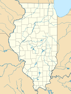
 Mulkeytown, Illinois
Coordinates: 37°58′15″N 89°06′41″W / 37.97083°N 89.11139°WCoordinates: 37°58′15″N 89°06′41″W / 37.97083°N 89.11139°W Country United States State Illinois County Franklin Area - Total 0.276 sq mi (0.7 km2) - Land 0.275 sq mi (0.7 km2) - Water 0.001 sq mi (0 km2) Elevation 446 ft (136 m) Population (2010) - Total 175 - Density 634.1/sq mi (244.8/km2) Time zone Central (CST) (UTC-6) - Summer (DST) CDT (UTC-5) ZIP code 62865 Area code(s) 618 GNIS feature ID 414225[1] Mulkeytown is an unincorporated census-designated place in Franklin County, Illinois, United States. Mulkeytown is located on Illinois Route 184 3 miles (4.8 km) west of Christopher. Mulkeytown has a post office with ZIP code 62865.[2] As of the 2010 census, its population was 175.[3]
References
- ^ "US Board on Geographic Names". United States Geological Survey. 2007-10-25. http://geonames.usgs.gov. Retrieved 2008-01-31.
- ^ ZIP Code Lookup
- ^ "American FactFinder". U.S. Census Bureau. http://factfinder2.census.gov/main.html. Retrieved 15 March 2011.
Municipalities and communities of Franklin County, Illinois County seat: Benton Cities Benton | Christopher | Orient | Sesser | West Frankfort | Zeigler

Villages Buckner | Ewing | Freeman Spur‡ | Hanaford | Macedonia‡ | North City | Royalton | Thompsonville | Valier | West City
Townships Unincorporated
communitiesAkin | Akin Junction | Benton Park | Bessie | Boothby | Cambon | Cleburne | Deering City | Diana | Ferber | Frisco | Groat | Hickory Corners | Kegley | Lake Creek | Meyer | Mitchell | Mulkeytown | New Bush | Parrish | Pershing | Plumfield | Rend City | Rust | Steel City | Urbain | Valier Patch | West End | Whittington
Categories:- Populated places in Franklin County, Illinois
- Census-designated places in Illinois
- Illinois geography stubs

Wikimedia Foundation. 2010.