- Mukundapur
-
Mukundapur — Village development committee — Location in Nepal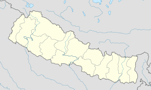
 Mukundapur
Coordinates: 27°42′N 84°19′E / 27.70°N 84.31°ECoordinates: 27°42′N 84°19′E / 27.70°N 84.31°E Country  Nepal
NepalZone Lumbini Zone District Nawalparasi District Population (1991) - Total 7,631 Time zone Nepal Time (UTC+5:45) Mukundapur is a village development committee in eastern part of Nawalparasi District in the Lumbini Zone of southern Nepal.The VDC lies on East-West (Mahendra) highway. At the time of the 1991 Nepal census it had a population of 7631.[1] According to the 2001 Nepal census, the VDC had a population of 10,092 (Male:4,939 and Female:5,153) living in 2,016 houses. The VDC is historically important as the "Mukundasen Durbar" built by King Madimukundasen of Palpa lies here. The VDC is named after this Durbar.
References
- ^ "Nepal Census 2001". Nepal's Village Development Committees. Digital Himalaya. http://www.digitalhimalaya.com/collections/nepalcensus/form.php?selection=1. Retrieved 18 December 2008.
Agryouli, Amarapuri, Amraut, Badahara Dubauliya, Baidauli, Banjariya, Benimanipur, Bharatipur, Bhujhawa, Bulingtar, Dadajheri Tadi, Dawanne Devi, Dedgaun, Deurali, Devachuli, Devagawa, Dhobadi, Dhurkot, Dibyapuri, Dumkibas, Gaidakot, Gairami, Guthi Parsauni, Guthisuryapura, Hakui, Harpur, Humsekot, Jahada, Jamuniya, Jamuwad, Jaubari, Kawaswati, Kolhuwa, Kotathar, Kudiya, Kumarwarti, Kusma, Mainaghat, Makar, Manari, Manjhariya, Mithukaram, Mukundapur, Naram, Narsahi, Naya Belhani, Pakalihawa, Palhi, Panchanagar, Parsauni, Pithauli, Pragatinagar, Pratappur, Rajahar, Rakachuli, Rakuwa, Ramnagar, Rampur Khadauna, Rampurwa, Ratnapur, Ruchang, Rupauliya, Sanai, Sarawal, Shivamandir, Somani, Sukrauli, Sunwal, Suryapura, Swathi, Tamasariya, Thulo Khairatawa, Tilakpur, Tribenisusta, Unwach, Upallo Arkhale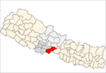 Categories:
- Populated places in Nawalparasi District
- Lumbini Zone geography stubs


Wikimedia Foundation. 2010.