- Antelias cave
-
Antelias cave 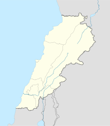
 Shown within Lebanon
Alternate name Mugharet-el-Bileni Location 2.5 kilometres (1.6 mi) east of Antelias Coordinates 33°54′00″N 35°37′00″E / 33.9°N 35.61666667°E Type Cave History Periods Paleolithic, Neolithic Site notes Excavation dates 1833, 1893, 1901, 1914, 1944, 1948 Archaeologists Heidenborg, Godefroy Zumoffen, Delore, Raoul Describes, Auguste Bergy, Ewing Condition destroyed Antelias Cave was a large cave located 2.5 kilometres (1.6 mi) east of Antelias, 10 kilometres (6.2 mi) northeast of Beirut close to the wadi of Ksar Akil.[1]
It was discovered by Heidenborg in 1833. Godefroy Zumoffen made an excavation in 1893, finding an Aurignacian industry amongst large quantities of bones and flints.[2] Henri Fleisch re-examined the material from Zumoffen's excavation and concluded that it was not solely Aurignacian but showed evidence of successive industries present as late as the Neolithic. Raoul Describes also excavated the site and found numerous tools made of bone including two harpoons which are now in the Museum of Lebanese Prehistory.[3] Auguste Bergy also made a small excavation here and another sounding was made possibly in 1948 by J. Ewing who described the industry as "transitional, Upper Paleolithic-to-Mesolithic".[4] D. A. Hooijer studied the fauna from the cave and found Dama and Capra to have been predominant.[5] Neolithic finds included a long, denticulated, lustrous blade. Bones of a human foetus were also found in the cave by Delore in 1901 which were published by Vallois in 1957 as being possibly Neolithic in date.[6] Collections from the cave can be found in the Musée de l'Homme, Paris, Museum of Lebanese Prehistory and the Archaeological Museum of the American University of Beirut.[1]
Antelias cave was completely destroyed by dynamite in the spring of 1964 due to quarrying in the area. Lorraine Copeland and Peter J. Wescombe recovered some cave deposits from which they hoped to extract material for radio-carbon dating.[1]
Further reading
- Copeland, Lorraine., The early Upper Palaeolithic material from levels VII-V, Antelias Cave, Lebanon Berytus, 19, 99-143, 45, 1970.
- Copeland, Lorraine and Hours, Francis., The later Upper Palaeolithic material from Antelias Cave, Lebanon, Levels IV-I, Berytus, 20, 57-138, 82, 1971.
- Copeland, Lorraine., "Natufian Sites in Lebanon" in Bar-Yosef and Valla (eds.) 1991, The Natufian Culture in the Levant, 27-42, 16, 1991.
Footnotes
- ^ a b c Lorraine Copeland; P. Wescombe (1965). Inventory of Stone-Age sites in Lebanon, pp. 66-67. Imprimerie Catholique. http://books.google.com/books?id=6YsRRwAACAAJ. Retrieved 21 July 2011.
- ^ Zumoffen, Godefroy., L'Homme prehistorique de la grotte d'Antelias au Liban, Syrie, Nature, Paris, 21: 341-342. L'Universite Saint Joseph, Beirut, 1893
- ^ Desribes, Raoul., Harpons trouvés dans la brèche paléolithique d'Antélias, L'Anthropologie, 25, 213, 1914
- ^ Ewing, J., List of Fossil Men in Lebanon. Catalogue des Hommes Fossiles. Publication of the International Geological Congress, Algiers, 1953.
- ^ Hooijer, D. A., The Fossil Vertebrates of Ksar Akil, a Paleolithic Rock-Shelter in the Lebanon. Zoloögische Verhandelgingen, 49, 1, 1961
- ^ Vallois, H., Le Sqelette de foetus humain fossile d'Antelias, Quaternaria, vol. 4, 1957.
External links
- The Natural History Museum Catalogue of Fossil Hominids
- University of Cologne Radio-Carbon context database entry for Antelias cave
 Archaeological sites in LebanonAadloun • Aaiha • Aammiq • Ain Harcha • Akbiyeh • Amioun • Anjar, Lebanon • Antelias cave • Ard Tlaili • Arqa • Baalbek • Batroumine • Batroun • Beirut • Beit Mery • Byblos • Dahr El Ahmar • Dakoue • Deir El Aachayer • Deir el Ahmar • Dekwaneh • Douris (Baalbek) • Elaea (Lebanon) • Hadeth south • Haret ech Cheikh • Hashbai • Hermel plains • Iaat • Jabal es Saaïdé • Jbaa • Jdeideh • Jebel Aabeby • Jeita Grotto • Joub Jannine • Jieh • Kamid al lawz • Kaukaba • Kefraya • Kfar Qouq • Kfarhata • Ksar Akil • Labweh • Lake Qaraoun (Ain Jaouze) • Lion Tower • Majdal Anjar • Mansourieh • Maronite mummies • Mayrouba • Moukhtara · Mtaileb · Nabi Zair • Nachcharini • Neba'a Faour • Niha Bekaa • Qaraoun • Ras Baalbek I • Ras Beirut • Ras El Kelb • Sands of Beirut • Sidon • Sin el Fil • Sarepta • Stone of the Pregnant Woman • Tahun ben Aissa • Tell Ain Nfaikh • Tell Ain Saouda • Tell Deir • Tell el-Burak • Tell Khardane • Tell Jisr • Tell Mureibit • Tell Neba'a Litani • Tell Zenoub • Tell Zeitoun • Temple of Bacchus • Temple of Eshmun • Toron • Tripolis (region of Phoenicia) • Tyre Necropolis • Tyre, Lebanon • Yanta • Ain W Zain • Zahlé •Categories:
- Paleolithic
- Neolithic settlements
- Archaeological sites in Lebanon

Wikimedia Foundation. 2010.