- Mount Hinokizuka Okumine
-
Mount Hinokizuka Okumine 桧塚奥峰 
Mount Hinokizuka Okumine from westElevation 1,420 m (4,659 ft) Listing List of mountains and hills of Japan by height Pronunciation [çinokidzukaokumine] Location Location Matsusaka, Mie, Japan Range Daikō Mountains Coordinates 34°21′N 136°6′E / 34.35°N 136.1°E Mount Hinokizukia Okumine (桧塚奥峰 Hinokizuka-okumine) is a 1,420 m (4,659 ft) mountain, in Matsusaka, Mie, Japan.
Contents
Outline
Mount Hinokizuka Okumine is one of Daikō Mountains. It is the tallest mountain of mountains in Mie Prefecture, which are not on the boarder with other prefectures.
Route
To the top of Mount Hinokizuka Okumine, there are two major routes. One is from Maakodani Tozanguchi, it takes two hours and 15 minutes. The other is via Myōjindaira and Mount Myōjin. It takes two hours and 40 minutes from the nearest parking space. If public transportation is used, it takes another 70 minutes from Ōmata Bus Stop of Nara Kōtsu.
Access
- Ōmata Bus Stop of Nara Kōtsu
Gallery
-

The top of Mount Hinokizuka Okumine (03/2009)
-

Mount Hinokizuka from the top of Mount Hinokizuka Okumine (03/2009)
-
Mount Ōdaigahara and Mount Ikegoya from the top of Mount Hinokizuka Okumine (03/2009)
-

Eastside view from the top of Mount Hinokizuka Okumine (03/2009)
-

Northside view from the top of Mount Hinokizuka Okumine (03/2009)
-

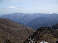
A view at Mount Hinokizuka Okumine (03/2009)
-

Trees with frosts from the top of Mount Hinokizuka Okumine (03/2009)
-

Trees with frosts at the top of Mount Hinokizuka Okumine (03/2009)
References
Categories:- Mountains of Mie Prefecture
- Visitor attractions in Mie Prefecture


Wikimedia Foundation. 2010.