- Moulamein
-
Moulamein
New South Wales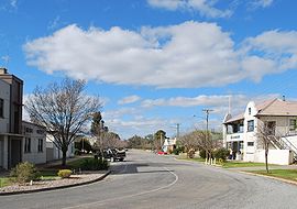
Morago Street, the main street of Moulamein, with the former Royal Hotel on the left and the Tattersalls Hotel on the right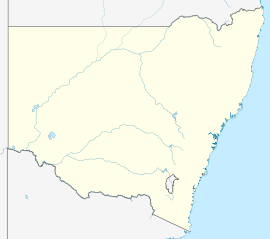
 Moulamein
Population: 349 (2006 Census)[1] Postcode: 2733 Elevation: 74 m (243 ft) Location: LGA: Wakool Shire County: Wakool State District: Murray-Darling Federal Division: Farrer Moulamein (
 /ˈmuːləmiːn/) is a small town in New South Wales, Australia, in the Wakool Shire. At the 2006 census, Moulamein had a population of 349 people.[1] Moulamein is the oldest town in the Riverina.[2]
The town is located between Balranald, Hay, Deniliquin and Swan Hill, at the junction of the Edward River and Billabong Creek. The name Moulamein is derived from a local Aboriginal word meaning "the meeting of the waters".[2]
The climate of this area is semi-arid, and the area is rich in birdlife such as waterfowl, wedge-tailed Eagles and emus. This area also has quite a lot of kangaroos.
History
Some accounts of Moulamein’s history make unsourced statements such as: “settled as early as 1830 Moulamein is the oldest town in the Riverina”.[3] However it is highly unlikely the township was established as early as 1830 considering that this was about the time of Charles Sturt’s exploration along the Murrumbidgee River just to the north of this region.
In about 1842 Augustus Morris came to the Riverina seeking grazing land in association with the entrepreneur and speculator Benjamin Boyd. Morris took up pastoral runs on the Edward River and explored the country surrounding the site of present-day Moulamein.[4] Morris was apparently the first European to describe the confluence of the Edward River and Billabong Creek as “The Moulamein”.
 The old wharf at Moulamein on the Edward River; riverboats carted wool and other products to and from Moulamein until the coming of the railway in 1923
Existing records of the Moulamein Court of Petty Sessions begin in 1847.[5] In June 1848 a contract was let for a court-house and lock-up to be built at Moulamein (to be finished within six weeks). Moulamein Post Office opened on 1 October 1849 [6]and the Clerk of Petty Sessions at Moulamein, Cornelius de Witt Jebb, applied for the position of postmaster. The post office closed in 1851 and was not reopened until 1859.[6] Moulamein's court-house pre-dated the one at Albury, so prisoners were brought there to be tried from far-flung regions of the Riverina. Richard Edward Wright established the Moulamein Inn at the location in 1848 and was granted a license for the hotel in February 1849. In November 1849 approval was granted for Moulamein to be laid out as a township. It was surveyed by Thomas Townsend 1851 and its township status gazetted on 9 September that year. Moulamein's first court-house was demolished in 1860.[7]
During the period 1864 to 1866 George Ashcroft held the license of the Traveller’s Rest Hotel at Moulamein.[8]
In 1866 it was reported that Moulamein had a population of 100 persons. At that time the township had two hotels, a post-office and "some stores". A tender was accepted for a school to be built at Moulamein in June 1866.[9]
Notes
- ^ a b Australian Bureau of Statistics (25 October 2007). "Moulamein (L) (Urban Centre/Locality)". 2006 Census QuickStats. http://www.censusdata.abs.gov.au/ABSNavigation/prenav/LocationSearch?collection=Census&period=2006&areacode=UCL155600&producttype=QuickStats&breadcrumb=PL&action=401. Retrieved 2 November 2009.
- ^ a b Geographical Names Board of NSW
- ^ For example, ‘Moulamein’, Walkabout Australian Travel Guide web-site, FairfaxDigital.
- ^ Buxton, Gordon L., The Riverina 1861-1891: An Australian Regional Study, Melbourne University Press, Melbourne, 1967.
- ^ Bench book, 2 August 1847 to 1 March 1895, CGS 3170, Courts of Petty Sessions (Moulamein), State Records of New South Wales.
- ^ a b Premier Postal History, Post Office List, https://www.premierpostal.com/cgi-bin/wsProd.sh/Viewpocdwrapper.p?SortBy=NSW&country=, retrieved 2009-06-11
- ^ 'The Western Riverina: A History of Its Development' by James Jervis (Royal Australian Historical Society Journal and Proceedings Vol. XXXVIII 1952), pp. 239-40.
- ^ Listing of hotel licensees, New South Wales Government Gazettes
- ^ The Western Riverina: A History of Its Development by James Jervis (Royal Australian Historical Society Journal and Proceedings Vol. XXXVIII 1952), pp. 240 (citing Pastoral Times, 23 June 1866).
External links
Coordinates: 35°05′S 144°02′E / 35.083°S 144.033°E
Towns in the Wakool Shire Local Government Area Categories:- Towns in New South Wales
- Towns in the Riverina
- River ports of Australia


Wikimedia Foundation. 2010.