- Mongun-Tayginsky District
-
Mongun-Tayginsky District (English)
Монгун-Тайгинский кожуун (Russian)
Монгун-Тайга кожуун (Tuvan)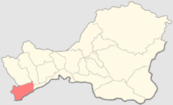
Location of Mogun-Tayginsky District on the map of the Republic of TyvaAdministrative status (as of 2009) Country Russia Federal subject Tuva Republic[1] Administrative center selo of Mugur-Aksy[2] Statistics Population (2010 Census,
preliminary)5,660 inhabitants[3] Population (2002 Census) 5,938 inhabitants[4] - Urban population 0% - Rural population 100% Time zone KRAST (UTC+08:00)[5] Mongun-Tayginsky District (Russian: Монгун-Тайгинский кожуун; Tuvan: Монгун-Тайга кожуун) is one of the seventeen administrative divisions of the Tuva Republic, Russia. Municipally, it is incorporated as the Municipal District of Mongun-Tayginsky Kozhuun. Its administrative center is the rural locality (a selo) of Mugur-Aksy.[2] District's population: 5,660 (2010 Census preliminary results);[3] 5,938 (2002 Census);[6] 5,576 (1989 Census).[7] Population of Mugur-Aksy accounts for 68.1% of the district's population.[6]
References
- ^ Constitution, Article 138.2a
- ^ a b Resolution #1648 ZP-1
- ^ a b Федеральная служба государственной статистики (Federal State Statistics Service) (2011). "Предварительные итоги Всероссийской переписи населения 2010 года (Preliminary results of the 2010 All-Russian Population Census)" (in Russian). Всероссийская перепись населения 2010 года (All-Russia Population Census of 2010). Federal State Statistics Service. http://www.perepis-2010.ru/results_of_the_census/results-inform.php. Retrieved 2011-04-25.
- ^ Федеральная служба государственной статистики (Federal State Statistics Service) (2004-05-21). "Численность населения России, субъектов Российской Федерации в составе федеральных округов, районов, городских поселений, сельских населённых пунктов – районных центров и сельских населённых пунктов с населением 3 тысячи и более человек (Population of Russia, its federal districts, federal subjects, districts, urban localities, rural localities—administrative centers, and rural localities with population of over 3,000)" (in Russian). Всероссийская перепись населения 2002 года (All-Russia Population Census of 2002). Federal State Statistics Service. http://www.perepis2002.ru/ct/doc/1_TOM_01_04.xls. Retrieved 2010-03-23.
- ^ Правительство Российской Федерации. Постановление №725 от 31 августа 2011 г. «О составе территорий, образующих каждую часовую зону, и порядке исчисления времени в часовых зонах, а также о признании утратившими силу отдельных Постановлений Правительства Российской Федерации». Вступил в силу по истечении 7 дней после дня официального опубликования. Опубликован: "Российская Газета", №197, 6 сентября 2011 г. (Government of the Russian Federation. Resolution #725 of August 31, 2011 On the Composition of the Territories Included into Each Time Zone and on the Procedures of Timekeeping in the Time Zones, as Well as on Abrogation of Several Resolutions of the Government of the Russian Federation. Effective as of after 7 days following the day of the official publication).
- ^ a b Федеральная служба государственной статистики (Federal State Statistics Service) (2004-05-21). "Численность населения России, субъектов Российской Федерации в составе федеральных округов, районов, городских поселений, сельских населённых пунктов – районных центров и сельских населённых пунктов с населением 3 тысячи и более человек (Population of Russia, its federal districts, federal subjects, districts, urban localities, rural localities—administrative centers, and rural localities with population of over 3,000)" (in Russian). Всероссийская перепись населения 2002 года (All-Russia Population Census of 2002). Federal State Statistics Service. http://www.perepis2002.ru/ct/doc/1_TOM_01_04.xls. Retrieved 2010-03-23.
- ^ "Всесоюзная перепись населения 1989 г. Численность наличного населения союзных и автономных республик, автономных областей и округов, краёв, областей, районов, городских поселений и сёл-райцентров. (All Union Population Census of 1989. Present population of union and autonomous republics, autonomous oblasts and okrugs, krais, oblasts, districts, urban settlements, and villages serving as district administrative centers.)" (in Russian). Всесоюзная перепись населения 1989 года (All-Union Population Census of 1989). Demoscope Weekly (website of the Institute of Demographics of the State University—Higher School of Economics. 1989. http://demoscope.ru/weekly/ssp/rus89_reg.php. Retrieved 2010-03-23.
Sources
- 6 мая 2001 г. «Конституция Республики Тыва», в ред. Конституционного закона №1419 ВХ-2 от 10 июля 2009 г «О внесении изменений в статью 113 Конституции Республики Тыва». Вступил в силу со дня официального опубликования. Опубликован: "Тувинская правда", 15 мая 2001 г. (May 6, 2001 Constitution of the Tyva Republic, as amended by the Constitutional Law #1419 VKh-2 of July 10, 2009 On Amending Article 113 of the Constitution of the Tyva Republic. Effective as of the official publication date).
- Законодательная палата Великого Хурала Республики Тыва. Постановление №1648 ЗП-1 от 21 декабря 2005 г. «Об утверждении реестра административно-территориального деления Республики Тыва», в ред. Постановления №455 ЗП-2 от 21 ноября 2007 г «О внесении изменения в реестр административно-территориального деления Республики Тыва». Вступил в силу 21 декабря 2005 г. Опубликован: "Тувинская правда", №2, 12 января 2006 г. (Legislative Chamber of the Great Khural of the Tyva Republic. Resolution #1648 ZP-1 of December 21, 2005 On Establishing the Registry of the Administrative-Territorial Division of the Tyva Republic, as amended by the Resolution #455 ZP-2 of November 21, 2007 On Amending the Registry of the Administrative-Territorial Division of the Tyva Republic. Effective as of December 21, 2005).
Administrative divisions of the Tuva Republic Capital: Kyzyl
Cities and towns 
Kozhuuns
(administrative districts)Barun-Khemchiksky · Bay-Tayginsky · Chaa-Kholsky · Chedi-Kholsky · Dzun-Khemchiksky · Erzinsky · Kaa-Khemsky · Kyzylsky · Mongun-Tayginsky · Ovyursky · Piy-Khemsky · Sut-Kholsky · Tandinsky · Tere-Kholsky · Tes-Khemsky · Todzhinsky · Ulug-KhemskyCategories:- Districts of Tuva

Wikimedia Foundation. 2010.