- Momeik
-
Momeik
Mong Mit (မိူင်းမိတ်ႈ)Location in Burma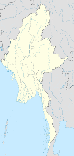
 Momeik
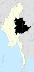
Coordinates: 23°7′N 96°41′E / 23.117°N 96.683°E Country Burma Division Shan State Government – Mayor Population (2005) – Ethnicities Shan, Palaung – Religions Buddhism Time zone MST (UTC+6.30) Momeik, known as Know as Mong Mit (မိူင်းမိတ်ႈ) in Shan, is a town situated on the Shweli River in northern Shan State of Myanmar (Burma).
Contents
Transport
It is connected by road to Mogok and its ruby mines, and via Mogok to Mandalay, and to Kyaukme which is on the Mandalay-Lashio railway line. Momeik is also linked to Myitkyina, capital of Kachin State via Mabein and Bhamo.[1][2] There is an airport for domestic flights to Momeik.[3]
Whereas Mogok lies at an elevation of 4,000 ft, Momeik is just 800 ft above sea level and 28 miles to the north of Mogok. Sixty miles by road to the west of Mogok lie Twinnge Village and the town of Thabeikkyin on the Ayeyarwady River (Irrawaddy).[4] There is now a direct road linking Twinnge with Momeik.[5]
History
Momeik, part of the state of Hsenwi, was founded in 1238. Thirteen villages of the Mogok Stone Tract were given to Momeik in 1420 as a reward for helping Yunnan raid Chiang Mai. In 1465, Nang Han Lung, the daughter-in-law of the Saopha (Sawbwa in Burmese) of Momeik, sent ruby as separate tribute from Hsenwi and succeeded in keeping the former possessions of Hsenwi until 1484 when Mogok was ceded to the Burmese kings.[6][7] It was however not until 1597 that the Saopha of Momeik was forced to exchange Mogok and Kyatpyin with Tagaung, and they were formally annexed by royal edict.[7][8]
Earlier in 1542, when the Shan ruler of Ava Thohanbwa (1527–1543) marched with the Saophas of Mohnyin, Hsipaw, Momeik, Mogaung, Bhamo and Yawnghwe to come to the aid of Prome against the Burmese, he was defeated by Bayinnaung. In 1544, Hkonmaing (1543-6), Saopha of Onbaung or Hsipaw and successor to Thohanbwa, attempted to regain Prome, with the help of Mohnyin, Momeik, Monè, Hsenwi, Bhamo and Yawnghwe, only to be defeated by King Tabinshwehti (1512–1550).[6]
Bayinnaung succeeded in three campaigns, 1556-9, to reduce the Shan states of Mohnyin, Mogaung, Momeik, Mong Pai (Mobyè), Saga, Lawksawk (Yatsauk), Yawnghwe, Hsipaw, Bhamo, Kalay, Chiang Mai, and Linzin (Vientiane), before he raided up the Taping and Shweli Rivers in 1562.[6]
A bell donated by King Bayinnaung (1551–1581) at Shwezigon Pagoda in Bagan has inscriptions in Burmese, Pali and Mon recording the conquest of Momeik and Hsipaw on 25 January 1557, and the building of a pagoda at Momeik on 8 February 1557.[9]
British rule
The Saopha of Momeik had just died at the time of the British annexation in 1885 leaving a minor as heir, and the administration at Momeik was weak. It was included under the jurisdiction of the Commissioner of the Northern Division instead of the Superintendent of the Northern Shan States. A pretender named Hkam Leng came to claim the title, but he was rejected by the ministers. A Burmese prince called Saw Yan Naing, who had risen up against the British, fled to the area and joined forces with Hkam Leng, and caused a great deal of problems during 1888-9 to the Hampshire Regiment stationed at Momeik.[10]
Sao Hkun Hkio, Saopha of Momeik, was one of the seven Saophas on the Executive Committee of the Shan State Council formed after the first Panglong Conference in March 1946. On 16 January 1947, they sent two memoranda, whilst a Burmese delegation headed by Aung San was in London, to the British Labour government of Clement Attlee demanding equal political footing as Burma proper and full autonomy of the Federated Shan States.[11] He was not one of the six Saophas who signed the Panglong Agreement on 12 February 1947.[12] The Cambridge-educated Sao Hkun Hkio however became the longest serving Foreign Minister of Burma after independence in 1948 until the military coup of Ne Win in 1962, with only short interruptions, the longest one of which being between 1958 and 1960 during Ne Win's caretaker government.[13][14]
After independence
The Shweli river valley and the hills around Momeik and Mogok are old strongholds of the Communist Party of Burma (CPB) as early as the 1950s, but it was not until 1968 that the 1st Brigade of the CPB People's Army regained control of the area, and briefly captured Momeik itself in 1977. Their plan to strike west to the plains north of Mandalay however was thwarted by clashes with the Shan State Army and the Palaung State Liberation Army as well as government military offensives.[15]
The Shan State Army-North's 3rd Brigade has been active in Momeik, Kyaukme, Hsipaw, Namtu and Lashio. It reached a cease-fire agreement with the Burmese military government (SLORC) in 1989, and its activities have been severely curtailed.[16][17] In 2005, an attempt by the Shan State Army-South based near the Thai border to fill the vacuum left by the cease-fire in the north was thwarted by the Burmese army.[18]
Economy
Minerals
Momeik is famous for its precious and semi-precious stones in its own right. Elbaite, a variant of Rubellite (Tourmaline or Anyant meaning 'inferior' in Burmese) including the "mushroom" tourmaline, and Petalite or Salinwa are mined in this region.[19][20][21][22]
Diamond found in Momeik region is believed to be derived from primary sources in northwestern Australia but distinguishable from similar stones from eastern Australia.[23]Gold mining in the area is being operated by Asia World and Shweli Yadana companies.[24]
Agriculture
Mogok ruby mines rely on the staple Momeik rice.[4] Hsinshweli strain high-yield rice as well as sugar cane, rubber, physic nut, jengkol bean and avocado are cultivated in the region.[5][25]
Notes
- ^ "Train Travel in Myanmar (Burma)". seat61.com. http://www.seat61.com/Burma.htm#Mandalay%20-%20Pyin%20Oo%20Lwin. Retrieved 2009-02-17.
- ^ "Transport in Myanmar". MODiNS.Net. http://www.modins.net/myanmarinfo/media/transport.htm. Retrieved 2009-02-27.
- ^ "Momeik Airport". World Aero Data. http://worldaerodata.com/wad.cgi?id=BM35977. Retrieved 2009-02-17.
- ^ a b Ehrmann, Martin (Spring 1957). "Gem Mining In Burma". Gems & Gemology. pp. 3–4. http://www.burmalibrary.org/docs/Ehrmann-ocr.pdf. Retrieved 2009-02-27.
- ^ a b "Momeik, granary of Shan State (North), to extend cultivation of crops". New Light of Myanmar. 26 August 2007. http://myanmargeneva.org/NLM2007/eng/8Aug/n070826.pdf. Retrieved 2009-02-27.
- ^ a b c Harvey, G E. History of Burma: From the Earliest Times to 10 March 1824. Asian Educational Services, 2000. pp. 101, 107, 109, 165–6. ISBN 9788120613652. http://books.google.co.uk/books?id=vmIVhKXwrFcC&pg=PA165&lpg=PA165&dq=momeik&source=web&ots=xnn67G89VD&sig=P41IVsgwNZ9BlTjbQ67bSdXyxdw&hl=en&ei=RoCUSYmyFM-g-gbix_SACQ&sa=X&oi=book_result&resnum=2&ct=result#PPA101,M1. Retrieved 2009-02-17.
- ^ a b Morgan, Diane. Fire and Blood: Rubies in Myth, Magic, and History. Greenwood Publishing Group, 2007. pp. 64. ISBN 9780275993047. http://books.google.co.uk/books?id=hKYPZGm37hMC&pg=PA64&lpg=PA64&dq=momeik&source=web&ots=xOOmInazYi&sig=pd0-VkpVjD1BUoV75Gn2dh5W90c&hl=en&ei=PouUSZ_UI8yL-gbvgumQCQ&sa=X&oi=book_result&resnum=4&ct=result. Retrieved 2009-02-17.
- ^ Hughes, Richard. "Ruby & Sapphire, chapter12:World Sources". Ruby-Sapphire.com. http://www.ruby-sapphire.com/r-s-bk-burma.htm. Retrieved 2009-02-17.
- ^ U Thaw Kaung. "Accounts of King Bayinnaung's Life and Hanthawady Hsinbyu-myashin Ayedawbon, a Record of his Campaigns". Chulalongkorn University. http://www.arts.chula.ac.th/~complit/event/hantawadi.htm. Retrieved 2009-02-25.
- ^ Crosthwaite, Charles. The Pacification of Burma. Routledge, 1968. pp. 267–280. ISBN 9780714620046. http://books.google.co.uk/books?id=Opeig29e4ikC&pg=RA1-PA277&dq=shweli+river&lr=&sig=ACfU3U3uLAvW0SgoEyq_vpOooUBPVW6DDQ#PPA270,M1. Retrieved 2009-02-25.
- ^ "Shans send Memoranda To His Majesty's Government". S.H.A.N.. http://www.shanland.org/general/2000/shans_send_memoranda_to_his_maje.htm/. Retrieved 2009-02-28.
- ^ "The Panglong Agreement, 1947". Online Burma/Myanmar Library. http://www.ibiblio.org/obl/docs/panglong_agreement.htm. Retrieved 2009-02-28.
- ^ "Foreign ministers". rulers.org. http://rulers.org/fm3.html. Retrieved 2009-03-16.
- ^ "Mrs. Beatrice Mabel Hkio". Hansard. 5 June 1967. http://hansard.millbanksystems.com/written_answers/1967/jun/05/mrs-beatrice-mabel-hkio. Retrieved 2009-03-16.
- ^ Bertil Lintner (1990). The Rise and Fall of the Communist Party of Burma (CPB). SEAP Publications. pp. 72–79. ISBN 9780877271239. http://books.google.co.uk/books?id=tMBtwdQ9ZUsC&pg=PA79&dq=shweli+river&sig=ACfU3U3k0AtgR7FTa87aAPgFa2bVaIQfwg#PPA72,M1. Retrieved 2009-02-28.
- ^ "Ceasefire group gets marching orders". S.H.A.N.. 2005-08-30. http://www.shanland.org/politics/2005/Ceasefire-group-gets-marching-orders/. Retrieved 2009-02-28.
- ^ "Truce Brings Only Grief, Says Ceasefire Leader". S.H.A.N.. 2005-05-23. http://www.shanland.org/politics/1999/truce_brings_only_grief.htm/. Retrieved 2009-02-28.
- ^ "The big chase". S.H.A.N.. 2006-01-03. http://www.shanland.org/war/2006/News-01030106/. Retrieved 2009-02-28.
- ^ "Tetrahedrally Coordinated Boron in Li-bearing Olenite from "Mushroom" Tourmaline from Momeik, Myanmar". The Canadian Mineralogist, August 2007, GeoScienceWorld. http://canmin.geoscienceworld.org/cgi/content/abstract/45/4/891. Retrieved 2009-02-27.
- ^ "Mushroom elbaite from the Kat Chay mine, Momeik, near Mogok, Myanmar: I. Crystal chemistry by SREF, EMPA, MAS NMR and Mössbauer spectroscopy". Mineralogical Magazine, June 2008, GeoScienceWorld. http://minmag.geoscienceworld.org/cgi/content/abstract/72/3/747. Retrieved 2009-02-27.
- ^ "Momeik". Rockhound.cz. http://www.rockhound.cz/english/vyhledat.php?odkud=0&lokalita=Momeik. Retrieved 2009-02-27.
- ^ "Petalite Crystals from Burma". "Mineral Classics". http://www.minclassics.com/PetBur1208.html. Retrieved 2009-02-27.
- ^ "Diamonds from Myanmar and Thailand: Characteristics and Possible Origins". Economic Geology, January 2001, GeoScienceWorld. http://econgeol.geoscienceworld.org/cgi/content/abstract/96/1/0159. Retrieved 2009-02-27.
- ^ "Lt-Gen Aung Htwe inspects Twinnge-Momeik Road construction, gold mines in Momeik". New Light of Myanmar. November 28, 2003. http://www.myanmar.gov.mm/NLM-2003/enlm/Nov28_rg3.html. Retrieved 2009-02-27.
- ^ "Service personnel to discharge duties assigned by local authorities for accomplishment of five rural development tasks". New Light of Myanmar. 2 September 2006. http://www.myanmargeneva.org/06nlm/n060902.htm. Retrieved 2009-02-27.
External links
- Satellite map GeoNames
- Tourmaline "Rubellite", Burma Momeik Finest Minerals
- Elbaite (Rubellite) Fabre Minerals
- High yield rice yields low S.H.A.N.
Coordinates: 23°07′00″N 96°41′00″E / 23.1166667°N 96.6833333°E
Shan State Capital: TaunggyiTaunggyi District 
Loilem District Loilem Township · Nansang Township · Kunhing Township · Lai-Hka Township · Kyethi Township · Mong Kung Township · Mong Hsu TownshipLashio District Mu Se District Kyaukme District Kunlong District Kengtung District Mong Hsat District Tachileik District Mong Hpayak District Langkho District Danu Self-Administered Zone Pa-O Self-Administered Zone Pa Laung Self-Administered Zone Kokang Self-Administered Zone Konkyan Township · Laukkaing TownshipWa Self-Administered Division Hopang Township · Mongmaw Township · Panwai Township · Nahpan Township · Metman Township · Pangsang TownshipMain cities and towns Taunggyi · Ayetharyar · Nyaungshwe · Hopong · Hsi Hseng · Kalaw · Aungban · · Lawksawk · Pinlaung · Pekon · Loilen · Pang Long · Langkho · Nansang · Kunhing · Mong Nai · Lai-Hka · Mawkmai · Mong Pan · Hong Pai · Kyethi · Mong Kung · Mong Hsu · Mong Ton · Lashio · Hseni · Mongyai · Tangyan · Muse · Mongko · Nanhkan · Kutkai · Kyaukme · Nawnghkio · Hsipaw · Namtu · Namhsan · Mongmit · Mabein · Mantong · Kunlong · Hopang · Laukkaing · Chinshwehaw · Kengtung · Mong Khet · Mong Yang · Mong Hsat · Mong Ping · Tachileik · Mong Hpayak · Mong YawngCategories:- Populated places in Shan State


Wikimedia Foundation. 2010.