- Mołtajny
-
Mołtajny — Village — 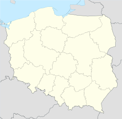
 Mołtajny
Coordinates: 54°17′N 21°21′E / 54.283°N 21.35°E Country  Poland
Voivodeship Warmian-Masurian County Kętrzyn Gmina Barciany Population 760 Mołtajny [mɔu̯ˈtai̯nɨ] (German Molthainen) is a village in the administrative district of Gmina Barciany, within Kętrzyn County, Warmian-Masurian Voivodeship, in northern Poland, close to the border with the Kaliningrad Oblast of Russia.[1] It lies approximately 8 kilometres (5 mi) north of Barciany, 23 km (14 mi) north of Kętrzyn, and 79 km (49 mi) north-east of the regional capital Olsztyn.
Before 1945 the area was part of Germany (East Prussia).
The village has a population of 760.
References
Seat Barciany
Other villages Aptynty • Arklity • Asuny • Błędowo • Bobrowo • Cacki • Czaczek • Dębiany • Dobrzykowo • Drogosze • Frączkowo • Garbnik • Garbno • Gęsie Góry • Gęsiki • Gęsiniec Wielki • Glinka • Główczyno • Górki • Gradowo • Gumniska • Kiemławki Małe • Kiemławki Wielkie • Kolwiny • Kotki • Krelikiejmy • Krymławki • Krzeczewo • Kudwiny • Maciejki • Markławka • Markuzy • Michałkowo • Modgarby • Mołtajny • Momajny • Moruny • Niedziałki • Niedziały • Ogródki • Pastwiska • Pieszewo • Piskorze • Podławki • Radoski Dwór • Radosze • Rodele • Rowy • Ruta • Rutka • Rzymek • Silginy • Skandawa • Skierki • Skoczewo • Sławosze • Solkieniki • Staniszewo • Stary Dwór Barciański • Suchawa • Święty Kamień • Szaty Wielkie • Taborzec • Wielewo • Wilkowo Małe • Wilkowo Wielkie • Winda • Zalewska GóraCategories:- Villages in Kętrzyn County
- Kętrzyn County geography stubs


Wikimedia Foundation. 2010.