- Milovaig
-
Coordinates: 57°27′06″N 6°44′40″W / 57.45155°N 6.74436°W
Milovaig Scottish Gaelic: Mìolabhaig 
 Milovaig
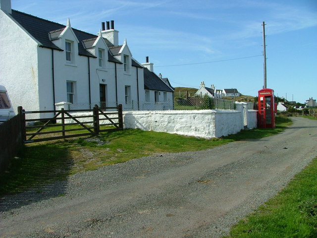
Milovaig shown within the Isle of SkyeOS grid reference NG155500 Council area Highland Country Scotland Sovereign state United Kingdom Post town Glendale Postcode district IV55 8 Police Northern Fire Highlands and Islands Ambulance Scottish EU Parliament Scotland List of places: UK • Scotland • Milovaig or Mìolabhaig, comprises two small scattered, mixed crofting and residential townships, consisting of Lower Milovaig to the North and Upper Milovaig to the South, situated on the south shore of Loch Pooltiel on the Duirinish peninsula, on the Isle of Skye, in the Highlands of Scotland. It is in the Scottish council area of Highland.
It is part of the Glendale estate.
 Milovaig
Skye / An t-Eilean Sgitheanach Main settlements Crofting townships
and settlementsAchachork · Aird of Sleat · Ardvasar · Armadale · Ashaig · Bernisdale · Bornesketaig · Boreraig · Borreraig · Borrodale · Borve · Bracadale · Breakish · Brogaig · Bualintur · Camastianavaig · Camuscross · Carbost, Loch Harport · Carbost, Portree · Claigan · Colbost · Drumfearn · Drynoch · Dunan · Duntulm · Edinbane · Elgol · Ellishadder · Eynort · Eyre · Fasach · Feorlig · Ferindonald · Fiskavaig · Flashader · Flodigarry · Galltrigill · Garafad · Geary · Gedintailor · Gillen · Glendale · Halistra · Harlosh · Heaste · Isleornsay · Kensaleyre · Kilbride · Kilmarie · Kilmore · Kilmuir · Kilvaxter · Kingsburgh · Kylerhea · Lealt · Lower Breakish · Luib · Milovaig · Ollach · Ose · Peinachorran · Portnalong · Ramasaig · Roag · Sconser · Skeabost · Sligachan · Staffin · Stein · Struan · Suladale · Talisker · Tarskavaig · Teangue · Torrin · Totaig · Tote · Treaslane · Trumpan · Uigshader · Ullinish · Upper BreakishMountains and hills Am Basteir · Beinn na Caillich · Blà Bheinn · Bruach na Frìthe · Clach Glas · Glamaig · Healabhal Bheag · Sgurr a' Ghreadaidh · Sgurr a' Mhadaidh · Sgurr Mhic Choinnich · Sgurr na Banachdich · Sgurr nan Gillean · Sgurr Dearg · Marsco · Quiraing/Meall na Suiramach · Sgurr Alasdair · The StorrHistory Armadale Castle · Battle of the Braes · Battle of the Spoiling Dyke · Caisteal Maol · Corriechatachan · Dùn Ringill · Dunvegan Castle · Fairy Flag · Flora MacDonald · Sir Rory Mor's Horn · Rubha an DùnainLocal culture Peninsulas Surrounding islands Ascrib Islands · Crowlin Islands · Eilean Bàn · Eilean Fladday · Eilean Mòr · Eilean Tigh · Eilean Trodday · Fladda-chùain · Harlosh Island · Isay · Lampay · Longay · Mingay · Oronsay · Pabay · Raasay · Scalpay · Rona · Soay · Staffin Island · Tarner Island · WiayCategories:- Populated places in Skye
- Highland geography stubs

Wikimedia Foundation. 2010.