Mills, New Mexico

Mills, New Mexico
Mills
—  Unincorporated community  —
Mills is located in New Mexico
Mills
Location within the state of New Mexico
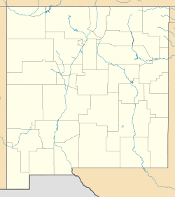
Coordinates: 36°05′08″N 104°15′19″W / 36.08556°N 104.25528°W / 36.08556; -104.25528Coordinates: 36°05′08″N 104°15′19″W / 36.08556°N 104.25528°W / 36.08556; -104.25528
Country United States
State New Mexico
County Harding
Elevation 6,115 ft (1,864 m)
Time zone Mountain (MST) (UTC-7)
 – Summer (DST) MDT (UTC-6)
ZIP codes 87730
Area code(s) 575
FIPS code
GNIS feature ID 908762

Mills is an unincorporated community in Harding County, New Mexico, founded in 1888. It lies on NM 39 eleven miles north of Roy. Mills lies within the Kiowa National Grassland. The post office there opened in 1889, was closed from 1901 to 1908, and has been open since.[1]

History

Mills was named after Melvin W. Mills, a rancher and attorney from Springer.[2]

Notes

  1. ^ Julyan, Robert (1998) "Mills" Place Names of New Mexico (2nd ed.) University of New Mexico Press, Albuquerque, New Mexico, page 229, ISBN 0-8263-1689-1
  2. ^ Pearce, T. M. (1965) "Mills" New Mexico Place Names; A Geographical Dictionary University of New Mexico Press, Albuquerque, New Mexico, page 101, OCLC 420847


Wikimedia Foundation. 2010.

Игры ⚽ Поможем написать реферат

Look at other dictionaries:

  • Mills House (Springer, New Mexico) — Mills House U.S. National Register of Historic Places …   Wikipedia

  • New Mexico — • A state of the United States Catholic Encyclopedia. Kevin Knight. 2006. New Mexico     New Mexico     † …   Catholic encyclopedia

  • New Mexico — This article is about the U.S. state of New Mexico. For other uses, see New Mexico (disambiguation). Land of Enchantment redirects here. For the Michael Martin Murphey album, see Land of Enchantment (album). State of New Mexico Estado de Nuevo… …   Wikipedia

  • New Mexico Territory — Territory of New Mexico Organized incorporated territory of the United States …   Wikipedia

  • New Mexico, Maryland — Coordinates: 39°36′12″N 76°56′56″W / 39.60333°N 76.94889°W / 39.60333; 76.94889 New Mexico is an unincorporated commun …   Wikipedia

  • Alamogordo, New Mexico — Infobox Settlement official name = The City of Alamogordo settlement type = City nickname = A town, The Space City, Alamo motto = The Friendliest Place on Earth [cite web url= http://ci.alamogordo.nm.us/ title= City of Alamogordo (official web… …   Wikipedia

  • Mora, New Mexico — David F. Cargo Library in Mora Coordinates …   Wikipedia

  • Espanola, New Mexico — Infobox Settlement official name = City of Española settlement type = City motto = Serving The Community With Pride Sources: [cite web |url=http://www.cityofespanola.org/ |title=City of Española Home Page |accessdate=2008 07 18 |publisher=City of …   Wikipedia

  • Mosquero, New Mexico —   Village   Loca …   Wikipedia

  • National Register of Historic Places listings in Colfax County, New Mexico — Location of Colfax County in New Mexico This is a list of the National Register of Historic Places listings in Colfax County, New Mexico. This is intended to be a complete list of the properties and districts on the National Register of Historic… …   Wikipedia

Share the article and excerpts

Direct link
Do a right-click on the link above
and select “Copy Link”