- Victor Harbor railway line
-
Contents
The Victor Harbor line is a broad gauge railway line in South Australia. It branches from the Adelaide-Melbourne railway at Mount Barker Junction and then runs south to Victor Harbor.
History
South Australia’s first railway venture was the opening of the Goolwa to Port Elliot horse tramway in 1854. The line ran from Goolwa on the Murray River to an ocean harbour at Port Elliot, later extended to a safer harbour at Victor Harbor. This line was used to move freight between the shallow-draft vessels navigating the Murray, and coastal and ocean-going vessels, without either having to traverse the narrow and shallow mouth of the river with unpredictable currents. The line was extended northwards to Strathalbyn in 1869, the connection from Adelaide reaching the town in 1884 and completing the link.[1] Until 1884 trains south of Strathalbyn were hauled by horse power, but between 1883 and 1885 the section to Currency Creek was rebuilt to steam railway standards.[2]
Australian National operated freight services on the Strathalbyn to Victor section were withdrawn in 1980,[3] and remaining freight trains to Strathalbyn were stopped in October 1987. In the early 1980's, AN general manager Don Williams announced that the Victor Harbor line would close, despite enormous public opposition. Several factors were noted for the closure of the line, such as a detoriating track condition, a long time-consuming route compared with a more direct road journey, and declining passenger numbers. Over 50,000 return journeys were made during 1977/78 but this dropped to only around 16,000 by 1982/83. The last AN passenger service ran on 30 April 1984, when loco 942 pulled 7 steel cars from Adelaide to Victor Harbor and return. Despite many people using the service in the last few months leading into the closure, it wasn't enough for passenger services to be retained. The SteamRanger Tourist Railway established in 1986 to operate tourist trains on the line. In late 1989 AN declared the Mt Barker Junction-Strathalbyn section unsafe and Steamranger-operated services from Adelaide to Strathalbyn were cancelled. That section was eventually renewed during 1990-91 with funding from the State Government, AN and other resources. First the lines beyond Strathalbyn were operated by SteamRanger train crews, later extending to the entire line.[3] In 1995 gauge conversion of the Adelaide-Melbourne railway cut the broad gauge Victor Harbor line off from the rest of the network, and volunteers took full responsibility for maintaining the track from Mount Barker Junction to Victor.[3]
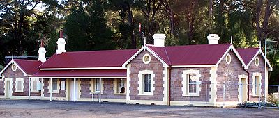
Stations
- Littlehampton
- Mount Barker
- Bugle Ranges
- Gemmells
- Strathalbyn
- Sandergrove
- Nurragi
- Milang
- Finniss
- Black Swamp
- Currency Creek
- Goolwa
- Middleton
- Port Elliot
- Victor Harbor
Line Guide
Steamranger Victor Harbor Line Heritage Services
Broad Gauge (Red), Standard Gauge (Blue)Legend


ARTC Mainline (Standard Gauge) to Adelaide 


50.0 km Mount Barker Junction 

ARTC Mainline (Standard Gauge) to Melbourne 
53.0 km Littlehampton 
South Eastern Freeway Tunnel 

55.1 km Mount Barker Steamranger Depot 
Western Flat Creek 
61.5 km Philcox Hill (Closed) 64.0 km Bugle Ranges (Closed) 
Wistow-Strathalbyn Road 70.1 km Gemmells (Closed) Angus River 81.5 km Strathalbyn Sandergrove (Closed 1973) 

Milang Line (Closed 1970) 97.0 km Finniss Finniss River 99.2 km Gilberts Goolwa-Strathalbyn Road 106.7 km Currency Creek 
Currency Creek 

Goolwa Steamranger Depot 
Hindmarsh Island Bridge 114.4 km Goolwa Victor Harbor-Goolwa Road 122.5 km Middleton 125.5 km Port Elliot 
132.0 km Victor Harbor See also
References
- ^ "Lineside Guide – Goolwa to Pt Elliot". www.steamranger.org.au. http://www.steamranger.org.au/enthusiast/guides/guide11.htm. Retrieved 22 April 2008.
- ^ "Lineside Guide – Strathalbyn to Sandergrove". www.steamranger.org.au. http://www.steamranger.org.au/enthusiast/guides/guide7.htm. Retrieved 22 April 2008.
- ^ a b c "SteamRanger Enthusiast Pages – Our history". www.steamranger.org.au. http://www.steamranger.org.au/enthusiast/history.htm. Retrieved 22 April 2008.
Further reading
The Victor Harbor Line Harvey, Dean Australian Railway Historical Society Bulletin July;August;September 1992 pp155–169;179–195;207–220
External links
Stations:
Line:
Categories:- Closed railway lines in South Australia

Wikimedia Foundation. 2010.