- Matsushima Air Field
-
Matsushima Air Field
松島飛行場
Matsushima Hikōjō
IATA: none – ICAO: RJST Summary Airport type Military Operator Japan Air Self-Defense Force Location Matsushima, Japan Elevation AMSL 7 ft / 2 m Coordinates 38°24′11″N 141°12′43″E / 38.40306°N 141.21194°ECoordinates: 38°24′11″N 141°12′43″E / 38.40306°N 141.21194°E Map Location in Japan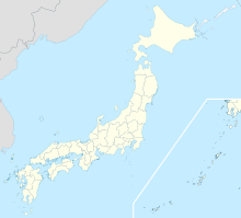
 RJST
RJSTRunways Direction Length Surface m ft 07/25 2,700 8,858 Concrete 15/33 1,500 4,921 Concrete Source: Japanese AIP at AIS Japan[1] Matsushima Air Field (松島飛行場 Matsushima Hikōjō) (ICAO: RJST) is a military aerodrome of the Japan Air Self-Defense Force Matsushima Airbase (松島基地 Matsushima Kitchi). It is located 6.6 NM (12.2 km; 7.6 mi) west[1] of Ishinomaki in the Miyagi Prefecture, Japan.
In 1971 an F-86F fighter jet from this base collided with All Nippon Airways Flight 58, causing 162 deaths. During the 2011 Tōhoku earthquake and tsunami, the base was flooded with seawater, and eighteen F-2Bs belonging to 21st Squadron, as well as other aircraft, were damaged or destroyed.[2][3]
Units
- Air Training Command
- 4th Air Wing
- 21st Fighter Training Squadron (F-2B)
- 11th Squadron, Blue Impulse
- 4th Air Wing
- Air Support Command
- Matsushima Air Rescue Wing (UH-60J,U-125A)
References
External links
Japanese airports First class airports Chūbu Centrair International · Kansai International · Narita International · Osaka International (Itami) · Tokyo International (Haneda)Second class airports Third class airports Aguni · Amami · Aomori · Fukue · Fukui · Fukushima · Hachijojima · Hanamaki · Hateruma · Ibaraki (Hyakuri) · Iejima · Iki · New Ishigaki · Ishigaki · Iwami · Izumo · Kamigoto · Kerama · Kikai · Kitadaito · Kobe · Kōzushima · Kumejima · Matsumoto · Memanbetsu · Minami-Daito · Miyakejima · Miyako · Monbetsu · Nakashibetsu · Nanki-Shirahama · New Tanegashima · Niijima · Noto · Odate-Noshiro · Ojika · Okayama · Oki · Okinoerabu · Okushiri · Oshima · Rebun · Rishiri · Sado · Saga · Shimojishima · Shizuoka · Shonai · Tarama · Tokunoshima · Tottori · Toyama · Tsushima · Yakushima · Yonaguni · YoronOther airports Amakusa · Chofu · Hiroshima-Nishi · Honda · Kasaoka · Kōnan · Komatsu* · Makurazaki · Miho-Yonago* · Misawa Air Base/Misawa Airport* · Nagoya · Oitakenou · Okadama* · Tajima · Teshikaga · Tokushima*
(*: dual military/civilian use)Military only airfields Akeno · Asahikawa · Ashiya · Atsugi · Chitose · Futenma · Gifu · Hachinohe · Hamamatsu · Hōfu · Hyakuri · Iruma · Iwakuni · Kanoya · Matsushima · Metabaru · Iwo Jima · Kadena · Kasumigaura · Kasuminome · Kisarazu · Minami Torishima · Nyutabaru · Ōminato · Ozuki · Shimofusa · Shizuhama · Tachikawa · Tateyama · Tokachi · Tsuiki · Utsunomiya · YokotaHeliports Defunct airports 
This article about transport in Japan is a stub. You can help Wikipedia by expanding it. - Air Training Command

